
Published 31 August 2026 · Updated 29 September 2026 · By Jatin Dua, Broker of Record, RE/MAX Quantum Realty
What's Your Home Worth Right Now?
Get a free AI-powered price range for your property in under 90 seconds, based on recent GTA comparable sales. No name or address required.
Get My Free Estimate →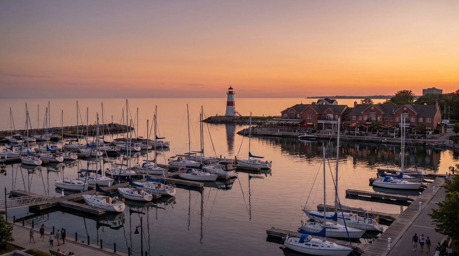
The ten things buyers in Port Credit are least often told, all of them documented: the Official Plan you are being quoted was replaced — Mississauga Official Plan 2051 was adopted 16 April 2025 and approved by the Province on 24 March 2026, and since 1 July 2024 Peel Region has had no planning responsibilities at all; that plan says applications for extra height and density “will be discouraged” because the Port Credit road network is full; Brightwater is capped at 3,893 homes and a gross FSI of 1.45 on 72 acres of former refinery land; the Hazel McCallion Line that terminates at Port Credit GO was publicly “expected late 2024” in 2021 and as of 25 June 2026 still has no announced opening date; the City’s own transportation master plan keeps Lakeshore Road at four lanes and puts a TTC streetcar over the Credit River bridge beyond 2041; there are eight live development applications in and beside the village, two of them already appealed; at the GO station a builder can buy a storey at a time by adding office space, up to 10; the Old Port Credit Village Heritage Conservation District requires a heritage permit under Section 42 of the Ontario Heritage Act before you erect, alter, remove or demolish anything; a Credit Valley Conservation inquiry costs $392 including HST and takes a minimum of four weeks; and there is no municipal land transfer tax and no vacant home tax here, but your assessment is still frozen at 1 January 2016 and a short-term rental is capped at 180 nights with a 6 per cent accommodation tax.
None of that is an argument against buying here. Port Credit is the best waterfront village in the western GTA and the amenity arriving over the next decade is real. It is an argument for buying here with the documents open.
Every item is traced to a primary source — an Official Plan chapter, a Local Area Plan, a by-law, a Metrolinx open house document, a conservation authority fee schedule, a provincial dataset — and each is listed at the bottom with the date I read it. One figure on this page is my own arithmetic from the City’s own application pages and one is my own land transfer tax calculation from the published provincial rate table; both are labelled where they appear. Eight things I deliberately left off because I could not source them properly: Brightwater’s Record of Site Condition history, remediation cost or soil volumes, because Ontario’s Environmental Site Registry was unreachable; Brightwater’s phase numbers and delivery dates; the private shuttle bus to Port Credit GO that appears in no City document; the Ontario Land Tribunal case numbers and hearing dates for the two appealed Lakeshore Road East files; Peel District School Board capacity and utilisation figures, because the board’s site refused every automated request; any claim that the Lakeshore West GO line is being electrified, because Metrolinx’s own project pages do not mention it; Lake Ontario water levels and any Port Credit shoreline erosion works; and the lighthouse’s build date, height or replica status. I will publish those when I can cite them.
Port Credit is the most photographed half-kilometre in Mississauga: a river mouth, a lighthouse, a marina, a genuine main street with restaurants on it, and a GO station that puts Union Station about twenty minutes away. It is also, quietly, one of the most heavily regulated pieces of ground in the western GTA. There is a brand-new Official Plan, a separate Local Area Plan, a Growth Node, a second Growth Node, a heritage conservation district, a conservation authority, a Protected Major Transit Station Area and a 72-acre brownfield, all stacked on the same few blocks.
A definition note before the list, because it changes what the documents say. The current plan splits Port Credit into three Character Areas: the Port Credit Growth Node (the Central Residential, Mainstreet Node, Harbour Mixed-Use and Riverside precincts), the Neighbourhood Character Area (the Old Port Credit Village heritage district, North Residential, South Residential and parts of the Mainstreet Neighbourhood), and the separately designated Port Credit West Village Growth Node, which is the Brightwater site. Which one your address sits in decides almost everything below.
1The Official Plan being quoted to you was replaced on 24 March 2026 — and Peel no longer approves anything
Almost every article, listing blurb and brochure written about Port Credit before the spring of 2026 is citing a document that no longer governs. Mississauga Official Plan 2051 was adopted by Council on 16 April 2025 and approved with modifications by the Ontario Ministry of Municipal Affairs and Housing on 24 March 2026. Every chapter and every Local Area Plan now carries the footer date 24 March 2026. If the words in front of you do not, they are out of date.
| What you will still see written | What the current plan actually says |
|---|---|
| Port Credit Community Node | Port Credit Growth Node, with a boundary that aligns with the Port Credit Protected Major Transit Station Area |
| Brightwater as simply “part of Port Credit” | Port Credit West Village Growth Node — a separately designated node with its own chapter of policies |
| Region of Peel as the approval authority | Ministry of Municipal Affairs and Housing approves certain official plan reviews and amendments; Peel comments only as a Public Body |
That last row is the one with money attached to it. The Region of Peel states it plainly: “On July 1, 2024, under the Planning Act, Peel Region was designated an ‘upper-tier municipality without planning responsibilities.’” As a result Brampton, Mississauga and Caledon became the land use planning authorities, and “The Ministry of Municipal Affairs and Housing is the approval authority for certain official plan reviews and amendments.” Peel attributes that specific change to Bill 162, the Get It Done Act, 2024.
Behind it sits one of the strangest municipal stories in Ontario. Bill 112, the Hazel McCallion Act (Peel Dissolution), 2023, received Royal Assent on 8 June 2023 as S.O. 2023, chapter 13, and would have dissolved the Regional Municipality of Peel effective 1 January 2025, making Mississauga a single-tier city. On 13 December 2023 the Minister reversed course and announced Peel would not be dissolved. Bill 185 received Royal Assent on 6 June 2024, in Peel’s words “formally confirming that Peel Region will not be dissolved.” Bill 240, which would have transferred regional roads and waste collection, died on 27 January 2025 when Parliament was dissolved. Peel’s own status line today reads: “Peel Transition Implementation on hold.”
How to read this as a buyer. One layer of approval that used to sit above a Port Credit development application is simply gone. When someone tells you a proposal beside your building “still has to go to the Region,” that has not been true since July 2024. And if a document describing your block says “Community Node,” it predates the plan in force — ask for the March 2026 version before you rely on a word of it.
2The Official Plan says more height and density here will be discouraged
This is the single most under-reported policy in Port Credit, and it is one sentence long. Port Credit Local Area Plan, policy 11.11, in the City’s own words:
“Due to capacity constraints on the Port Credit transportation network, development applications requesting increases in density and height, over and above what is currently permitted in the Port Credit Local Area Plan will be discouraged unless it can be demonstrated, to the City’s satisfaction, that the proposed development has included measures to limit the amount of additional vehicular demand.”
That sits alongside a growth target, not against it. Chapter 14 states that the Growth Node “has the potential to reach the targeted density of 200 residents and jobs combined per hectare for the Port Credit Protected Major Transit Station Area,” and that development “will contribute towards the achievement of a balanced residents to jobs ratio of 2:1.” In the Mainstreet Node Precinct, single-use residential buildings are not permitted at all, and the City says it will encourage employment uses on the second and third floors. Three locations must specifically justify their employment content: the GO Station parking lot and the four corners of Ann Street and Park Street East, the Port Credit Harbour Marina at 1 Port Street East, and the Port Credit West Village Precinct.
| Where | Height the plan states in words |
|---|---|
| Central Residential Precinct | Will have the highest building heights in Port Credit, decreasing to the east and west |
| Lakeshore Road West frontages, North Residential — Shawnmarr, Indian Heights, Credit Grove | Generally 4 storeys |
| Lakeshore Road West frontages, South Residential — Cranberry Cove, Hiawatha | Generally 4 storeys |
| Commercial plaza between Harrison Avenue and Wesley Crescent | Maximum 4 storeys |
| Employment lands abutting the CN line | Maximum height generally equivalent to a 2 storey residential building |
| Mainstreet Node Precinct | Single-use residential buildings are not permitted |
There is an escape hatch, and it is written into the plan. Under LAP §12.1.2 and Chapter 14 §14.2.8.2.8, heights above the mapped limits “may be considered through a site specific Official Plan Amendment application,” subject to six tests — one of which is again “measures to limit the amount of additional vehicular and traffic impacts on the Port Credit transportation network.” That is the door every application in item six walked through.
One honest limitation. The numeric height limits for individual Port Credit blocks are not in the text of the plan at all. They live on Map 2A in the Local Area Plan and Map 14-2.7.1 in Chapter 14, which are images inside the PDFs. I am not going to publish a “maximum X storeys” figure for a specific block that I have not read off the map itself or checked against Zoning By-law 0225-2007, and neither should anyone else.
How to read this as a buyer. Two opposite things are both true here: the plan wants density around the station, and the plan says it will resist applications that add traffic. That combination is exactly why so many Port Credit files end up at the Tribunal rather than at Council. If you are buying for a view, a low-rise streetscape or a specific sight line, the words in the plan are not your protection — the map and the by-law are, and even those can be amended site by site.
3Brightwater is capped at 3,893 homes, on 72 acres of former refinery land
The Official Plan does not use marketing language about the site. Chapter 14 §14.2.8.1 says the Port Credit West Village Growth Node “consists of a property formerly used as a refinery that is undergoing a significant revitalization through remediation and redevelopment,” and the Port Credit Local Area Plan calls it “the large brownfield site” and sets an objective “to recognize the former refinery site as an important location along the waterfront that requires special attention.”
| Brightwater / Port Credit West Village | Figure | Source and date |
|---|---|---|
| Site area | 72 acres | City news release, 30 July 2019 |
| Total parkland | About 18 acres | City project page, Future parks at Brightwater |
| Waterfront park | 13 acres | same |
| Units endorsed by Council in 2019 | 2,995 — townhomes, mid-rise and high-rise up to 29 storeys | City news release, 30 July 2019 |
| Additional units sought in 2024 | 898 more units, maximum 35 storeys | OPA 24-4 W1 public meeting notice, 4 July 2024 |
| Current Official Plan cap | Maximum 3,893 residential units and maximum gross FSI 1.45 for the entire site | MOP 2051, Ch.14 §14.2.8.2.3, 24 March 2026 |
Roads, parks and hazard lands are counted inside that FSI calculation. One thing is expressly excluded from the unit cap: “the 0.3 hectare parcel of land at the northwest quadrant of Mississauga Road South and Port Street West that will be developed for affordable housing.”
The built form is prescribed precinct by precinct, and the rules are more specific than most buyers realise:
| Precinct | What the Official Plan requires |
|---|---|
| A — West Village Square | The gateway from Lakeshore Road West and the site’s primary access point. Minimum 2 storeys fronting Lakeshore, with portions permitted at 1 storey only for minor architectural variation or where screened |
| B — The Promenade | A linear park with a public street on its western edge running to the water. Will contain the highest densities and tallest buildings on the site |
| C — The Campus | Only non-residential uses permitted on the first storey of every building. Minimum 5 storeys at the northeast corner, maximum 16 storeys at the southwest corner. Surface parking lots are not permitted |
| D — Old Port Transition | Residential, school and park uses, transitioning to the heritage district. The park block may be moved south without amending the plan, and relocation is required if a public school is developed here |
| E — Parkside | Primarily low-rise townhouses transitioning to Cranberry Cove. One mid-rise permitted abutting the Waterfront Park: max 6 storeys across the west portion and majority, max 12 storeys at the east portion |
| F — Waterfront Park | Incorporates the existing Waterfront Trail; intended as a regional destination |
Two mechanisms are worth knowing. Delivery is controlled by subdivision, not by a published schedule: §14.2.8.2.6 says development “will occur by way of one or more plans of subdivision which will determine the alignment of municipal roads, the location of parks and conditions respecting development phasing.” And the streets are meant to be yours: “The street network will be comprised of public streets, unless arrangements for private streets are made that are satisfactory to the City.” The plan also encourages a district energy system and permits a cogeneration facility as an accessory use in the high-rise designation.
How to read this as a buyer. The plan commits to remediation in four words — “Extensive remediation will be completed prior to development” — and Ontario’s framework is a Record of Site Condition filed on the provincial Environmental Site Registry under O. Reg. 153/04, backed by Phase One and Phase Two assessments certified by a Qualified Person. That regime is real, and it is applied elsewhere in Port Credit: Special Site 148 permits development only after an RSC is filed. What I will not do is tell you how many RSCs exist for 70 Mississauga Road South, when they were filed, or what was removed — the provincial registry was unreachable when I wrote this and none of it is verified here. Before you buy on this site, have your lawyer pull the Record of Site Condition from the registry and read it. It is a public document and it is the single most important piece of paper attached to the address.
4The Hazel McCallion Line ends at Port Credit GO, and it has no opening date
The project itself is not in doubt. Metrolinx describes the Hazel McCallion Line as 18 kilometres and 19 stops, running from Port Credit GO to Brampton Gateway Terminal, with the Port Credit stop “located adjacent to the Port Credit GO.” The Official Plan approved on 24 March 2026 still describes it as the “future Hurontario Light Rail Transit station.”
| What Metrolinx published | When | What it said |
|---|---|---|
| Article on works at Port Credit GO | 1 March 2021 | LRT operations “Expected… late 2024” |
| Virtual open house question and answer document | 25 June 2026 | “A final opening date will be announced once these critical phases have been successfully completed and the project enters Revenue Service Demonstration” |
| Same document, on journey time | 25 June 2026 | Asked how long a trip from Square One to Port Credit GO would take: “Operating speeds are being determined in consultation with the municipalities” |
Metrolinx gives its own reasons for the slippage: “complex utility relocations, maintaining traffic in one of the region’s busiest corridors, pandemic-related labour and supply chain impacts, and coordination at major crossings.” That is a documented slide of at least two years from a date the agency itself published, with no replacement date and, as of June 2026, not even a modelled journey time.
Trains are moving, but not here. A Metrolinx construction notice dated 6 August 2026 set light rail vehicle testing for 11 to 18 August 2026, 9:00 a.m. to 4:00 p.m., at approximately 10 kilometres an hour, running from the Operation, Maintenance and Storage Facility to Hurontario Street via Edwards Boulevard and Topflight Drive. That is north Mississauga. Nobody is testing trains at the Port Credit end.
What does work today is the GO station, and it works well. Port Credit GO, 30 Queen Street East, has 350 free parking spaces in the North Lot, reserved and carpool parking, bike racks and MiWay connections, and is staffed 05:40 to 20:40 on weekdays and 06:20 to 20:40 at weekends and holidays. Accessibility works ran through 2020 and 2021: an east ramp from August 2020, island platform repairs, tactile safety tiles, a new west-side accessibility ramp and south platform elevator upgrades in spring 2021. On the corridor, Metrolinx commits to “15-minute service or better throughout the day between Toronto and Burlington, alongside new hourly service to and from Hamilton seven days a week” and “two-way, all-day service between Union and Hamilton.” The City’s transportation master plan also confirms local MiWay Route 23 will be maintained alongside express service between Clarkson GO and Long Branch GO via Port Credit GO.
How to read this as a buyer. Do not pay an LRT premium for a train with no announced opening date. If a floor plan, a brochure or an agent quotes you a year, ask which Metrolinx document it comes from — as of 25 June 2026 the agency’s own answer is that the date will be announced later. The GO train, on the other hand, is running now with published service commitments, and that is the transit fact you can actually underwrite.
5Lakeshore Road is planned to stay four lanes, and the preferred river fix is a streetcar after 2041
The governing study is the Lakeshore Connecting Communities Transportation Master Plan, Draft Final Report dated 1 September 2021, covering Lakeshore Road from Southdown Road to the east city limit. Its growth assumption is blunt: “By 2041, the Lakeshore Communities will grow by approximately 56,000 people and 16,500 jobs.” Without improvements, the report finds Lakeshore Road congested or above capacity “through Port Credit (Mississauga Road to Cawthra Road),” with the Credit River screenline becoming heavily congested westbound in the afternoon peak.
| What the master plan actually recommends for Port Credit | Detail |
|---|---|
| Preferred cross-section, Segments 4, 5A and 5C | 4 travel lanes, with lay-by parking on one or both sides alternating with planting zones, continuous separated bike lanes throughout and sidewalks on both sides |
| Why the parking stayed | Public feedback that “layby parking in the Port Credit Neighbourhood was important” |
| Higher-order transit | Potential east of Mississauga Road; ridership potential west of Mississauga Road expected to remain low |
| Preferred Credit River crossing | Introducing a streetcar on the existing Lakeshore Road bridge was “deemed to be the most preferred multi-modal crossing alternative” |
| The Queen Street Extension | Not recommended, but could be carried forward for future study; the preferred active-transportation-only crossing is a new crossing at Queen Street |
| Phasing | Phase 1 transit service improvements 2019–2025; Phase 2A multi-modal road work 2025–2030; Phase 2B 2031–2041; Phase 3, “Protection for Extension of TTC Streetcar” — beyond 2041 |
A new crossing is contemplated at all because the existing Lakeshore Road bridge “will become congested by 2041” and a new one would fill a 3 kilometre gap in the east-west road network. The Local Area Plan separately lists roads it wants but has not built: High Street West between Harrison and Wesley and from Peter Street North to John Street North, Iroquois Avenue from Cayuga to Briarwood, extending Minnewawa Road south to Wanita Road, and “additional crossing(s) of the Credit River.”
The Port Credit-specific recommendations are small and practical: widen the west-side sidewalk on Hurontario Street between Lakeshore Road and Park Street for passengers transferring from the Lakeshore express bus to the LRT, and improve walking and cycling on Ann Street and Helene Street to reach Port Credit GO. A dedicated Port Credit Walkability Audit was carried out as Appendix A.5 of the study.
Then the caveat, in the report’s own words: “Implementation of improvements is dependent on administrative prioritization. Depending on available funding and municipal priorities, the timing for this project to proceed with environmental assessment approvals, detailed design and construction may vary.”
How to read this as a buyer. Nobody is widening Lakeshore Road through the village. The City’s answer to 56,000 more people is four lanes, better sidewalks, separated bike lanes and, one day past 2041, a streetcar on the existing bridge. Read that together with the policy in item two and it explains the whole planning posture here: the road is the constraint, and it is not being fixed. If your commute depends on driving east or west across the Credit River in the afternoon peak, drive it at 5 p.m. on a Thursday before you make an offer.
6There are eight live development applications in and beside the village, and two are already appealed
These are the files on the City’s own active development applications directory, in or immediately adjacent to Port Credit, as at 31 August 2026:
| Address | File | Proposal | Status |
|---|---|---|---|
| 12 and 26 Park Street East | OZ/OPA 26-13 W1 | 26 storeys, 288 units, purpose-built rental, maintaining the existing rental housing on the lands | Received, posted 13 August 2026 |
| 17 and 19 Ann St, 84 and 90 High St, 91 Park St E | OZ/OPA 22-3 W1 | 23 storeys, 362 condominium units, ground-floor commercial, two historic structures preserved, public park | Under review; resubmitted Nov 2022, Aug 2023, Aug 2024 and Nov 2024 |
| 128 Lakeshore Road East | OZ/OPA 22-5 W1 | 11 storeys, 42 units plus ground-floor commercial | Appealed; resubmitted Aug and Oct 2025 |
| 170 Lakeshore Road East | OZ/OPA 21-16 W1 | 15-storey apartment with ground-related commercial | Appealed |
| 42 Port Street East and 99 Lakeshore Road East | OZ/OPA 22-30 W1 | 10 storeys, ground-floor commercial | Under review |
| 50 High Street East | OZ 25-19 W1 | 11-storey rental, 96 units | Under review; public meeting held 5 January 2026 |
| 579–619 Lakeshore Rd E, 1022 and 1028 Caven St | OZ/OPA 22-26 W1 | One 6-storey and three 16-storey buildings, 1,070 units | Under review |
| 70 Mississauga Road South | OZ 25-17 W1 | Rezoning of three development blocks within Brightwater to reflect previously approved Official Plan permissions | Active, posted 29 August 2025 |
I added up the unit counts published on the City of Mississauga’s own application pages for the files above. The dataset is official; the arithmetic is mine.
Five of those eight files publish a unit count, and together they come to 1,858 units. Three of them — 170 Lakeshore Road East, 42 Port Street East and the Brightwater rezoning — do not publish a unit count on the page I read, so the true pipeline is larger than 1,858 and I am not going to guess by how much. All of this is on top of the Brightwater cap of 3,893.
Two of the files are marked Appealed: 128 Lakeshore Road East and 170 Lakeshore Road East. The City pages say only that. I could not retrieve Ontario Land Tribunal case numbers, hearing dates or outcomes for either, so there are none on this page. And note the newest file: 12 and 26 Park Street East was posted on 13 August 2026, eighteen days before I wrote this, and it is the tallest proposal on the Port Credit books. Applications move; check it again on the day you write an offer.
One thing to avoid conflating. Ward 1 also contains large files that are not in Port Credit: 49 South Service Road (26 storeys, 352 units), 1250 South Service Road (four buildings, 997 units), 1000 and 1024 Dundas Street East (543 units) and 1580–1650 Dundas Street East (3,027 units, appealed). If someone quotes you a scary Ward 1 total, ask which side of the Local Area Plan boundary each file sits on.
How to read this as a buyer. Eight open files in a village this small is a lot, and two of them are already out of the City’s hands. If you are buying a low-rise property or a low-floor unit with a view, ask me to pull the live application for the block in front of you and the block behind it. It takes minutes, it is free, and it is the difference between buying a view and renting one until someone else builds.
7At the GO station, a builder can buy a storey at a time by adding office space
Chapter 17 of the Official Plan sets Special Site policies that override the general rules, and Port Credit has several. They are where the genuinely unusual requirements live.
| Special Site | Where | What the plan requires |
|---|---|---|
| 148 | South of the CN line, east of Queen Street West | Development permitted only after a Record of Site Condition is filed on the ministry registry under O. Reg. 153/04; secondary office use maximum 4 storeys |
| 150 | North side of Lakeshore Road West, east of Benson Avenue | Maximum 16 townhouses plus maximum 309 retirement and seniors apartment units; 4 storeys on Lakeshore stepping to 8 storeys northward |
| 158 | 1 Port Street East, the Port Credit Harbour Marina lands | Minimum 6,000 m² of office floor area, developed concurrently with residential; a landmark building required in Area A; Area B restricted to a marina facility; a marina action plan and a development master plan required |
| 159 | Southeast corner of Lakeshore Road East and Elizabeth Street South | Maximum 56 residential units; Area A maximum 4 storeys; Area B 4 storeys on Port Street East stepping to 10 storeys north, but 1 storey against the easterly boundary |
| 160 | GO Station Southeast — west of Hurontario, south of the CN line, east of Helene, north of High Street | 8 storeys fronting Hurontario with a 45-degree angular plane generally after 6 storeys, and up to 10 storeys purchasable one storey at a time by adding office use |
Site 160 is the one worth reading twice. Beyond the storey-for-office trade, it sets a minimum of 2 storeys everywhere, requires 30 metres of separation between buildings of 8 or more storeys (25 metres on Block 1), caps residential floorplates above the fifteenth storey at 800 m² (900 m² on Block 1), and fixes minimum employment floor area at 3,250 m² on Block 1 and 1,400 m² on Block 2. A separate Port Credit GO Station Southeast Area Master Plan governs the lands; I could not locate that master plan document itself on the City’s site.
Site 158, the marina lands, carries the most commercially interesting clause in the whole Port Credit file. Development must proceed by plan or plans of subdivision, multiple landowners must enter a cost-sharing and front-ending agreement, and the Section 37 community benefits base value is fixed to the zoning permissions in effect as of 1 January 2017. The policy basis is the Inspiration Port Credit 1 Port Street East Comprehensive Master Plan.
Everyday land use rules are unusual here too. In the Mixed Use designation motor vehicle rental is prohibited; drive-throughs are prohibited on sites shown on Map 3; commercial parking facilities may be permitted in Public Open Space; and thirteen uses are barred from Business Employment lands, including adult entertainment, funeral establishments, restaurants, overnight accommodation and truck terminals.
How to read this as a buyer. Special Site policies are the reason two identical-looking lots on the same street can have completely different futures. If you are buying anywhere between the GO station and the harbour, look up which Special Site number your address falls under before you form a view about what goes up beside you. A neighbour who can add three storeys by adding an office floor is not a hypothetical — it is written into the plan.
8Old Port Credit Village is a Heritage Conservation District, and you need a permit to touch a building
The Old Port Credit Heritage Conservation District Plan is dated 1 January 2020, and the district is designated by by-law under Part V of the Ontario Heritage Act. Most buyers hear the phrase “heritage district” and assume it means a plaque. It does not.
From the Plan itself: “Under Section 42 of the Ontario Heritage Act, a heritage permit is required for the erection, demolition, removal” and alteration of buildings in the District.
Individual properties are formally classified as “contributing” or “other,” and the Plan sets separate policies for alterations, additions and demolition depending on which classification a property carries, plus a distinct policy set for properties fronting Lakeshore Road East and West. Certain heritage permit applications also require a Heritage Impact Assessment. The Plan does contain exemptions, for residential, commercial, institutional and public realm properties at sections 17.2 to 17.5, and Appendix A carries a chart summarising exactly which proposals need a permit and which do not.
The district sits on top of the Official Plan rather than instead of it. The Local Area Plan at §12.2.2 and Chapter 14 at §14.2.7.4.4 and §14.2.7.5.4 confirm that the heritage district governs the south side of Lakeshore Road West between Mississauga Road and the Credit River, and between Front Street South and the Credit River. It is also the eastern neighbour that Brightwater’s Old Port Transition precinct is required to transition down to.
One thing I am not printing: the designating by-law number. It is not stated in the text of the Plan I read, and a heritage by-law number is exactly the sort of figure that should not be repeated on trust.
How to read this as a buyer. If you are buying inside the district, your renovation budget has a permit process in it, your timeline has a heritage review in it, and a demolition-and-rebuild plan may simply not be available to you. Before you write an offer on a house in Old Port Credit Village, get the property’s classification — contributing or other — and read the Appendix A chart against what you actually intend to do. That is a one-evening job that has saved buyers six figures.
9The Credit River costs $392 and four weeks before your lawyer can even answer the question
Credit Valley Conservation regulates development in its regulated areas under the Conservation Authorities Act and Ontario Regulation 41/24, and its regulation mapping “was approved and updated as of the February 20, 2026 board of directors meeting.” If your property is in a regulated area, the standard solicitor and realtor inquiry is not a phone call. It is a formal, paid, scheduled process.
| Credit Valley Conservation solicitor and realtor inquiry | Detail |
|---|---|
| Administration fee | $392 including HST, effective 20 February 2026 |
| Credit card surcharge | $11.67 |
| Turnaround | A minimum of 4 weeks, first come first served |
| What you must supply | A formal letter and an accurate property survey |
| What the answer covers | Whether the site is subject to CVC regulation, what features exist on the property, and the nature of any past violations of CVC regulations on the property |
| Office | 1255 Old Derry Road, Mississauga ON L5N 6R4 |
The policy behind it is strict. Chapter 4 of the Official Plan states that development in flood plains is subject to the one-zone concept unless a special policy area or two-zone concept has been approved, and that designating a Special Policy Area “must be approved by the Ministers of Municipal Affairs and Housing and Natural Resources.” More directly: “Development and site alteration is generally prohibited on lands subject to flooding,” and buildings in or adjacent to the flood plain “will be protected to the elevation of the Regulatory Flood and will not impact upstream or downstream properties.”
The hazards are named in the Local Area Plan itself: “Natural Hazard Lands are associated with features such as the Tecumseh Creek, Credit River, Credit Valley and Lake Ontario Shoreline.” The plan also records that the mouth of the Credit is “an ecologically significant estuary,” that the river holds a provincially significant wetland complex just north of the plan area, that it is identified in the Provincial Greenbelt Plan as an Urban River valley, and that it is warm water fish habitat and a migratory route for coldwater species. Those designations are why permits here are not a formality.
Recent weather makes the point better than policy does. In a news release dated 19 August 2024 the City recorded more than 106 mm of rainfall in the storm of 16 July 2024 and upwards of 170 mm to some areas on 17 and 18 August 2024, with parks flooded, trails washed out, embankments eroded and residents dealing with basement flooding. The City states it has invested over $231.5 million in stormwater infrastructure since 2016, including $33.7 million in 2024 alone.
How to read this as a buyer. Four weeks is longer than most conditional periods. If you are buying anywhere near the river, the valley, Tecumseh Creek or the shoreline, that inquiry has to be started at the front of the process, not after you go firm — and the survey requirement means you need the survey first. One caution on the other side: I found no Special Policy Area designation for Port Credit in either the Local Area Plan or Chapter 4, but absence of a mention in two documents is not the same as a confirmed no. Ask CVC directly rather than taking my word or anyone else’s.
10No municipal land transfer tax, no vacant home tax — but a 180-night rental cap and a 6 per cent tax
Start with the good news, because it is worth real money. Ontario’s official land transfer tax page names exactly one municipality with its own additional tax: “If you buy property in the City of Toronto, you may also pay the City of Toronto’s own municipal land transfer tax.” Mississauga is not on that list. Crossing Etobicoke Creek westward removes a second land transfer tax from your closing entirely.
| Portion of the purchase price | Ontario land transfer tax rate |
|---|---|
| Up to $55,000 | 0.5% |
| $55,001 to $250,000 | 1.0% |
| $250,001 to $400,000 | 1.5% |
| Over $400,000 | 2.0% |
| Over $2,000,000, where the land contains one or two single family residences | 2.5% |
I applied the Government of Ontario’s published bracket table above to a sample price. The rate table is official; the arithmetic is mine, and your lawyer’s statement of adjustments is the number that counts.
On a $1,200,000 purchase the provincial land transfer tax works out to $20,475 — $275 on the first $55,000, $1,950 on the next $195,000, $2,250 on the next $150,000 and $16,000 on the balance above $400,000. In Toronto there would be a second municipal land transfer tax on top of that. In Mississauga there is not. Two related points: the City has no vacant home tax by-law — the only recorded Council action is a motion of 23 June 2021 referring a vacant home tax, along with four other revenue tools, to the October 2021 Budget Committee for study — and your property tax is still calculated from a decade-old value, because MPAC states that a 2016 notice “reflects the assessed value and classification of your property as of January 1, 2016” and that this value is the basis for your 2026 property taxes, the province having filed a regulation on 16 August 2023 extending the postponement of a province-wide reassessment.
Now the part investors get wrong. Short-Term Rental Accommodation Licensing By-law 0289-2020, approved 9 December 2020 and amended by By-laws 0251-2021, 0051-2023, 0171-2024 and 0170-2025, defines a short-term rental as accommodation provided for 30 consecutive days or less and then restricts it hard: “No Person shall… operate, advertise, broker, carry on the business of or permit the operation… of a Short Term Rental Accommodation unless the property is the Principal Residence of that Person,” and “The Licence Manager shall issue only one Licence per person, as persons are permitted only one Principal Residence pursuant to this By-law.”
| Renting your Port Credit condo short term | The rule |
|---|---|
| Principal residence | Required. It cannot be an investment unit you do not live in |
| Night cap | No more than 180 days in a calendar year |
| Separate guests on the same days | Prohibited |
| Accessory buildings | Prohibited as short-term rental accommodation |
| Licences per person | One, valid for one year |
| Annual fee | $283 |
| Police check | Level 1 criminal record check, Peel Regional Police only, dated within 60 days |
| Insurance | Commercial general liability, $2 million per occurrence |
| Condominiums | Condominium board permission required |
| Operating unlicensed | Fines up to $100,000 |
| Municipal Accommodation Tax | 6 per cent on rentals of 30 days or less, HST charged on the amount, returns filed monthly and remitted by the last day of the following month |
How to read this as a buyer. The tax picture in Port Credit is genuinely friendlier than in Toronto: one land transfer tax instead of two, no vacant home tax by-law, and an assessment base frozen at January 2016 values. The short-term rental picture is the opposite. You may only list your own principal residence, only one property, for at most 180 nights a year, with condo board sign-off, $2 million of liability cover and a 6 per cent tax filed every month. If anyone has sold you a Port Credit condo as a nightly-rental investment, that plan does not survive contact with By-law 0289-2020.
Four more, because they come up every week
Port Credit Secondary School is not in Port Credit. It sits at 70 Mineola Road East, north of the QEW in Mineola, with an enrolment of 1,370 on the Ontario Ministry of Education’s final 2024–25 data published in July 2026. The schools actually inside the Port Credit Local Area Plan area are Forest Avenue Public School at 20 Forest Avenue (JK–6, enrolment 205), Riverside Public School at 30 John Street North (JK–8, enrolment 305) and St. James Catholic Global Learning Centre at 98 Wanita Road (JK–8, enrolment 240). Ministry enrolment figures in that dataset are rounded to the nearest five. What I cannot tell you is whether any of them is over capacity: the Peel District School Board’s site refused every automated request, so I have no capacity, utilisation or accommodation-review data for either board, and I am not going to characterise a school as full or empty without it. The one on-the-record signal that the City expects school demand here is that the Official Plan designates school uses in Brightwater’s Old Port Transition precinct and requires the park block to move south if a public school is built there.
The City-run marina has fifteen slips, and the lighthouse is an office. Credit Village Marina at 12 Stavebank Road South is operated by the City of Mississauga and has 15 seasonal slips for vessels up to 45 feet, open early May to the end of October, with a 5-star environmental rating from Boating Ontario. 2025 seasonal rates, before 13 per cent HST, were $106.64 per foot for residents and $117.31 per foot for non-residents; three-hour shopper docking was $13.98 for residents. The City’s own navigation notes describe “a grounded freighter breakwall with a red flashing light” and “a lighthouse serving as the Port Credit Business Association headquarters.” On 3 October 2020 the Port Credit BIA held a ribbon-cutting naming the Lighthouse Landing “The Queen Bea Lookout,” for Beatrice Moreira-Laidlow, the BIA’s former General Manager. I have seen the lighthouse called a 1991 replica of a specific height in a dozen places; none of that is in any City document I could find, so it is not on this page.
Statistics Canada does not publish a Port Credit. Search the 2021 Census Profile for “Port Credit” and it returns under “Other place names,” with the note that corresponding census subdivisions are provided where data is not available. The corresponding subdivision listed for Port Credit is Mississauga (City), Ontario — the whole city of more than 700,000 people. There is therefore no official Statistics Canada population, dwelling or income figure for Port Credit, and any such number circulating online was built by somebody choosing census tracts themselves. I have not done that here, because choosing the tracts is a judgement, not a source. The nearest properly sourced Port Credit population measure that does exist is a planning target: the Official Plan’s 200 residents and jobs combined per hectare for the Protected Major Transit Station Area, with a 2:1 residents-to-jobs ratio, and a commitment that the City will monitor population density and the population to employment ratio in Port Credit. Note also that the 2026 Census was collected in May 2026 and no results have been released; 2021 is still the current data.
The CN line is a planning constraint, not just a noise complaint. The Local Area Plan states that the rail corridor “defines the northern boundary of this area and restricts the types of use that can be redeveloped on adjacent properties,” caps adjacent employment development at a height “generally equivalent to a 2 storey residential building” for warehousing, self-storage, wholesaling and manufacturing, and requires that lighting, noise levels, loading and garbage areas not negatively affect neighbouring homes. One of the plan’s stated objectives is “to appropriately balance the constraints associated with both the Canadian National Railway line and adjacent residential uses,” and Chapter 8 requires development to “respect railway operations and lines and address public safety” with noise “mitigated through appropriate built form and site design.” What the Official Plan does not contain is a numeric setback from the rail corridor. If you are told there is a required distance, ask which document it comes from.
What this list is not
It is not an argument against buying here. Port Credit is a real waterfront village with a GO station twenty minutes from Union, a main street where single-use residential towers are not even permitted, a heritage district protecting the old village, roughly 18 acres of new parkland including a 13-acre waterfront park being built on the former refinery lands, a chain of existing waterfront parks from Rhododendron Gardens and Ben Machree through J.C. Saddington, Marina Park and Memorial Park to St. Lawrence, Tall Oaks and Hiawatha, a City-run marina at the river mouth, a lighthouse, and an Official Plan that actively resists adding traffic to its own streets. Very few places in the GTA can say all of that, and none of the others are in Mississauga.
The point is that every one of the ten items above is knowable before you sign. Most buyers find out afterwards. That is the entire difference between working with someone who has read the Local Area Plan and working with someone who has read the listing.
Thinking about a specific building or street in Port Credit?
A neighbourhood list is the right frame for understanding a market and the wrong frame for a decision. What a home is worth here depends on which Character Area it sits in, which Special Site number applies to the block beside it, whether it falls inside the heritage district or a CVC regulated area, and what has actually sold in the building. Send me the address and I will give you the comparable sales that apply to it, the live applications on that block, and a straight answer on whether to move now or wait.
[email protected] · 833-330-1925 · Book a free consultation
Confidential. Read personally and answered within 24 hours. I never share, sell or distribute your information.
Ask the local expert
Ask me anything about Port Credit
Send me the building, the block or the question. You get a straight answer from someone who works this stretch of the lakeshore every week, including when the answer is that you should wait. No drip campaign you cannot get out of.
Got it.
I read these personally and answer within 24 hours. If it is urgent, call or text 833-330-1925.
Confidential. Read personally and answered within 24 hours. I never share, sell or distribute your information. Not intended to solicit buyers or sellers currently under contract with another brokerage.
Frequently asked questions
Has Mississauga’s Official Plan changed for Port Credit?
Yes, and recently. Mississauga Official Plan 2051 was adopted by Council on 16 April 2025 and approved with modifications by the Ontario Ministry of Municipal Affairs and Housing on 24 March 2026. Every chapter and Local Area Plan now carries that date. The terminology changed too: what older documents call the Port Credit Community Node is now the Port Credit Growth Node, and Brightwater is a separately designated Port Credit West Village Growth Node.
Does the Official Plan allow taller buildings in Port Credit?
Not easily. Port Credit Local Area Plan policy 11.11 says that because of capacity constraints on the Port Credit transportation network, applications requesting increases in density and height over what is currently permitted will be discouraged unless the applicant demonstrates measures to limit additional vehicular demand. Extra height can still be considered through a site specific Official Plan Amendment, subject to six tests, one of which is again limiting traffic impacts.
How many homes are approved at Brightwater?
Mississauga Official Plan 2051, Chapter 14, sets a maximum of 3,893 residential units and a maximum gross floor space index of 1.45 for the entire 72-acre site. Council endorsed 2,995 units up to 29 storeys in July 2019, and a July 2024 public meeting notice sought an additional 898 units at up to 35 storeys. A 0.3 hectare affordable housing parcel at Mississauga Road South and Port Street West is excluded from the cap.
When will the Hazel McCallion LRT open?
There is no announced opening date. Metrolinx stated in a June 2026 open house document that a final opening date will be announced once critical phases are complete and the project enters Revenue Service Demonstration. Metrolinx had previously published, in March 2021, that operations were expected in late 2024. The line runs 18 kilometres and 19 stops from Port Credit GO to Brampton Gateway Terminal, and even the Square One to Port Credit trip time is undetermined.
Will Lakeshore Road be widened through Port Credit?
No. The Lakeshore Connecting Communities Transportation Master Plan of September 2021 recommends four travel lanes through Port Credit, with lay-by parking alternating with planting zones, continuous separated bike lanes and sidewalks on both sides. The preferred Credit River crossing solution is a streetcar on the existing Lakeshore Road bridge, and protection for a TTC streetcar extension is Phase 3, scheduled beyond 2041.
What is being proposed in Port Credit right now?
Eight files sit on the City’s active applications directory in or beside the village. They include 26 storeys and 288 rental units at 12 and 26 Park Street East, filed 13 August 2026; 23 storeys and 362 units on Ann and High Streets; 1,070 units at 579 to 619 Lakeshore Road East; 96 rental units at 50 High Street East; and rezoning of three Brightwater blocks. Two files, at 128 and 170 Lakeshore Road East, are appealed.
Is there a municipal land transfer tax in Mississauga?
No. Ontario’s land transfer tax page names only the City of Toronto as charging its own additional municipal land transfer tax. In Mississauga you pay the provincial tax alone: 0.5 per cent up to $55,000, 1 per cent to $250,000, 1.5 per cent to $400,000, 2 per cent above that, and 2.5 per cent above $2 million where the land contains one or two single family residences. On $1,200,000 that is $20,475 by my own calculation.
Does Mississauga have a vacant home tax?
Mississauga has no vacant home tax by-law. The City’s by-laws index lists short term rental, residential rental, rental apartment, rental housing protection and second unit by-laws, but no vacant home or vacant unit tax. The property taxes pages make no mention of one. The only recorded Council action is a motion of 23 June 2021 referring a vacant home tax, alongside four other revenue tools, to the October 2021 Budget Committee for study.
Can I run an Airbnb in a Port Credit condo?
Only if it is your principal residence. Short-Term Rental Accommodation Licensing By-law 0289-2020 prohibits operating a short-term rental unless the property is the operator’s principal residence, allows only one licence per person, and caps rentals at 180 days in a calendar year. Condominium residents need board permission. The licence costs $283 a year and requires $2 million liability cover. A 6 per cent Municipal Accommodation Tax is remitted monthly.
Do I need a permit from Credit Valley Conservation?
You do if the property is in a regulated area under the Conservation Authorities Act and Ontario Regulation 41/24. The standard solicitor and realtor inquiry costs $392 including HST, effective 20 February 2026, plus $11.67 for credit card payment, and takes a minimum of four weeks on a first-come basis. It requires a formal letter and an accurate survey, and it reports regulation status, site features and any past regulation violations.
Related reading
- Brightwater, Port Credit: What Buyers Should Know About the 72-Acre Waterfront Community
- Port Credit Condos: Buying on the Mississauga Waterfront in 2026
- Top 10 things no one will tell you about Mimico and Humber Bay Shores
- Top 10 things no one will tell you about New Toronto and Long Branch
- Top 10 things no one will tell you about Alderwood, Etobicoke
- Top 10 things no one will tell you about The Queensway and Stonegate-Queensway
- Top 10 things no one will tell you about The Kingsway, Etobicoke
- Top 10 things no one will tell you about Islington and Etobicoke Centre
- Toronto West market report, July 2026
Sources
Every figure on this page traces to one of these, and each was read on 31 August 2026. Primary sources only — an Official Plan chapter, a Local Area Plan, a by-law, a City news release, a transit agency project page or open house document, a conservation authority fee schedule, a provincial dataset, or the agency that administers the thing being described. Where I could not verify something from a primary source, it is not on the page.
- Mississauga Official Plan. City of Mississauga project page. Mississauga Official Plan 2051 adopted by Council 16 April 2025 and approved with modifications by the Ministry of Municipal Affairs and Housing on 24 March 2026, and the amendments and appeals record. mississauga.ca
- Port Credit Local Area Plan. Mississauga Official Plan 2051, 24 March 2026. The three Character Areas, policy 11.11 discouraging additional height and density, the 4-storey Lakeshore Road West frontages, the CN corridor constraints at §12.2.3.4, the natural hazard features at §6, the unbuilt road list at §11 and the site specific amendment route at §12.1.2. mississauga.ca
- Chapter 14 — Growth Nodes. Mississauga Official Plan 2051, 24 March 2026. The 200 residents and jobs per hectare target, the 2:1 residents to jobs ratio, the Mainstreet Node prohibition on single-use residential, and the Port Credit West Village policies including the 3,893-unit and 1.45 FSI caps and the Area A to F built form rules. mississauga.ca
- Chapter 17 — Special Sites. Mississauga Official Plan 2051, 24 March 2026. Special Sites 148, 150, 158, 159 and 160, including the Record of Site Condition condition, the 6,000 m² office minimum at 1 Port Street East, the 1 January 2017 Section 37 base value, and the storey-for-office trade at the GO Station Southeast site. mississauga.ca
- Chapter 4 — Sustaining the Natural Environment. Mississauga Official Plan 2051, 24 March 2026. The one-zone flood plain concept, the ministerial approval requirement for a Special Policy Area, the general prohibition on development on lands subject to flooding, and the Regulatory Flood protection standard. mississauga.ca
- Council endorses proposed Port Credit West Village redevelopment plan, and Future parks at Brightwater. City of Mississauga news release, 30 July 2019, and the City project page. The 72-acre site area, the 2,995 units up to 29 storeys endorsed by Council, the approximately 18 acres of parkland and the 13-acre waterfront park. mississauga.ca
- OPA 24-4 W1 — public meeting notice. City of Mississauga, 4 July 2024; applicant Port Credit West Village Partners Inc. The application for an additional 898 units at a maximum of 35 storeys, with a public meeting on 29 July 2024. mississauga.ca
- Active development applications. City of Mississauga directory and individual application pages. File numbers, applicants, proposals, unit counts and appeal status for 12 and 26 Park Street East, 17 and 19 Ann Street, 128 and 170 Lakeshore Road East, 42 Port Street East, 50 High Street East and 579 to 619 Lakeshore Road East, together with the application page for OZ 25-17 W1 at 70 Mississauga Road South published 29 August 2025. mississauga.ca
- Brownfields redevelopment. Government of Ontario. The Record of Site Condition framework under O. Reg. 153/04, filed on the Environmental Site Registry and requiring Phase One and Phase Two environmental site assessments certified by a Qualified Person. ontario.ca
- Hazel McCallion Line project page, and the light rail vehicle testing notice. Metrolinx. The 18 kilometres and 19 stops from Port Credit GO to Brampton Gateway Terminal, and the construction notice of 6 August 2026 setting testing from 11 to 18 August 2026 at approximately 10 kilometres an hour in north Mississauga. metrolinx.com
- HML Townhall 2026 Slido responses. Metrolinx virtual open house of 25 June 2026. The statement that a final opening date will be announced once the project enters Revenue Service Demonstration, the delay causes, and the undetermined Square One to Port Credit journey time. assets.metrolinx.com
- Metrolinx working on multiple projects at Port Credit GO, and the GO Transit station details page. Metrolinx, 1 March 2021, and GO Transit. The LRT station adjacent to Port Credit GO, the accessibility works of 2020 and 2021, the statement that LRT operations were expected in late 2024, and the 30 Queen Street East address with 350 free North Lot parking spaces, bike racks, MiWay connections and staffed hours. metrolinx.com
- Lakeshore West line GO Expansion. Metrolinx. The commitment to 15-minute service or better throughout the day between Toronto and Burlington, new hourly service to and from Hamilton seven days a week, and two-way all-day service between Union and Hamilton. metrolinx.com
- Lakeshore Connecting Communities Transportation Master Plan — Draft Final Report. City of Mississauga, 1 September 2021. The 56,000 people and 16,500 jobs by 2041, the congestion finding through Port Credit, the four-lane preferred cross-section with lay-by parking and separated bike lanes, the streetcar on the existing Lakeshore Road bridge, the phasing to beyond 2041, the MiWay Route 23 commitment, the implementation caveat, and the Port Credit Walkability Audit at Appendix A.5. mississauga.ca
- For solicitors and realtors, and Regulation mapping. Credit Valley Conservation. The $392 including HST inquiry fee effective 20 February 2026, the $11.67 credit card charge, the minimum four-week turnaround, the survey requirement, the scope of the response, and regulation under the Conservation Authorities Act and Ontario Regulation 41/24 with mapping approved 20 February 2026. cvc.ca
- Mississauga’s stormwater infrastructure important in historic 100-year storms. City of Mississauga news release, 19 August 2024. The 106 mm of rainfall on 16 July 2024, upwards of 170 mm on 17 and 18 August 2024, and the $231.5 million invested in stormwater infrastructure since 2016 including $33.7 million in 2024. mississauga.ca
- Old Port Credit Heritage Conservation District Plan. City of Mississauga, 1 January 2020. Designation by by-law under Part V of the Ontario Heritage Act, the Section 42 heritage permit requirement, the contributing and other classifications, the Lakeshore Road frontage policies, the exemptions at sections 17.2 to 17.5 and the Appendix A permit chart. mississauga.ca
- Official plan — planning responsibilities, and Peel transition. Region of Peel. The 1 July 2024 designation as an upper-tier municipality without planning responsibilities, the transfer of planning authority to Brampton, Mississauga and Caledon, the ministry as approval authority, Peel’s Public Body role, and the transition status line reading that implementation is on hold. peelregion.ca
- Land transfer tax, and Calculating land transfer tax. Government of Ontario, last updated 2 January 2026 and 22 April 2026. The statement that only the City of Toronto levies an additional municipal land transfer tax, and the provincial bracket table used for the worked example on this page. ontario.ca
- Short-Term Rental Accommodation Licensing By-law 0289-2020, the licence page, and the Municipal Accommodation Tax. City of Mississauga, approved 9 December 2020 and amended by By-laws 0251-2021, 0051-2023, 0171-2024 and 0170-2025; licence page last modified 27 July 2026. The 30-day definition, the principal residence requirement, the 180-day cap, the one licence per person rule, the $283 fee, the Peel Regional Police check, the $2 million insurance, the condominium board permission, the fines up to $100,000, and, from the City’s Municipal Accommodation Tax page, the 6 per cent tax on accommodation of 30 days or less with monthly returns remitted by the last day of the following month. mississauga.ca
- City of Mississauga to look at new revenue tools, and the by-laws index. City of Mississauga news release, 23 June 2021, and the current by-laws index. The Council motion referring a vacant home tax and four other revenue tools to the October 2021 Budget Committee, and the absence of any vacant home or vacant unit tax by-law. mississauga.ca
- The Assessment Cycle. Municipal Property Assessment Corporation. The 1 January 2016 valuation date used as the basis for 2026 property taxes, and the regulation filed on 16 August 2023 extending the postponement of a province-wide reassessment. mpac.ca
- School information and student demographics. Ontario Ministry of Education, final 2024–25 data published July 2026, extract date 17 July 2026. Addresses, grade ranges and rounded enrolment for Port Credit Secondary School, Forest Avenue Public School, Riverside Public School and St. James Catholic Global Learning Centre. data.ontario.ca
- Credit Village Marina, and the Port Credit lighthouse. City of Mississauga. The 15 seasonal slips for vessels up to 45 feet, the May to October season, the 2025 per-foot rates, the Boating Ontario 5-star environmental rating, the lighthouse serving as the Port Credit Business Association headquarters, and the 3 October 2020 naming of the Queen Bea Lookout. mississauga.ca
- Census Profile 2021 — search results for Port Credit. Statistics Canada. Port Credit appears only under other place names, with Mississauga (City), Ontario given as the corresponding census subdivision, so no official Port Credit population, dwelling or income figure exists. statcan.gc.ca
What this page is and is not. This is general information about public documents affecting a Mississauga waterfront neighbourhood, not legal, tax, engineering, environmental or financial advice, and not an opinion on the value or condition of any particular property. Statutes, by-laws, tax rates, conservation authority fees, transit schedules, project schedules, school data and municipal policies change; every figure here is dated to 31 August 2026 and should be re-checked against the source before you rely on it. Note in particular that Mississauga does not levy a municipal land transfer tax — Ontario names only the City of Toronto as charging one — so a Toronto land transfer tax calculator will overstate your closing costs on a Port Credit purchase; confirm the actual figure with your lawyer. Development applications described here are proposals or decisions as recorded on the dates stated and may since have changed; a received or appealed application is not a built building. Where a source could not be verified, the point is either omitted or flagged as unverified rather than estimated. For advice on a specific transaction, consult a lawyer, an accountant and a qualified professional as applicable. Jatin Dua is a Broker of Record with RE/MAX Quantum Realty Inc., Brokerage. Not intended to solicit buyers or sellers currently under contract with another brokerage.
About the author — Jatin Dua, Etobicoke and Toronto real estate expert
I am the Broker of Record and co-founder of RE/MAX Quantum Realty at 799 The Queensway in Etobicoke, with more than $100 million in GTA sales volume. I write these pages the same way I work a file: read the primary source, quote it, date it, and say plainly where the source is silent or where two documents disagree. If a figure on this page has no citation beside it, that is a mistake and I want to hear about it.
I work with buyers, sellers, renters and investors across Port Credit and the Mississauga lakeshore, Islington, Etobicoke Centre, The Kingsway, Stonegate-Queensway, Mimico, Humber Bay Shores, Alderwood and the wider west end. [email protected] or 833-330-1925.