
Published 31 August 2026 · Updated 29 September 2026 · By Jatin Dua, Broker of Record, RE/MAX Quantum Realty
What's Your Home Worth Right Now?
Get a free AI-powered price range for your property in under 90 seconds, based on recent GTA comparable sales. No name or address required.
Get My Free Estimate →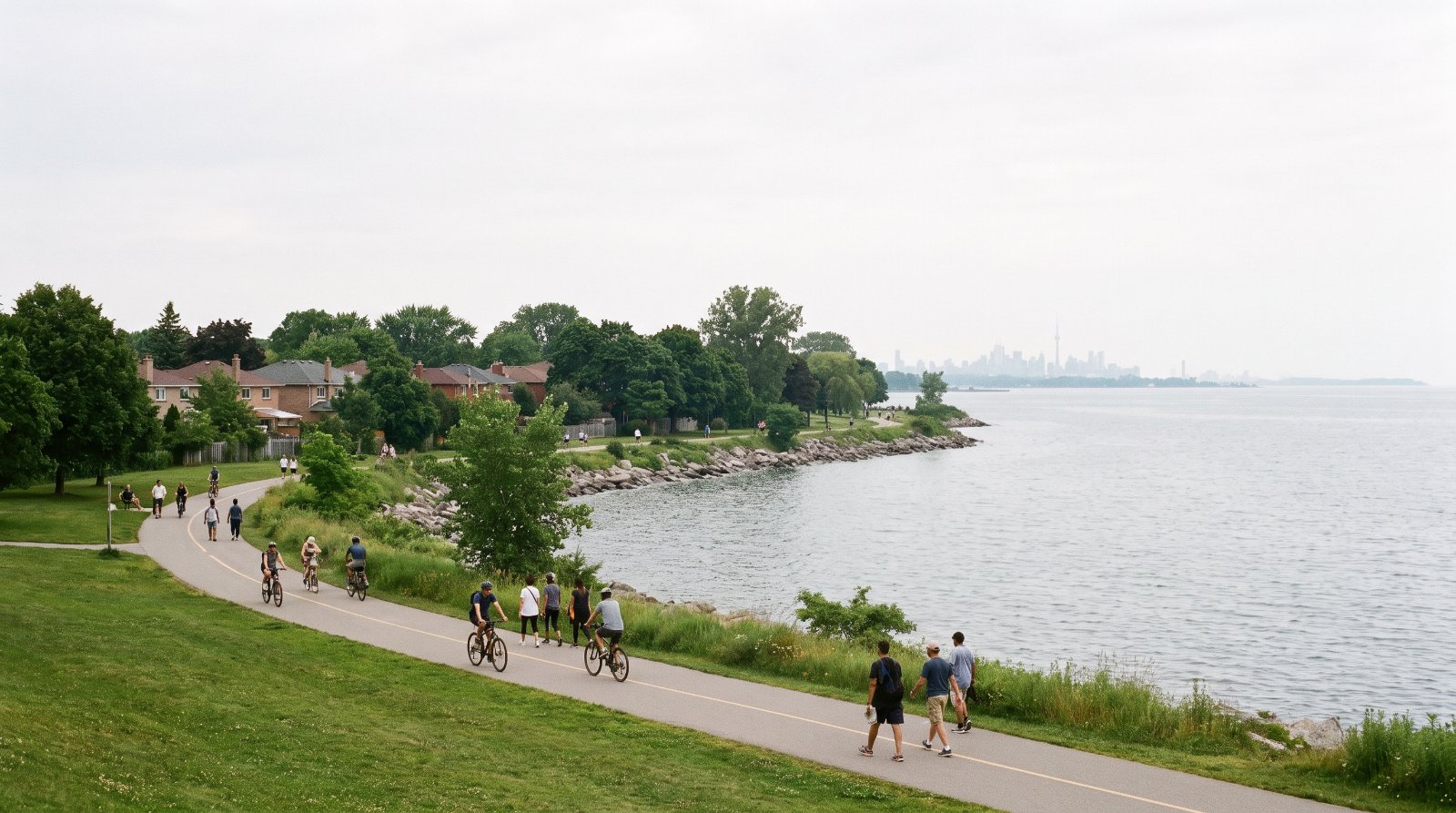
The ten things buyers in Lakeview are least often told, all of them documented: the Province’s zoning order for Lakeview Village says, in its own words, “There is no maximum height” on the apartment and commercial lands, while the City’s Official Plan next door caps Lakeshore Road East at two to eight storeys and 30 metres; the approved unit count went from 8,050 in 2021 to 16,000, and the City’s own project page still says 12,000; the 518 million litre a day wastewater plant on the shoreline failed its effluent limits for suspended solids and phosphorus in 2025, ran seven bypasses totalling about 725 million litres, and had no Ministry inspection at all that year; four odour complaints are published in the plant’s 2025 annual report and the mitigation works are three to six years away; the plant ran at 83 per cent of rated capacity in 2025 and its $1.03 billion expansion must be in service by 2041; Class 4 industrial noise warning clauses will be registered on title in Blocks 1 to 5 and 18 of Lakeview Village; a 1954 hurricane is still the legal design storm here, at 285 mm of rain in 48 hours; 63 per cent of the local housing stock was built in 1980 or earlier and renters are cost-burdened at 41.6 per cent against 22.1 per cent for owners; the Hazel McCallion light rail line stops at Port Credit GO and rail transit to Lakeview is a post-2041 aspiration; and there is no municipal land transfer tax here at all, which on a $1.5 million house is $26,475 you do not pay.
None of that is an argument against buying here. Lakeview is getting a new 26-hectare conservation area, 45 acres of parkland, a rebuilt pier and the largest waterfront redevelopment in Mississauga’s history, on a shoreline that was closed to the public for half a century. It is an argument for buying here with the documents open.
Every item is traced to a primary source — a provincial regulation, a Council by-law, a Region of Peel annual compliance report, a Class Environmental Assessment, an acoustic feasibility study, a census profile — and each is listed at the bottom with the date I read it. A few figures on this page are my own arithmetic from official tables rather than published statistics, and they are labelled where they appear. Nine things I deliberately left off because I could not source them properly: the names and capacity figures of the schools serving Lakeview, the Record of Site Condition for the Lakeview Village lands and any soil or groundwater result, the demolition date of the four Lakeview smokestacks, the opening date of the Hazel McCallion Line, the completion date for the Long Branch GO works, the full MiWay route list and frequencies on Lakeshore Road East, whether Mississauga has a vacant home tax, the current Non-Resident Speculation Tax rate, and the annual short-term rental licence fee. I will publish those when I can cite them.
Lakeview is the last big piece of unbuilt Lake Ontario shoreline between Toronto and Hamilton, and the Province and the City are currently disagreeing, in writing, about how tall it should be. Behind the construction hoarding is a 177-acre former coal-fired power station site. Beside it is the largest wastewater treatment plant in Peel Region. Between them is a neighbourhood of wartime houses and 1960s apartment slabs that is about to have as many as 16,000 new homes dropped next to it.
One geographic note before the list, because it decides which documents apply. The City’s Lakeview Local Area Plan defines the Lakeshore Corridor as running “from Seneca Avenue to the east end of the municipal boundary at Etobicoke Creek” — so Etobicoke Creek is the Mississauga line, and Marie Curtis Park straddles the creek mouth on both sides of it. Statistics Canada does not publish a geography called Lakeview; the closest published unit is the L5E postal district, and where I quote census figures below they are L5E, not Lakeview, and I say so each time.
1The Province zoned Lakeview Village with no maximum height at all
This is the single most under-reported fact about buying anywhere near this site, and it is four words long.
Ontario Regulation 91/23, the Zoning Order — City of Mississauga, Regional Municipality of Peel, was made and filed on 12 May 2023 by Steve Clark, then Minister of Municipal Affairs and Housing, and published in The Ontario Gazette on 27 May 2023. The City’s news release describes it as issued in late 2023 and its project page says May 2023; the regulation itself carries the 12 May 2023 date, so that is the one I use.
| The Province’s zoning order (O. Reg. 91/23) | The City’s Official Plan next door (MOP 2051) | |
|---|---|---|
| Height, apartment lands | s.4(3)2, Residential Apartment 5 zone: “There is no maximum height.” | Lakeview LAP §12.2.4: “Development fronting Lakeshore Road East will be two to eight storeys in height” |
| Height, commercial lands | s.6(2)2, Commercial 4 zone: “There is no maximum height.” | §12.2.5: additional height up to a maximum of 30 metres on existing lots deeper than 60 metres |
| Named height caps | Two only — areas 10-C and 10-D on Map 334, each a maximum of 10 storeys | §12.2.7: a streetwall of minimum two to maximum four storeys |
| Floor area | 2,200 m² maximum gross floor area per storey above 12 storeys, except Block “A”, which has no maximum | §12.1.1.1: the commercial site at North Service Road and Stanfield Road may intensify to a maximum of four storeys |
| Resident parking | 0.7 spaces per apartment unit, 1.0 per townhouse, 0.15 visitor spaces per unit; EV-ready at 10 per cent of resident and 5 per cent of visitor spaces | §12.1.3.2: industrial and Business Employment buildings along the CN line limited to “a maximum height generally equivalent to a two storey residential building” |
Two more things about that Order that almost nobody knows. It applies to lands shown on Maps 332, 333 and 334, which are filed at the Ministry’s Toronto office at 777 Bay Street and are not published in the regulation text — so the boundaries of the no-height-limit area are not something you can read online. And section 13 provides that the Order “is deemed for all purposes, except the purposes of section 24 of the Act, to be a by-law passed by the council of the City of Mississauga.” It displaces Mississauga Zoning By-law 0225-2007 and most of By-law 0119-2022.
What makes it an enhanced Minister’s Zoning Order is section 12(2): every owner must enter into one or more agreements with the City dealing with the matters in section 47(4.4) of the Planning Act. That is the hook the City used to get money and affordable units out of it, which is item 2.
How to read this as a buyer. Both of these are current law, at the same time, on adjoining land. If you are buying a low-rise property on Lakeshore Road East, the City’s two-to-eight-storey policy is your planning context. If you are buying a view unit in Lakeview Village, nothing in the Province’s order stops a taller building going up in front of you, and the maps that would tell you where are in a filing cabinet on Bay Street. Ask me to pull the live file for the block in front of you before you write.
2The approved unit count went from 8,050 to 16,000, and the City’s own two pages disagree
The master plan for the 177-acre site was endorsed by Council on 6 November 2019. The land is the former Lakeview Generating Station, bought from Ontario Power Generation in 2017 by Lakeview Community Partners Limited — TACC Construction, Greenpark, CCI Development, Branthaven and Argo. The municipal addresses are 1082 Lakeshore Road East and 800 Hydro Road, and the planning file is OZ 19-3 W1.
| Date | What happened | Units |
|---|---|---|
| 6 November 2019 | Master plan endorsed by Council | — |
| 2021 | Approved by the City | 8,050 |
| 12 May 2023 | Enhanced Minister’s Zoning Order, O. Reg. 91/23, s.3(4)1: “There shall be no more than 16,000 dwelling units.” | 16,000 |
| 8 April 2024 | Minister’s Order under s. 49.2 of the Planning Act requiring the City and the owner to enter agreements on community benefits and affordable housing | — |
| May 2024 | Council by-law authorising the subdivision agreement and a community benefits agreement worth $14 million toward the pier and cultural amenities, tied to the first 8,050 units | 8,050 |
| 2 October 2024 | Council enacted the by-law authorising execution of the s.49.2 Agreement, Special Council Item 18.1 | 16,000 |
| 7 October 2024 | Tridel and the owner launched construction of the first residential building, Harbourwalk; occupancy projected early 2029 | — |
| Still published today | The City’s own Lakeview Village project page states 12,000 residential units, including 800 affordable or attainable | 12,000 |
Both the 16,000 figure and the 12,000 figure were live on City of Mississauga pages on 31 August 2026. The 16,000 comes from the regulation and the City’s 7 October 2024 news release; the 12,000 comes from the City’s Lakeview Village project page. I am not going to pretend one of them is authoritative for planning purposes. The regulation is law; the project page is the City describing its own project. The terms of the October 2024 agreement are worth knowing because they set the affordable share precisely: an additional $28 million for reconstruction of the Lakeview Village Pier on top of the earlier $14 million, 5 per cent of all units beyond 8,050 up to 16,000 affordable, and a further 5 per cent of mixed type or tenure — shared-equity mortgage or market rental. The earlier 8,050-unit agreement required the owner to complete odour and noise mitigation measures and to set aside land for a Peel District School Board school site.
And Lakeview Village is not the only file. I enumerated the City’s complete list of active development applications on 31 August 2026, and the result is itself a finding: there are only two active applications in the whole Lakeview study area. Everything else on Lakeshore Road East in that list is in Port Credit, west of here. Those two, though, are large:
| File | Where | What is proposed | Status |
|---|---|---|---|
| OPA 24-11 W1 Rangeview Estates |
850–1083 Rangeview Road and 830–1076 Lakeshore Road East, south side, east of Cawthra Road | Increase density from 3,700 to 5,300 dwelling units, revise the park layout, and identify locations for 25-storey apartment buildings; extensions of Ogden Avenue and Leading Sea Avenue | Under review. Master plan endorsed by Council 31 July 2024; public meeting 24 November 2025 |
| OZ/OPA 22-32 W1 Dixie Outlet Mall |
1250 South Service Road, Ward 1 | “Four 4 to 19 storey apartment buildings consisting of 997 residential units, park space and the demolition of a portion of Dixie Mall” | Under review, updated 8 June 2026. Submitted January 2023 with Phase 1 and Phase 2 Environmental Site Assessment Reports on file; resubmitted May 2024 |
On contamination I am going to be careful, because the primary record is not public. The Rangeview public notice says only this: “The remediation of potential on-site contamination will be evaluated through the review of future rezoning applications.” For the Lakeview Village lands I could not obtain a Record of Site Condition or any soil or groundwater result, so there is nothing about either on this page. What I can tell you is the legal framework: a residential Record of Site Condition under O. Reg. 153/04 is required before residential use of a former industrial site, and you or your lawyer can ask for the specific record by file number.
How to read this as a buyer. The affordable commitment applies to units above 8,050, not to the whole project, and it is contractual rather than aspirational. More usefully: the fact that the City wrote odour and noise mitigation into the very first agreement tells you what the City itself expected the issues here to be. Items 3 to 6 are those issues.
3The wastewater plant on the shoreline failed two of its effluent limits in 2025, and the Ministry did not inspect it once
The G.E. Booth Water Resource Recovery Facility at 1300 Lakeshore Road East is Peel’s largest wastewater plant, rated at 518 million litres a day, part of the second-largest water and wastewater system in Ontario and the fourth-largest in Canada. It is a Class 4 facility under O. Reg. 129/04 and it serves Bolton, Caledon East, the east sides of Brampton and Mississauga, parts of York Region and part of the City of Toronto. Peel says it has been in service since 1955; the City’s own Lakeview Local Area Plan says the plant opened in 1961 and was later renamed. Two official sources, two dates.
Here is what its own 2025 Annual Performance Report records. This is a compliance document the Region is required to publish, and it is not written to be read by homebuyers.
| 2025 result | Figure | Limit |
|---|---|---|
| Total Suspended Solids, annual average | 28.63 mg/L | 25 mg/L under the Environmental Compliance Approval — failed |
| Total Phosphorus, annual | Failed the ECA final-effluent limit | |
| Federal Wastewater Systems Effluent Regulations | TSS breached the 25 mg/L monthly average in February, March, November and December; CBOD breached in February | |
| February 2025 alone | TSS 103.86 mg/L; CBOD 30 mg/L; TP 1.48 mg/L; phosphorus loading 563 kg/day against a 394 kg/day limit | |
| November 2025 | TSS 41.90 mg/L, TP 0.9 mg/L — multiple incinerator units offline for capital work | |
| December 2025 | TSS monthly average 34.23 mg/L | |
| Disinfection | The report records “short periods of disinfection interruption in the final effluent” | |
| Bypasses and spills | Seven secondary bypasses and seven spill events | |
| Ministry inspection | §5.1: no MECP inspection of the plant took place in 2025 | |
The February failure has a documented cause: a ferrous chloride dosing failure in Plant 2, primary clarifiers 12 and 13 out of service for scum accumulation, and cold temperatures. The Region’s own summary judgement, at §4.14.1, is this: “Despite the plant being near the hydraulic rated capacity for several years, the plant meets the Approval limits most of the time.” The seven bypasses, all from Plant 3, all secondary, all disinfected, were these:
| Date | Volume | Reason given |
|---|---|---|
| 5–6 March | 14 ML | Heavy precipitation and snow melt |
| 10–11 March | 14 ML | Snow melt |
| 15–18 March | 147 ML | Heavy precipitation and snow melt |
| 2–4 April | 452 ML | Heavy precipitation |
| 23–24 September | 8 ML | Other |
| 17 November | 3 ML | Heavy precipitation |
| 28–29 November | 87 ML | Heavy precipitation and snow melt |
Adding the seven published bypass volumes gives about 725 million litres released in 2025. The table is the Region of Peel’s, taken from an official compliance report; the addition is mine. Each event carries its own MECP Spills Action Centre reference number, listed in the report.
How to read this as a buyer. None of this is hidden — it is published every year, by law, in a PDF almost nobody opens. It is also not a reason to panic: the effluent is released 1.4 kilometres offshore and the exceedances are episodic rather than constant. What it is, is a fact about the single largest piece of infrastructure in this neighbourhood, on a year when the Ministry did not inspect it. If you are buying within sight of the plant, read the current annual report before you write, not after.
4Four odour complaints are on the 2025 public record, and the fix is three to six years away
Peel is required by its Environmental Compliance Approval to log, investigate and resolve odour complaints, and to publish them. Four entries appear for 2025. The Region’s own words are more informative than any summary of them.
| Date | Complaint | Peel’s recorded response |
|---|---|---|
| 19 July | “Report of strong sewage odours on July 19 and periodically throughout the summer.” | Plant performance and air quality data for that date reviewed and found “within normal operating ranges”; local collection system assessed |
| 16–17 September | “Report of strong sewage odours near the lake shore, recurring outdoor odours throughout the previous month, believed to be originating from the facility.” | “One odour control unit was temporarily shut down for maintenance on September 16 and restarted on September 17, which may have contributed to the odour.” Dry weather also identified as a factor |
| 22 September | Sewage odours over the weekend, “potentially associated with plant operations and maintenance activities” | Sources identified as “the ferric sulfate trial and ongoing maintenance on primary clarifier 9 and TOX 2” |
| 1 December | Report of “severe odours on November 25 and 27” and ongoing concerns during the summer | “Likely related to increased solids inventory due to biosolids processing limitations with only two TOX units in operation at the time.” Site inspected 1 December, no abnormal odours detected |
The Region is not denying the problem. Its public odour page states that the plant “is being upgraded to reduce odours and modernize the facility” and that “the local community can expect odours to drop by more than 90% once this work is done.” The works include enclosing the primary clarifiers, building new odour control facilities and upgrading the highest-odour sections such as the headworks building. Staff use olfactometers around the site and the plant carries real-time odour sensors tracking wind-driven change.
The timing is the part that matters to a purchase decision. The 2025 annual report states at §4.10 that the odour mitigation upgrades are “expected to be completed in the next 3 to 6 years” — which from a 2025 report means somewhere between 2028 and 2031. Meanwhile the money is real: $25,730,199 was spent on odour mitigation alone in 2025, within a total plant capital spend of $125,220,623.
How to read this as a buyer. The odour is documented, the cause is usually a specific unit being down for maintenance, the fix is funded, and the fix is three to six years out from a report published in 2026. If you are buying anywhere on the eastern Lakeview shoreline, view on a warm still day rather than a windy one, and know that the complaint line is 905-791-7800 and that every call you make ends up in a published table. That is unusually good transparency for a piece of infrastructure. Use it.
5The plant is running at 83 per cent of capacity, and its billion-dollar expansion has a legal deadline of 2041
From §4.8 of the 2025 report: the annual average daily flow was 427.8 million litres a day, or 83 per cent of rated capacity, and “flows to the plant peaked in 2019 at 91% of the capacity.” The Region adds, in its own words, that it “recognizes that the plant capacity is approaching 90% of design, which increases the possibility of bypass occurrences and potential impacts to effluent quality during high flows.”
That is the engine behind everything else on this list. The Region’s Schedule C Municipal Class Environmental Assessment, Volume 0 Executive Summary, March 2024, sets out the plan:
| Element | What the Class EA says |
|---|---|
| Preferred solution | Expand G.E. Booth from 518 to 550 MLD; expand Clarkson from 350 to 500 MLD |
| Diversion sequence | 80 MLD diverted to Clarkson from 2026; Clarkson expands in 2029; a further 70 MLD by 2031, 150 MLD in total |
| Trigger date | G.E. Booth reaches 90 per cent of approved capacity in 2041. “Expansion facilities at the G.E. Booth WRRF must be in service by 2041.” |
| East-to-West trunk sewer diversion | 2,400 mm diameter, 11 km deep gravity tunnel between Spring Creek and the Credit River, largely along Derry Road. The March 2024 EA expected completion by 2026; the 2025 annual report says 2028, redirecting about 70 MLD. I use the newer date. |
| Offline storage | A storage facility on the East Trunk Sewer to cut wet-weather peaks and secondary bypasses, “expected to be brought into service in 2026” |
| Capital cost | $1,033,600,000 in 2023 dollars for the plant expansion; about $1.2 billion including the new outfall. The outfall alone is $209,704,000. |
| New outfall | A 3,000 m long, 6 m diameter tunnel with diffusers beginning 2,000 m offshore, 68 ports over a kilometre, initial peak capacity 2,100 MLD, design life 75 to 100 years |
| Process changes | Chlorination and dechlorination replaced with UV disinfection; new anaerobic digestion upstream of incineration |
| Site | “The ash lagoons will be removed, tanks covered, and the site landscaped to include plantings and buffers.” |
On 26 February 2024, Peel Regional Council approved an additional $130 million to add 40 MLD of capacity and move its availability forward from 2039 to 2028. The Region states that 40 MLD can support between 28,000 and 47,000 additional housing units depending on the type of development. The contractors named are ROMAG Contracting Ltd. and CIMA Canada Inc.
The solids side is the part that generates the odours and the trucks. G.E. Booth thickens, dewaters and incinerates sludge on site, in fluidized-bed incinerators whose exhaust gases leave the freeboard at 700 to 900 °C, with ash slurry pumped to on-site lagoons. In 2025 the plant generated 47,481 dry tonnes of sludge cake, incinerated 45,891 dry tonnes and turned 1,590 into fertilizer. Clarkson’s dewatered biosolids are trucked about 18 kilometres to G.E. Booth to be burned. The EA’s own verdict: “The existing incineration process at the G.E. Booth WRRF has challenges related to its capacity, long-term sustainability, cost effectiveness, and reliability.”
How to read this as a buyer. A billion dollars is about to be spent on this site over the next fifteen years, ending with covered tanks, no ash lagoons, UV disinfection and a landscaped buffer. That is genuinely good for property values on the east side of Lakeview. It also means fifteen more years of heavy construction next to a residential neighbourhood that does not exist yet. The EA itself names who is affected: “the G.E. Booth WRRF is surrounded by sensitive land uses, including Applewood Creek and Marie Curtis Park to the east, the planned Lakeview Village Development to the west.”
6Industrial noise warning clauses will be registered on the title of Lakeview Village homes
The City published the Lakeview Village Community Environmental Noise Feasibility Report, prepared by Valcoustics Canada Ltd., File 120-0302. Section 6.2.4 sets out the warning clauses that are to be registered on title and included in agreements of purchase and sale and in leases. These are not optional developer boilerplate; they are a planning requirement.
| Clause | Applies to | What it says |
|---|---|---|
| Type B | All dwelling units | Despite noise control features, “sound levels due to increasing road traffic may on occasions interfere with some activities of the dwelling occupants as the sound levels exceed the sound level limits of the Municipality and the Ministry of the Environment, Conservation and Parks” |
| Type D | All dwelling units | Central air conditioning is supplied “which will allow windows and exterior doors to remain closed” |
| Type E | Units near Rangeview Road | “Purchasers/tenants are advised that due to the proximity to the existing industrial uses along Rangeview Road, sound from these facilities may, at times, be audible.” |
| Class 4 | Blocks 1 to 5 and 18 | “Notwithstanding any noise mitigation at source or in the design of this development and individual dwellings, noise from the industrial/infrastructure facilities may at time interfere with some activities of the dwelling occupants. In the event of such an occurrence, residents are advised to close the windows.” |
The industrial neighbours are named in the study: Interior Manufacturing Group at 895 Lakefront Promenade and 992 and 996 Rangeview Road, Xtreme Tire Garage at 1044 Rangeview Road, Long Branch Foundry, Plasterform Decorative Architectural Systems and Allegion. The City’s Official Plan protects rather than converts the adjacent Dixie Employment Area: Chapter 16 §16.8 states that “existing and permitted employment uses within the area will be protected from non-compatible uses to ensure continued viability of the Employment Area.”
On the treatment plant specifically, §6.3.3 records that G.E. Booth “operates 24 hours a day, 7 days a week”, and that the modelling used the plant’s Acoustic Assessment Report by Wood Environment & Infrastructure Solutions dated 25 October 2019, prepared for its Amended Environmental Compliance Approval 6339-BJJRCS dated 22 January 2020. Modelled levels at Lakeview Village came in below both the Class 1 and Class 4 exclusion limits, so no mitigation was required for the plant. But the report is explicit that the acoustic assessment “did not account for the future noise sources that may be added as part of the expansion” — the same billion-dollar expansion in item 5.
Two more findings from the same study. The site design “includes commercial buildings along the east property line that will act as a buffer between the wastewater treatment plant and the proposed residential uses”, and the report notes those buffer buildings may themselves include noise-sensitive uses such as post-secondary educational facilities. And a verified negative that is worth more than most of the positives on this page: §4.1.3 states that “the Lakeview site is well outside the NEF 25 contour from Pearson International Airport. Thus, aircraft noise impacts are not anticipated for this site and have not been considered further.” The site sits about 350 metres from the CN Oakville Subdivision, which carries freight, VIA and GO trains, and the setback was judged sufficient.
How to read this as a buyer. If someone tells you Lakeview is under the flight path, they are wrong and there is a study that says so. If someone tells you a Class 4 designation is a technicality, they are also wrong: it is a formal acknowledgement that industry is allowed to be louder here than in an ordinary residential area, and the remedy written into your own title document is to close the window. Read your agreement of purchase and sale for the block number. Blocks 1 to 5 and 18 are the ones that carry it.
7A 1954 hurricane is still the legal design storm here, in 2026
Ontario Regulation 41/24, Prohibited activities, exemptions and permits, under the Conservation Authorities Act, was made on 5 December 2023, filed 16 February 2024 and published in The Ontario Gazette on 2 March 2024. Schedule 1, Table 1 lists both Credit Valley Conservation and the Toronto and Region Conservation Authority — the two authorities whose jurisdictions meet in Lakeview — and for both, for all areas, the applicable standards are “the Hurricane Hazel Flood Event Standard, the 100 Year Flood Event Standard and the 100-year flood level plus wave uprush.”
Schedule 2 defines that first standard in hourly detail: over 48 hours in a drainage area of 25 km² or less, 73 mm in the first 36 hours, then 6, 4, 6, 13, 17, 13, 23, 13, 13, 53, 38 and 13 mm in hours 37 through 48 — a total of 285 mm in 48 hours. Section 4(1) requires each authority to publish maps of the areas where development is prohibited, and section 4(2) to review them at least once a year.
| What the documents say about water in Lakeview | Source |
|---|---|
| Five watercourses plus the Lake Ontario shoreline make up the Natural Hazard Lands: Etobicoke Creek, Applewood Creek, Serson Creek, Cawthra Creek and Cooksville Creek | Lakeview Local Area Plan §7 |
| The Dixie Employment Area contains lands “within a storm flood plain” with a special policy area established by TRCA restricting development | MOP 2051 Chapter 16 §16.8 |
| Special Site 132: lands west of Etobicoke Creek at Dundas Street East are “entirely within the Regional Storm Flood Plain of the Etobicoke Creek”; the minimum level of flood protection is never less than the 350-year storm flood plain | MOP 2051 Chapter 17 |
| Special Site 129, Applewood: in the Little Etobicoke Creek spill zone, classified as special policy area flood plain; TRCA approval required for any building, addition, fill placement or watercourse alteration | MOP 2051 Chapter 17 |
| Etobicoke Creek watershed: 22,404 hectares, six Flood Vulnerable Clusters covering 508 hectares, about 60 per cent urban and 12.3 per cent natural as of 2019 | TRCA watershed page |
| Every subwatershed except the Headwaters is more than 50 per cent impervious; Little Etobicoke Creek is highest at 68.7 per cent | TRCA watershed page |
There is a water quality footnote worth knowing if you plan to swim. A 2018 TRCA research project traced sources of fecal contamination at sites along Etobicoke Creek between Highway 407 and Marie Curtis Park at the creek mouth, after a record-setting 126 mm in 24 hours rain event, and the results “suggested that stormwater outfalls may be a major source.” On the day I read TRCA’s site, 31 August 2026, it was carrying a live banner: “A Flood Watch is in effect.”
How to read this as a buyer. A storm from 1954 is the number the engineers still design to, and it is written into a regulation made in 2023. That is not nostalgia, it is the largest rainfall event on record in this watershed, and the creek that carried it is the eastern boundary of Lakeview. Before you waive conditions on anything near Etobicoke, Applewood, Serson, Cawthra or Cooksville Creek, ask me to run the address against the conservation authority’s regulated area mapping. It takes minutes and it is the cheapest thing in the transaction.
8Two thirds of the housing here predates 1981, and renters are cost-burdened at nearly twice the owner rate
A geography note first, because it changes what the numbers mean. Statistics Canada does not publish a geography called Lakeview. The closest published unit is the L5E forward sortation area, the postal district that covers the neighbourhood. Everything in this item is the 2021 Census Profile for L5E, and it is the postal district, not the neighbourhood boundary.
| Period of construction, L5E | Dwellings |
|---|---|
| 1960 or before | 1,610 |
| 1961 to 1980 | 1,765 |
| 1981 to 1990 | 415 |
| 1991 to 2000 | 630 |
| 2001 to 2005 | 300 |
| 2006 to 2010 | 190 |
| 2011 to 2015 | 175 |
| 2016 to 2021 | 245 |
On those published counts, 63.3 per cent of the occupied stock in L5E was built in 1980 or earlier, and 30.2 per cent predates 1960. The counts are Statistics Canada’s, from the official 2021 Census Profile, published as 25 per cent sample data; the percentages are my arithmetic from them.
The stock is also unusually split between two extremes. Of 5,315 occupied private dwellings, 2,475 are single-detached houses and 1,630 are apartments in buildings of five or more storeys, with only 160 semi-detached and 490 row houses in between. That is a wartime-and-1960s neighbourhood with almost no missing middle — and up to 16,000 new units proposed on 177 acres next door.
| 2021 Census, L5E postal district | Figure |
|---|---|
| Population | 12,972 |
| Total private dwellings | 5,539, of which 5,315 occupied by usual residents |
| Median age | 45.2 — average 44.0 |
| Aged 65 and over | 2,670, or 20.6 per cent |
| Owner households / renter households | 4,105 / 1,230; 54.6 per cent of owners carry a mortgage |
| Median value of dwellings | $900,000 — average $1,030,000 |
| Median monthly shelter cost | $1,660 owned, $1,400 rented |
| Spending 30 per cent or more of income on shelter | 22.1 per cent of owners; 41.6 per cent of tenants |
| In core housing need | 9.5 per cent of owners; 29.0 per cent of tenants |
| Tenant households in subsidised housing | 16.3 per cent |
| Median total household income, 2020 | $98,000 — average $122,000 |
| Dwellings needing major repairs | 320 of 5,335 |
How to read this as a buyer. Two facts sit together here. Nearly two thirds of the houses predate 1981, so your inspection matters more than your comparables do — ask about the drains, the panel and the pipe material before you ask about the kitchen. And the renter side of this neighbourhood is already under real pressure, at 41.6 per cent cost-burdened and 29.0 per cent in core housing need, three times the owner rate. Only a defined slice of the new units above 8,050 is contractually affordable. If you are an investor modelling rents here, model that.
9The light rail line does not come to Lakeview, and rail transit here is a post-2041 aspiration
Metrolinx describes the Hazel McCallion Line as “18 km of light rail transit from Port Credit GO to Brampton Gateway Terminal”, with 19 stations and stops and four major transit hubs. The southern terminus is Port Credit GO. Lakeview is east of Port Credit, and the line does not enter Lakeview. Two extension studies exist as separate Metrolinx projects, to downtown Mississauga and downtown Brampton; neither extends toward Lakeview. Metrolinx’s overview page carries no in-service date, so I am not printing one.
What Lakeview is actually getting is bus. The Lakeshore Bus Rapid Transit project “is planned to extend for two kilometres along Lakeshore Road from the Etobicoke Creek to East Avenue”, funded through the Investing in Canada Infrastructure Program. Its Transit Project Assessment Process is finished: Notice of Commencement re-issued June 2022, Notice of Completion issued 27 July 2023, the 30-day public review closed 28 August 2023 and the 35-day Minister’s review closed 3 October 2023. In the City’s words, “the TPAP for this project is now complete.” The appendices include a Phase 1 Environmental Site Assessment, an air quality report, an environmental noise assessment, a climate change report and culvert extension drawings for Applewood and Serson Creeks.
| Lakeshore Connecting Communities Transportation Master Plan, endorsed by Council 5 June 2019 | What it commits to |
|---|---|
| Corridor | 13 km of Lakeshore Road from Southdown Road to Etobicoke Creek, plus Royal Windsor Drive; horizon 2020 to 2041 |
| Growth assumed | “This corridor is expected to grow by 56,000 people and 16,500 jobs by 2041, based on proposed developments along Lakeshore Road.” |
| Phase One, 2019–2025 | Local bus every 7.5 minutes, express every 10 minutes in rush hour |
| Phase Two, 2025–2030, east end | Dedicated transit lanes from East Avenue to Deta Road, protected cycle tracks, express bus every 5 minutes in rush hour |
| Phase Three, post-2041 | “The extension of rail-based transit from the Long Branch GO Station to Mississauga Road.” |
The nearest rail station is Long Branch GO, station code LO on the Lakeshore West line, which is in Toronto, immediately east of Etobicoke Creek. It is currently under major reconstruction: a new west tunnel with elevators and stairs, a new east pedestrian tunnel with elevators and stairs, modified Edgeware Drive stair access with a new canopy, and rehabilitated platforms with a snow-melting system and heated shelters. At the time I read the notices, the north platform staircase on Edgeware Drive was closed, the east platform was being demolished, and Metrolinx was advising that “half of the platform is closed for construction and not all train doors will open at Long Branch GO” — riders must use one of the five coaches closest to the locomotive. No completion date is published on the project page, so I am not giving you one.
On the bus side, the MiWay service changes released on 20 June 2025 name three routes in the Dixie and Lakeview corridor: Route 4 North Service Road, Route 5 Dixie and Route 31 Ogden. “Route 31 Ogden will be revised to provide service from Long Branch GO station to Dixie GO station via Ogden Avenue.” Stops inside the Dixie Outlet Mall bus terminal for all three routes were moved out to a new on-street bay on Dixie Road “due to congestion and accessibility issues”, and Route 5 no longer loops inside the terminal. I could not retrieve the full route list or the frequencies for Lakeshore Road East itself, so those are not on this page.
How to read this as a buyer. If a listing or a pre-construction pitch mentions the LRT, ask where the southern terminus is. It is Port Credit GO, and the plan that would bring rail to Lakeview is a Phase Three item beyond 2041 in a 2019 master plan. What is real and dated is a two-kilometre bus rapid transit corridor with a completed environmental assessment, dedicated transit lanes to Deta Road in the 2025 to 2030 phase, and a GO station across the creek in Toronto that is being rebuilt right now. Price the bus, not the train.
10There is no municipal land transfer tax here at all, and your assessment is from 2016
This is the item that puts money back in your pocket, and it is the clearest difference between buying in Lakeview and buying three hundred metres east across Etobicoke Creek. Ontario levies land transfer tax under section 2(1) of the Land Transfer Tax Act: 0.5 per cent to $55,000, 1.0 per cent to $250,000, 1.5 per cent to $400,000, 2.0 per cent above that, and an additional 0.5 per cent on the amount above $2,000,000 where the land contains one or two single-family residences. First-time buyers can claim a refund of up to $4,000.
Toronto charges a second, municipal land transfer tax on top, under power granted by the City of Toronto Act, 2006 and implemented as Toronto Municipal Code Chapter 760, applied to every Toronto purchase since 1 February 2008. On 17 December 2025 Toronto Council passed graduated rates for higher-value residential property, effective 1 April 2026: 2.5 per cent from $2,000,000.01 to $3,000,000, 4.40 per cent over $3M to $4M, 5.45 per cent over $4M to $5M and 6.50 per cent over $5M to $10M. Neither the Region of Peel nor the City of Mississauga levies a municipal land transfer tax — the taxing power exists only under the Toronto statute.
The bracket tables below are the Province’s, read from the Land Transfer Tax Act on e-Laws, and the City of Toronto’s, read from its published rate page. Both are official. The dollar figures are my arithmetic applied to those brackets, and you should have your own lawyer confirm them on your own transaction.
| Purchase price | Ontario land transfer tax — payable either side of the creek | Toronto municipal land transfer tax you do not pay in Lakeview |
|---|---|---|
| $800,000 | $12,475 | $12,475 |
| $1,000,000 | $16,475 | $16,475 |
| $1,500,000 | $26,475 | $26,475 |
| $2,500,000 | $48,975 | $48,975 |
| $3,500,000 | $73,975 | $83,475 |
Note what the April 2026 Toronto brackets did to the top of that table. Below $2 million the two taxes mirror each other, so the Mississauga saving is simply equal to the provincial tax. Above $3 million they no longer mirror, and the gap widens sharply. On a $3.5 million house the Toronto municipal tax alone is $83,475, and in Lakeview it is nil. On the Non-Resident Speculation Tax I am not printing a percentage: section 2(2.1) of the Act sets 15 per cent but expressly allows the Minister to prescribe an alternate rate by regulation, and I have not read the current regulation.
| MPAC, the assessment your Mississauga tax bill is built on | What MPAC states |
|---|---|
| Valuation date for 2026 taxes | “Property assessments for the 2026 property tax year will continue to be based on fully phased-in January 1, 2016 current values.” |
| Why | The province filed a regulation on 16 August 2023 extending the postponement of a province-wide reassessment through the end of the 2021–2024 cycle |
| The test for an appeal | MPAC’s own framing: “Could I have sold my property on January 1, 2016 for the assessed value.” |
How to read this as a buyer. A Lakeview house whose 2021 census-reported median value was $900,000 is being taxed in 2026 off a 1 January 2016 valuation, and so is a brand-new Lakeview Village condo. That is a live fact, not a historical one. On the vacant home tax: a search of the City of Mississauga’s by-law and publication library returns no vacant home tax by-law, and the only City reference is a 23 June 2021 news release listing it among five potential future revenue tools. I am reporting that as “none found,” not as “there is none” — confirm with the City Clerk before you rely on it.
Four more, because they come up every week
Every new home here pays an education development charge, and it goes up every July. Both Peel boards levy education development charges on every new residential unit, under a 2024 by-law signed in June 2024. For 1 July 2026 to 30 June 2027 the rates are $4,376 (Peel District School Board) plus $1,300 (Dufferin-Peel Catholic District School Board), a total of $5,676 per residential unit. That rises to $5,976 for 2027–28 and $6,276 for 2028–29. The non-residential rate for 2024–25 was $0.56 plus $0.54, or $1.10 per square foot. On the school itself, the earlier Lakeview Village agreement required land to be set aside for a Peel District School Board site, and the Province’s own zoning order, at s.4(1)(g) of O. Reg. 91/23, permits “a public school that is situated in an apartment building, retirement building or long-term care building.” I am not naming the schools that currently serve Lakeview or quoting their utilisation, because I could not retrieve either board’s accommodation data from a primary source.
Lakeview Village’s heating will run on the treatment plant’s treated sewage. The district energy system is owned and operated by Enwave. It runs on natural gas from first occupancy in early 2029 and transitions to treated effluent from G.E. Booth by 2034. Foundation work on the district energy operations centre has already started. The Region’s Class EA confirms it from the other side: “Treated effluent will be used in the DEC to support heating and cooling of buildings in the Lakeview Village Development, thereby significantly reducing GHG emissions.” The City describes the system as positioned to be the first of its kind in Ontario and the largest in Canada. Whatever you think of the source, it is a real answer to a real question about running costs, and it is unusual enough that you should ask how it is billed before you buy.
There is no provincial air quality monitor anywhere near Lakeview. Ontario’s only ambient air monitoring station in Mississauga sits at 3359 Mississauga Road North on the University of Toronto Mississauga campus, at latitude 43.546174 and longitude -79.658797, and it measures ozone, fine particulate and nitrogen dioxide only. On my own calculation from those published coordinates it is roughly 9.6 kilometres west-north-west of the Lakeview Village site — the coordinates are the Ministry’s, the distance is my arithmetic. There is no provincial monitor downwind of the treatment plant, the incinerators or the QEW. That does not mean the air is bad. It means nobody is publishing a number for it, and you should not accept one from a listing.
You cannot run a second unit here as a short-term rental. Mississauga’s Short-Term Rental Accommodation Licensing By-law 0289-2020, approved at Council on 9 December 2020 and amended by by-laws 0251-2021 and 0170-2025, defines a short-term rental as accommodation provided for 30 consecutive days or less, requires a licence, and permits only one licence per person because a person is permitted only one principal residence under the by-law. Applicants must supply government-issued identification, a signed principal-residence declaration and a criminal record check issued within the last 60 days; non-compliant listings must come down within 24 hours of a request from the Licence Manager; and records of every concluded transaction must be kept for three years. Fines under the 2025 amendment run from a minimum of $500 to a maximum of $100,000, with continuing offences at up to $10,000 a day and no overall cap. I have not printed the annual licence fee, because it sits in a User Fees by-law I did not read.
What this list is not
It is not an argument against buying here. On 5 June 2026 the Jim Tovey Lakeview Conservation Area opened to visitors: 26 hectares of new green space west of Marie Curtis Park, led by Credit Valley Conservation with the City, the Region of Peel and TRCA, with a 170-metre boardwalk, nearly four kilometres of new trails with rest areas every 90 metres, scenic viewing areas with interpretive signage, an Indigenous Teaching Amphitheatre, offshore breakwater islands, and Serson Creek reconnected to Lake Ontario. It was built, on the late Councillor’s own founding idea, out of clean fill from Region of Peel capital works. Lakeview Village adds more than 45 acres of parkland and six parks, over 1.5 million square feet of employment space in an Innovation Corridor planned for 9,000 research jobs, and a $17 million National Active Transportation Fund contribution toward extending the Trans Canada Trail. The Small Arms Inspection Building at 1352 Lakeshore Road East, part of this community since 1939 and a place where “two thirds of those employed at this site were women,” reopened as a cultural hub on 23 June 2018. And Lake Shore Road, in the City’s own words, “first opened in 1804, and in 1917 it was the first concrete road in Ontario.” Very few neighbourhoods in the GTA can say all of that, and none of them can say it with no municipal land transfer tax.
The point is that every one of the ten items above is knowable before you sign. Most buyers find out afterwards. That is the entire difference between working with someone who has read the zoning order and the annual compliance report and working with someone who has read the listing.
Thinking about a specific building or street in Lakeview?
A neighbourhood list is the right frame for understanding a market and the wrong frame for a decision. What a home is worth here depends on which block it is on, which side of the Lakeshore Corridor height policy it sits under, whether its title will carry a Class 4 noise clause, how far it is from the treatment plant fence line, and what has actually sold nearby. Send me the address and I will give you the comparable sales that apply to it, the live applications on that block, and a straight answer on whether to move now or wait.
[email protected] · 833-330-1925 · Book a free consultation
Confidential. Read personally and answered within 24 hours. I never share, sell or distribute your information.
Ask the local expert
Ask me anything about Lakeview, Mississauga
Send me the building, the block or the question. You get a straight answer from someone who works this pocket every week, including when the answer is that you should wait. No drip campaign you cannot get out of.
Got it.
I read these personally and answer within 24 hours. If it is urgent, call or text 833-330-1925.
Confidential. Read personally and answered within 24 hours. I never share, sell or distribute your information. Not intended to solicit buyers or sellers currently under contract with another brokerage.
Frequently asked questions
How tall can they build at Lakeview Village?
There is no stated limit on most of it. Ontario Regulation 91/23, the provincial zoning order made and filed on 12 May 2023, says in section 4(3)2 for the apartment zone and section 6(2)2 for the commercial zone that there is no maximum height. Only two areas carry a cap, 10-C and 10-D on Map 334, at ten storeys each. By contrast the City’s Official Plan limits development fronting Lakeshore Road East to two to eight storeys.
How many homes are being built at Lakeview Village?
It depends which City page you read, and both were live on 31 August 2026. The site was approved in 2021 for 8,050 units. The enhanced Minister’s Zoning Order raised the ceiling to 16,000, in the regulation’s own words: there shall be no more than 16,000 dwelling units. The City’s Lakeview Village project page still states 12,000 residential units, including 800 affordable or attainable. The regulation is law; the project page is the City describing its own project.
How much of Lakeview Village will be affordable?
A defined slice above the original approval. Under the section 49.2 agreement Council authorised on 2 October 2024, 5 per cent of all units beyond 8,050 and up to 16,000 must be affordable, plus a further 5 per cent of mixed type or tenure, meaning shared-equity mortgage or market rental. The same agreement adds 28 million dollars for pier reconstruction on top of an earlier 14 million dollar community benefits contribution tied to the first 8,050 units.
Is the sewage treatment plant beside Lakeview a problem?
It has a documented compliance record you should read. The G.E. Booth facility at 1300 Lakeshore Road East failed its Environmental Compliance Approval limits for total suspended solids and total phosphorus in 2025, with an annual average of 28.63 mg/L against a 25 mg/L limit. It ran seven secondary bypasses totalling about 725 million litres on my addition of the published table, recorded seven spill events, and had no Ministry inspection at all that year.
Are there odour complaints on record at G.E. Booth?
Yes, four are published for 2025 in the plant’s own annual report, dated 19 July, 16 to 17 September, 22 September and 1 December. The Region attributed the September odours partly to an odour control unit shut down for maintenance, and the late November odours to increased solids inventory with only two incinerator units running. Peel’s odour page says the community can expect odours to drop by more than 90 per cent once upgrades are done, which the report puts three to six years out.
Will my Lakeview Village home have a warning clause on title?
Very likely. The City-published environmental noise feasibility report by Valcoustics sets out warning clauses to be registered on title and included in agreements of purchase and sale. Type B and Type D apply to all dwelling units, Type E advises that industrial sound from Rangeview Road may be audible, and a Class 4 clause required for Blocks 1 to 5 and 18 advises that industrial or infrastructure noise may interfere with occupants’ activities and that residents should close the windows.
Is Lakeview under the Pearson flight path?
No, and there is a study that says so. Section 4.1.3 of the Lakeview Village Community Environmental Noise Feasibility Report states that the Lakeview site is well outside the NEF 25 contour from Pearson International Airport, so aircraft noise impacts are not anticipated and were not considered further. The site is about 350 metres from the CN Oakville Subdivision rail line, a setback the same report judged sufficient without mitigation.
Does Lakeview flood?
Parts of the area sit in regulated flood plain, and the governing standard is Hurricane Hazel. Ontario Regulation 41/24 applies the Hurricane Hazel Flood Event Standard, 285 mm of rain in 48 hours, to all areas of both Credit Valley Conservation and TRCA. The Lakeview Local Area Plan identifies natural hazard lands along the Lake Ontario shoreline and five watercourses: Etobicoke, Applewood, Serson, Cawthra and Cooksville Creeks. Special policy area flood plain designations apply in the Dixie and Applewood areas.
Does the Hazel McCallion LRT serve Lakeview?
No. Metrolinx describes the line as 18 kilometres from Port Credit GO to Brampton Gateway Terminal, with 19 stations and stops. Port Credit GO is the southern terminus and Lakeview is east of it, so the line does not enter the neighbourhood. Neither extension study heads this way. Lakeview’s transit project is instead a two-kilometre bus rapid transit corridor on Lakeshore Road from Etobicoke Creek to East Avenue, whose environmental assessment completed on 27 July 2023.
Do I pay a municipal land transfer tax in Mississauga?
No. Neither the Region of Peel nor the City of Mississauga levies one; that taxing power exists only under the City of Toronto Act, 2006. You pay the provincial land transfer tax only. On my arithmetic from the published brackets, that means a buyer in Lakeview avoids about 12,475 dollars on an 800,000 dollar purchase, 26,475 dollars at 1.5 million, and 83,475 dollars at 3.5 million once Toronto’s graduated rates from 1 April 2026 are applied.
Related reading
- Top 10 things no one will tell you about Port Credit, Mississauga
- Top 10 things no one will tell you about Alderwood, Etobicoke
- Top 10 things no one will tell you about New Toronto and Long Branch
- Top 10 things no one will tell you about Mimico and Humber Bay Shores
- Top 10 things no one will tell you about The Queensway and Stonegate-Queensway
- Top 10 things no one will tell you about Islington and Etobicoke Centre
- Toronto West market report, July 2026
Sources
Every figure on this page traces to one of these, and each was read on 31 August 2026. Primary sources only — a provincial regulation, a Council by-law, a Region of Peel compliance report, a Class Environmental Assessment, an acoustic study, a census profile, or the agency that administers the thing being described. A few figures are my own arithmetic from official tables and are labelled where they appear. Where I could not verify something from a primary source, it is not on the page.
- O. Reg. 91/23, Zoning Order — City of Mississauga, Regional Municipality of Peel. Ontario e-Laws. Made and filed 12 May 2023, gazetted 27 May 2023. Section 3(4)1 capping units at 16,000; sections 4(3)2 and 6(2)2 stating there is no maximum height; the 10-storey caps at 10-C and 10-D on Map 334; the 2,200 m² per-storey limit and the Block A exception; the 0.7 and 0.15 parking ratios; section 4(1)(g) on a school in an apartment building; sections 12(2) and 13. ontario.ca
- Lakeview Village project page. City of Mississauga. The 177-acre site, the 6 November 2019 master plan endorsement, the 12,000-unit figure, 45 acres of parkland and six parks, the 1.5 million sq ft Innovation Corridor and 9,000 jobs, the $17 million active transportation fund, the ownership by Lakeview Community Partners Limited from OPG in 2017, the May 2024 by-law and $14 million contribution, the Harbourwalk launch of 7 October 2024, and the Enwave district energy timeline of 2029 and 2034. mississauga.ca
- Mississauga’s waterfront revitalization is moving forward with more housing at Lakeview Village, and Special Council Agenda 2 October 2024, Item 18.1. City of Mississauga news release of 7 October 2024 and the by-law authorising execution of the section 49.2 Agreement. The move from 8,050 to 16,000 units, the additional $28 million for the pier, the 5 per cent affordable and 5 per cent mixed tenure terms, the earlier requirement for odour and noise mitigation and a Peel District School Board site, the municipal addresses 1082 Lakeshore Road East and 800 Hydro Road, planning file OZ 19-3 W1, and the Minister’s Order of 8 April 2024 under section 49.2 of the Planning Act. mississauga.ca
- Mississauga Official Plan 2051 — Lakeview Local Area Plan, 24 March 2026. City of Mississauga. Section 12.2 on the Lakeshore Corridor from Seneca Avenue to Etobicoke Creek; §12.2.4 two to eight storeys; §12.2.5 the 30-metre maximum; §12.2.7 the two to four storey streetwall; §12.1.1.1 the four-storey cap at North Service and Stanfield; §12.1.3.2 the two-storey-equivalent limit along the CN line; §7 the five watercourses and natural hazard lands; §2 the history of the generating station, the 1952 water plant and 1961 wastewater plant, Lake Shore Road in 1804 and 1917, and the war-time housing. Mississauga Official Plan 2051 was adopted by Council on 16 April 2025 and approved with modifications by the Ministry of Municipal Affairs and Housing on 24 March 2026, and contains this Local Area Plan as a Part Four document. mississauga.ca
- MOP 2051 Chapter 17 Special Sites, and Chapter 16 Employment Areas, both 24 March 2026. City of Mississauga. Special Site 132 in the Dixie Employment Area, entirely within the Regional Storm Flood Plain of Etobicoke Creek with a minimum flood protection level never less than the 350-year storm flood plain; Special Site 129 in the Applewood neighbourhood; and Chapter 16 §16.8 protecting existing and permitted employment uses in the Dixie Employment Area from non-compatible uses, with the special policy area flood plain within it. mississauga.ca
- 2025 G.E. Booth Water Resource Recovery Facility Annual Performance Report. Region of Peel, published March 2026. The 518 MLD rating, Class 4 designation under O. Reg. 129/04, the ECA numbers, the 427.8 MLD annual average at 83 per cent of capacity and the 2019 peak at 91 per cent, the TSS and TP failures and the 28.63 mg/L annual average, the federal WSER breaches, the February, November and December monthly figures, the disinfection interruptions, the seven bypasses in Table 13, the seven spills, the four odour complaints in Table 12, the 3-to-6-year odour upgrade horizon, the $25,730,199 odour capital spend within $125,220,623 total, the 47,481 dry tonnes of sludge cake, the 2028 diversion date and the absence of any MECP inspection in 2025. peelregion.ca
- G.E. Booth WRRF Schedule C Municipal Class Environmental Assessment, Volume 0 Executive Summary, March 2024. Region of Peel, prepared by GM BluePlan Engineering. The expansion from 518 to 550 MLD, the diversion sequencing, the 2041 in-service requirement, the $1,033,600,000 capital estimate and $209,704,000 outfall, the 3,000 m by 6 m outfall tunnel with 68 diffuser ports, UV disinfection and anaerobic digestion, the removal of the ash lagoons, the incineration challenges, and the list of surrounding sensitive land uses. peelregion.ca
- Peel Region to invest an additional $130 million to expand capacity at the G.E. Booth Water Resource Recovery Facility. Region of Peel press release, 26 February 2024. The additional $130 million, the 40 MLD of capacity, the move from 2039 to 2028, the 28,000 to 47,000 housing units it can support, the 1955 in-service date and the named contractors. peelregion.ca
- Wastewater odours, and water resource recovery processes at Clarkson and G.E. Booth. Region of Peel. The upgrade programme, the statement that the community can expect odours to drop by more than 90 per cent once the work is done, the enclosure of primary clarifiers and headworks upgrades, the olfactometers and real-time odour sensors, and the 905-791-7800 complaint line. The companion process page for Clarkson and G.E. Booth supplies the service area covering Bolton, Caledon East, east Brampton and Mississauga, parts of York Region and part of Toronto, the fluidized-bed incineration at 700 to 900 °C with continuous emissions monitoring and on-site ash lagoons, and the trucking of Clarkson biosolids about 18 kilometres for incineration. peelregion.ca
- Lakeview Village Community Environmental Noise Feasibility Report, File 120-0302. Valcoustics Canada Ltd. for Lakeview Community Partners, published by the City of Mississauga. Section 4.1.2 on the 350-metre CN Oakville Subdivision setback; §4.1.3 placing the site well outside the NEF 25 contour; §6.2.4 the Type B, D, E and Class 4 warning clauses registered on title for Blocks 1 to 5 and 18; §6.3.3 on 24/7 plant operation, the 25 October 2019 Acoustic Assessment Report, ECA 6339-BJJRCS and the exclusion of future expansion noise; and the named industrial neighbours on Rangeview Road and Lakefront Promenade. mississauga.ca
- O. Reg. 41/24, Prohibited activities, exemptions and permits. Ontario e-Laws, under the Conservation Authorities Act. Made 5 December 2023, filed 16 February 2024, gazetted 2 March 2024. Schedule 1 Table 1 applying the Hurricane Hazel Flood Event Standard, the 100 Year Flood Event Standard and the 100-year flood level plus wave uprush to all areas of Credit Valley Conservation and TRCA; Schedule 2 defining the 285 mm 48-hour storm; and section 4 on mapping and annual review. ontario.ca
- Etobicoke Creek watershed. Toronto and Region Conservation Authority. The 22,404-hectare drainage area, eight subwatersheds, six Flood Vulnerable Clusters covering 508 hectares, the 60 per cent urban and 12.3 per cent natural land cover, the 68.7 per cent imperviousness of Little Etobicoke Creek, and the 2018 fecal contamination research following a 126 mm 24-hour rain event. trca.ca
- Hazel McCallion Line, and the Long Branch GO Station Improvement notice. Metrolinx and GO Transit. The 18-kilometre alignment from Port Credit GO to Brampton Gateway Terminal, the 19 stations and stops, and the two extension studies. No in-service date is published on the page, so none appears here. The companion GO Transit construction notice for Long Branch GO gives station code LO on the Lakeshore West line, the new west and east tunnels with elevators, the Edgeware Drive stair works, the snow-melting platforms and heated shelters, and the notice that half the platform is closed and not all train doors will open; it publishes no completion date. metrolinx.com
- Lakeshore Bus Rapid Transit (BRT) study, and the Lakeshore Connecting Communities Transportation Master Plan. City of Mississauga. The two-kilometre corridor from Etobicoke Creek to East Avenue, ICIP funding, the June 2022 Notice of Commencement, the 27 July 2023 Notice of Completion, the review periods closing 28 August and 3 October 2023, and the environmental appendices including the Applewood and Serson Creek culvert extensions. The City’s news release of 5 June 2019 on the Lakeshore Connecting Communities Transportation Master Plan supplies the 13-kilometre corridor, the 2020 to 2041 horizon, the growth of 56,000 people and 16,500 jobs, the Phase One and Phase Two service levels and dedicated lanes to Deta Road, and the post-2041 Phase Three rail extension from Long Branch GO. mississauga.ca
- MiWay service changes starting June 30. City of Mississauga, 20 June 2025. Routes 4 North Service Road, 5 Dixie and 31 Ogden in the Dixie corridor, the revision of Route 31 to run from Long Branch GO to Dixie GO via Ogden Avenue, and the relocation of stops out of the Dixie Outlet Mall terminal to an on-street bay on Dixie Road. mississauga.ca
- Rangeview Estates — OPA 24-11 W1 Public Notice, 3 November 2025, and the Dixie Outlet Mall application OZ/OPA 22-32 W1. City of Mississauga. The proposed increase from 3,700 to 5,300 dwelling units with 25-storey apartment locations at 850–1083 Rangeview Road and 830–1076 Lakeshore Road East, the 24 November 2025 public meeting, and the statement that remediation of potential on-site contamination will be evaluated through future rezoning applications; and Slate Asset Management’s proposal for four 4 to 19 storey buildings with 997 units at 1250 South Service Road, with Phase 1 and Phase 2 Environmental Site Assessment Reports of January 2023 on file. mississauga.ca
- 2021 Census Profile, forward sortation area L5E. Statistics Canada, DGUID 2021A0011L5E. Population 12,972, 5,315 occupied private dwellings, median age 45.2, 20.6 per cent aged 65 and over, the structural type and period of construction counts, tenure at 4,105 owner and 1,230 renter households, median dwelling value $900,000, shelter cost burden at 22.1 and 41.6 per cent, core housing need at 9.5 and 29.0 per cent, and median household income of $98,000 in 2020. Published as 25 per cent sample data. statcan.gc.ca
- Land Transfer Tax Act, R.S.O. 1990, c. L.6. Ontario e-Laws. Section 2(1) brackets, the additional 0.5 per cent above $2,000,000 on land with one or two single-family residences, sections 9.2(2) and (3) on the $4,000 first-time buyer refund, and section 2(2.1) setting a 15 per cent Non-Resident Speculation Tax subject to a prescribed alternate rate. ontario.ca
- Municipal Land Transfer Tax rates and fees. City of Toronto. The tax granted under the City of Toronto Act, 2006, implemented as Municipal Code Chapter 760 since 1 February 2008, and the graduated brackets passed on 17 December 2025 and effective 1 April 2026. Used here only for the contrast with Mississauga, which levies no municipal land transfer tax. toronto.ca
- The Assessment Cycle. Municipal Property Assessment Corporation. The regulation filed 16 August 2023, the continued use of fully phased-in 1 January 2016 current values for the 2026 property tax year, and the Request for Reconsideration test. mpac.ca
- Education Development Charge rate charts, and the 2024 EDC By-law signed June 2024. Peel District School Board. The per-unit residential rates by period, including $4,376 plus $1,300 for 1 July 2026 to 30 June 2027, and the $0.56 plus $0.54 per square foot non-residential rate for 2024–25. peelschools.org
- New conservation area brings new life to Mississauga’s waterfront, and New conservation area honours Jim Tovey. City of Mississauga news release of 5 June 2026 and TRCA, 28 August 2018. The 26-hectare Jim Tovey Lakeview Conservation Area now open west of Marie Curtis Park, led by Credit Valley Conservation with the City, Region of Peel and TRCA, with the 170-metre boardwalk, nearly four kilometres of new trails, the Indigenous Teaching Amphitheatre, offshore breakwater islands and the reconnection of Serson Creek to Lake Ontario. TRCA’s article of 28 August 2018 records the unanimous CVC board vote to name the area after the Ward 1 Councillor, the joint effort of Peel, CVC and TRCA, the fall 2016 construction start, and the founding idea of reusing clean fill from Region of Peel capital works. mississauga.ca
- Air Quality Ontario — Mississauga station 46108. Ontario Ministry of the Environment, Conservation and Parks. The province’s only Mississauga ambient air monitoring station, at 3359 Mississauga Road North on the UTM campus, latitude 43.546174 and longitude -79.658797, measuring ozone, fine particulate and nitrogen dioxide only. The distance from Lakeview quoted on this page is my own calculation from those coordinates. airqualityontario.com
- Short-Term Rental Accommodation Licensing By-law 0289-2020, as amended. City of Mississauga, approved at Council 9 December 2020 and amended by by-laws 0251-2021 and 0170-2025. The 30-day definition, the principal residence requirement and one licence per person, the criminal record check within 60 days, the 24-hour advertising takedown, the three-year record retention, and the $500 minimum to $100,000 maximum fines. mississauga.ca
- The Small Arms Inspection Building officially opens in Mississauga, and O. Reg. 396/01. City of Mississauga news release of 11 June 2018 for the 23 June 2018 opening at 1352 Lakeshore Road East, and the statement that two thirds of those employed at the wartime munitions site were women; and Ontario e-Laws, O. Reg. 396/01 under the Environmental Protection Act, made 17 October 2001, whose section 3 required that after 30 April 2005 coal not be used to generate electricity at the Lakeview Generating Station on Hydro Road. ontario.ca
What this page is and is not. This is general information about public documents affecting a Mississauga neighbourhood, not legal, tax, engineering, environmental or financial advice, and not an opinion on the value or condition of any particular property. Statutes, regulations, by-laws, tax rates, transit schedules, project schedules, school boundaries and municipal policies change; every figure here is dated to 31 August 2026 and should be re-checked against the source before you rely on it. Some figures on this page are my own arithmetic from official tables and are labelled as such; they are not published statistics. Census figures are for the L5E forward sortation area, which covers Lakeview, and not for a Statistics Canada geography named Lakeview. Note that Toronto’s Municipal Land Transfer Tax does not apply in Mississauga; the land transfer tax figures on this page are illustrative arithmetic from published brackets and are not a quotation of the tax payable on any particular transaction, which your lawyer should calculate. Development applications and zoning orders described here are proposals, approvals or instruments as recorded on the dates stated and may since have changed; an approved application is not a built building. For advice on a specific transaction, consult a lawyer, an accountant and a qualified professional as applicable. Jatin Dua is a Broker of Record with RE/MAX Quantum Realty Inc., Brokerage. Not intended to solicit buyers or sellers currently under contract with another brokerage.
About the author — Jatin Dua, Etobicoke and Toronto real estate expert
I am the Broker of Record and co-founder of RE/MAX Quantum Realty at 799 The Queensway in Etobicoke, with more than $100 million in GTA sales volume. I write these pages the same way I work a file: read the primary source, quote it, date it, and say plainly where the source is silent or where two documents disagree. If a figure on this page has no citation beside it, that is a mistake and I want to hear about it.
I work with buyers, sellers, renters and investors across Lakeview, Port Credit, Alderwood, New Toronto, Long Branch, Mimico, Humber Bay Shores, Stonegate-Queensway, The Kingsway and the wider west end. [email protected] or 833-330-1925.