
Published 31 August 2026 · Updated 29 September 2026 · By Jatin Dua, Broker of Record, RE/MAX Quantum Realty
What's Your Home Worth Right Now?
Get a free AI-powered price range for your property in under 90 seconds, based on recent GTA comparable sales. No name or address required.
Get My Free Estimate →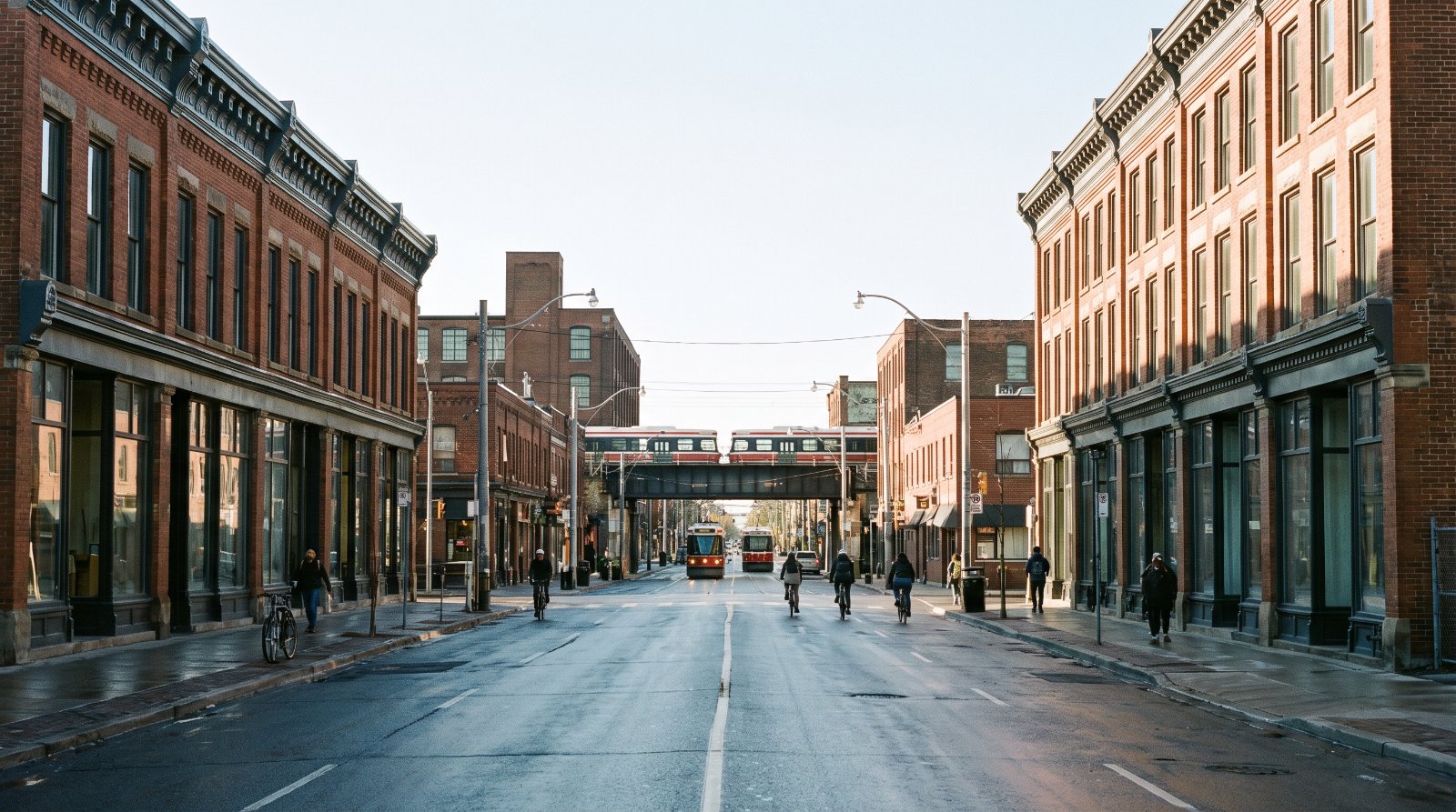
The ten things buyers in The Junction are least often told, all of them documented: the City has recommended designating 292 properties and 2 City-owned parks as a Heritage Conservation District, of which 154 are proposed as contributing, but the City’s own boards state that “properties are not protected under the Ontario Heritage Act until after the adoption of the HCD Plan” and the Plan has not been written; on the Heritage Register, Junction streets carry 53 properties — only 16 designated, 37 merely listed, including 13 landmark buildings on Dundas West with no designation at all; there are 178 development application files in and around the neighbourhood, including three towers of 37, 42 and 25 storeys at Dundas and Bloor; a Core Employment conversion at 108–162 Vine Avenue is at the Ontario Land Tribunal, inside the heritage study area’s own boundary; the GO station coming to the Stockyards was renamed from St. Clair-Old Weston and has no published opening date; Humberside Collegiate ran at 133 per cent of capacity in 2023 and the TDSB projects 144 per cent by 2028; 55 per cent of Junction Area dwellings were built in 1960 or earlier and only 12 per cent are single-detached; the Stockyards packing-plant lands sit under Ontario’s Record of Site Condition regime; three of the City’s basement flooding study areas covering this ward were only completed in 2024; and the Municipal Land Transfer Tax gained new brackets on 1 April 2026.
None of that is an argument against buying here. The Junction is one of the best main streets in Toronto and the numbers underneath it are stronger than its reputation. It is an argument for buying here with the documents open.
Every item is traced to a primary source — a City planning study page, a Council decision item, a City-commissioned historic context statement, a Metrolinx project page, a school board accommodation strategy, a City open dataset — and each is listed at the bottom with the date I read it. A few figures are my own calculations from the City’s published open data rather than published statistics, and they are labelled where they appear. Seven things I deliberately left off because I could not source them properly: the year the Junction’s liquor ban actually ended, the West Toronto Diamond grade separation and any rail noise or vibration study, the status of a Bloor-Lansdowne GO station, any named contaminated site or Record of Site Condition in the Stockyards, the West Toronto Railpath and its extension, air quality and odour from the remaining industry, and the MPAC valuation date behind your assessment. I will publish those when I can cite them.
The Junction is the rare Toronto neighbourhood whose name is a literal description. Five railways converged here between 1853 and 1884, the CPR moved its shops from Parkdale in 1890, the Union Stock Yards opened at Keele and St Clair in 1903, and the town was annexed to Toronto in May 1909. Everything a buyer likes about the place today — the wide Dundas Street West streetwall, the brick semis, the cheap-for-Toronto square footage — exists because of what used to be made and slaughtered and shunted here. Everything a buyer needs to check exists for the same reason.
One geography note first, because it changes every number. In the City’s current 158-neighbourhood model the relevant areas are Junction Area (#90), Weston-Pelham Park (#91), Junction-Wallace Emerson (#171) and Dovercourt Village (#172). The older 140-neighbourhood name Dovercourt-Wallace Emerson-Junction has been split and no longer exists. Where I quote census figures below they are for Junction Area (#90) unless I say otherwise, and if someone quotes you a statistic under the old name against 2021 data, the number is wrong.
1The heritage district everyone mentions does not protect a single building yet
This is the most important thing to understand before you buy on Dundas Street West, and almost nobody says it out loud. The City is running the “West Toronto Junction – Heritage Conservation District (HCD) Study.” Its page, last updated 2 July 2026, states: “The Study is in its final stage. The final consultant recommendations will be presented to the Toronto Preservation Board upon completion in November 2026.”
The boundary, in the City’s own words, is the “Junction Phase 1 HCD Study Area,” which “includes commercial, mixed-use, residential and institutional properties situated along a curving portion of Dundas Street West, bound by Gilmour Avenue to the west and Humberside Avenue to the southeast. Properties fronting onto a small section of Keele Street are also included in the Study Area from Vine Avenue to the north, and Annette Street to the south.” The City adds that “the Study Area boundary may be refined through the Study process.”
| Study Findings and Recommendations, June 2026 | Figure |
|---|---|
| Recommendation | Designate as a Heritage Conservation District |
| Extent on Dundas Street West | 2665/2668 to 3179/3190, plus portions of Keele, High Park Avenue and St John’s Road |
| Properties in the study area | 292 properties plus 2 City-owned parks |
| Proposed contributing | 154 |
| Proposed non-contributing | 138 |
| Status of that split | A “proposed list of contributing properties and may be subject to change during the Plan phase” |
Now the sentence that matters. The City’s general HCD study information boards of June 2026 state, in exactly these words: “Properties are not protected under the Ontario Heritage Act until after the adoption of the HCD Plan.” A Study is not a Plan. The Plan phase still has to be written, consulted on and adopted by Council after the November 2026 milestone.
There is a second layer to this, and it is on the public record. When Council prioritised the HCD studies on 31 January and 1 March 2018, item 2018.PG25.4, it asked the Chief Planner to “identify and implement interim monitoring measures” for two areas only — Harbord Village Phase 3 and West Annex Phase 2. The Junction was not among them. The same item is where Council directed that “the boundary of the Heritage Conservation District for The Junction Phase 1 be expanded westward to Gilmour Avenue.”
| Date | Item | What happened |
|---|---|---|
| 13 May 2014 | TE32.87 | Initial HCD nomination |
| 5 April 2017 | PG19.2 | HCD prioritisation recommendations |
| 31 Jan / 1 Mar 2018 | PG25.4 | Study authorised; boundary extended west to Gilmour Avenue; no interim protection for the Junction |
| January 2025 | — | Study commenced |
| 11 June 2025 | — | First community open house |
| 17 June 2026 | — | Second open house; survey closed 10 July 2026 |
| November 2026 | — | Consultant recommendations to the Toronto Preservation Board |
How to read this as a buyer. Two opposite risks sit in the same fact. If you are buying a building the study proposes as contributing, the rules that will govern your future alterations are being written right now and you cannot read them yet. If you are buying next door to one, nothing currently stops the owner from altering it. Twelve years have already passed between the 2014 nomination and the November 2026 milestone, so do not price either outcome as imminent. Ask me which side of the 154 your address falls on before you write.
2Thirteen of the Junction’s landmark Dundas West buildings are listed, not designated
The Dundas West streetwall reads as protected. Most of it is not, and the distinction is the whole ball game: a designated property under Part IV of the Ontario Heritage Act is protected by a by-law with a number and a date, while a listed property is on a register and is not.
I downloaded the City of Toronto’s Heritage Register open dataset — the Q2 2026 shapefile extract, dataset last refreshed 4 June 2026, 12,328 records — and filtered it to Junction street addresses. The dataset is the City’s and the descriptions and by-law numbers below are transcribed from it; the filtering and the counts are mine.
| Heritage Register, Junction streets | Count |
|---|---|
| Total properties on the register | 53 |
| Designated under Part IV (individually protected) | 16 |
| Listed, not designated | 37 |
| Carrying an HCD (Part V) value | None |
The designated ones are mostly churches and the odd bank. 2854 Dundas St W, the Bank of Toronto of 1911 by Eustace Bird with Carrère and Hastings, is designated by By-law 597-89. 2896 Dundas St W, the Canadian Imperial Bank of Commerce of 1905 to 1909 by Darling and Pearson, is designated by By-laws 225-2019 and 949-2019. 288 to 292 Annette St, the Heintzman House of 1889 by Knox, Elliot & Jarvis, is designated by By-law 178-81, and 166 High Park Ave, the Herman Heintzman House of 1891, by By-law 838-86. Here is the other half: these thirteen Dundas West buildings are on the register but carry no designation, with the year each was listed.
| Address | Building | Listed |
|---|---|---|
| 2694 Dundas St W | Wardell’s Monumental Works, 1911 | 1997 |
| 2822 Dundas St W | Kilburn Hall, 1890–91, James A. Ellis | 1994 |
| 2856 Dundas St W | Campbell Block, 1888 | 1983 |
| 2859 Dundas St W | Bank of British North America, now Bank of Montreal, 1907, Ellis & Connery | 1979 |
| 2867 Dundas St W | Alexander Chisholm building, 1911 | 1997 |
| 2897 Dundas St W | William Hepinstall Building, 1888, addition 1891 | 2005 |
| 2903 Dundas St W | Cumming and Co. Undertakers, 1890–91 | 1994 |
| 2928 Dundas St W | William Speers Commercial Building, Smith and Wright | 1998 |
| 2945 Dundas St W | Dominion Bank, 1916, John M. Lyle | 1996 |
| 2959 Dundas St W | W.H. Ives, Tailor Building, 1889 | 1996 |
| 2975 Dundas St W | James Hall, 1888 | 1990 |
| 3351 Dundas St W | Dominion Bank, 1925, John M. Lyle | 1996 |
| 3358 Dundas St W | Jacob Casselman Building, 1910 | 1995 |
Look at the two in bold. The City’s own register attributes both Dominion Bank buildings — 2945 Dundas West, 1916 and 3351 Dundas West, 1925 — to John M. Lyle, the architect of the Union Station façade and the Runnymede Library. Two Lyle banks on one street, and neither is designated.
How to read this as a buyer. This gap is precisely what the HCD is meant to close, and until the HCD Plan is adopted it stays open. If you are buying one of these buildings, you have more freedom than you probably assume and that freedom has an expiry date. If you are buying a condo or a house whose value depends on the streetscape staying as it is, understand that thirteen of its best buildings currently rest on a register entry rather than a by-law. Heritage designations can be added at any Council meeting, so this is a snapshot dated 4 June 2026, not a permanent state.
3There are 178 live development files in and around this neighbourhood
I downloaded the City of Toronto’s Development Applications open dataset in full — 26,432 rows, resource 8907d8ed-c515-4ce9-b674-9f8c6eefcf0d, last refreshed 31 August 2026 — and filtered it to Junction, Stockyards and Junction Triangle street ranges. The dataset is the City’s and every file number, description and status below is transcribed from it; the filtering and the totals are mine.
| Filtered result | Count |
|---|---|
| Unique application files | 178 |
| Under Review | 31 |
| Council Approved | 8 |
| OMB / Ontario Land Tribunal appeal | 6 |
| OMB Approved | 4 |
| Refused | 1 |
The largest single site is 2400 to 2440 Dundas Street West, the block at Dundas and Bloor beside the GO and UP station. A 2023 zoning by-law amendment file covered three towers with 1,214 dwelling units, 6,372.4 m² of non-residential space and a 1,043 m² public park. Two site plan applications submitted in June 2025 are both Under Review: Phase 1 is “a 37-storey tower on a 3 storey podium (Tower A) and will include 447 purpose built rental units, 11 of which will be affordable units secured as in-kind contribution pursuant to Subsection 37(6) of the Planning Act,” with the existing grocery store relocating to the second floor. Phase 2 is “two towers at 25 and 42 storeys on a 2-storey shared podium with 56 affordable rental units,” plus a new public park, a privately owned publicly accessible space, and access to the relocated Metrolinx pick-up and drop-off at 2376 Dundas St W.
In the Junction proper, on the Dundas West and Keele blocks people actually shop on:
| Address | File | Status | Proposal |
|---|---|---|---|
| 3286–3316 Dundas St W | 26 129467 STE 04 SA | Under Review | 11 storeys, 191 units, 6 rental replacement, retail at grade |
| 2461–2475 Dundas St W | 24 187123 STE 04 OZ | Ontario Land Tribunal appeal | 29 storeys, 281 units, 9 rental replacement |
| 2461–2475 Dundas St W | 24 187222 STE 04 SA | Under Review | 29 storeys, 288 units, 19,645 m² gross floor area |
| 3–21 Quebec Ave | 24 121126 STE 04 OZ | OMB Approved | 19 storeys, 144 units, 12 rental replacement |
| 21 Quebec Ave | 25 210259 STE 04 SA | Under Review | 19 storeys, 137 units, 12,970.6 m² GFA |
| 50–403 Heintzman St | 22 140177 STE 04 SA | Closed | 11 storeys, 281 units, 16,185.2 m² residential GFA |
North and east of the rail corridor the numbers get larger. At 116–142 Ryding Ave, file 26 124085 WET 05 OZ, submitted 3 March 2026 and Under Review, the proposal is three towers of 20, 34 and 26 storeys with a new park equal to 10 per cent of the site. At 611–623 Keele St a 33-storey building of roughly 395 units is Council Approved, with a second Council-approved file amending the Keele-St. Clair Secondary Plan for height. At 2595 St Clair Ave W the file covered a 20-storey tower and an 11-storey mid-rise, 505 units. At 221 Sterling Rd, Under Review, it is three towers of 27, 24 and 21 storeys with 861 condominium and 58 rental replacement units. At 1799 St Clair Ave W, three mixed-use towers with 93,034 m² of residential floor area.
How to read this as a buyer. The Junction’s two-and-three-storey main street is being ringed by towers on every side that is not the main street itself. Six of these files are already at the Tribunal, which means the height on those sites will be decided by an adjudicator rather than by Council. None of this is hidden — it is a public dataset refreshed daily — but almost nobody looks at it before making an offer. Send me the address and I will pull the live file for the block in front of it.
4A Core Employment conversion is at the Tribunal inside the heritage study area
Vine Avenue is the northern limit of the Junction HCD study area on Keele Street. It is also the site of a live application to take land out of industrial use, and that application is under appeal.
| Site | File | Submitted | Status | What is asked |
|---|---|---|---|---|
| 108–162 Vine Ave | 25 223395 STE 04 OZ | 10 Sep 2025 | Ontario Land Tribunal appeal | “…redesignate the lands comprising 108-162 Vine Avenue from Core Employment Areas to Mixed Use Areas and Parks. There is no zoning by-law amendment application proposed at this time.” |
| 224–258 Wallace Ave | 26 160909 STE 09 OZ | 14 May 2026 | Under Review | “Standalone Official Plan Amendment application to redesignate the subject site from Core Employment Areas to Mixed Use Areas.” |
| 5–43 Junction Rd | 24 229283 WET 05 OZ | 22 Oct 2024 | Council Approved | An Official Plan Amendment “to reduce the employment gross floor area and modify the affordable housing provisions required by SASP 782” |
The reason these are happening now is a change in provincial law. Under Bill 97, the Helping Homebuyers, Protecting Tenants Act, 2023, the Planning Act definition of an area of employment was narrowed to “manufacturing uses, warehousing uses (including uses related to the movement of goods), and research and development in connection with manufacturing.” In the City’s words, “commercial uses, including stand-alone retail and stand-alone office uses, and institutional uses (e.g., schools and day cares) have been explicitly identified as uses not permitted.”
Toronto has been rewriting its Official Plan to match ever since: OPA 668, Council 20 July 2023, item PH5.2; OPA 680, Council 25 July 2024, item PH14.1; and OPA 804, adopted as By-law 447-2025 on 29 May 2025, item PH21.1, and submitted to the Minister. OPA 668 and OPA 680 require ministerial approval under O. Reg. 396/24, filed 18 October 2024.
The other half of the picture is the City’s Zoning Conformity for Official Plan Employment Areas work, whose Phase 1 will “remove zoning permissions for sensitive uses for lands designated Employment Areas.” Council and committee dates on that are 10 December 2019, 28 June 2021, PH26.2 and 9 November 2021, PH27.2. The City notes that its Employment Areas “accommodated over 400,000 jobs, representing about 25% of all jobs in Toronto.”
How to read this as a buyer. “Sensitive uses” is planning language for homes. Where Core Employment designation holds, housing is not coming and the industrial neighbour is protected rather than gradually zoned out. Where a conversion succeeds, you get towers instead. Both outcomes are live within a few hundred metres of the Junction main street, and the Vine Avenue one will be decided at the Tribunal. If you are buying anywhere between Keele, Wallace and the rail corridor, ask which designation your view sits on.
5The GO station coming to the Stockyards was renamed, and has no published opening date
If you have searched for the St. Clair-Old Weston GO station and found nothing, this is why. Metrolinx now calls it “Stockyards Station (previously St. Clair-Old Weston Station).” The project exists; the name you were given does not.
| Stockyards Station | What Metrolinx states |
|---|---|
| Location | “Located on Union Street, north of St. Clair Avenue West” |
| Line | Kitchener Line GO Expansion, serviced by UP Express |
| Early works began | May 2024 |
| Signal removal | October 2024 |
| Track shift completion expected | May 2026 |
| Tunnel excavation starting | June 2026 |
| Connections | “Connections to the TTC streetcar service on St. Clair Avenue” plus a transit bus loop |
| Opening date | Not published |
At the other end of the neighbourhood the connection that already carries people is being rebuilt. Metrolinx is “extending the existing south side pedestrian tunnel at Bloor GO/UP Station” to reach “a new TTC concourse in the lower level of The Crossways building,” with two elevators and a stairwell. Transfer time between Bloor GO/UP and Dundas West subway falls to “less than two minutes” from “five to eight minutes” above ground. Metrolinx states that “construction of the connection between the two stations is now underway”: construction started May 2024, tunnel excavation was complete in September 2024, and staircase frame installation was planned for January 2026. Roughly 600 people transfer there daily today, projected to 1,600 by 2041.
On the subway itself, the honest answer comes by exclusion. The TTC’s Easier Access Program schedule lists only College, King, Museum and Spadina (2026), Islington (2027) and Old Mill (2028) as stations still to be made accessible, with the caveat that “all schedules are subject to change.” Neither Dundas West nor Keele appears on that list, which means both are already accessible. I could not find a TTC page stating the year each was completed, so I am not going to print one.
How to read this as a buyer. Do not pay a premium today for a GO station whose opening year Metrolinx has not published. Do count the Bloor to Dundas West tunnel, because that one is being built and the time saving is stated by the agency building it. And if step-free access matters to you, both Line 2 stations here already have it, which is more than several stations further east can say.
6The catchment high school was at 133 per cent of capacity, and the board projects 144
From the Toronto District School Board’s own Long-Term Program and Accommodation Strategy 2024–2033, school data tables. Capacity and head count are 2023; the later columns are the board’s own projected utilisation.
| School | Capacity 2023 | Enrolment 2023 | 2023 | 2028 | 2033 | 2038 |
|---|---|---|---|---|---|---|
| Humberside Collegiate Institute | 1,032 | 1,378 | 133% | 144% | 138% | 136% |
| Brock Public School | 352 | 295 | 84% | 103% | 143% | 155% |
| Carleton Village Jr & Sr Sports and Wellness Academy | 619 | 524 | 85% | 124% | 138% | 137% |
| Perth Avenue Jr PS | 550 | 543 | 99% | 114% | 118% | 120% |
| Keele Street Public School | 648 | 595 | 92% | 94% | 102% | 104% |
| Annette Street Jr & Sr PS | 568 | 514 | 90% | 92% | 96% | 97% |
| Runnymede Jr & Sr PS | 1,011 | 957 | 95% | 94% | 99% | 99% |
| Indian Road Crescent Jr PS | 387 | 243 | 63% | 79% | 80% | 79% |
| Western Technical-Commercial School | 1,515 | 1,340 | 88% | 83% | 83% | 83% |
| Runnymede Collegiate Institute | 756 | 513 | 68% | 75% | 83% | 82% |
The same tables give surplus seats, where a negative number is a shortfall. Humberside goes from −343 in 2023 to −451 in 2028. Brock goes from +57 to −12 to −150 to −195. Carleton Village goes from +95 to −148 to −233. Perth Avenue from +7 to −78 to −101. Keele Street from +53 to +37 to −16.
One more figure explains a lot about Humberside. The board records its TDSB participation rate at 96 per cent and its home-school participation rate at 59 per cent — that is, a large share of its students come from outside its own attendance boundary. An over-capacity school that draws heavily from elsewhere is a different problem from one that is simply full of local children, and it is the kind of thing that gets addressed by an optional-attendance change rather than a new building.
How to read this as a buyer. If you are buying here for Humberside, buy inside the boundary and check it on the board’s own tool on the day you write the offer, not from a listing. The LTPAS is approved annually by the Board of Trustees, so a newer edition may have superseded the 2024–2033 figures above — these are the numbers in the edition I read on 31 August 2026. I could not retrieve TCDSB figures or confirm whether any boundary review is currently underway, so I am not going to characterise the Catholic option either way.
7Fifty-five per cent of the housing was built before 1961, and only 12 per cent is detached
From the City’s Neighbourhood Profiles, 2021 Census, 158-neighbourhood model, dataset last refreshed 27 May 2026, for Junction Area (#90) and its neighbours:
| Junction Area | Weston-Pelham Park | Junction-Wallace Emerson | Runnymede-Bloor West Village | |
|---|---|---|---|---|
| Population (25% sample base) | 14,010 | 10,680 | 23,180 | 10,120 |
| Occupied private dwellings | 6,035 | 4,195 | 10,180 | 3,840 |
| Owner share | 58% | 59% | 50% | 78% |
| Median household income, 2020 | $96,000 | $81,000 | $84,000 | $138,000 |
| Median dwelling value | $1,000,000 | $900,000 | $1,000,000 | $1,370,000 |
| Median shelter cost, owned | $1,900 | — | — | $1,760 |
| Median shelter cost, rented | $1,460 | $1,020 | $1,480 | $1,600 |
| Low income prevalence (LIM after tax) | 8.8% | 13.1% | 11.2% | 5.1% |
Now the stock itself, which is the part that surprises people:
| Junction Area, occupied private dwellings by structural type | Count |
|---|---|
| Single-detached | 745 |
| Semi-detached | 1,020 |
| Row house | 600 |
| Apartment or flat in a duplex | 435 |
| Apartment, fewer than 5 storeys | 2,475 |
| Apartment, 5 storeys or more | 730 |
| Built 1960 or before | 3,315 |
The counts above are Statistics Canada 2021 Census figures as published by the City in an official dataset. The two percentages are my arithmetic on those counts: 3,315 of 6,035 dwellings built in 1960 or earlier is 55 per cent, and 745 of 6,035 single-detached is 12 per cent.
That second number changes the redevelopment maths. Toronto now permits four-unit multiplexes city-wide: Council decision 10 May 2023, item 2023.PH3.16, with the Official Plan amendment By-law 473-2023 in effect 14 June 2023 and the zoning amendment By-law 474-2023 in effect 12 May 2023. Garden suites are in force too, from Council on 2 February 2022 (By-laws 100-2022 and 101-2022) and updated on 24 June 2025 (By-laws 846-2025 and 849-2025), with the City noting the amendments are in force “with the exception of one property-specific appeal that is maintained,” and directing that a site abutting a public laneway follows the separate laneway suite rules instead. On six units, I am going to quote the City exactly and then tell you what I could not confirm. The City states: “On June 25-26, 2025, City Council adopted Official Plan and Zoning By-law Amendments to enable zoning permissions for residential buildings with up to six units in Toronto & East York District and Ward 23. City Council also adopted the Multiplex Monitoring Zoning By-law. These amendments are now in force.” Those are By-laws 653-2025, 654-2025 and 648-2025. What I could not verify is which side of the Toronto and East York district line a given Junction address falls on. Development files here carry two different prefixes — STE on the Dundas West side and WET in the Stockyards — and that is suggestive, not proof. I am not going to tell you a six-plex is as-of-right on your lot on the strength of a file prefix.
How to read this as a buyer. A Junction semi is not a Junction semi. It is a pre-1961 building on a lot that carries at least four units of as-of-right permission and possibly six, in a neighbourhood where the median dwelling value is $1,000,000 and the median household income is $96,000 — the strongest income-to-price ratio of any neighbourhood in this cluster except Runnymede-Bloor West Village. Before you buy, get the district question answered in writing for your specific address, and get the pre-1961 building inspected properly. Both of those cost less than a month of carrying costs.
8You are buying on the doorstep of the Union Stock Yards, and Ontario has a law about that
The Junction’s industrial past is not decorative either. The City’s own West Toronto Junction Historic Context Statement, prepared for Heritage Preservation Services by Common Bond Collective and finalised 13 May 2020, records that “in 1903 the Union Stock Yards opened a $250,000 complex at Keele and St Clair streets to replace the smaller city-owned facilities downtown,” that “the first meat packing plant in the stockyards area was completed in 1905 and acquired by Swift Canadian in 1911,” that “Gunns Limited constructed a second plant nearby which went into operation in 1907,” and that “in 1913 Harris Abattoir expanded and built a brand new integrated packing plant.”
One piece of that industrial fabric is legally protected. The Symes Road Incinerator at 150 Symes Rd is designated under Part IV of the Ontario Heritage Act by By-law 73-2014, enacted and passed 30 January 2014. It also has a live Site Plan Amendment application, file 23 134151 WET 05 SA, submitted 13 April 2023 and recorded as Under Review.
The legal mechanism that follows all this around is Ontario’s Record of Site Condition regime, administered by the Ministry of the Environment, Conservation and Parks. In the province’s own words: “If you are a property owner who wants to change the use of a property to a new use that is more sensitive than the previous use (e.g. houses on an old factory or dry cleaning site), you must have a record of site condition filed in the Environmental Site Registry first.”
| Record of Site Condition regime | What the province states |
|---|---|
| Governing law | Environmental Protection Act, Part XV.1, and O. Reg. 407/19 |
| Phase One environmental site assessment | Identifies “any potentially contaminating activity in the phase one study area” |
| Phase Two environmental site assessment | Determines “the location and concentration of one or more contaminants” |
| Registry coverage | Records of site condition and transition notices filed “since October 1, 2004” |
How to read this as a buyer. Every residential conversion on former employment land in this part of the city — the Sterling Road blocks, the St Clair West sites, the Junction Road lands — required a record of site condition, and every one of those is a public document with a number. I could not reach the Environmental Site Registry from this session, so I have no site-specific contamination data for any Junction address and I am not going to imply otherwise. What I will do is search the registry by address before you waive conditions on anything built on a former industrial parcel. It is free, and it is the single most useful hour in a Junction purchase.
9The basement flooding studies covering this ward were only completed in 2024
The City has run basement flooding Environmental Assessment studies in 67 study areas between 2006 and 2024. The City states that study area boundaries “generally align with sanitary subsewersheds (areas serviced by the same local sewer infrastructure).” No study area is named “The Junction.” These are the ones whose listed wards include Parkdale-High Park, the Junction’s ward:
| Study area | Wards listed | Study completed |
|---|---|---|
| 4 — Jane Street / St. Clair Avenue West | Parkdale-High Park, York South-Weston | 2014 |
| 5 — Humber River / Bloor Street West | Parkdale-High Park | 2014 |
| 42 — Downtown | Parkdale-High Park, Davenport and four others | 2024 |
| 44 — Mid-Toronto | Parkdale-High Park, York South-Weston, Davenport and five others | 2024 |
| 62 — Downtown – Waterfront | Parkdale-High Park, Davenport and three others | 2024 |
Study areas 4 and 5 belong to the Rockcliffe Flood Mitigation Projects, and to the west, study area 3 — Keele Street / Eglinton Avenue West, listing York South-Weston among its wards and completed in 2011 — belongs to the Fairbank Silverthorn Trunk Storm Sewer System project. Study area 45, Black Creek, was completed in 2022.
The sequence matters more than the map. Remediation follows study, so an area whose Environmental Assessment finished in 2024 is at the beginning of its construction queue, not the end of it. Set that beside the fact from item 7 that 3,315 of 6,035 Junction Area dwellings were built in 1960 or earlier, and you have old houses on old service connections in study areas that were only assessed two years ago.
How to read this as a buyer. These study areas are ward-tagged rather than neighbourhood-tagged, and a ward is an enormous thing. Do not conclude anything about a specific house from the table above — check the address itself on the City’s interactive basement flooding map, and ask the seller directly whether there is a backwater valve, a sump pump and a history of water in the basement. In a neighbourhood where most of the houses predate 1961, that answer is worth more than any neighbourhood-level statistic on this page.
10The land transfer tax changed on 1 April 2026, and the short-term rental rules close the investor route
City Council passed the amendment on 17 December 2025: “City Council passed an amendment to introduce graduated Municipal Land Transfer Tax rates for high-value residential properties containing one or two single-family residences,” effective 1 April 2026.
| Value of consideration — one or two single-family residences | Rate from 1 April 2026 |
|---|---|
| Up to $55,000 | 0.5% |
| $55,000.01 – $250,000 | 1.0% |
| $250,000.01 – $400,000 | 1.5% |
| $400,000.01 – $2,000,000 | 2.0% |
| $2,000,000.01 – $3,000,000 | 2.5% |
| $3,000,000.01 – $4,000,000 | 4.40% |
| $4,000,000.01 – $5,000,000 | 5.45% |
| $5,000,000.01 – $10,000,000 | 6.50% |
| $10,000,000.01 – $20,000,000 | 7.55% |
| Over $20,000,000 | 8.60% |
For every other property type the rates are unchanged: 0.5 per cent to $55,000, 1.0 per cent to $250,000, 1.5 per cent to $400,000 and 2.0 per cent above $400,000. There is also a Municipal Non-Resident Speculation Tax of 10 per cent and an MLTT administration fee of $102.56 plus HST. All of that sits on top of the provincial land transfer tax.
Here is the non-alarmist framing, which is also the accurate one. With a Junction Area median dwelling value of $1,000,000, the great majority of Junction transactions sit in the 2.0 per cent band and are completely unaffected by the April 2026 change. The new brackets bite above $3 million, which in this neighbourhood is a small number of trades.
On holding costs, the City states that “beginning with the 2024 taxation year, the VHT rate increased to 3% of the property’s Current Value Assessment.” A property counts as vacant if it was “vacant for six months or more during the taxation year.” A false declaration or a failure to provide information “may result in a fine of up to $10,000, in addition to payment of the tax,” and interest runs at “1.25 per cent on the first day of default and on the first day of each month thereafter.” Seven exemption categories exist — death of the registered owner, a principal resident in care, repairs or renovations, transfer of legal ownership, occupancy for full-time employment, a court order, and vacant new inventory — plus a secondary residence held for medical reasons. The governing authority is City of Toronto Municipal Code Chapter 778.
And if the plan was to run a Junction semi or a new condominium unit as an Airbnb, read Chapter 547 first. It defines a short-term rental as “living accommodation for a rental period of less than 28 consecutive days in exchange for payment,” requires registration with Municipal Licensing and Standards, limits an operator to their principal residence — which “shall not include more than one dwelling unit” — and caps rentals at 180 nights per calendar year whether entire-unit or partial. Offences carry “a fine not exceeding $100,000” plus “a fine not to exceed $10,000 for each day during which the offence continues.”
How to read this as a buyer. The principal-residence rule is the one that quietly ends a lot of Junction investment plans. You cannot buy a second unit here and run it nightly, legally, at any price. What you can do is rent it for 28 days or more, which falls outside the regime entirely. On the tax side, the honest answer for most Junction buyers is that 1 April 2026 changed nothing for them — and I would rather tell you that than sell you an urgency that is not in the by-law.
Four more, because they come up every week
The Junction voted itself dry in 1904, and the City’s own history stops there. The City-commissioned West Toronto Junction Historic Context Statement, final 13 May 2020, records that “high amounts of public drunkenness, fighting, as well as gambling and prostitution contributed to a strong prohibitionist sentiment locally,” and that “citizens voted in favour of an alcohol ban in the 1904 municipal elections, which extended to liquor stores as well as licensed establishments. Most of the town’s hotels closed following the implementation of the law on May 1, 1904.” You will read everywhere that the ban ended in a particular year in the 1990s. That year does not appear in this City document, and I could not reach a primary source for the repeal, so I am not printing a date. Local accounts place the end of the ban in the 1990s; the 1904 start is documented, dated and quotable.
The Stockyards secondary plan only became fully secure in August 2025. The Keele-St. Clair Secondary Plan went through Council as PH14.4 (29 June 2020, work plan), PH25.8 (28 June 2021, directions report, including “preliminary assessments of potential Employment Area conversions”), PH29.10 (25 November 2021, draft), and PH33.2 (27 April 2022, final recommendation report), before Council adopted Official Plan Amendment 537 on 22 July 2022, enacted as By-law 1107-2022. But it was only on 15 August 2025 that “the enacting By-law 1107-2022 was approved without modifications by the Ministry of Municipal Affairs and Housing.” The study area covers land “approximately 500-800 metres from the planned GO/SmartTrack station” and examined “the Employment Area adjacent to McCormack Street.” If someone quoted you Stockyards heights from a 2022 document, the ministerial approval is three years younger than they think.
The old police station is becoming a health centre. At 209 Mavety St, file 23 156329 STE 04 OZ submitted 5 June 2023, the proposal is “an interior retrofit and renovation of a former and vacant police station to accommodate a community health centre.” Small, unglamorous, and a better indicator of where a neighbourhood is going than most tower renderings.
The mid-rise rules that will shape Dundas West are still being written. The City’s Mid-Rise Housing Implementation Initiative defines mid-rise as “5- to 6-storeys within Neighbourhoods, to 10- to 14-storeys along Avenues.” Council adopted the Missing Middle and Midrise report with amendments on 23–24 July 2025, item 2025.PH23.6, and the Planning and Housing Committee adopted a Proposals Report with amendments on 7 May 2026, item 2026.PH30.8, with staff studying amenity space, bicycle parking, lot coverage and waste collection standards and a review of Type G loading requirements beginning in 2026. The page does not name Dundas Street West or Keele Street specifically, and there is no City planning study called a Dundas West or Keele Avenue study — if you have been told there is one, ask for the link.
What this list is not
It is not an argument against buying here. The Junction has a genuine nineteenth-century main street of 292 properties the City has recommended protecting, two John M. Lyle bank buildings within a mile of each other, two already-accessible Line 2 stations, a rebuilt two-minute connection between Bloor GO/UP and Dundas West being built by Metrolinx right now, a median household income of $96,000 against a median dwelling value of $1,000,000 — the best income-to-price ratio in this cluster outside Runnymede-Bloor West Village — and a low-income rate of 8.8 per cent, lower than every adjacent neighbourhood except Bloor West Village. Very few places in Toronto offer that combination at that price.
The point is that every one of the ten items above is knowable before you sign. Most buyers find out afterwards. That is the entire difference between working with someone who has read the study display boards and working with someone who has read the listing.
Thinking about a specific block in The Junction?
A neighbourhood list is the right frame for understanding a market and the wrong frame for a decision. What a house or a unit is worth here depends on whether it is inside the HCD study area, whether it is proposed as contributing, what is under review on the block behind it, which school boundary it actually sits in, and what has really sold nearby. Send me the address and I will give you the comparable sales that apply to it, the live applications on that block, and a straight answer on whether to move now or wait.
[email protected] · 833-330-1925 · Book a free consultation
Confidential. Read personally and answered within 24 hours. I never share, sell or distribute your information.
Ask the local expert
Ask me anything about The Junction
Send me the block, the address or the question. You get a straight answer from someone who works this pocket every week, including when the answer is that you should wait. No drip campaign you cannot get out of.
Got it.
I read these personally and answer within 24 hours. If it is urgent, call or text 833-330-1925.
Confidential. Read personally and answered within 24 hours. I never share, sell or distribute your information. Not intended to solicit buyers or sellers currently under contract with another brokerage.
Frequently asked questions
Is The Junction a heritage conservation district?
Not yet. The City’s West Toronto Junction HCD Study is in its final stage and the consultant recommendations go to the Toronto Preservation Board in November 2026. The June 2026 findings recommend designating 292 properties plus 2 City-owned parks, with 154 proposed as contributing and 138 non-contributing. The City’s own display boards state that properties are not protected under the Ontario Heritage Act until after the adoption of the HCD Plan, and that Plan has not been written.
Does the HCD study protect my Junction building right now?
No. The City states plainly that properties are not protected under the Ontario Heritage Act until after the adoption of the HCD Plan. When Council prioritised the HCD studies in 2018 under item PG25.4, it directed interim monitoring measures for Harbord Village Phase 3 and West Annex Phase 2 only. The Junction was not included. The same item extended the Junction study boundary westward to Gilmour Avenue.
How many Junction buildings are actually protected?
On my filtering of the City’s Heritage Register open data, refreshed 4 June 2026, Junction streets carry 53 register properties: 16 designated under Part IV and 37 merely listed. None carries a Part V heritage conservation district value, because the district does not exist yet. Thirteen landmark commercial buildings on Dundas Street West are listed but not designated, including two Dominion Bank buildings the register attributes to John M. Lyle.
How much development is planned in The Junction?
A great deal. Filtering the City’s Development Applications dataset, refreshed 31 August 2026, to Junction, Stockyards and Junction Triangle streets returns 178 unique files: 31 Under Review, 8 Council Approved, 6 at the Ontario Land Tribunal, 4 OMB Approved and 1 Refused. The largest site is 2400 to 2440 Dundas Street West, where phased applications cover towers of 37, 42 and 25 storeys with hundreds of purpose-built rental units.
What is happening on Vine Avenue?
An application to redesignate 108 to 162 Vine Avenue from Core Employment Areas to Mixed Use Areas and Parks, file 25 223395 STE 04 OZ submitted on 10 September 2025, is under appeal at the Ontario Land Tribunal. No zoning by-law amendment is proposed at this time. Vine Avenue is the northern limit of the Junction HCD study area on Keele Street, so a conversion fight is running inside the heritage study boundary.
When does the Stockyards GO station open?
Metrolinx has not published an opening date, and I will not invent one. The station is now called Stockyards Station, previously St. Clair-Old Weston Station, on Union Street north of St. Clair Avenue West, on the Kitchener Line and serviced by UP Express. Early works began in May 2024, signal removal was October 2024, track shift completion was expected in May 2026 and tunnel excavation was starting in June 2026.
Are Dundas West and Keele stations accessible?
Yes, by exclusion. The TTC’s Easier Access Program schedule lists only College, King, Museum and Spadina for 2026, Islington for 2027 and Old Mill for 2028 as stations still to be made accessible, with the caveat that all schedules are subject to change. Neither Dundas West nor Keele appears, which means both are already accessible. I could not find a TTC page stating the year each was completed, so I am not printing one.
Are the schools full in The Junction?
The high school is. On the TDSB’s Long-Term Program and Accommodation Strategy 2024-2033, Humberside Collegiate had a 2023 capacity of 1,032 against an enrolment of 1,378, which is 133 per cent, and the board projects 144 per cent by 2028. Brock Public School is projected to go from 84 per cent in 2023 to 156 per cent by 2043, and Keele Street Public School tips past capacity by 2033. The strategy is approved annually, so check for a newer edition.
How old are the houses in The Junction?
Older than most buyers expect. On the City’s 2021 Census neighbourhood profile for Junction Area, 3,315 of 6,035 occupied private dwellings were built in 1960 or earlier, which is 55 per cent on my arithmetic. Only 745 dwellings, or 12 per cent, are single-detached. The stock is overwhelmingly semi-detached, row house and small apartment, with 2,475 units in buildings of fewer than five storeys.
Can I run a Junction property as a short-term rental?
Only if it is your principal residence. Toronto Municipal Code Chapter 547 defines a short-term rental as accommodation for fewer than 28 consecutive days, requires registration with Municipal Licensing and Standards, limits an operator to a principal residence that shall not include more than one dwelling unit, and caps rentals at 180 nights per calendar year. Offences carry fines not exceeding $100,000 plus up to $10,000 for each day the offence continues.
Related reading
- Top 10 things no one will tell you about High Park and Swansea
- Top 10 things no one will tell you about Roncesvalles, Toronto
- Top 10 things no one will tell you about The Kingsway, Etobicoke
- Top 10 things no one will tell you about Islington and Etobicoke Centre
- Toronto Municipal Land Transfer Tax: the bracket table from 1 April 2026
- Toronto Vacant Home Tax: the buyer can be left holding it
- Toronto West market report, July 2026
Sources
Every figure on this page traces to one of these, and each was read on 31 August 2026. Primary sources only — City planning study pages, Council decision items, a City-commissioned historic context statement, transit agency project pages, a school board accommodation strategy, provincial guidance, and City open datasets. A few counts are my own calculations from those datasets and are labelled where they appear. Where I could not verify something from a primary source, it is not on the page.
- West Toronto Junction Heritage Conservation District Study. City of Toronto, City Planning, page last updated 2 July 2026. The study status and November 2026 Preservation Board milestone, the Junction Phase 1 Study Area boundary from Gilmour Avenue to Humberside Avenue and the Keele Street segment from Vine to Annette, and the note that the boundary may be refined. toronto.ca
- West Toronto Junction HCD Study — Study Findings and Recommendations display boards. City of Toronto, June 2026. The recommendation to designate, the Dundas Street West extent 2665/2668 to 3179/3190, the 292 properties plus 2 City-owned parks, and the 154 contributing and 138 non-contributing split described as proposed and subject to change. toronto.ca
- West Toronto Junction general HCD study information display boards. City of Toronto, June 2026. The statement that properties are not protected under the Ontario Heritage Act until after the adoption of the HCD Plan. toronto.ca
- Heritage Conservation District Study Prioritization and Interim Protective Measures, item 2018.PG25.4. City of Toronto Council, 31 January and 1 March 2018. The interim monitoring measures directed for Harbord Village Phase 3 and West Annex Phase 2 only, and the direction to extend the Junction Phase 1 boundary westward to Gilmour Avenue. secure.toronto.ca
- West Toronto Junction Historic Context Statement. Prepared for Heritage Preservation Services, City of Toronto, by Common Bond Collective; final 13 May 2020. The five converging railways from 1853 to 1884, the 1890 CPR shops relocation, the May 1909 annexation, the 1904 alcohol ban and its 1 May 1904 implementation, and the 1903 Union Stock Yards and the packing plants of 1905, 1907 and 1913. toronto.ca
- Heritage Register open dataset. City of Toronto Open Data, Q2 2026 extract, refreshed 4 June 2026, 12,328 records. The 53 Junction register properties, the 16 Part IV designations with their by-law numbers and dates, and the 37 listed properties including the thirteen on Dundas Street West. The filtering and counts are my own. open.toronto.ca
- Development Applications open dataset. City of Toronto Open Data, resource 8907d8ed-c515-4ce9-b674-9f8c6eefcf0d, refreshed 31 August 2026. Every file number, description and status on this page, including 2400–2440 Dundas St W, 2461–2475 Dundas St W, 3–21 Quebec Ave, 116–142 Ryding Ave, 611–623 Keele St, 221 Sterling Rd, 108–162 Vine Ave, 224–258 Wallace Ave, 150 Symes Rd and 209 Mavety St. The 178-file total and the status counts are my own calculation. open.toronto.ca
- Bill 97 Area of Employment Official Plan Amendments. City of Toronto. The narrowed Planning Act definition of an area of employment, the exclusion of stand-alone retail, office and institutional uses, OPA 668 of 20 July 2023, OPA 680 of 25 July 2024, OPA 804 adopted as By-law 447-2025 on 29 May 2025, and O. Reg. 396/24 filed 18 October 2024. toronto.ca
- Zoning Conformity for Official Plan Employment Areas. City of Toronto. Phase 1 removing zoning permissions for sensitive uses on Employment Areas lands, the committee dates of 28 June 2021 (PH26.2) and 9 November 2021 (PH27.2), and the statement that Employment Areas accommodated over 400,000 jobs, about 25 per cent of all jobs in Toronto. toronto.ca
- Keele-St. Clair Local Area Study. City of Toronto. The Council sequence PH14.4, PH25.8, PH29.10 and PH33.2, the adoption of Official Plan Amendment 537 on 22 July 2022, and the study area description at approximately 500 to 800 metres from the planned GO/SmartTrack station. toronto.ca
- By-law 1107-2022, Keele-St. Clair Secondary Plan. City of Toronto. The enacting by-law for Official Plan Amendment 537. toronto.ca
- Official Plan Review — Ministry decision on OPA 537. City of Toronto, August 2025. The statement that By-law 1107-2022 was approved without modifications by the Ministry of Municipal Affairs and Housing on 15 August 2025. toronto.ca
- Stockyards Station, Kitchener Line GO Expansion. Metrolinx. The renaming from St. Clair-Old Weston Station, the Union Street location, UP Express service, the May 2024 early works, October 2024 signal removal, May 2026 track shift and June 2026 tunnel excavation, the St. Clair streetcar connection, and the absence of any published opening date. metrolinx.com
- Bloor Station TTC Connection. Metrolinx. The extension of the south side pedestrian tunnel, the new TTC concourse in the lower level of The Crossways, the two elevators and stairwell, the fall in transfer time from five to eight minutes to less than two, and the roughly 600 daily transfers projected to 1,600 by 2041. metrolinx.com
- Easier Access Program Schedule. Toronto Transit Commission. The six stations still to be made accessible — College, King, Museum and Spadina in 2026, Islington in 2027 and Old Mill in 2028 — the absence of Dundas West and Keele from that list, and the caveat that all schedules are subject to change. ttc.ca
- Long-Term Program and Accommodation Strategy 2024–2033, School Data. Toronto District School Board. Revised capacity and head count for 2023 and projected utilisation and surplus seats for 2028, 2033, 2038 and 2043 for Humberside Collegiate, Brock, Carleton Village, Perth Avenue, Keele Street, Annette Street, Runnymede, Indian Road Crescent, Western Technical-Commercial and Runnymede Collegiate, plus Humberside’s 96 per cent TDSB and 59 per cent home-school participation rates. The strategy is approved annually by the Board of Trustees. tdsb.on.ca
- Neighbourhood Profiles, 2021 Census, 158-neighbourhood model. City of Toronto Open Data, refreshed 27 May 2026, from Statistics Canada 2021 Census 25 per cent sample data. Population, dwellings, tenure, income, dwelling values, shelter costs, low income prevalence and structural type for Junction Area (#90), Weston-Pelham Park (#91), Junction-Wallace Emerson (#171), Dovercourt Village (#172), Runnymede-Bloor West Village (#89) and High Park North (#88). open.toronto.ca
- Multiplex Study (2–4 units), and Multiplex Housing. City of Toronto. Council decision 2023.PH3.16 of 10 May 2023, By-law 473-2023 in effect 14 June 2023 and By-law 474-2023 in effect 12 May 2023 for four units city-wide, and the quoted June 2025 adoption of six-unit permissions in Toronto and East York District and Ward 23 under By-laws 653-2025, 654-2025 and 648-2025. toronto.ca
- Garden Suites. City of Toronto. Council item 2022.PH30.2 with By-laws 100-2022 and 101-2022, the 24 June 2025 update under item PH23.1 with By-laws 846-2025 and 849-2025, the statement that the amendments are in force with the exception of one property-specific appeal, and the direction to the separate laneway suite rules where a site abuts a public lane. toronto.ca
- Mid-Rise Housing Implementation Initiative. City of Toronto. The definition of mid-rise as 5 to 6 storeys within Neighbourhoods and 10 to 14 storeys along Avenues, Council item 2025.PH23.6 of 23–24 July 2025, and Planning and Housing Committee item 2026.PH30.8 of 7 May 2026. toronto.ca
- Brownfields redevelopment and records of site condition. Government of Ontario, Ministry of the Environment, Conservation and Parks. The requirement to file a record of site condition before changing to a more sensitive use, the Environmental Protection Act Part XV.1 and O. Reg. 407/19, the scope of Phase One and Phase Two environmental site assessments, and Environmental Site Registry coverage since 1 October 2004. ontario.ca
- Basement Flooding Protection Program Map, with the Rockcliffe and Fairbank Silverthorn project pages. City of Toronto. The 67 study areas studied from 2006 to 2024, the alignment of study areas with sanitary subsewersheds, and the wards and completion years for study areas 3, 4, 5, 42, 44, 45 and 62. toronto.ca
- Municipal Land Transfer Tax rates and fees. City of Toronto. The Council amendment of 17 December 2025, the bracket table for properties containing one or two single-family residences effective 1 April 2026, the rates for all other properties, the 10 per cent Municipal Non-Resident Speculation Tax and the $102.56 plus HST administration fee. toronto.ca
- Vacant Home Tax. City of Toronto. The 3 per cent of Current Value Assessment rate from the 2024 taxation year, the six-month definition of vacancy, the fine of up to $10,000, interest at 1.25 per cent monthly, the exemption categories, and Municipal Code Chapter 778. toronto.ca
- Licensing and Registration of Short-Term Rentals, Municipal Code Chapter 547. City of Toronto. The fewer-than-28-day definition, the principal residence requirement that shall not include more than one dwelling unit, the registration requirement, the 180-night cap, the three-year record retention rule and the fines of up to $100,000 plus $10,000 for each continuing day. toronto.ca
What this page is and is not. This is general information about public documents affecting a Toronto neighbourhood, not legal, tax, engineering, environmental or financial advice, and not an opinion on the value or condition of any particular property. Statutes, by-laws, tax rates, transit schedules, project schedules, school boundaries and municipal policies change; every figure here is dated to 31 August 2026 and should be re-checked against the source before you rely on it. Several counts on this page are my own calculations from official open datasets and are labelled as such; they are not City-published statistics. Development applications described here are proposals or decisions as recorded on the dates stated and may since have changed; a recommended or approved application is not a built building, and a recommended heritage conservation district is not an adopted one. For advice on a specific transaction, consult a lawyer, an accountant and a qualified professional as applicable. Jatin Dua is a Broker of Record with RE/MAX Quantum Realty Inc., Brokerage. Not intended to solicit buyers or sellers currently under contract with another brokerage.
About the author — Jatin Dua, Etobicoke and Toronto real estate expert
I am the Broker of Record and co-founder of RE/MAX Quantum Realty at 799 The Queensway in Etobicoke, with more than $100 million in GTA sales volume. I write these pages the same way I work a file: read the primary source, quote it, date it, and say plainly where the source is silent or where two documents disagree. If a figure on this page has no citation beside it, that is a mistake and I want to hear about it.
I work with buyers, sellers, renters and investors across The Junction, High Park, Bloor West Village, The Kingsway, Islington, Stonegate-Queensway, Mimico, Humber Bay Shores, Alderwood and the wider west end. [email protected] or 833-330-1925.