
Published 31 August 2026 · Updated 29 September 2026 · By Jatin Dua, Broker of Record, RE/MAX Quantum Realty
What's Your Home Worth Right Now?
Get a free AI-powered price range for your property in under 90 seconds, based on recent GTA comparable sales. No name or address required.
Get My Free Estimate →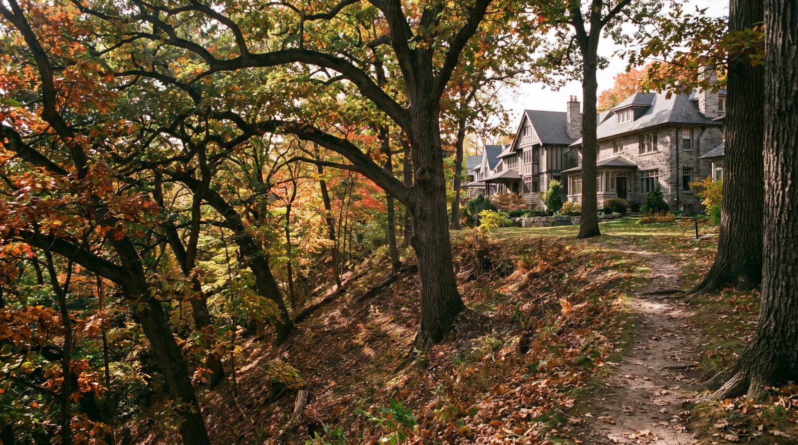
The ten things buyers around High Park and Swansea are least often told, all of them documented: inside a protected ravine area a permit is triggered by harming or removing any tree regardless of size, with fines from $500 to $100,000 per tree and $500 to $10,000 a day for a continuing offence, while the ordinary city-wide threshold is a stem of 30 centimetres measured at 1.4 metres; a ravine permit application requires a geotechnical report on soil conditions and slope stability and an arborist report covering every tree within 12 metres of the work, with tree planting guarantees at $583 per tree; on a valley or shoreline lot TRCA is a second, separate approval under Ontario Regulation 41/24; private vehicles have been banned from High Park on weekends and statutory holidays since August 2023, with roadworks in the park from July to September 2026 and construction from summer 2027 to summer 2028; the Bloor West Village heritage study was completed and the district was never designated; Council enabled up to six units in Toronto and East York District in June 2025, not the four that applies city-wide; live applications beside the park include 35 and 20 storeys with 639 units at 21 Windermere and 41 and 39 storeys with 873 units at Mountview and Oakmount; the City’s flood study area 49 is named Islington-Bloor, Park Lawn, South Kingsway and the protection subsidy pays up to $6,650 per property; 53.8 per cent of High Park-Swansea’s dwellings were built in 1960 or before; the Gardiner section from the Humber River to Dufferin is the only one whose status is “pending an engineering evaluation”; and from 1 April 2026 the municipal land transfer tax runs to 4.40 per cent above $3 million while the Vacant Home Tax deems you vacant if you do not declare.
None of that is an argument against buying here. This is one of the most established addresses in west Toronto, wrapped around one of the best parks in the country. It is an argument for buying here with the documents open.
Every item is traced to a primary source — a Municipal Code chapter, a Council item, a City project page, a conservation authority permit page, a school board admissions page, a City open dataset — and each is listed at the bottom with the date I read it. A few figures are my own arithmetic from official data rather than published statistics, and they are labelled where they appear. Seven things I deliberately left off because I could not source them properly: prescribed burns in the black oak savannah, anything about Wendigo Creek or Spring Creek, Grenadier Pond water quality results, the specific setback distances in metres under Ontario Regulation 41/24, the 501 Queen and 506 Carlton route structures, a Swansea “Area of Special Identity” that I found no evidence for in current City policy, and which named local schools are closed to out-of-area admission. I will publish those when I can cite them.
High Park is 399 acres, about two-thirds of it still in a natural state, and it contains roughly 23 hectares of black oak savannah — the City calls it the most significant area of tallgrass savannah, prairie and woodland in Toronto, a globally rare ecosystem with less than three per cent of it left after European settlement. That is the reason people buy here, and it is also the reason the rules on the land around it are unlike the rules anywhere else in the city.
One geographic note before the list, because it changes every number. What people call High Park and Swansea is two City neighbourhoods, not one: High Park-Swansea is neighbourhood 87 and High Park North is neighbourhood 88. They have almost the same population and they are close to opposites on tenure. Where I quote census figures below, I name which one they belong to.
1In the ravine by-law there is no such thing as a small tree
Toronto has two tree by-laws, and this is one of the few parts of the city where the difference between them decides what you can do with your own back garden.
| Private Tree By-law, Municipal Code Chapter 813 | Ravine and Natural Feature Protection, Chapter 658 | |
|---|---|---|
| What triggers a permit | A tree with at least one stem of 30 centimetres diameter or more, measured 1.4 metres above ground level | Any tree regardless of size, plus excavation, fill, grading, dumping, and constructing structures or retaining walls |
| Where it applies | Private land across the city | Land shown as a shaded “protected area” on a Data Map in Schedule A-2 |
| Fine for injuring or destroying a tree | $500 minimum, $100,000 maximum per tree, plus a possible special fine of $100,000 | $500 minimum, $100,000 maximum per tree |
| Other violations | — | $500 to $100,000, and $500 to $10,000 per day for a continuing offence |
| Overlap | Section 813-13 exempts trees in ravine protection areas from Chapter 813, because Chapter 658 governs them instead | |
Section 658-2 requires a permit to “injure, destroy, remove or permit the injury, destruction or removal of any tree on any land in a protected area,” and separately to place or dump fill or refuse, or to alter the grade of land. Section 658-1 defines a protected area to take in ravines with a minimum two-metre elevation change and a history of water flow, tableland forests, treed portions of the Lake Iroquois shoreline, and valley-located public parks. The City’s own permit guidance puts the trigger in one line: “Harming or removing any tree regardless of size.”
The exemptions are narrow. Chapter 658 exempts dead, diseased or hazardous trees certified by the General Manager, standard arboricultural pruning, utility line pruning, fruit tree removal for production, certified emergency work, and fill under five cubic metres for turf maintenance. Chapter 813 exempts terminally diseased and imminently hazardous trees, pruning for tree health, and trees in rooftop gardens with soil depth under 1.5 metres. Under section 813-20 a replacement tree must be “planted and maintained in good condition for a period of two years,” and where you cannot replant on site, the cash in lieu is 120 per cent of the cost of replanting. City street trees are protected at any size.
Here is how to check a specific address, and it takes five minutes. Open the City’s mapping tool at map.toronto.ca/torontomaps, enter the address, and tick the Ravine and Natural Feature Protection By-law box under Boundaries. Protected areas appear as striped layers. I will tell you plainly that I could not query that map programmatically to produce a street list, so I am not going to tell you which Swansea or High Park streets are captured. Check the address, not the reputation of the street.
How to read this as a buyer. On a protected lot, the mature oak at the back is not a feature you own outright. It is a permit. Before you buy a house here on the strength of a renovation or an addition you intend to build, run the address through that map layer and price the permit work into the offer, not into the regret.
2A ravine permit needs a geotechnical slope-stability report, and TRCA is a second approval on top of it
This is the single most under-reported cost of owning a valley lot in Swansea or High Park, and it sits in the City’s own application instructions.
To apply for a Ravine and Natural Feature Protection permit for proposed construction, the City requires all of the following:
| Required with a ravine permit application | Detail |
|---|---|
| Zoning notice | Recent notice for the proposed construction |
| Plan of survey | Showing the limits of the RNFP area on the property |
| Site plan | Existing and proposed buildings and structures, “including decks and underground foundation extensions” |
| Arborist report | Covering trees within 12 metres of construction activity |
| Landscape and forest restoration plans | Hard and soft landscaping |
| Grading plans | Scale drawings, metric, with title, date, north arrow and municipal address |
| Geotechnical report | “Geotechnical report addressing soil conditions and slope stability,” plus drainage and sediment control measures |
| Financial securities | Tree planting guarantees at $583 per tree, being 120 per cent of two-year maintenance costs; City tree protection guarantees appraised by diameter, species, condition and location |
Now the second layer. Separately and in addition, a property that includes or adjoins a watercourse, a valley, a wetland, a shoreline or hazardous land such as a steep slope or flood plain sits in a TRCA regulated area, governed by Ontario Regulation 41/24 under the Conservation Authorities Act. A TRCA permit is required for a new or replacement home, a home addition, a garage, shed, deck or pool, landscaping, the “placing or excavation of fill,” interference with a wetland, and alterations to a shoreline or watercourse. Section 5 of the regulation lists the exemptions. TRCA warns in its own words that “flood plains, in particular, are not always apparent.”
Two honest gaps. The City does not publish a processing timeline for ravine permits on the page I read, so I am not going to invent one. And I could not retrieve the operative text of Ontario Regulation 41/24 giving the regulated distances in metres from a wetland or from the stable top of a slope, so I am not going to print a setback figure. Use TRCA’s own regulated area search tool for the address, and if the answer matters, ask TRCA directly before you waive a condition.
How to read this as a buyer. A Swansea or High Park property backing onto the ravine or the Humber can face two separate approvals before any building permit is issued: the City permit under Chapter 658, with a geotechnical slope-stability report and a 12-metre-radius arborist report, and the TRCA permit under Ontario Regulation 41/24. That is engineering money and calendar time. Buy the house you want to live in, not the house you plan to extend, unless you have priced both approvals first.
3High Park is closed to private cars every weekend, and the road work runs into 2028
The High Park Movement Strategy is a City study with a stated destination. It “takes a phased approach to improving how park visitors access and move around High Park, with a long-term goal of achieving a car-free High Park.” An interim report went to the Infrastructure and Environment Committee on 11 May 2022 as item 2022.IE30.16, and City Council approved the Strategy in May 2023 as item 2023.IE3.7.
What is already in force, since August 2023: private vehicles are prohibited in the park on weekends and statutory holidays; the Bloor Street gates are exit-only for private vehicles, with entry via Parkside Drive, Spring Road and Colborne Lodge Drive; and car traffic on Colborne Lodge Drive is one-way. The TTC 203 High Park Loop runs 8 a.m. to 7 p.m., with weekend and holiday service from 15 March to 31 October and weekday service from 4 May to 4 September. Wheel-Trans operates year-round. A recreational cycling pilot proposed in 2024 was placed on hold pending an ecological study by TRCA; CampTO Plus cycling launched in summer 2025 and continues in summer 2026. The separate High Park Shuttle ran in May 2025 and was replaced by TTC service.
| What happens next, on the City’s published schedule | When |
|---|---|
| Online survey | 1 to 21 April 2026 |
| Virtual public meeting, road redesign phase 2 | 7 April 2026 |
| Preliminary roadworks: curb realignment and asphalt removal on Colborne Lodge Drive and West Road | Early July to early September 2026 |
| Detailed design | Fall 2026 to winter 2027 |
| Construction | Summer 2027 to summer 2028 |
| Report back to Council | By 2027 |
Then there is the fortnight nobody plans for. During cherry blossom peak bloom the City states there is “no visitor vehicle or parking access to High Park,” and that “only Wheel-Trans vehicles and TTC buses will be allowed into High Park during peak bloom.” The City publishes no fixed dates and directs people to the High Park Nature Centre’s Blossom Watch instead. Peak bloom is described as late April or early May, and the blossoms “typically last between four to 10 days, depending on weather conditions.” There are about 50 trees, planted in 2017 and 2018, mostly on the east side of Grenadier Pond.
One thing I am not going to tell you: what happens to the parking supply. The City’s own study page carries two statements that do not sit together — a conversion of spaces on Colborne Lodge Road and West Road to a parallel configuration, and a statement that there will be no reduction or reallocation of existing parking spaces. One of them is almost certainly scoped to a particular phase. Until that is resolved on the page, a parking count from me would be a guess.
How to read this as a buyer. If you are buying on Parkside, Spring Road, Colborne Lodge Drive, or any street that feeds the park gates, the traffic pattern on the day you view is not the traffic pattern you are buying. Weekends are already car-free inside the park, roadworks land in the park in July 2026, and the main construction is 2027 to 2028. View on a Saturday in blossom season before you decide how much the park frontage is worth to you.
4The heritage study for Bloor West Village was finished. The district was never designated
This is the cleanest example on the page of a document that exists and a protection that does not.
The City lists exactly four entries under Heritage Conservation District Studies Completed: Bloor West Village, Casa Loma, the Distillery District and Weston II. Bloor West Village is not among Toronto’s 27 designated Heritage Conservation Districts. It is not on the list of districts in development, which is Junction Phase I and West Annex Phase II. It is not under appeal, which is West Queen West. It is a completed study with no designation and no linked plan document. The study was initiated in Fall 2017, with a study area described as bounded by High Park to the east and the Humber River to the west, and findings to be presented to the Toronto Preservation Board aligned with the Avenue Study timeline.
For contrast, look one neighbourhood west. The Heritage Register in this part of the city is numerically dominated by Baby Point — 112 records on Baby Point Road, 62 on Baby Point Crescent and 10 on Baby Point Terrace in the City’s open dataset. That is what a designated district looks like in the data. Bloor West Village does not look like that.
What buyers here actually have is a Heritage Register listing, which is not the same thing. The City states it plainly: “Being listed on the Heritage Register is not the same thing as being a designated heritage property.” A listed property means the owner must give the City 60 days’ notice before demolition, and listing does not restrict renovations, alterations that do not need a building permit, or development. A designated property has a by-law registered on title and must comply with heritage conservation requirements for alterations and development. Bill 23 amendments to the Ontario Heritage Act also gave Toronto’s Chief Planner limited authority to add listed properties to the Register without Toronto Preservation Board review, where they meet provincial criteria and are subject to a planning application.
From the City’s Heritage Register open data, dated 4 June 2026, here is what that means on the ground:
| Address | Status | On the register since | Built | Description in the dataset |
|---|---|---|---|---|
| 1778, 1908, 1914, 1920 and 1926 Bloor St W | Listed | 5 February 2025 | c.1928–1930 | “Identified within the Bloor West Village study area” |
| 2223 Bloor St W | Part IV designated | 1989 | 1927–28 | Runnymede Theatre, Chapman and Oxley — By-law 97-90, designated 29 January 1990 |
| 2178 Bloor St W | Listed | 1975 | 1929 | Runnymede Branch, Toronto Public Library, John M. Lyle |
| 210 Riverside Dr | Listed | 1979 | c.1935 | “Journey’s End”, L.M. Montgomery House |
| 4 and 8 South Kingsway | Part IV designated | 1998 | 1750–51 | Site of Fort Toronto and the Jean Rousseau trade post — By-law 801-98 |
| 83 Deforest Rd | Listed | 1987 | 1930 | Swansea Fire Hall, Robert McGiffin |
| 95 Lavinia Ave | Listed | 1987 | 1960 | Swansea’s municipal building, N.A. Armstrong |
| 166 High Park Ave | Part IV designated | 1973 | 1891 | Herman Heintzman House — By-law 838-86 |
| 11 Colborne Lodge Dr | Listed | 1973 | 1836 | J.G. Howard House, Colborne Lodge |
How to read this as a buyer. Five Bloor Street West buildings were added to the Register on 5 February 2025 with the dataset note that they were identified within the Bloor West Village study area. That is a listing, and a listing buys the City 60 days. If you are buying a listed commercial or residential property here, the question to ask your lawyer is not “is it heritage,” it is “listed or designated,” because only one of those is registered on title.
5Six units, not four, if the by-law schedule reaches your lot
Almost every article you will read about Toronto small-scale housing says four units. In this part of the city the number Council actually enabled is six.
| Permission | Council decision | By-laws | In force | Scope |
|---|---|---|---|---|
| Multiplex, 2 to 4 units | 10 May 2023, item 2023.PH3.16 | OPA law0473 (2023); ZBA law0474 (2023) | Zoning 12 May 2023; Official Plan 14 June 2023 | City-wide |
| Residential buildings of up to six units | 25 to 26 June 2025 | OPA law0653 (2025); ZBA law0654 (2025); monitoring by-law law0648 (2025) | The City states the amendments “are now in force” | Toronto and East York District, and Ward 23 only — not city-wide |
| Garden suite, one per property | 2 February 2022; amendments 24 June 2025, item PH23.1 | OPA By-law 0100-2022; ZBA By-law 0101-2022 | 2 February 2022, with one property-specific appeal maintained | Most residential zones; Ontario Regulation 462/24 in force 20 November 2024 affects some garden suite regulations |
High Park-Swansea and High Park North sit in Toronto and East York District, which is the district the six-unit amendments name. A Sixplexes Citywide Study is under way to consider extending it. I will add the caveat I would give a client: confirm the by-law schedule against your specific lot before you pay for drawings, because a district boundary in a zoning by-law is a mapped line, not a neighbourhood name.
How to read this as a buyer. A six-unit permission is worth real money on a wide lot near a subway station, and it is worth nothing at all on a lot where Chapter 658 governs every tree and TRCA has to approve the excavation. Items 1 and 2 on this page are the constraint that decides whether item 5 is an opportunity. On a ravine lot, work out the permit path before you pay a premium for the density.
6What is actually approved around the park, in file numbers
The City’s development application data records every open file. Note one quirk before you read it: the dataset still uses legacy “OMB Appeal” and “OMB Approved” labels, and those now mean the Ontario Land Tribunal.
| Address | Proposal | File | Submitted | Status |
|---|---|---|---|---|
| 21 Windermere Ave | 35 and 20 storeys, 639 units, including rent-geared-to-income rental replacement | 26 164282 STE 04 SA | 21 May 2026 | Under review |
| 26–36 Mountview Ave and 21–29 Oakmount Rd | 41 and 39 storeys, 873 units, 11 rental replacement | 25 222465 STE 04 OZ | 9 September 2025 | Appeal received |
| 35–95 High Park Ave and 66–102 Pacific Ave | 35, 11 and 30 storeys, 764 rental units | 20 210125 STE 04 SA | 23 October 2020 | Notice of approval conditions issued |
| 111 Pacific Ave | 32 and 25 storeys plus townhouses | 20 206487 STE 04 SA | 14 October 2020 | Notice of approval conditions issued |
| 1730 Bloor St W | 25 storeys, 200 units | 25 217120 STE 04 OZ | 27 August 2025 | Council approved |
| 1728 Bloor St W | 19 storeys, 89 units rising to 99 in the later file | 23 119823 STE 04 OZ | 3 March 2023 | Tribunal approved |
| 1930–1938 Bloor St W and 3–21 Quebec Ave | 19 storeys, 144 units, 12 rental replacement | 24 121126 STE 04 OZ | 1 March 2024 | Tribunal approved |
| 2273–2279 Bloor St W | 15 storeys, 60 units | 25 269621 STE 04 OZ | 24 December 2025 | Council approved |
| 2453–2469 Bloor St W | 12 storeys, 91 units | 23 181154 STE 04 OZ | 28 July 2023 | Tribunal approved |
| 1978 Lake Shore Blvd W | 698 units | 22 138558 STE 04 SA | 26 April 2022 | Under review |
The unit counts above are the City’s, taken from its Development Applications dataset as downloaded on 31 August 2026. The addition is mine.
Those eight files with published unit counts total 2,870 homes within a short walk of the park, before you count 111 Pacific or the Dundas Street West corridor behind it. On Dundas, the largest single file is 2252–2290 Dundas Street West: six buildings, about 2,312 units of which 1,156 are rental, plus a 3,405 square metre public park, submitted 13 July 2022 and still under review. At 2400–2440 Dundas Street West, phase one is a 37-storey building with 447 rental units and phase two is 42 and 25 storeys with 56 affordable rental units and a new public park.
How to read this as a buyer. Three of the closest files were approved by the Tribunal rather than by Council, and one of the two biggest is already under appeal. That tells you where the real decisions about this skyline are being made. Before you write on anything on Bloor between Keele and Jane, or on Windermere, send me the address and I will pull the live file for the block from the City’s Application Information Centre so you know what is actually pending beside it.
7There is a City flood study area that names South Kingsway, and a subsidy that pays 80 per cent
The City’s Basement Flooding Protection Program is “a multi-year program helping to reduce the risk of flooding by making improvements to the sewer system and overland drainage routes.” Between 2006 and 2024 the City completed Environmental Assessment studies in 67 areas. Three of them cover this geography:
| Study area | Name | Wards covered | Completed |
|---|---|---|---|
| 4 | Jane Street / St. Clair Avenue West | Parkdale-High Park, York South-Weston | 2014 |
| 5 | Humber River / Bloor Street West | Parkdale-High Park | 2014 |
| 49 | Islington-Bloor, Park Lawn, South Kingsway | Etobicoke Centre, Etobicoke-Lakeshore, Parkdale-High Park | 2022 |
Study Area 49 is the one that names South Kingsway and Park Lawn, which is to say Swansea. That is not a reason to panic. It is a reason to use the subsidy, which most owners here do not know exists. For work completed on or after 12 November 2025, the City’s Basement Flooding Protection Subsidy Program pays:
| Measure | Subsidy |
|---|---|
| Backwater valve | Up to 80 per cent of invoiced cost, maximum $1,600 per device, maximum two devices |
| Sump pump | Up to 80 per cent, maximum $2,250, plus up to $300 for a battery backup |
| Severance and capping of a storm sewer or weeping tile connection | Up to 80 per cent, maximum $400 |
| Overall maximum per property | $6,650 |
The conditions are specific. You must be the registered owner of a single-family, duplex, triplex or fourplex in Toronto; downspouts must be disconnected from the sewer or hold a City exemption; front-yard paving must comply with zoning; your contractor must hold a valid Toronto business licence; you must apply within two years of installation; and you must have no outstanding taxes or debts to the City. A building permit is required for a backwater valve installation.
How to read this as a buyer. On a pre-1960 house, ask the seller for the backwater valve permit and the invoice, not for reassurance. If there is none, the subsidy is available to you after closing, and the maximum is $6,650. That is a line item you can raise during the conditional period rather than discover in a July storm.
8More than half the houses in High Park-Swansea were built in 1960 or earlier
From the City’s Neighbourhood Profiles, 2021 Census, 158-neighbourhood model, for the two neighbourhoods people mean when they say High Park:
| Indicator | High Park-Swansea (87) | High Park North (88) |
|---|---|---|
| Population in private households | 22,665 | 21,855 |
| Occupied private dwellings | 10,450 | 11,100 |
| Owner households | 6,245 (59.8%) | 3,710 (33.4%) |
| Renter households | 4,210 (40.3%) | 7,390 (66.6%) |
| Median household total income, 2020 | $101,000 | $83,000 |
| Median value of dwellings | $1,200,000 | $1,300,000 |
| Average value of dwellings | $1,424,000 | $1,354,000 |
| Median monthly shelter cost, owned | $1,820 | $1,700 |
| Tenant households spending 30 per cent or more of income on shelter | 38.0% | 41.6% |
| Dwellings needing major repairs | 710 | 910 |
| Median age | 40.8 | 39.2 |
And the two facts that matter most for a renovation budget, from the same profile:
| Period of construction | High Park-Swansea | High Park North |
|---|---|---|
| 1960 or before | 5,625 (53.8%) | 4,195 (37.8%) |
| 1961 to 1980 | 1,800 | 4,385 (39.5%) |
| 1981 to 1990 | 540 | 660 |
| 1991 to 2000 | 390 | 405 |
| 2001 to 2005 | 235 | 230 |
| 2006 to 2010 | 595 | 255 |
| 2011 to 2015 | 1,065 | 380 |
| 2016 to 2021 | 200 | 595 |
The counts above are Statistics Canada 2021 Census data as published in the City’s official Neighbourhood Profiles dataset. The shares in this paragraph are my arithmetic from those counts.
On the structural type counts, single-detached houses are 2,640 of 10,450 dwellings in High Park-Swansea, about 25 per cent, and apartments in buildings of five or more storeys are 3,415, about 33 per cent. In High Park North the same apartment category is 6,620 of 11,100, about 60 per cent, against 1,385 single-detached houses. That is the whole story of the two neighbourhoods in four numbers: one is a detached-and-lowrise owner market with a large apartment edge, the other is a tower market with a detached pocket inside it.
How to read this as a buyer. When someone quotes you an average price or an average rent for “High Park,” ask which of the two neighbourhoods it came from, because one is 60 per cent owner-occupied and the other is 67 per cent renter. And note what more than half of the housing stock predating 1961 means in practice: it is the same stock that sits in the ravine by-law areas in item 1, needs the permits in item 2, and is inside the flood study area in item 7. Your inspection matters more here than your comparables do.
9The stretch of Gardiner in front of Swansea is the one with no schedule
The City divides the Gardiner Expressway Rehabilitation Strategy into six sections. Five of them have a status. One does not.
| Section | Status |
|---|---|
| Jarvis St to Cherry St | Complete, 2021, using accelerated bridge construction with pre-fabricated sections |
| Dufferin St to Strachan Ave | Complete, 2026; the elevated portion replaced |
| Highway 427 to the Humber River | In progress: reconstruction of 6.5 kilometres of at-grade expressway and rehabilitation of 15 bridges, early work focused on the Park Lawn Road and Mimico Creek bridges |
| Grand Magazine St to York St | Not yet started; two kilometres of elevated section to be replaced |
| Cherry St to the Don Valley Parkway | Partially under way; alignment shifts northward, coordinated with the Ontario Line and Port Lands |
| Humber River to Dufferin St | “Pending an engineering evaluation” |
The last row is the stretch that fronts Swansea and Humber Bay, and it is the only one of the six with no committed schedule. The active western work is the Highway 427 to Humber River section, which includes the Park Lawn Road bridge.
I could not find published construction dates, lane closures or completion years for either the western section or the Humber-to-Dufferin section, so I am not going to print any. I also want to be straight about a claim you will see repeated in neighbourhood write-ups: that Lake Shore Boulevard and the Gardiner cut Swansea off from the waterfront. I found no City document that says that. It may be your experience of the walk. It is not a documented City finding, and I am not going to dress it up as one.
How to read this as a buyer. The most likely major expressway project in front of this neighbourhood is the one with no dates attached. If you are buying south of Ellis Avenue or anywhere with a Gardiner outlook, treat the rehabilitation of that section as a known unknown on a ten-year view, and ask what the City has published for the section number rather than what a neighbour heard.
10The land transfer tax brackets changed on 1 April 2026, and the Municipal Code has not caught up
On a neighbourhood where the median dwelling value in the 2021 Census was already $1.2 million, the closing costs are a real number. Toronto’s Municipal Land Transfer Tax gained new graduated brackets for properties containing one or two single-family residences, effective 1 April 2026. The City’s own wording: “On December 17, 2025 City Council passed an amendment to introduce graduated Municipal Land Transfer Tax rates for high-value residential properties containing one or two single-family residences. The new MLTT rates will take effect on April 1, 2026.” The Council item is 2025.EX28.1, adopted with amendments on 16 and 17 December 2025.
| Value of consideration | Rate from 1 April 2026 |
|---|---|
| Up to $55,000 | 0.5% |
| $55,000.01 to $250,000 | 1.0% |
| $250,000.01 to $400,000 | 1.5% |
| $400,000.01 to $2,000,000 | 2.0% |
| $2,000,000.01 to $3,000,000 | 2.5% |
| $3,000,000.01 to $4,000,000 | 4.40% |
| $4,000,000.01 to $5,000,000 | 5.45% |
| $5,000,000.01 to $10,000,000 | 6.50% |
| $10,000,000.01 to $20,000,000 | 7.55% |
| Over $20,000,000 | 8.60% |
All other properties are taxed at 0.5 per cent to $55,000, 1.0 per cent to $250,000, 1.5 per cent to $400,000 and 2.0 per cent above that. The administration fee is $102.56 plus HST per transaction, and an MLTT refund or rebate request costs $221.22. The first-time purchaser rebate is a maximum of $4,475 for conveyances on or after 1 March 2017, under Municipal Code Chapter 760, section 760-60C.
Now the part nobody mentions. As read on 31 August 2026, the consolidated Municipal Code Chapter 760 still publishes the pre-April-2026 table at section 760-9.2A, with 3.5 per cent from $3 million to $4 million and 7.5 per cent above $20 million. The Code consolidation appears not to have caught up with the amendment. Cite the City’s Rates and Fees page and item 2025.EX28.1 for what you will actually pay, and expect to see the old table quoted at you from the Code in the meantime.
| Vacant Home Tax rule | What the City states |
|---|---|
| Rate | 3 per cent of Current Value Assessment, as of the 2024 taxation year |
| Definition | The property “was vacant for six months or more during the taxation year” |
| No declaration filed | Owners who fail to declare are automatically deemed vacant |
| Exemptions | Death of a registered owner; principal resident in long-term care; major repairs or renovations preventing occupancy; transfer of legal ownership during the year; court order prohibiting occupancy; newly constructed units actively marketed for sale; medical necessity from 2024 |
| False declaration | “A fine of up to $10,000, in addition to payment of the tax” |
| Interest on unpaid amounts | 1.25 per cent monthly |
Two things I will not print. I could not confirm the Municipal Code chapter number for the Vacant Home Tax, so I am not going to cite one. And the declaration deadline for the current year was not stated on the page I read, so check the City’s date before you rely on a number from an article. On assessment, MPAC states only that “due to the COVID-19 pandemic, the Ontario government has postponed the 2020 Assessment Update.” Which valuation date currently applies is not stated on that page, and I am not going to print one from memory.
How to read this as a buyer. In a neighbourhood where detached houses trade well above the census median, the jump from 2.5 to 4.40 per cent at $3 million is a five-figure step on the statement of adjustments, and the provincial land transfer tax sits on top of it. On the ownership side, the deeming rule is the one that costs money for nothing: you do not have to leave a house empty to be taxed, you only have to forget to file, once, in a year you were renovating or dealing with an estate.
Four more, because they come up every week
High Park station only became accessible in March 2025. The TTC’s own project page records “two new elevators, one to each subway platform,” plus improved signage, CCTV, “a new main entrance structure and automatic sliding doors,” and states that “work at High Park Station was completed in March 2025.” Runnymede and Keele were both made accessible earlier, in the 2019 to 2023 tranche of the Easier Access programme. If you are comparing this pocket with Bloor West Village or the Junction on step-free access, all three of your local stations now have it, and that is newer news than most listings suggest.
Optional attendance closes in January, and the status list is not published until November. The TDSB’s out-of-area admissions process for 2027-28 opens on 4 January 2027 and closes at 4:00 p.m. on 22 January 2027. You may apply to one school per application, across regular, remote learning, early French immersion and middle immersion programs. Families must arrange their own transportation, and you must still register at your designated local school as a backup. Schools are graded “Closed,” “Limited (Siblings),” “Limited (Siblings or Feeder School)” or “Limited,” and the board says the 2027-28 statuses will be updated in November 2026. I could not retrieve the current status table for the schools serving High Park and Swansea, so I am not going to tell you which of them are closed. Check the board’s designated-school lookup for the exact address and ask for the status in writing.
Grenadier Pond carries three separate provincial and municipal designations. The City records that “in 2022, the Ministry of Natural Resources and Forestry designated Grenadier Pond as a Provincially Significant Wetland Complex based on a wetland evaluation conducted by the Toronto Region and Conservation Authority,” and the same page identifies it as an Environmentally Significant Area and an Area of Natural and Scientific Interest. Fishing is permitted at the south end only, with a valid Outdoors Card and licence tag, and the City notes that “some bigger fish shouldn’t be eaten due to contaminants.” I could not retrieve any water quality monitoring data for the pond, so there are no numbers on this page about it.
The Bloor West Village Avenue Study finished in December 2025, and the guidelines came out in April 2026. A final staff report and the Bloor West Village Urban Design Guidelines were adopted by City Council on 16 December 2025, and the guidelines document is dated April 2026. The City confirms that a coordinated but separate Bloor Street West Heritage Conservation District Study runs alongside it. I have not read the guidelines end to end, so I am not going to summarise the study boundaries or the height directions for you. If you are buying anything on Bloor between the Humber and High Park, that document is the one to read before you form a view about what goes up across the street.
What this list is not
It is not an argument against buying here. This is a neighbourhood wrapped around a 399-acre park, roughly two-thirds of it still natural, holding about 23 hectares of globally rare black oak savannah and an animal display that has run since 1893 and draws more than 600,000 visitors a year. Three subway stations serve it and all three are now step-free. Nearly 60 per cent of High Park-Swansea households own their homes, the median household income is above the city’s, and the City has completed the flood studies here rather than leaving them in a queue. Very few places in Toronto can say all of that.
The point is that every one of the ten items above is knowable before you sign. Most buyers find out afterwards, usually when an arborist report or a slope-stability report turns up in the middle of a renovation. That is the entire difference between working with someone who has read the by-law and working with someone who has read the listing.
Thinking about a specific street in High Park, Swansea or Bloor West Village?
A neighbourhood list is the right frame for understanding a market and the wrong frame for a decision. What a house is worth here depends on whether the ravine by-law layer touches the lot, whether TRCA has to approve what you want to build, which of the two census neighbourhoods it sits in, and what is actually pending on the block. Send me the address and I will give you the comparable sales that apply to it, the live applications beside it, and a straight answer on whether to move now or wait.
[email protected] · 833-330-1925 · Book a free consultation
Confidential. Read personally and answered within 24 hours. I never share, sell or distribute your information.
Ask the local expert
Ask me anything about High Park, Swansea or Bloor West Village
Send me the street, the address or the question. You get a straight answer from someone who works this pocket every week, including when the answer is that you should wait. No drip campaign you cannot get out of.
Got it.
I read these personally and answer within 24 hours. If it is urgent, call or text 833-330-1925.
Confidential. Read personally and answered within 24 hours. I never share, sell or distribute your information. Not intended to solicit buyers or sellers currently under contract with another brokerage.
Frequently asked questions
Do I need a permit to remove a tree in High Park or Swansea?
Very likely yes. Across Toronto, the private tree by-law in Municipal Code Chapter 813 protects any tree with at least one stem of 30 centimetres diameter measured 1.4 metres above ground. Inside a protected ravine area, Chapter 658 goes much further: a permit is triggered by harming or removing any tree regardless of size. Fines run from a $500 minimum to a $100,000 maximum per tree.
How do I check whether a property is in the ravine protection area?
Use the City’s mapping tool at map.toronto.ca/torontomaps. Enter the address, then tick the Ravine and Natural Feature Protection By-law box under Boundaries. Protected areas show as striped layers. A protected area includes ravines with a minimum two-metre elevation change and a history of water flow, tableland forests, treed portions of the Lake Iroquois shoreline, and valley-located public parks. Check the specific lot, because the layer does not follow street names.
What does a ravine permit application actually require?
More than most buyers expect. The City requires a recent zoning notice, a plan of survey showing the limits of the protected area, a site plan including decks and underground foundation extensions, an arborist report covering trees within 12 metres of construction, landscape and forest restoration plans, grading plans, and a geotechnical report addressing soil conditions and slope stability. Tree planting guarantees are set at $583 per tree.
Do I need a TRCA permit as well as a City permit?
On a valley, wetland, shoreline or steep-slope property, yes, and it is separate. TRCA permits fall under Ontario Regulation 41/24 and cover new or replacement homes, additions, garages, sheds, decks, pools, landscaping, placing or excavating fill, interference with wetlands, and alterations to shorelines and watercourses. Section 5 of the regulation sets out exemptions. TRCA warns that flood plains in particular are not always apparent, so use its regulated area search tool.
Can you drive into High Park?
Not on weekends. Private vehicles have been prohibited in the park on weekends and statutory holidays since August 2023, the Bloor Street gates are exit-only for private vehicles, and Colborne Lodge Drive is one-way. Entry is via Parkside Drive, Spring Road and Colborne Lodge Drive. During cherry blossom peak bloom the City states there is no visitor vehicle or parking access at all, and only Wheel-Trans vehicles and TTC buses are allowed in.
Is Bloor West Village a Heritage Conservation District?
No. The City lists Bloor West Village under Heritage Conservation District Studies Completed, alongside Casa Loma, the Distillery District and Weston II, but it is not one of Toronto’s 27 designated districts, it is not on the in-development list, and it is not under appeal. The study was initiated in Fall 2017. Individual buildings are listed on the Heritage Register, which requires 60 days notice before demolition but does not restrict renovations.
How many units can I build on a lot in High Park or Swansea?
Potentially six. Council enabled multiplexes of two to four units city-wide in May 2023, with the zoning amendment in effect on 12 May 2023. In June 2025 Council adopted amendments allowing residential buildings of up to six units in Toronto and East York District and Ward 23 only, by-laws law0653 and law0654, and the City states these are now in force. High Park and Swansea fall in that district, but confirm the by-law schedule for your lot.
What is being built around High Park right now?
The largest live files include 21 Windermere Avenue at 35 and 20 storeys with 639 units, under review since May 2026, and 26 to 36 Mountview Avenue with 21 to 29 Oakmount Road at 41 and 39 storeys with 873 units, which is under appeal. On Bloor, 1730 Bloor West at 25 storeys and 200 units is Council approved, and 1728, 1930 to 1938 and 2453 to 2469 Bloor West were approved by the Ontario Land Tribunal.
Does Swansea have a basement flooding problem?
The City has studied it. Basement flooding study area 49, named Islington-Bloor, Park Lawn, South Kingsway, was completed in 2022, and study area 5, Humber River and Bloor Street West, was completed in 2014. For work done on or after 12 November 2025 the City subsidises up to 80 per cent of a backwater valve to a maximum of $1,600 per device, a sump pump to $2,250 plus $300 for battery backup, and up to $6,650 per property overall.
How much Toronto land transfer tax will I pay on a High Park house?
From 1 April 2026 the municipal rate on a property with one or two single-family residences is 2.0 per cent between $400,000 and $2 million, 2.5 per cent to $3 million, then 4.40 per cent to $4 million, 5.45 per cent to $5 million and 6.50 per cent to $10 million. There is a $102.56 plus HST administration fee, and a first-time purchaser rebate of up to $4,475. Provincial land transfer tax is charged on top.
Related reading
- Top 10 things no one will tell you about Roncesvalles, Toronto
- Top 10 things no one will tell you about The Kingsway, Etobicoke
- Top 10 things no one will tell you about The Queensway and Stonegate-Queensway
- Top 10 things no one will tell you about Mimico and Humber Bay Shores
- Toronto Municipal Land Transfer Tax: the bracket table from 1 April 2026
- Toronto Vacant Home Tax: the buyer can be left holding it
- Toronto West market report, July 2026
Sources
Every figure on this page traces to one of these, and each was read on 31 August 2026. Primary sources only — a Municipal Code chapter, a Council item, a City project or permit page, a conservation authority, a transit agency, a school board, or a City open dataset. A small number of totals and shares are my own arithmetic from those datasets and are labelled where they appear. Where I could not verify something from a primary source, it is not on the page.
- Municipal Code Chapter 658, Ravine and Natural Feature Protection. City of Toronto. Section 658-2 on the permit requirement for any tree, fill and grade alteration; section 658-1 on the definition of a protected area and the two-metre elevation change; section 658-4 exemptions including fill under five cubic metres; and the section 658-12 penalties of $500 to $100,000 per tree and $500 to $10,000 per day. toronto.ca
- When to Apply For a Tree or Ravine Permit. City of Toronto. The trigger of harming or removing any tree regardless of size, excavation, fill, dumping and retaining walls, and the instructions for checking an address on the City’s mapping tool at map.toronto.ca/torontomaps by ticking the Ravine and Natural Feature Protection By-law box under Boundaries. toronto.ca
- How to Apply For a Tree or Ravine Permit. City of Toronto. The full document list for a ravine permit application, including the plan of survey, the arborist report covering trees within 12 metres, the geotechnical report addressing soil conditions and slope stability, and the $583 per tree planting guarantee. toronto.ca
- Municipal Code Chapter 813, Trees. City of Toronto. Section 813-12 on the 30-centimetre stem measured at 1.4 metres; section 813-13 exemptions including trees in ravine protection areas; section 813-20 on two-year maintenance and cash in lieu at 120 per cent; and the section 813-29 penalties. toronto.ca
- TRCA Planning and Permits. Toronto and Region Conservation Authority. Ontario Regulation 41/24 under the Conservation Authorities Act, the activities requiring a permit including home additions, decks, pools and fill placement, the section 5 exemptions, and the warning that flood plains in particular are not always apparent. trca.ca
- TRCA Regulated Area Search Tool. Toronto and Region Conservation Authority. The tool to run a specific address against the regulated area before waiving a condition. trca.ca
- High Park Movement Strategy. City of Toronto study page. The long-term goal of a car-free High Park, the interim report of 11 May 2022 as item 2022.IE30.16, Council approval in May 2023 as item 2023.IE3.7, the vehicle restrictions in force since August 2023, TTC route 203 hours and seasons, the cycling pilot and shuttle history, and the 2026 to 2028 schedule, together with the road redesign phase 2 public meeting presentation of 7 April 2026. toronto.ca
- Cherry Blossoms in Toronto parks. City of Toronto. The statement that there is no visitor vehicle or parking access during peak bloom, that only Wheel-Trans vehicles and TTC buses are allowed in, the four to ten day bloom window and the roughly 50 trees planted in 2017 and 2018. toronto.ca
- High Park, Colborne Lodge and the High Park Animal Display. City of Toronto parks and museums pages. The 1873 Howard deed of 165 acres, the purchases of 1876 and 1930 expanding the park to 399 acres, the animal display established in 1893 and its more than 600,000 visitors a year. Approximately two-thirds of the park in a natural state, the roughly 23 hectares of tallgrass savannah, prairie and woodland, and the 2022 Provincially Significant Wetland Complex designation of Grenadier Pond together with its Environmentally Significant Area and Area of Natural and Scientific Interest status. toronto.ca
- Fishing in Toronto’s parks. City of Toronto. Fishing permitted at the south end of Grenadier Pond only, the Outdoors Card and licence tag requirement, and the note that some bigger fish should not be eaten due to contaminants. toronto.ca
- Heritage Conservation Districts and Studies, and the Bloor Street West HCD Study. City of Toronto. Bloor West Village listed under studies completed alongside Casa Loma, the Distillery District and Weston II; its absence from the 27 designated districts, the in-development list and the districts under appeal; and the Fall 2017 initiation with a study area bounded by High Park to the east and the Humber River to the west. toronto.ca
- Heritage Register, and the Heritage Register open dataset. City of Toronto. The distinction between listing and designation, the 60 days notice before demolition, the Bill 23 amendments to the Ontario Heritage Act, and the register file HRAPQ22026 dated 4 June 2026 from which the address, status, listing date and description entries on this page are taken. toronto.ca
- Bloor West Village Avenue Study, and the Bloor West Village Urban Design Guidelines, April 2026. City of Toronto. The final staff report and urban design guidelines adopted by Council on 16 December 2025, and the coordinated but separate Bloor Street West Heritage Conservation District Study. toronto.ca
- Multiplex Study (2–4 Units), Multiplex Housing, and Expanding Housing Options in Neighbourhoods. City of Toronto. Council decision of 10 May 2023 as item 2023.PH3.16 with by-laws law0473 and law0474 in effect 14 June and 12 May 2023; and the 25 to 26 June 2025 adoption of by-laws law0653, law0654 and law0648 enabling up to six units in Toronto and East York District and Ward 23 only. toronto.ca
- Garden Suites. City of Toronto. Council adoption on 2 February 2022 with By-laws 0100-2022 and 0101-2022, the property-specific appeal maintained, the amendments of 24 June 2025 as item PH23.1, and Ontario Regulation 462/24 in force 20 November 2024. toronto.ca
- Application Information Centre, and the Development Applications open dataset. City of Toronto. The live lookup for any planning file, and the dataset downloaded 31 August 2026 from which the addresses, storeys, unit counts, file numbers, submission dates and statuses in item 6 are taken, including the legacy OMB labels that now mean the Ontario Land Tribunal. toronto.ca
- Basement Flooding Protection Program, and the Program Map. City of Toronto. The programme description, the Environmental Assessment studies completed in 67 areas between 2006 and 2024, and study areas 4, 5 and 49 with their wards and completion years. toronto.ca
- Basement Flooding Protection Subsidy Program. City of Toronto. The subsidy levels for work completed on or after 12 November 2025, the $1,600 backwater valve cap for up to two devices, the $2,250 sump pump cap with $300 for battery backup, the $400 severance and capping cap, the $6,650 overall maximum, and the eligibility conditions. toronto.ca
- Gardiner Expressway Rehabilitation Strategy. City of Toronto. The six sections and their statuses, including the 6.5 kilometres and 15 bridges in the Highway 427 to Humber River section, and the Humber River to Dufferin Street section pending an engineering evaluation. toronto.ca
- Municipal Land Transfer Tax rates and fees, and Council item 2025.EX28.1. City of Toronto. The bracket table effective 1 April 2026, the $102.56 plus HST administration fee, the $221.22 refund request fee, the $4,475 first-time purchaser rebate under Chapter 760 section 760-60C, and the Council decision adopted 16 and 17 December 2025. toronto.ca
- Municipal Code Chapter 760, Municipal Land Transfer Tax. City of Toronto. As read on 31 August 2026 the consolidation still shows the pre-April-2026 table at section 760-9.2A, with 3.5 per cent from $3 million to $4 million rising to 7.5 per cent above $20 million. toronto.ca
- Vacant Home Tax; and MPAC, Understanding Your Assessment. City of Toronto and the Municipal Property Assessment Corporation. The 3 per cent rate from the 2024 taxation year, the six-month definition, the automatic deeming rule, the exemption categories, the $10,000 fine and 1.25 per cent monthly interest; and MPAC’s statement that the province has postponed the 2020 Assessment Update. toronto.ca
- Elementary Out-of-Area Admissions, and Out-of-Area Admissions. Toronto District School Board. The 2027-28 window opening 4 January 2027 and closing at 4:00 p.m. on 22 January 2027, one school per application, the transportation and local-school registration requirements, the four status categories, and the November 2026 status update. tdsb.on.ca
- High Park Station. Toronto Transit Commission. The two new elevators, the new main entrance structure and automatic sliding doors, and the completion of the work in March 2025. ttc.ca
- Neighbourhood Profiles, 2021 Census, 158-neighbourhood model. City of Toronto Open Data, dataset 6e19a90f-971c-46b3-852c-0c48c436d1fc, file nbhd_2021_census_profile_full_158model.xlsx, refreshed 27 May 2026. Population, tenure, income, dwelling value, shelter cost, structural type and period of construction for High Park-Swansea (87) and High Park North (88), published as Statistics Canada 25 per cent sample data. toronto.ca
Weighing High Park–Swansea against somewhere else? Bloor West Village vs High Park–Swansea, High Park–Swansea vs Roncesvalles and Islington–City Centre West vs High Park–Swansea. All of it sits in one place: 100 Toronto neighbourhood comparisons, head to head.
What this page is and is not. This is general information about public documents affecting a Toronto neighbourhood, not legal, tax, engineering, environmental or financial advice, and not an opinion on the value or condition of any particular property. Statutes, by-laws, tax rates, transit schedules, construction schedules, school admission statuses and municipal policies change; every figure here is dated to 31 August 2026 and should be re-checked against the source before you rely on it. A small number of totals and shares on this page are my own arithmetic from official datasets and are labelled as such; they are not City-published statistics. Development applications described here are proposals or decisions as recorded on the dates stated and may since have changed; a recommended or approved application is not a built building. Whether a specific property falls inside a ravine protected area or a conservation authority regulated area must be confirmed against the City’s and TRCA’s own mapping for that address. For advice on a specific transaction, consult a lawyer, an accountant and a qualified professional as applicable. Jatin Dua is a Broker of Record with RE/MAX Quantum Realty Inc., Brokerage. Not intended to solicit buyers or sellers currently under contract with another brokerage.
About the author — Jatin Dua, Etobicoke and Toronto real estate expert
I am the Broker of Record and co-founder of RE/MAX Quantum Realty at 799 The Queensway in Etobicoke, with more than $100 million in GTA sales volume. I write these pages the same way I work a file: read the primary source, quote it, date it, and say plainly where the source is silent or where two documents disagree. If a figure on this page has no citation beside it, that is a mistake and I want to hear about it.
I work with buyers, sellers, renters and investors across High Park, Swansea, Bloor West Village, The Kingsway, Stonegate-Queensway, Mimico, Humber Bay Shores, Alderwood and the wider west end. [email protected] or 833-330-1925.