

Published 26 September 2026 · By Jatin Dua, Broker of Record, RE/MAX Quantum Realty
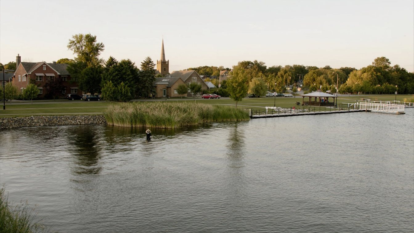
Lake Scugog is a shallow, dam-created lake, about 68 square kilometres with an average depth of 1.4 metres and a maximum of 7.6, made when William Purdy dammed the Scugog River at Lindsay in 1834 and flooded what had been wetland. That origin explains everything a buyer needs to know: weedy, marl-bottomed frontage on most of its 172 kilometres of shoreline, a level set by Parks Canada at the Lindsay dam and drawn down each autumn to protect shorelines from ice, and a federal lakebed on which every dock, boathouse or in-water work needs a Parks Canada permit with a 32-foot maximum dock length. Kawartha Conservation regulates the shore itself under Ontario Regulation 41/24, and Scugog’s zoning puts most lakefront lots in a Shoreline Residential zone with a 3,000-square-metre minimum lot and 30 metres of frontage. Port Perry is on municipal wells and sewer; the rural shore and Scugog Island generally are not. There is no GO and no short-term rental licence. TRREB’s April to June 2026 community report put Port Perry’s average at $972,283.
A lake that was a marsh
Before 1834 the area was wetland with wild rice and cattails and open water only in the deeper channels. William Purdy’s mill dam at Lindsay raised the water by about ten feet, created Scugog Island and the smaller islands, and so angered upstream settlers that they tore the dam apart in 1838; a replacement dam and lock, completed in 1844, brought the lake up about four feet. Today Lake Scugog is roughly 68 square kilometres with an average depth of 1.4 metres and a maximum of 7.6 near Caesarea, the shallowest of the large Kawartha lakes, a hard-water lake laying down marl at about a millimetre a year and classified as eutrophic, with tributary phosphorus roughly twice the provincial objective and aquatic plants, including invasive watermilfoil and starry stonewort, across much of its 172 kilometres of shoreline. The lake flushes about twice a year.
Say it plainly to yourself before you fall for a view: this is not Lake Simcoe or Lake Ontario. Swimming and boating happen in shallow, vegetated water, and the weed line in front of your dock is part of the property.
Who controls the water, and who controls the shore
Two authorities divide a Scugog shoreline lot. Parks Canada, through the Trent–Severn Waterway, controls what happens in the water: it operates the Lindsay dam, managing the level within a navigation range and drawing the lake down in late fall and January to protect shorelines and structures from ice damage, and it requires a permit for all work on, under or over the bed and waters of the waterway. That includes installing, repairing or removing docks, boathouses, boat lifts, swim rafts, launch ramps and shoreline stabilisation, dredging and removing aquatic vegetation. The maximum dock length is 32 feet unless an extension is granted for site conditions, and Parks Canada advises applying several months ahead. Because the lakebed is federal, Ontario’s 15-square-metre Public Lands Act exemption that applies on Lake Simcoe does not apply here.
Kawartha Conservation controls the shore and floodplain above the water under Ontario Regulation 41/24, in effect since 1 April 2024, requiring permits for shoreline works including new stone walls, for work in flood hazard areas and near wetlands, with fees on every application and property mapping online. The Township’s zoning defines the high-water mark on Lake Scugog as 249.92 metres above sea level. Read shoreline protection and who pays; the answer is the same on Scugog, with an extra federal permit.
The Shoreline Residential zone
Scugog’s Zoning By-law 14-14, adopted in March 2014, approved by the Ontario Municipal Board on 29 September 2014 and consolidated in June 2025, has something Georgina and Innisfil lack: a dedicated Shoreline Residential zone. Its standards are large-lot by design: a minimum lot of 3,000 square metres with 30 metres of frontage, a 7.5-metre front yard, a 12-metre rear yard and 3-metre interior side yards. Permitted uses include a single detached dwelling, an owner-occupied bed and breakfast, a home occupation and an additional dwelling unit only within the primary dwelling on lots of at least 3,000 square metres. A boathouse is permitted as an accessory building but may not exceed 35 square metres, and pools, gazebos and saunas must sit at least 1.2 metres from the shoreline. There is no general numeric building setback from the high-water mark in the by-law text; that comes from Kawartha Conservation’s regulated area. An Oak Ridges Moraine version of the zone applies where the moraine reaches the shore.
No rental licence, and only owner-occupied B&Bs
Scugog has no short-term rental licensing by-law. Zoning By-law 14-14 does not list short-term accommodation as a permitted use anywhere; the only short-stay use in residential and shoreline zones is a bed and breakfast of up to three rooms within a single detached dwelling that is the proprietor’s principal residence, with the proprietor in attendance. Claims circulating online about a formal ban or a 2014 tribunal ruling are not something I could verify; what I can verify is that whole-cottage rentals are not a permitted use in the by-law. If rental income is part of your plan, ask the Township in writing.
Wells, sewers and the island
Port Perry’s drinking water is groundwater from three municipal wells, serving Port Perry and Prince Albert through about 70 kilometres of watermain; it is not lake water. Wastewater from the urban area goes to the Nonquon Water Pollution Control Plant, commissioned in 2017 with a rated capacity of 5,900 cubic metres a day and tertiary treatment discharging to the Nonquon River; the volunteer lake stewards credit it with reducing the river’s nutrient load to the lake to negligible levels. Scugog Island and the lakeshore hamlets such as Caesarea and Seagrave are generally on private wells and septic, which the zoning’s private-service hamlet zones reflect. Scugog sits outside the Lake Simcoe watershed, so the Simcoe 100-metre mandatory septic re-inspection does not apply, and I found no Scugog equivalent; commission your own septic inspection.
Getting there, and the tax bill
Highway 7/12 connects Port Perry south to Whitby and Oshawa and Highway 7A runs east–west through the town. There is no GO rail in Scugog; the nearest stations are on the Lakeshore East line, and Durham Region Transit runs the 950 route from Uxbridge and Port Perry to Durham College and Ontario Tech plus on-demand rural service. The Township publishes no kilometre figure to Toronto, so I will not. The 2026 residential tax rate is 1.387026 percent, combining the Township at 0.453266, Durham Region at 0.780760 and education at 0.153, after a Township levy increase of 4.12 percent, and assessments remain on January 2016 values.
Port Perry: the town and the lake project
Reuben Crandell, a Loyalist, built the first homestead in May 1821; Peter Perry laid out village lots on the shore in 1848 on the site of a former Indigenous village, and the town took his name in 1852. It incorporated as a village in 1871, the first train on the Port Whitby and Port Perry Railway arrived in 1872 and the grain elevator built the next year is described as Canada’s oldest surviving. The Township of Scugog was formed in 1974 from Scugog, Reach and Cartwright townships and the town, and counted 21,581 people in 2021. The Mississaugas of Scugog Island First Nation’s casino is the area’s largest private employer.
On the water, the Lake Scugog Enhancement Project aims to rebuild Port Perry’s bay with a 245-metre berm containing a new 1.5-hectare wetland, 3.67 hectares of dredging and angling platforms; the environmental assessment finished in April 2023 with dredging scheduled for autumn 2024, and local reporting since suggests rising costs have slowed it. Treat it as under way and delayed, and ask the Township for the current schedule if a Port Perry lot is in view of the bay.
What TRREB shows
TRREB’s August 2026 Market Watch recorded 18 sales in Scugog, all detached, at an average of $819,217 and a median of $825,000, with 59 new listings, 141 active listings and 5.1 months of inventory on the trend; the HPI composite benchmark was $898,000, down 3.35 percent year over year. Year to date, 167 sales averaged $929,345. The April to June 2026 community report separates Port Perry, 59 sales at an average of $972,283 and a median of $900,000 with detached houses averaging about $1,004,000, from Rural Scugog, the row that holds Scugog Island and the lakeshore hamlets, 21 sales at $851,394 average and $780,000 median. Durham Region as a whole averaged $819,569 in August.
TRREB does not split waterfront from the rest, and Rural Scugog is a small sample that swings; its first-quarter average was over $1.17 million on nine sales. For a lakefront lot, the comparables are the handful of shoreline sales over two or three years, adjusted for the depth of water off the dock, the weed line, the permits and the services. Read how to price a lakefront house.
The takeaway
Lake Scugog is a shallow, weedy, dam-made lake with a federal lakebed, so every dock needs a Parks Canada permit and the level drops each autumn to protect your shore from ice. Kawartha Conservation governs the shore, the Shoreline Residential zone asks for 3,000-square-metre lots, most rural frontage is on wells and septic, whole-cottage rentals are not a permitted use, and there is no GO. Port Perry itself is a serviced heritage town with a rebuilding bay. Price the water for what it is.
Where I fit
I work across Toronto and the GTA, and Port Perry is where I send clients who want a lake within Durham Region and are honest about wanting a town more than open water. Book a call to compare it with Lake Simcoe and Lake Ontario options, or run the estimator below on the home you own now.
Free tool — AI home value estimator
Instant Home Valuation
What’s your home
worth today?
Answer six quick questions and get an instant value range built from current Toronto & GTA sale data — property type, size, condition, lot and location all weighted the way a real pricing conversation weighs them. Takes about ninety seconds.
Reading recent GTA sale data…
Building your estimate
Estimated market value
—
$0–$0
Most likely value $0 · roughly $0 per square foot
What moved the number
Starting from the area baseline for your property type, here’s what each answer added or subtracted.
Market context
Recent local averages for comparison.
—
A range is a starting point.
A strategy is what sells.
This model doesn’t know that your neighbour’s identical semi went $80,000 over asking last month, or which two upgrades actually pay back in your area. That conversation is free and takes twenty minutes.
Frequently asked questions
How deep is Lake Scugog?
About 1.4 metres on average and 7.6 metres at its deepest near Caesarea, according to Kawartha Conservation’s management plan. It is a dam-created lake and much of its 172 kilometres of shoreline is shallow and vegetated.
Do I need a permit for a dock on Lake Scugog?
Yes. The lakebed is part of the Trent–Severn Waterway, so Parks Canada requires a permit for all work on, under or over the bed and waters, including docks, boathouses, lifts, rafts and shoreline stabilisation. The maximum dock length is 32 feet unless an extension is granted.
Who regulates the Lake Scugog shoreline?
Kawartha Conservation, under Ontario Regulation 41/24, for the shore and floodplain, with permits and fees for shoreline works. Parks Canada controls the water and lakebed.
What is the minimum lot size for a waterfront lot in Scugog?
In the Shoreline Residential zone of Zoning By-law 14-14, 3,000 square metres with 30 metres of frontage, a 7.5-metre front yard and a 12-metre rear yard. Boathouses are limited to 35 square metres.
Can I rent out a cottage on Lake Scugog short-term?
Whole-dwelling short-term accommodation is not a permitted use in the zoning by-law. Only an owner-occupied bed and breakfast of up to three rooms is permitted, and the Township has no rental licensing by-law.
Is Port Perry on municipal water?
Yes, from three groundwater wells serving Port Perry and Prince Albert, with sewage treated at the Nonquon plant commissioned in 2017. Scugog Island and the lakeshore hamlets are generally on private wells and septic.
What is the average house price in Port Perry?
TRREB’s April to June 2026 community report shows 59 sales in Port Perry at an average of $972,283 and a median of $900,000. Scugog as a whole averaged $819,217 in August 2026 on 18 sales, all detached.
Sources
- Parks Canada — Trent–Severn Waterway in-water and shoreline works permits — all in-water work, 32 ft dock
- Kawartha Conservation — Apply for a permit — O. Reg. 41/24, shoreline works
- Kawartha Conservation — Lake Scugog Environmental Management Plan (May 2010) — lake dimensions, phosphorus
- Township of Scugog — Zoning By-law 14-14, office consolidation June 2025 — SR zone standards
- Township of Scugog — 2026 final tax rates — residential rate
- Township of Scugog — Lake Scugog Enhancement Project — berm, dredging, wetland
- Region of Durham — 2022 Port Perry Drinking Water System report — three wells
- Water Canada, 16 June 2017 — Port Perry’s new pollution control plant commissioned — Nonquon WPCP
- Scugog Lake Stewards — Operation of the dam at Lindsay — autumn drawdown
- Wikipedia — Port Perry — founding dates
- TRREB — Market Watch, August 2026 — Scugog figures
- TRREB — Community Housing Market Report, Scugog, Q2 2026 — Port Perry, Rural Scugog
Related reading
- Waterfront homes in the GTA: the complete guide
- Georgina waterfront homes on Lake Simcoe
- Shoreline protection: armour stone, seawalls and who pays
- Dock and boathouse conditions in Ontario
- Port Whitby and Ajax waterfront
- What $1.2 million buys on the GTA waterfront
About the author — Jatin Dua, Toronto and GTA real estate broker
I am Jatin Dua, Broker of Record and co-founder of RE/MAX Quantum Realty Inc., Brokerage, Unit 101, 799 The Queensway, Etobicoke. I work with buyers and sellers across Toronto and the GTA, with deep local knowledge of the west end and the Lake Ontario shoreline. Four-plus years of active GTA transactions and over $100 million in sales volume. Every market figure here comes from TRREB’s published tables and every rule from the regulator or the legislation, so you can check all of it without asking me.
Reach me at connect@jatindua.com or 833-330-1925, or book a call.