

Published 26 September 2026 · By Jatin Dua, Broker of Record, RE/MAX Quantum Realty
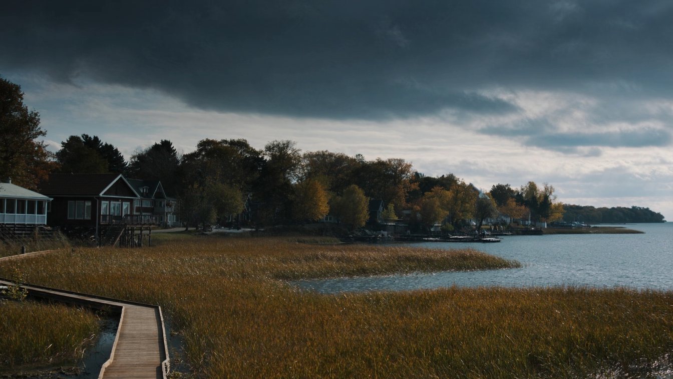
Clarkson is Mississauga’s westernmost lakefront, from Winston Churchill Boulevard at the Oakville line east to Lorne Park, and it is the only stretch of the western shore where a house can back onto a protected coastal wetland. Rattray Marsh, 38 hectares bought by Credit Valley Conservation in 1975 after residents fought off a luxury subdivision and marina, is the last baymouth-bar marsh between Burlington and Toronto. The neighbourhood also lives beside a refinery and a cement plant, which is why the same lot can be priced very differently on either side of a few streets. Credit Valley Conservation regulates the shore and publishes its hazard mapping; Mississauga’s character-area policies encouraged one- and two-storey houses here until a 2025 zoning overhaul. Clarkson GO is the busiest station on the network outside Union. Price lakefront, marsh-side and interior lots as three different things.
Where Clarkson is, and what borders it
Clarkson is bounded by Lake Ontario to the south, Oakville to the west, Erindale and Erin Mills to the north and Lorne Park to the east. It was settled from 1808 by Warren Clarkson and his brother, became the “strawberry capital of Ontario” after Edward Sutherland introduced berry growing in 1856, and kept a village feel around Lakeshore Road West and Clarkson Road long after Mississauga absorbed it. Lakeshore Road jogs north for two kilometres along Southdown Road here before resuming its lakeside course.
The neighbours matter. A Suncor refinery, formerly Petro-Canada, and a Holcim cement plant sit at the community’s edge, and the historic Bradley Museum and Benares House sit inside it. A buyer looking at a Clarkson lakefront street should stand on the lot and look both ways along the shore before looking at the water.
Rattray Marsh: how a neighbourhood kept its wetland
Major James Rattray owned the shoreline estate and let locals swim from his beach. When he died in 1969 developers proposed luxury homes and a marina on the land. The Rattray Estate Preservation Committee, led by Ruth Hussey, ran a letter-writing and media campaign; the 1973 Lake Ontario floods depressed the land’s value and the developer offered to sell; Mayor Martin Dobkin proposed that the conservation authority buy it, and Rattray Marsh Conservation Area opened on 5 October 1975.
Today it is 38 hectares, designated a provincially significant wetland, an environmentally significant area and an area of natural and scientific interest, with 428 plant species and 227 recorded bird species, and more than 300,000 visitors a year through the Turtle Creek entrance. In March 2020 CVC raised the bridge above lake flood levels and built an elevated boardwalk protected by new stone armouring. For an owner beside it, the marsh is a permanent neighbour that will never be built on and a public trail that brings hundreds of thousands of people a year past your fence.
Credit Valley Conservation at the edge
The Clarkson shoreline is in Credit Valley Conservation’s jurisdiction, which covers the Credit River watershed and the smaller watersheds that drain directly to the lake. CVC published a Lake Ontario Shoreline Study in 2021 that maps erosion, flood and dynamic beach hazards along its shore, and its Regulation Map Viewer, updated by the board in February 2026, shows regulated areas under Ontario Regulation 41/24. Any new house, addition, wall or fill within the regulated area needs CVC’s permit before a City of Mississauga building permit. The numeric setbacks CVC applies are in its study; get the mapping for the specific lot rather than assuming the Halton figures apply across the border.
The parks on either side
Jack Darling Memorial Park at 1180 Lakeshore Road West opened in 1968 as Shoreline Park on land the Ontario Water Resources Commission had bought for a water plant, and was renamed in 1971 for Jack Darling, a community advocate who helped establish the Sheridan Research Park. It has an unsupervised beach, a spray pad, an off-leash area and a paved section of the Waterfront Trail that connects to Rattray Marsh. Richard’s Memorial Park at 804 Lakeshore Road West adds a second beach to the east. Between them, Lorne Park Estates is a private community with private roads. For a Clarkson owner the parks are the public face of the shore; the marsh is the protected one.
Character areas, and the 2025 overhaul
Mississauga’s Official Plan divides its older neighbourhoods into 23 character areas, and Clarkson-Lorne Park is one. Its infill policy encouraged buildings of one to two storeys designed to de-emphasize height as a composition of small elements, which is why the rebuilds you see here are lower and wider than in Toronto. Two things have changed. In December 2023 Council permitted fourplexes as of right in low-rise neighbourhoods city-wide, up to three storeys including a partly above-grade basement unit. And in 2025 the City moved to consolidate a dozen detached zones into two, Residential Large Lot with a 550-square-metre minimum and 15-metre frontage and Residential Small Lot at 285 and 9.75, with a 10.7-metre sloped-roof height limit, while deleting some character-area restrictions to permit semis. Heritage conservation districts were not to be amended. Confirm the current by-law for the specific lot before you assume the old one- and two-storey guidance still binds a rebuild.
Clarkson GO
Clarkson GO at 1110 Southdown Road has 2,539 parking spaces including a 1,200-space garage built between 2012 and 2014, peak express service, and is described as the busiest station on the GO network other than Union. It sits north of the lakefront streets and is a drive or a bus for most of them, but it is the reason Clarkson works for a daily Toronto commuter in a way Oakville’s estate lots do not.
How to price Clarkson lakefront
Three tiers, and the industrial neighbours cut across them. True lakefront lots are priced against other Clarkson and Lorne Park lakefront sales over two or three years, adjusted for frontage, shoreline condition and permits, CVC’s setback, and proximity to the refinery and plant. Lots backing onto Rattray Marsh are a separate small market with a permanent natural neighbour and a public trail, and buyers pay for the first and discount for the second in different proportions. Interior Clarkson houses are Mississauga houses of that size and age with a lake walk. Mississauga has no municipal land transfer tax, which matters at these prices. Read the pricing method.
The takeaway
Clarkson is Mississauga’s western lakefront, with a protected marsh its residents saved in 1975, a refinery and cement plant they live beside, Credit Valley Conservation’s mapping at the edge, a character-area rulebook being rewritten since 2023, and the busiest GO station outside Union. Stand on the lot and look both ways, get CVC’s mapping, confirm the current zoning, and price lakefront, marsh-side and interior as three markets.
Where I fit
I sell on both sides of the Etobicoke–Mississauga line and I know which Clarkson streets sell on the marsh and which sell despite the plant. Run the estimator below on your current home, or book a call.
Free tool — AI home value estimator
Instant Home Valuation
What’s your home
worth today?
Answer six quick questions and get an instant value range built from current Toronto & GTA sale data — property type, size, condition, lot and location all weighted the way a real pricing conversation weighs them. Takes about ninety seconds.
Reading recent GTA sale data…
Building your estimate
Estimated market value
—
$0–$0
Most likely value $0 · roughly $0 per square foot
What moved the number
Starting from the area baseline for your property type, here’s what each answer added or subtracted.
Market context
Recent local averages for comparison.
—
A range is a starting point.
A strategy is what sells.
This model doesn’t know that your neighbour’s identical semi went $80,000 over asking last month, or which two upgrades actually pay back in your area. That conversation is free and takes twenty minutes.
Frequently asked questions
What is Rattray Marsh?
A 38-hectare coastal wetland on the Clarkson shoreline, bought by Credit Valley Conservation in 1975 after residents defeated a luxury subdivision and marina proposal. It is a provincially significant wetland and the last baymouth-bar marsh between Burlington and Toronto.
Who regulates the Clarkson shoreline?
Credit Valley Conservation, under Ontario Regulation 41/24. Its 2021 Lake Ontario Shoreline Study maps the hazards and its public Regulation Map Viewer shows regulated areas.
Is Clarkson near industry?
Yes. A Suncor refinery and a Holcim cement plant border the community. Their proximity affects price differently on different streets.
Can I build a fourplex on a Clarkson lot?
Since December 2023 Mississauga permits fourplexes as of right in low-rise neighbourhoods, up to three storeys including a partly above-grade basement unit, subject to zoning and conservation rules on the specific lot.
Which GO station serves Clarkson?
Clarkson GO at 1110 Southdown Road, with 2,539 parking spaces and peak express service, described as the busiest GO station outside Union.
Is Lorne Park Estates public?
No. It is a private community of about 31 hectares between Jack Darling Park and Richard’s Memorial Park with privately owned and maintained roads.
Does Mississauga charge a municipal land transfer tax?
No. Only Toronto does. Mississauga buyers pay the provincial Ontario land transfer tax only.
Sources
- Wikipedia — Rattray Marsh Conservation Area — size, preservation history, 1975 opening
- Credit Valley Conservation Foundation — Rattray Marsh — designations, species, 2020 boardwalk
- Credit Valley Conservation — Lake Ontario Shoreline Study — hazard mapping
- Credit Valley Conservation — Regulation mapping — map viewer, February 2026 update
- Mississauga Official Plan — Chapter 16, Neighbourhoods — character areas, Clarkson-Lorne Park policy
- City of Mississauga — Neighbourhood zoning review recommendation report (March 2025) — RL/RS zones, height limits
- City of Mississauga, Dec 2023 — Fourplexes approved — as-of-right fourplexes
- Wikipedia — Clarkson GO Station — parking, busiest outside Union
Related reading
- Lincoln lakefront homes: Beamsville to Jordan Harbour
- What $1.5 million buys on the GTA waterfront
- The Mississauga waterfront at every budget
- Lorne Park lakefront homes
- Southeast Oakville lakefront estates
- Conservation authority regulated land: TRCA and CVC
- Waterfront house due diligence checklist
- Mineola, Port Credit and Lakeview houses
About the author — Jatin Dua, Toronto and GTA real estate broker
I am Jatin Dua, Broker of Record and co-founder of RE/MAX Quantum Realty Inc., Brokerage, Unit 101, 799 The Queensway, Etobicoke. I work with buyers and sellers across Toronto and the GTA, with deep local knowledge of the west end and the Lake Ontario shoreline. Four-plus years of active GTA transactions and over $100 million in sales volume. Every market figure here comes from TRREB’s published tables and every rule from the regulator or the legislation, so you can check all of it without asking me.
Reach me at connect@jatindua.com or 833-330-1925, or book a call.