

Published 26 September 2026 · By Jatin Dua, Broker of Record, RE/MAX Quantum Realty
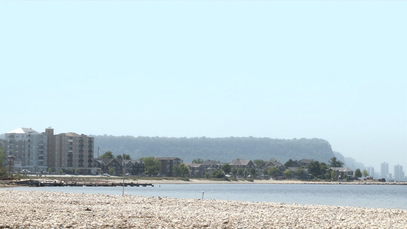
Stoney Creek’s shoreline runs east from Confederation Beach Park through Winona to the Grimsby line, and it is the most affordable stretch of Lake Ontario where a GTA buyer can still find a detached house with the lake behind it. It is also the shore with the clearest erosion record: a peer-reviewed study of ten kilometres of Stoney Creek frontage between 1934 and 1979 found low bluffs of silty clay receding on average more than a metre a year, and that 71 percent of the seawalls and groynes built to stop it were damaged or destroyed within ten years. Since 27 October 2025 Confederation GO has had train service, which changes the commute argument. Buy here for space and price, and do the shoreline homework before the floor plan.
Where Stoney Creek meets the lake
Stoney Creek was a town in its own right until it became a city in 1985 and was amalgamated into Hamilton in 2001. Its shoreline begins at Confederation Beach Park on Van Wagners Beach Road, where the City owns the land and the Hamilton Conservation Authority runs it, and continues east past the QEW-side residential streets to Winona and Fifty Point at the Niagara boundary. Winona, an early settlement known as “the Fifty” after Fifty Mile Creek, had a population of about 14,000 in 2021 and has held a peach festival since 1967.
The public shoreline anchors are Confederation Beach Park, with its sand beach and the Hamilton Beach Trail running 4.3 kilometres through it, and Fifty Point Conservation Area, 80 hectares with a 330-slip marina, campground and beach, established in 1978. Between them is a strip of private lakefront and near-lakefront houses that most GTA buyers have never looked at.
The bluffs, and what the record says
The Hamilton Conservation Authority names the “Stoney Creek bluffs” in its shoreline policy for a reason. A study of ten kilometres of this shoreline from 1934 to 1979, published in the Journal of Great Lakes Research, found low bluffs cut into silty-clay till receding on average more than 1.0 metre a year. Over those decades the share of frontage with protection rose from 30 to 64 percent, mostly seawalls and groynes built by individual owners. The results were poor: 71 percent of structures were damaged or destroyed within ten years and 87 percent within twenty, with failures peaking during high lake levels. The authors blamed poor design and construction and a lack of coordination between adjacent owners.
That is a forty-year-old dataset and the shoreline has changed since, but the lesson has not: on a clay bluff, a wall built without engineering and without regard to the neighbour’s wall fails, and it fails when the lake is high, which is exactly when you need it. Read the shoreline protection guide before you fall for a lot with a “new” wall.
The Hamilton Conservation Authority’s rules
Under Ontario Regulation 41/24, in force since 1 April 2024, the HCA regulates development along the shoreline. Its flooding hazard is the 100-year flood level plus a 15-metre allowance for wave uprush; its erosion hazard is based on the historical recession rate with an allowance and stable-slope provisions; and where beach and dune systems exist, a dynamic beach hazard applies in which no development is permitted. Any new house, addition, deck, pool, retaining wall or shoreline work inside the regulated area needs the HCA’s permit before a City of Hamilton building permit. The HCA has said the 2024 regulation change affected only nine percent of its regulated area, so assume a lakefront lot here is regulated until the mapping says otherwise.
The City is also finishing a Confederation Beach and Hamilton Beach Shoreline Management Master Plan for Ward 5, launched with fieldwork in 2023 to identify flooding and erosion hazards along Hamilton Beach, Confederation Beach and the trail, citing more frequent extreme high-water events. A 2019 assessment found about a third of Hamilton’s public shoreline in poor condition. Private owners face the same lake with less budget.
What the 2019 high water did
In spring 2019 Lake Ontario reached its highest gauge readings on record. The HCA’s flood outlook noted flooding at Fifty Point Marina and collapsed, closed sections of the Waterfront Trail; the risk was greatest with north and east winds driving storm surge onto this shore. Repairs to Hamilton’s waterfront trails and breakwalls after the 2017 high water had already been estimated at up to $5 million. A private owner’s lot faced the same waves with no municipal budget behind it. Ask any seller what 2017 and 2019 did to the shoreline and the structure, and ask for photographs.
Confederation GO changes the commute argument
For decades the honest objection to Stoney Creek was the commute: the QEW or nothing. On 27 October 2025 GO trains began serving Confederation GO at Centennial Parkway North, ten kilometres beyond West Harbour on the Lakeshore West line, with 148 parking spaces and 13 weekday trips at opening. Grimsby GO, further east, was under construction as of August 2026 with no opening date. Neither is a walk from the lakefront streets, but a Toronto-bound rail commute from Stoney Creek now exists in a way it did not two years ago. Price it as a real amenity; do not price Grimsby GO until it opens.
Buying here: the checklist that matters more than elsewhere
- HCA mapping for the specific lot, showing the regulated area and the erosion hazard setback from the stable top of bank.
- A current survey locating the top of bank and the water’s edge, compared with the previous survey to get the lot’s own recession rate.
- Permits and engineering for every wall, groyne, stair and deck near the edge, and a look at what the neighbours have built on either side.
- An insurance quote on the address before you waive; erosion and earth movement are excluded from standard policies and some insurers decline bluff lots.
- The setback question: can this house be rebuilt where it stands, or only further back? Ask the HCA for a pre-consultation view before you buy with a rebuild in mind.
Read the full waterfront due diligence checklist; Stoney Creek is where every item on it earns its place.
How to price a Stoney Creek lakefront house
Three tiers: true lakefront lots on the bluff, houses across the road from the lake, and the subdivisions north toward the QEW. Comparables must come from the same tier. Within the lakefront tier, adjust for distance to the top of bank, whether the shoreline is engineered and permitted, and whether an insurer will write it. A stable, armoured, well-set-back lot is a rare asset at a price no Oakville or Burlington lakefront can match. An unprotected lot losing ground is a house with a view and a bill coming, and should be priced against the tier behind it with a view allowance. Hamilton has no municipal land transfer tax, which matters at these prices.
The takeaway
Stoney Creek is the most attainable true lakefront between Toronto and Niagara, on a clay bluff with the best-documented erosion history on the lake and a new GO station that finally answers the commute question. Get the HCA mapping, the survey, the permits and the insurance answer before you offer, price the tier you are actually buying, and treat an engineered, permitted shoreline as the most valuable thing on the lot.
Where I fit
I work across Toronto and the GTA and increasingly help Toronto sellers move west to Hamilton and Stoney Creek for the space and the lake. If a Stoney Creek lakefront lot is on your list, I will help you get the HCA mapping and the survey before you spend money on an inspection. Run the estimator below on your current home, or book a call.
Free tool — AI home value estimator
Instant Home Valuation
What’s your home
worth today?
Answer six quick questions and get an instant value range built from current Toronto & GTA sale data — property type, size, condition, lot and location all weighted the way a real pricing conversation weighs them. Takes about ninety seconds.
Reading recent GTA sale data…
Building your estimate
Estimated market value
—
$0–$0
Most likely value $0 · roughly $0 per square foot
What moved the number
Starting from the area baseline for your property type, here’s what each answer added or subtracted.
Market context
Recent local averages for comparison.
—
A range is a starting point.
A strategy is what sells.
This model doesn’t know that your neighbour’s identical semi went $80,000 over asking last month, or which two upgrades actually pay back in your area. That conversation is free and takes twenty minutes.
Frequently asked questions
Is Stoney Creek waterfront a good place to buy a house?
It is the most affordable true lakefront between Toronto and Niagara and now has GO train service at Confederation GO. The risk is bluff erosion: the shoreline’s low clay bluffs have a documented history of receding, so the conservation mapping, survey and insurance checks matter more here than almost anywhere else.
How fast is the Stoney Creek shoreline eroding?
A published study of ten kilometres of Stoney Creek shoreline from 1934 to 1979 found an average recession of more than one metre a year. Rates vary by section and by protection, so compare a current survey with the previous one for the specific lot.
Do I need a permit to build a seawall in Stoney Creek?
Yes. The shoreline is in the Hamilton Conservation Authority’s regulated area under Ontario Regulation 41/24, and the HCA permit is needed before any City of Hamilton building permit. In-water work may also need federal fisheries review.
When did Confederation GO open?
Train service began on 27 October 2025 on the Lakeshore West line, with 148 parking spaces and 13 weekday trips at opening. The bus loop had opened in 2019.
Is Grimsby GO open?
No. As of August 2026 Metrolinx described it as under construction, with no opening date published.
Does Hamilton have a municipal land transfer tax?
No. Council considered the idea in January 2025 and did not pursue it. Only Toronto has a municipal land transfer tax.
What happened on the Stoney Creek shore in 2019?
Record lake levels flooded Fifty Point Marina and collapsed sections of the Waterfront Trail, with the highest risk during north and east winds. Ask any seller what 2017 and 2019 did to their shoreline.
Sources
- Journal of Great Lakes Research — Shoreline erosion and protection, Stoney Creek 1934–1979 — recession rate, structure failure record
- Hamilton Conservation Authority — Planning and Regulation Policies (September 2025) — shoreline hazard definitions
- Hamilton Conservation Authority — Fifty Point Conservation Area — size, marina, facilities
- City of Hamilton — Confederation Beach and Hamilton Beach Shoreline Management Master Plan — study scope and timeline
- Metrolinx — Confederation GO opens — opening date and service
- Metrolinx — Grimsby GO Station — construction status
- CBC Hamilton, June 2019 — Lake Ontario water levels and flooding — 2019 impacts
Related reading
- Grimsby and Winona lakefront homes
- Lincoln lakefront homes: Beamsville to Jordan Harbour
- The Oakville, Burlington and Hamilton waterfront at every budget
- What $900,000 buys on the GTA waterfront
- Hamilton Beach Strip and Burlington Beachway
- Shoreline protection: armour stone, seawalls and who pays
- Shoreline erosion and your property line
- Waterfront house due diligence checklist
- Scarborough Bluffs: buying on the edge
About the author — Jatin Dua, Toronto and GTA real estate broker
I am Jatin Dua, Broker of Record and co-founder of RE/MAX Quantum Realty Inc., Brokerage, Unit 101, 799 The Queensway, Etobicoke. I work with buyers and sellers across Toronto and the GTA, with deep local knowledge of the west end and the Lake Ontario shoreline. Four-plus years of active GTA transactions and over $100 million in sales volume. Every market figure here comes from TRREB’s published tables and every rule from the regulator or the legislation, so you can check all of it without asking me.
Reach me at connect@jatindua.com or 833-330-1925, or book a call.