
Published 31 August 2026 · Updated 29 September 2026 · By Jatin Dua, Broker of Record, RE/MAX Quantum Realty
Part of the Alderwood area guide — prices, what to check before you buy, and the full FAQ.
What's Your Home Worth Right Now?
Get a free AI-powered price range for your property in under 90 seconds, based on recent GTA comparable sales. No name or address required.
Get My Free Estimate →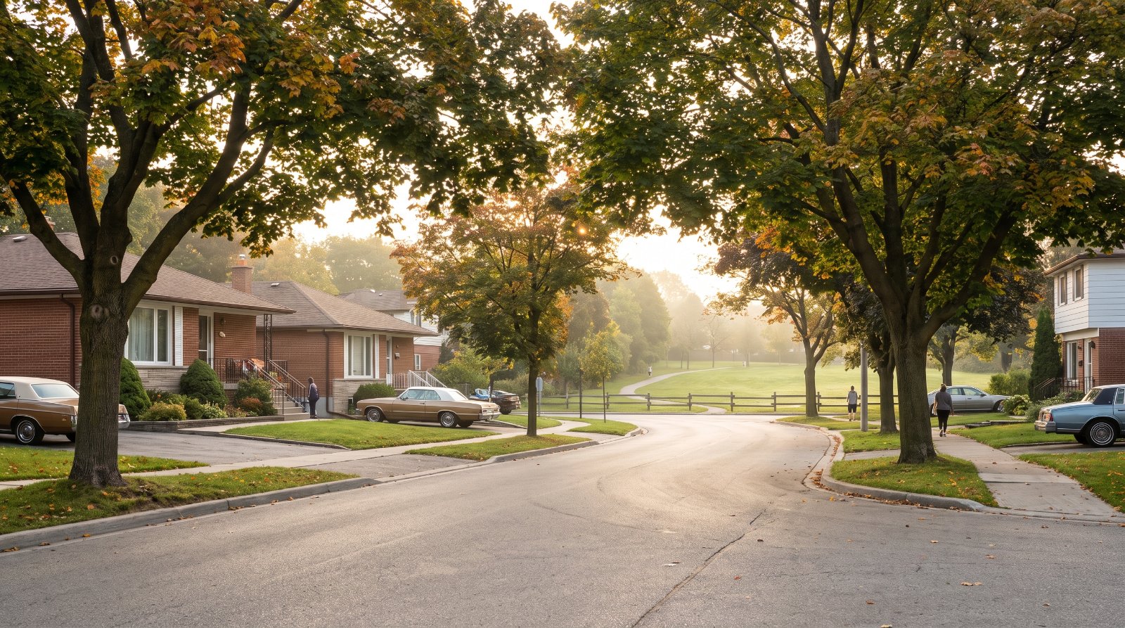
The ten things buyers in Alderwood are least often told, all of them documented: three of the sixty-two basement-flooding projects on the City’s entire 2026–2030 construction list are in Alderwood, all scheduled for 2026; behind that sits a citywide backlog the City itself puts at roughly 50 years and $22 billion; about 5 per cent of the neighbourhood sits inside TRCA’s regulated area, where a permit is needed before you build, grade or place fill; there are roughly 7.7 kilometres of expressway and expressway ramp inside a 4.98 square kilometre neighbourhood, including the point where the QEW becomes the Gardiner; four bus routes serve it and no rapid transit at all, with Kipling station 3.6 kilometres away; there are 360 metres of public laneway in the whole neighbourhood, which effectively closes the laneway-suite route; four towers of up to 38 storeys and 1,196 units are already Council-approved on Evans Avenue; employment-land conversion applications next door now go straight to the Ontario Land Tribunal; 54 per cent of the housing stock was built in 1960 or earlier; and crossing Etobicoke Creek into Mississauga removes the Toronto land transfer tax entirely.
None of that is an argument against buying here. Alderwood is one of the best-value detached-house neighbourhoods left in Toronto. It is an argument for buying here with the documents open.
Every item is traced to a primary source — a City budget attachment, a Council decision, a TRCA dataset, a TTC schedule feed, a census profile — and each is listed at the bottom with the date I read it. Several figures on this page are my own calculations from the City’s and TRCA’s published geographic data rather than published statistics, and they are labelled where they appear. Four things I deliberately left off because I could not source them properly: school capacity and utilisation figures, any named contaminated site, anything about the provincial QEW improvement project, and Toronto Pearson noise contours over Alderwood. I will publish those when I can cite them.
Alderwood is the part of Toronto most people drive past at 100 kilometres an hour without knowing it exists. It sits in the far south-west corner of the city, bounded by Etobicoke Creek and the Mississauga border on one side, the Queen Elizabeth Way and Highway 427 on another, and the Horner and Evans Avenue industrial belt on a third. Inside that triangle is a quiet 1950s neighbourhood of detached houses on real lots, at prices that no longer exist anywhere closer to downtown.
One geographic note before the list, because it changes the numbers. The City’s official Alderwood neighbourhood is larger than the Alderwood people talk about: the boundary reaches north of the QEW and takes in the Queensway auto-dealership strip. Where I quote census or City statistics below, they are for the City’s Alderwood, and I say so.
1Three of the City’s sixty-two basement-flooding projects for 2026 to 2030 are in Alderwood
This is the strongest single fact about buying a house here, and it cuts both ways.
Alderwood sits in Basement Flooding Study Area 38, “Etobicoke Creek – The West Mall,” whose Environmental Assessment the City completed in 2018 — years ahead of most of the city. That head start shows up directly in the construction schedule. The City’s Basement Flooding Protection Program — Project list: 2026–2030 contains 62 projects citywide. Three of them are in Alderwood, all in the 2026 construction year:
| Project | Year | Streets | Works |
|---|---|---|---|
| 38-15 | 2026 | Ecker Dr, Etobicoke Trail E, Etobicoke Valley Park, Hargrove Ln, Savona Dr, Westhead Rd | Sanitary sewer replacement, storm sewer replacements, inlet control devices |
| 38-16 | 2026 | Delma Dr, Dunning Cres, Gair Dr, Fulham Dr, Highbury Dr, Horner Ave, Mitcham Dr, Stephney Dr, Westhead Rd | Sanitary and storm sewer replacements |
| 38-17 | 2026 | Albright Ave, Avalon Rd, Eltham Dr, Evans Ave, Finsbury Cres, Foch Ave, Gort Ave, Horner Ave, Jellicoe Ave, Orianna Dr, Woodbury Rd | Sanitary and storm sewer replacements, inlet control devices |
Now the context, from the City’s own status update to Council in April 2025. Across all 67 completed study areas there are roughly 1,200 recommended projects at about $18 billion; about 650 meet the Council-adopted $68,000 cost-per-benefitting-property threshold; 167 have been constructed, benefiting an estimated 31,000 properties; and at the current rate the remaining eligible projects “would take about 50 years to complete.” The 2026 budget notes revise the total programme cost “from $18 billion to an estimated $22 billion” with $1.721 billion committed from 2026 to 2035.
How to read this as a buyer. Alderwood is near the front of a fifty-year queue, which is genuinely good news for a neighbourhood of pre-1961 houses on combined-era sewers. It also means road construction on named streets this year. If you are buying on Westhead, Horner, Evans, Jellicoe or any other street in those three project lists, ask what stage the work is at before you set a closing date — and check whether the City’s basement flooding subsidy programme applies to the property.
2Part of Alderwood is inside the flood plain, and TRCA has to sign off before you build
Etobicoke Creek is not decorative. TRCA records the watershed at roughly 22,404 hectares, the westernmost in its jurisdiction, with six Flood Vulnerable Clusters covering 508 hectares and a watershed that is about 60 per cent urban with 12 per cent natural cover. TRCA operates 12 dams, six dikes and nine flood control channels across its area.
I took TRCA’s published regulatory flood line and 2025 regulated area layers and overlaid them on the City’s official Alderwood neighbourhood boundary. Both inputs are official; the arithmetic is mine.
| Measure | Inside the City’s Alderwood |
|---|---|
| TRCA regulatory flood plain | 16.3 hectares — 3.3 per cent of the neighbourhood |
| TRCA Regulated Area (2025) | 26.5 hectares — 5.3 per cent |
| Etobicoke Creek centreline within the neighbourhood | 1,994 metres |
| Neighbourhood area | 497.8 hectares (4.98 km²) |
Inside a TRCA regulated area you need a permit under section 28 of the Conservation Authorities Act and Ontario Regulation 41/24 before you build a new home or replace one, add an addition, garage, shed, deck or pool, do landscaping, or place or excavate fill. TRCA’s own guidance warns that flood plains “are not always visually apparent.”
Roughly one hectare in twenty here sits in that regulated strip, and it is exactly the land along the creek and the valley park that looks like the best backyard in the neighbourhood. I could not find any Special Policy Area designation for Alderwood, and I am reporting that as “none found,” not as “there is none.” Before you waive conditions on anything near the creek, I will run the address against TRCA’s regulated area mapping.
There is history behind all of this. The federal Hurricane Hazel archive records that Etobicoke Creek had seven severe floods dating back to 1804 before 1954, that 164 Long Branch properties were expropriated for a total of $800,000 after the storm, and that the land which became Marie Curtis Park was raised about ten metres by infill. A 1959 flood control proposal contemplated a dam and reservoir requiring 1,200 acres of floodplain land at a cost of $2,522,000. Other accounts give somewhat different property counts; I am quoting the federal record.
3There are 7.7 kilometres of expressway inside this neighbourhood
Alderwood contains the point where the Queen Elizabeth Way becomes the Gardiner Expressway. Not near it — inside it.
I clipped the City of Toronto Centreline dataset to the official Alderwood boundary and measured by feature class. The data is the City’s; the measurement is mine.
| Feature class | Length inside Alderwood |
|---|---|
| Expressway | 3,111 m |
| Expressway ramp | 4,564 m |
| Major arterial ramp | 710 m |
| Major railway | 2,196 m |
| Public laneway | 360 m |
The named expressway centrelines inside the neighbourhood include the QEW eastbound at 1,621 metres and the F.G. Gardiner Expressway eastbound at 1,238 metres, plus a dense set of 427, Brown’s Line, Evans Avenue and West Mall ramps. There is also more than two kilometres of major railway.
That is the honest trade in Alderwood: it is a quiet interior neighbourhood wrapped in one of the busiest transport interchanges in the country, and the difference between a street three blocks in and a street backing onto a ramp is real. I could not find any Alderwood-specific noise study, and I could not verify anything about the provincial QEW improvement project, so I am not going to tell you either exists. What I will do is stand on the lot with you at rush hour.
4Four bus routes, no rapid transit, and the route name in every neighbourhood guide is wrong
I selected every TTC stop inside the official Alderwood boundary from the City’s open transit feed and joined it to the schedule tables. The feed is the TTC’s; the count is mine.
| Route | Weekly scheduled stop events in Alderwood | Type |
|---|---|---|
| 123 Sherway | 10,200 | Bus |
| 110 Islington South | 3,780 | Bus |
| 15 Evans | 3,100 | Bus |
| 315 Evans–Brown’s Line | 1,245 | Blue Night bus |
There are 54 TTC stops inside the neighbourhood and not one streetcar, subway or rail stop. The nearest subway platform is Kipling station, about 3.63 kilometres from the neighbourhood centroid in a straight line; Islington is about 4.67 kilometres. Long Branch GO station sits outside the boundary, roughly 1.38 kilometres away.
And a small correction that tells you how carefully most neighbourhood write-ups are checked: the 123 Shorncliffe that appears in half of them has not existed since 2018. The TTC’s own route page lists it as the 123 Sherway, operating all day, every day, until 1 a.m.
5You can build a fourplex or a garden suite here. You almost certainly cannot build a laneway suite
Toronto’s multiplex permissions apply in Alderwood. City Council adopted them on 10 May 2023; the Official Plan amendment came into effect 14 June 2023 and the zoning amendment 12 May 2023. They permit up to four units in RD, RS and RT zones, allow a height of up to 10 metres where the current maximum is lower, exempt multiplex building types from floor space index regulations, and permit a multiplex within roughly the same building envelope a detached house would get.
Garden suites are in force too, adopted by Council on 24 June 2025 with one property-specific appeal outstanding, and governed by Chapter 150.7 of Zoning By-law 569-2013.
Laneway suites are a different story. The by-law was extended city-wide on 16 July 2019 to R, RD, RS, RT and RM zones — but a laneway suite is only permitted on a property that shares a property line with a public lane.
The entire 497.8-hectare neighbourhood contains five laneway segments totalling 360 metres: off Brown’s Line north of Albright, off Mitcham east of Fulham, off Brown’s Line north of Burlingame, off Brown’s Line south of Roseland, and off Evans west of Brown’s Line.
So if a listing or a builder is selling you Alderwood on laneway-suite potential, ask which lane. On the City’s own map there are five of them in the whole neighbourhood and all are short stubs. The fourplex and garden-suite routes are the ones that are actually open here, and on lots this size they are worth understanding properly before you buy.
6Four towers of up to 38 storeys are already approved on Evans Avenue
At 560–580 Evans Avenue and 24 The East Mall, at the eastern edge, the City’s development records show application 14 268446 WET 06 OZ, submitted 30 December 2014, status Council Approved, for “four residential towers with buildings heights of 21, 29, 32 and 38 storeys containing 1,196 residential units, and 11 three-storey townhouses” plus a 119-unit nine-storey seniors building. A predecessor file on the same assembly dates to 2011.
The plan of subdivision that would implement it — file 21 228063 WET 03 SB, for a 0.41-hectare public park, two public streets and four development blocks — was still recorded as Under Review in the City’s data refresh of 31 August 2026.
Smaller files inside the neighbourhood are more typical of what actually gets built here:
| Address | File | Status | Proposal |
|---|---|---|---|
| 208 Brown’s Line | 23 129522 WET 03 SA | Under review | Five-storey building, phase two of the approved 200–204 Brown’s Line development |
| 312 and 314–316 Brown’s Line | 21 146532 WET 03 SA | Notice of approval conditions issued | Five-storey mixed use, 13 units, commercial at grade, car-lift parking |
| 408 Brown’s Line | 20 152955 WET 03 CD | Complete | Four to six storey mid-rise, 81 units, 269 m² non-residential |
| 276 Lanor Ave | 26 104291 WET 03 CD | Draft plan approved | Four-unit condominium |
Twelve years from a Council approval to a subdivision that is still under review is the real timescale here. If someone is pricing a nearby house on the strength of the Evans Avenue towers arriving, ask which year. I will pull the live application file for any block you are considering before you write.
7The employment land next door is now contestable, parcel by parcel
The South Etobicoke Area of Employment that Alderwood backs onto is, in City Planning’s words, home to “over 1,800 businesses” providing “over 44,000 jobs in the area, an increase of 5,000 jobs since 2021.”
At 350, 360 and 364 Evans Avenue and 14–16 Arnold Avenue, application 24 253116 WET 03 OZ, submitted 23 December 2024, proposes to redesignate the lands from Core Employment Areas to Mixed Use Areas to permit residential uses. The applicant appealed to the Ontario Land Tribunal on 4 June 2025 because Council did not decide within the statutory timeframe. A case management conference was held on 3 September 2025 and a second was scheduled for 25 February 2026. City staff recommend that Council direct the City Solicitor “to attend the Ontario Land Tribunal in opposition to the current application.”
The reason this is suddenly happening is in the same staff report: the Provincial Planning Statement (2024) “removed the requirement that conversions of employment areas to non-employment uses only be permitted through a Municipal Comprehensive Review.”
That single change turned a city-wide, once-in-a-decade planning exercise into a series of individual appeals. For an Alderwood homeowner, the industrial belt on the far side of Horner and Evans is no longer a fixed feature of the neighbourhood — it is contested land, one parcel at a time, at a Tribunal. Whether that is good news depends entirely on what you want your street to look like in ten years. It is worth having an opinion before you buy, not after.
8More than half the houses here were built in 1960 or earlier
From the City’s 2021 Census neighbourhood profile for Alderwood, Neighbourhood 20:
| Period of construction | Dwellings |
|---|---|
| 1960 or before | 2,605 |
| 1961 to 1980 | 1,120 |
| 1981 to 2000 | 430 |
| 2001 to 2015 | 375 |
| 2016 to 2021 | 255 |
That is 54 per cent of the occupied stock built in 1960 or earlier and 78 per cent before 1981, on my arithmetic from those counts. The rest of the profile explains why people move here:
| 2021 Census, Alderwood | Figure |
|---|---|
| Single-detached houses | 2,900 of 4,785 dwellings (60.6%) |
| Detached plus semi-detached | 3,465 — 72.4 per cent |
| Owner households | 76.7% |
| Renter households | 23.2% |
| Median household income, 2020 | $106,000 |
| Average household size | 2.6 |
| Average rooms per dwelling | 6.4 |
| Dwellings needing major repairs | 235 |
| Low income prevalence (LIM after tax) | 6.2% |
Those two facts sit together. This is a neighbourhood of owner-occupied detached houses at a median household income well above the city’s, and more than half of those houses predate 1961 — which is to say they predate the sewer standards the City is spending 2026 replacing under item 1 above. Your inspection matters more here than your comparables do. Population figures on this page are Statistics Canada 25 per cent sample data, as published.
9Crossing Etobicoke Creek saves you the entire Toronto land transfer tax
Alderwood’s western boundary is Etobicoke Creek, and on the other side is Mississauga. Toronto charges its own Municipal Land Transfer Tax under Municipal Code Chapter 760, on top of the provincial land transfer tax. Mississauga does not charge one.
| Toronto MLTT, one or two single-family residences, from 1 April 2026 | Rate |
|---|---|
| Up to $55,000 | 0.5% |
| $55,000.01 – $250,000 | 1.0% |
| $250,000.01 – $400,000 | 1.5% |
| $400,000.01 – $2,000,000 | 2.0% |
| $2,000,000.01 – $3,000,000 | 2.5% |
| Over $3,000,000 – $4,000,000 | 4.40% |
| Over $4,000,000 – $5,000,000 | 5.45% |
| Over $5,000,000 – $10,000,000 | 6.50% |
| Over $10,000,000 – $20,000,000 | 7.55% |
| Over $20,000,000 | 8.60% |
There is also a municipal non-resident speculation tax of 10 per cent effective 1 January 2025, and administration fees of $102.56 plus HST per transaction.
On a $1.1 million house the Toronto municipal tax is a five-figure line on your statement of adjustments, and it disappears the moment you cross the creek. That is not a reason to buy in Mississauga — the schools, the services and the transit are different on each side, and so is the resale market. It is a reason to know what you are paying for. I put the number in front of clients on both sides of the creek before they choose.
10Your assessment is a decade old, and the Vacant Home Tax deems you vacant if you do not declare
MPAC states that “property assessments for the 2026 property tax year will continue to be based on fully phased-in January 1, 2016 current values,” the province having filed a regulation on 16 August 2023 extending the postponement of a province-wide reassessment.
| Vacant Home Tax rule | What the City states |
|---|---|
| Rate | 3 per cent of Current Value Assessment, from the 2024 taxation year |
| Definition | Vacant for six months or more in the taxation year |
| No declaration filed | The property is deemed vacant |
| Declaration | Annual, required from every residential property owner |
| 2025 tax year payment dates | 15 September, 15 October and 16 November 2026 |
| Penalty | Fine up to $10,000 for a false declaration or failure to provide information |
And if you were planning to run a unit as a short-term rental: Toronto Municipal Code Chapter 547 defines one as a stay of fewer than 28 consecutive days, requires the operator to register their principal residence, and caps entire-unit rentals at 180 nights a year.
The deeming rule is the one that costs money for no reason. You do not have to leave a house empty to be taxed. You only have to forget to file, once, in a year you were renovating or travelling or dealing with an estate. I put the declaration window in my clients’ calendars.
Two more, because they come up every week
Alderwood Pool is officially a community centre. In the City’s own Parks and Recreation Facilities register, the asset at 2 Orianna Drive is recorded with the type “Community Centre” rather than as a pool. The neighbourhood’s other registered assets are Alderwood Memorial Park at 215 Sheldon Avenue, with a playground, and Etobicoke Valley Park at 615 Horner Avenue, with a ball diamond, playground and washroom. There are roughly 3,265 metres of trail-classified centreline inside the neighbourhood, the Etobicoke Creek Trail corridor and its connectors, on a system the City describes as extending north to Caledon and south to Lake Ontario.
Marie Curtis Park is not in Alderwood. It is adjacent, at the creek mouth, and it is shared with Mississauga. I mention it because it appears in most Alderwood listings and because the distinction matters if you are checking which municipality maintains what. Similarly, the large tower proposals at Kipling and Bloor, at 150 Sherway Drive, and at 1543–1551 The Queensway are all outside the neighbourhood boundary, whatever a listing says. If a nearby development is being used to justify a price, ask me where the boundary actually runs.
What this list is not
It is not an argument against buying here. Alderwood is one of the last places in Toronto where an ordinary family can buy a detached house with a driveway and a real backyard, in a neighbourhood with a pool, two parks and a creek trail, where three quarters of your neighbours own their homes and the median household income is above the city’s. The City is replacing the sewers this year rather than in thirty years’ time. Those are all genuine advantages and I would say so to anyone.
The point is that every one of the ten items above is knowable before you sign. Most buyers find out afterwards. That is the entire difference between working with someone who has read the budget attachment and working with someone who has read the listing.
Thinking about a specific street in Alderwood?
A neighbourhood list is the right frame for understanding a market and the wrong frame for a decision. What a house is worth here depends on which side of the creek regulated area it sits on, whether its street is in a 2026 sewer project, how close it is to a ramp, and what has actually sold nearby. Send me the address and I will give you the comparable sales that apply to it, the construction schedule for that street, and a straight answer on whether to move now or wait.
[email protected] · 833-330-1925 · Book a free consultation
Confidential. Read personally and answered within 24 hours. I never share, sell or distribute your information.
Ask the local expert
Ask me anything about Alderwood
Send me the street, the address or the question. You get a straight answer from someone who works this pocket every week, including when the answer is that you should wait. No drip campaign you cannot get out of.
Got it.
I read these personally and answer within 24 hours. If it is urgent, call or text 833-330-1925.
Confidential. Read personally and answered within 24 hours. I never share, sell or distribute your information. Not intended to solicit buyers or sellers currently under contract with another brokerage.
Frequently asked questions
Does Alderwood flood?
Part of it sits in the Etobicoke Creek flood plain. On my own overlay of TRCA’s published layers on the City’s official neighbourhood boundary, about 16.3 hectares, or 3.3 per cent of Alderwood, falls inside TRCA’s regulatory flood line, and about 26.5 hectares, or 5.3 per cent, falls inside the 2025 regulated area. Inside a regulated area you need a TRCA permit before building, adding an addition, garage, shed, deck or pool, landscaping, or placing or excavating fill. I found no Special Policy Area designation for Alderwood, and I report that as none found rather than none existing.
Is the City fixing the sewers in Alderwood?
Yes, in 2026. Alderwood is in Basement Flooding Study Area 38, whose Environmental Assessment was completed in 2018. The City’s project list for 2026 to 2030 contains 62 projects citywide, and three of them – 38-15, 38-16 and 38-17 – are in Alderwood, all scheduled for the 2026 construction year, covering sanitary and storm sewer replacement and inlet control devices on more than twenty named streets.
How long is the citywide basement flooding backlog?
About fifty years, on the City’s own account. Its April 2025 status update to Council records roughly 1,200 recommended projects at about $18 billion across 67 study areas, of which about 650 meet the Council-adopted $68,000 cost-per-benefitting-property threshold. 167 have been constructed, benefiting an estimated 31,000 properties, and at the current rate the remaining eligible projects would take about 50 years. The 2026 budget notes revise the total programme cost to an estimated $22 billion.
What transit serves Alderwood?
Four TTC bus routes and nothing else. From the City’s open transit feed there are 54 TTC stops inside the neighbourhood, served by the 123 Sherway, 110 Islington South, 15 Evans and the 315 Evans-Brown’s Line Blue Night bus. There is no streetcar, subway or rail stop inside the boundary. Kipling station is about 3.63 kilometres from the neighbourhood centroid in a straight line, and Long Branch GO is about 1.38 kilometres away, outside the boundary.
Can I build a laneway suite in Alderwood?
Almost certainly not. The laneway suite by-law was extended city-wide on 16 July 2019, but it only permits a suite on a property that shares a property line with a public lane. On the City’s centreline file the entire neighbourhood contains five laneway segments totalling 360 metres, all short stubs off Brown’s Line, Mitcham and Evans. Fourplexes, permitted city-wide since 2023, and garden suites, in force since 24 June 2025, are the routes that are actually open here.
What is being built on Evans Avenue?
The City’s development records show application 14 268446 WET 06 OZ at 560 to 580 Evans Avenue and 24 The East Mall, submitted on 30 December 2014 and recorded as Council Approved, for four residential towers of 21, 29, 32 and 38 storeys with 1,196 residential units, 11 three-storey townhouses and a 119-unit nine-storey seniors building. The implementing plan of subdivision was still recorded as Under Review in the City’s data as at 31 August 2026.
Will the industrial land beside Alderwood become condos?
It is being fought over. At 350, 360 and 364 Evans Avenue and 14 to 16 Arnold Avenue, an application submitted in December 2024 seeks to redesignate lands from Core Employment Areas to Mixed Use Areas. The applicant appealed to the Ontario Land Tribunal in June 2025 and City staff recommend that Council direct the City Solicitor to attend in opposition. The staff report notes that the Provincial Planning Statement of 2024 removed the requirement that employment conversions only proceed through a Municipal Comprehensive Review, which is why these applications now go straight to the Tribunal.
How old are the houses in Alderwood?
Older than most buyers expect. On the 2021 Census profile, 2,605 of about 4,790 occupied dwellings were built in 1960 or earlier and a further 1,120 between 1961 and 1980 – roughly 54 per cent pre-1961 and 78 per cent pre-1981 on my arithmetic. Single-detached houses make up 2,900 of 4,785 dwellings, owner households 76.7 per cent, and the median household income in 2020 was $106,000.
Do I pay less land transfer tax in Mississauga than in Alderwood?
Yes, and the boundary is Etobicoke Creek. Toronto levies a Municipal Land Transfer Tax under Municipal Code Chapter 760 on top of the provincial land transfer tax; Mississauga does not levy one. The Toronto rates for properties containing one or two single-family residences run to 2.0 per cent between $400,000 and $2 million, 2.5 per cent to $3 million, and from 1 April 2026, 4.40 per cent above $3 million rising to 8.60 per cent above $20 million. There is also a 10 per cent municipal non-resident speculation tax effective 1 January 2025.
Why is my Alderwood assessment so much lower than the market price?
Because Ontario assessments are frozen. MPAC states that property assessments for the 2026 property tax year continue to be based on fully phased-in 1 January 2016 current values, following a regulation filed on 16 August 2023 extending the postponement of a province-wide reassessment. The Vacant Home Tax, at 3 per cent, is charged on that same Current Value Assessment – and a property with no declaration filed is deemed vacant.
Related reading
- Top 10 things no one will tell you about New Toronto and Long Branch
- Top 10 things no one will tell you about The Queensway and Stonegate-Queensway
- Top 10 things no one will tell you about Mimico and Humber Bay Shores
- Toronto Municipal Land Transfer Tax: the bracket table from 1 April 2026
- Land transfer tax on an Etobicoke purchase, and the first-time buyer rebates
- Toronto Vacant Home Tax: the buyer can be left holding it
- Toronto West market report, July 2026
Sources
Every figure on this page traces to one of these, and each was read on 31 August 2026. Primary sources only. Several measurements are my own calculations from official geographic and schedule data and are labelled where they appear. Where I could not verify something from a primary source, it is not on the page.
- Basement Flooding Protection Program — Project list: 2026–2030. City of Toronto, 2026 budget cycle background file. Projects 38-15, 38-16 and 38-17, their streets, works and construction year, within a 62-project citywide list. toronto.ca
- Basement Flooding Protection Program, and the Program Map. City of Toronto; the 67 completed study areas, Study Area 38 “Etobicoke Creek – The West Mall” completed 2018, the $68,000 cost-per-property threshold and the prioritisation criteria. toronto.ca
- Basement Flooding Protection Program Status Update, item 2025.IE20.7. City of Toronto Council, adopted 23–24 April 2025. The 1,200 recommended projects, $18 billion, 650 eligible, 167 constructed, 31,000 properties and the 50-year estimate. toronto.ca
- 2026 Capital and Operating Budget Notes — Toronto Water. City of Toronto; $1.721 billion for construction from 2026 to 2035 and the revision of total programme cost to an estimated $22 billion. toronto.ca
- Etobicoke Creek watershed, and TRCA flood risk management. Toronto and Region Conservation Authority; watershed area, six flood vulnerable clusters covering 508 hectares, land cover, and the 12 dams, six dikes and nine flood control channels. trca.ca
- TRCA regulatory flood line and Regulated Area 2025 layers. TRCA Open Data. The hectare and percentage figures on this page are my own overlay of these layers on the City’s official Alderwood neighbourhood boundary. trca.ca
- TRCA planning and permits. Toronto and Region Conservation Authority; permit requirements under section 28 of the Conservation Authorities Act and Ontario Regulation 41/24, and the warning that flood plains are not always visually apparent. trca.ca
- Hurricane Hazel — mitigation and aftermath. Environment and Climate Change Canada archive; the seven severe Etobicoke Creek floods since 1804, the 164 expropriated Long Branch properties, the ten-metre infill at Marie Curtis Park and the 1959 flood control proposal. canada.ca
- Toronto Centreline (TCL) open dataset. City of Toronto Open Data, refreshed 28 August 2026. The expressway, ramp, railway, laneway and trail lengths on this page are my own measurement of this dataset clipped to the Alderwood boundary. open.toronto.ca
- TTC Routes and Schedules open dataset, and TTC route 123. City of Toronto Open Data, refreshed 27 August 2026, and the TTC’s own route page confirming the 123 Sherway. The stop and service counts are my own calculation from the schedule feed. ttc.ca
- Multiplex Study (2–4 units). City of Toronto; Council adoption 10 May 2023, item 2023.PH3.16, the Official Plan amendment in effect 14 June 2023 and the zoning amendment in effect 12 May 2023, and the four-unit, 10-metre and FSI-exemption provisions. toronto.ca
- Garden Suites, and Changing Lanes: Laneway Suites in Toronto. City of Toronto; the 24 June 2025 garden suite adoption and Chapter 150.7, and the 16 July 2019 city-wide laneway suite extension with its public-lane frontage requirement. toronto.ca
- Development Applications open dataset. City of Toronto Open Data, refreshed 31 August 2026. Files 14 268446 WET 06 OZ, 21 228063 WET 03 SB, 23 129522 WET 03 SA, 21 146532 WET 03 SA, 20 152955 WET 03 CD and 26 104291 WET 03 CD, with their descriptions and statuses. open.toronto.ca
- 350, 360, 364 Evans Avenue and 14–16 Arnold Avenue — staff report. City of Toronto, Planning and Housing Committee, 8 January 2026. The conversion application, the Tribunal appeal and case management conferences, the employment area figures, and the effect of the Provincial Planning Statement (2024) on Municipal Comprehensive Review. toronto.ca
- Neighbourhood Profiles, 2021 Census, 158-neighbourhood model. City of Toronto Open Data, refreshed 27 May 2026. Alderwood is Neighbourhood 20. Population, dwelling type, construction period, tenure, income and repair figures, published as Statistics Canada 25 per cent sample data. open.toronto.ca
- Parks and Recreation Facilities open dataset. City of Toronto Open Data; Alderwood Pool at 2 Orianna Drive classified as a Community Centre, Alderwood Memorial Park and Etobicoke Valley Park with their amenities. open.toronto.ca
- Municipal Land Transfer Tax rates and fees. City of Toronto; the bracket table effective 1 April 2026, the municipal non-resident speculation tax and the administration fees. toronto.ca
- Vacant Home Tax. City of Toronto; the 3 per cent rate, the six-month definition, the deeming rule, the 2026 instalment dates and the penalties. toronto.ca
- Licensing and Registration of Short-Term Rentals, Municipal Code Chapter 547. City of Toronto; the fewer-than-28-day definition, the principal residence requirement and the 180-night cap on entire-unit rentals. toronto.ca
- The Assessment Cycle. Municipal Property Assessment Corporation; the 1 January 2016 valuation date, the regulation filed 16 August 2023 and application to the 2026 tax year. mpac.ca
What this page is and is not. This is general information about public documents affecting a Toronto neighbourhood, not legal, tax, engineering, environmental or financial advice, and not an opinion on the value or condition of any particular property. Statutes, by-laws, tax rates, transit schedules, construction schedules and municipal policies change; every figure here is dated to 31 August 2026 and should be re-checked against the source before you rely on it. Several measurements on this page are my own calculations from official geographic and schedule datasets and are labelled as such; they are not City-published statistics, and boundary-based figures depend on the City’s official neighbourhood boundary rather than the colloquial one. Development applications described here are proposals or decisions as recorded on the dates stated and may since have changed. For advice on a specific transaction, consult a lawyer, an accountant and a qualified professional as applicable. Jatin Dua is a Broker of Record with RE/MAX Quantum Realty Inc., Brokerage. Not intended to solicit buyers or sellers currently under contract with another brokerage.
About the author — Jatin Dua, Etobicoke and Toronto real estate expert
I am the Broker of Record and co-founder of RE/MAX Quantum Realty at 799 The Queensway in Etobicoke, with more than $100 million in GTA sales volume. I write these pages the same way I work a file: read the primary source, quote it, date it, and say plainly where the source is silent or where two documents disagree. Where a number is my own calculation rather than a published statistic, I label it. If a figure on this page has no citation beside it, that is a mistake and I want to hear about it.
I work with buyers, sellers, renters and investors across Alderwood, New Toronto, Long Branch, Mimico, Humber Bay Shores, Stonegate-Queensway, The Kingsway and the wider west end. [email protected] or 833-330-1925.