
Published 7 September 2026 · Updated 29 September 2026 · By Jatin Dua, Broker of Record, RE/MAX Quantum Realty
What's Your Home Worth Right Now?
Get a free AI-powered price range for your property in under 90 seconds, based on recent GTA comparable sales. No name or address required.
Get My Free Estimate →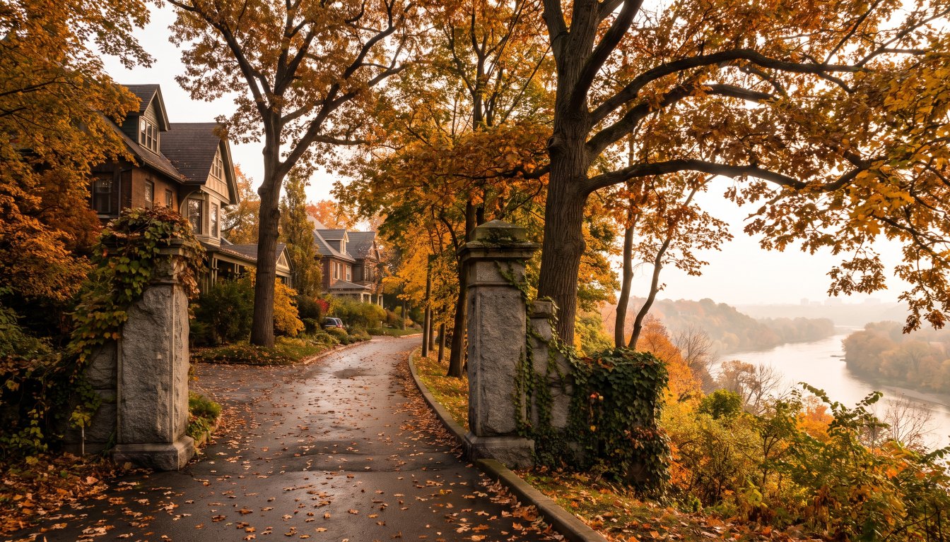
Baby Point occupies the site of Teiaiagon, an Iroquois (Seneca) village with a peak population near 5,000, abandoned before 1700 when the Mississaugas displaced the Iroquois. James Baby settled the area in 1816; the government acquired the land in 1910 for a planned military base; and Robert Home Smith bought it and began subdividing in 1912. Most houses date from the 1920s and 1930s.
It is a designated Heritage Conservation District — Teiaiagon–Baby Point — and it sits on a peninsula overlooking the Humber, surrounded by ravine and parkland. The stone entrance gates at Jane Street and Baby Point Road were restored in 2011.
Four layers of history on one peninsula
| Period | What was here |
|---|---|
| Before 1700 | Teiaiagon, an Iroquois (Seneca) village with a peak population near 5,000, abandoned when the Mississaugas displaced the Iroquois |
| 1816 | James Baby settles the area |
| 1910 | The government acquires the land for a planned military base |
| From 1912 | Robert Home Smith buys it and begins subdividing; most houses built in the 1920s and 1930s |
| Today | Teiaiagon–Baby Point Heritage Conservation District |
The stone entrance gates at Jane Street and Baby Point Road, restored in 2011, mark the entrance to what is effectively a single planned enclave on a peninsula above the Humber.
What the geography does
Baby Point is bounded by the Humber River to the west — from south of Baby Point Crescent to St. Marks Road — east to Jane Street and south to Raymond Avenue. The larger homes on Baby Point Road and Baby Point Crescent back directly onto the Humber Valley ravine.
Two consequences follow. The setting is exceptional and permanent, because valley land cannot be developed. And the properties that enjoy it are subject to Municipal Code Chapter 658 ravine protection — permits required to injure, destroy or remove a tree, place or dump fill, or alter grade, with fines from $500 to $100,000 per tree — and, where TRCA jurisdiction applies under O. Reg. 41/24, to conservation authority clearance before a building permit issues.
The heritage district
Teiaiagon–Baby Point is a designated Heritage Conservation District. A district plan governs exterior alterations, additions and demolition; demolition of contributing buildings is strongly resisted and new construction must be compatible in scale, massing, materials and fenestration.
Interior work, in-kind repairs, exterior painting and landscaping are typically outside the heritage permit process — so the interior of a Baby Point house can be entirely contemporary while the street elevation stays what it has been since the 1920s.
Where it sits in the market
The west end of Toronto as a whole recorded 31 sales above $3 million between January and April 2026 — roughly comparable to York Region’s 35 and ahead of Peel’s 24. Baby Point is one of the small number of west-end enclaves that account for that figure, alongside Kingsway South at 9, Humber Valley Village and the Old Mill area.
What to verify
- Heritage status and the district plan for the specific address, including whether the building is a contributing property.
- Ravine protected area mapping and TRCA regulated area status, separately.
- Table land versus slope on any property backing the valley.
- A tree count of everything 30 centimetres or more.
- Whether past exterior alterations were done with a heritage permit — unpermitted work becomes your problem on closing.
The practical takeaway
Baby Point gives you a planned enclave, a protected streetscape and a valley setting, in exchange for a permit process on almost anything you do outside. Buy it for the peninsula and the district plan, plan the interior freely, and sequence every approval before you draw.
Frequently asked questions
What was Teiaiagon?
An Iroquois (Seneca) village on the site, with a peak population near 5,000, abandoned before 1700 when the Mississaugas displaced the Iroquois. The heritage district name — Teiaiagon–Baby Point — records that history.
Who developed Baby Point?
Robert Home Smith, the same developer behind The Kingsway and Humber Valley Village. The government had acquired the land in 1910 for a planned military base; Home Smith bought it and began subdividing in 1912, with most houses built in the 1920s and 1930s.
Is Baby Point a heritage conservation district?
Yes. Teiaiagon–Baby Point is among Toronto’s designated Heritage Conservation Districts. A district plan governs exterior alterations, additions and demolition, while interior work, in-kind repairs, painting and landscaping are typically exempt from a heritage permit.
What is the ravine situation?
The neighbourhood occupies a peninsula overlooking the Humber and is surrounded by ravine and parkland. Larger homes on Baby Point Road and Baby Point Crescent back directly onto the Humber Valley ravine, which brings Chapter 658 ravine protection and, where applicable, TRCA regulation under O. Reg. 41/24 into play.
What are the boundaries?
The Humber River to the west, from south of Baby Point Crescent to St. Marks Road, east to Jane Street and south to Raymond Avenue.
Can I rebuild in Baby Point?
Demolition of contributing buildings in a heritage conservation district is strongly resisted, and new construction must be compatible in scale, massing, materials and fenestration. Interiors are largely outside the heritage permit process. Confirm the position for the specific address before buying with a rebuild in mind.
Thinking about buying or selling at the top end?
Send me the address, or the shortlist you are considering. I will tell you what the property is actually worth today, what the land is worth without the house, what the transfer tax and carrying costs will be, and whether the deal makes sense. Confidential, always.
[email protected] · 833-330-1925 · Book a free consultation
Confidential. Read personally and answered within 24 hours. I never share, sell or distribute your information.
Related reading
- Buying a heritage home in Toronto: Part IV vs Part V
- The Kingsway: how one developer’s rules still set prices
- Buying a ravine lot in Toronto: what the bylaw does to your plans
- West Toronto vs North Toronto luxury: two different kinds of money
Sources
Everything above that is a rule, a rate or a published number comes from these. Verify anything that matters to your own deal.
- City of Toronto — Heritage Conservation Districts
- City of Toronto — Municipal Code Chapter 658, Ravine and Natural Feature Protection
- RE/MAX Canada — 2026 Spotlight on Luxury Real Estate, Greater Toronto
About the author — Jatin Dua, Broker of Record
I’m the Broker of Record at RE/MAX Quantum Realty, 799 The Queensway in Etobicoke, and I work with buyers, sellers and investors across Toronto and the west GTA. A large part of my work sits in the upper end of the market, where the comparables are thin, the rules are heavier and the cost of a wrong number is measured in hundreds of thousands of dollars.
The free estimators on this site are mine. I built them because the first question every owner asks is “what is it worth?” and the honest answer starts with a number you can check yourself. [email protected] or 833-330-1925.