
Published 1 September 2026 · Updated 29 September 2026 · By Jatin Dua, Broker of Record, RE/MAX Quantum Realty
What's Your Home Worth Right Now?
Get a free AI-powered price range for your property in under 90 seconds, based on recent GTA comparable sales. No name or address required.
Get My Free Estimate →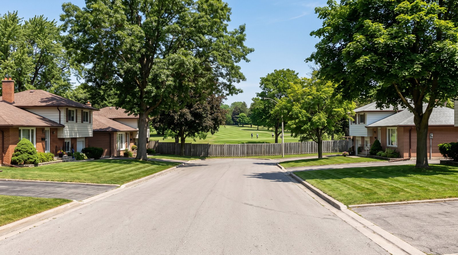
The ten things buyers in Markland Wood and Eatonville are least often told, all of them documented: Site and Area Specific Policy 29 prohibits new residential development inside the Lester B. Pearson International Airport Operating Area, and on the City’s own open-data polygon that area reaches Bloor Street West and covers, by my calculation, 25.5 per cent of Markland Wood and 42.1 per cent of Eringate-Centennial-West Deane; nobody has publicly reconciled that policy with the four-unit multiplex by-law or the garden-suite by-law, and the only fourplex conversion ever put to the Committee of Adjustment in these three neighbourhoods was refused in March 2026, on a street inside the Operating Area; the golf course is designated Parks and Open Space Areas, zoned OG — a zone that permits no residential use of any kind — sits 96.1 per cent inside the ravine by-law area on my measurement, and carries no development application of any kind in a City dataset refreshed the day I read it; there is no Major Transit Station Area anywhere in the three neighbourhoods and none at any of the seven Eglinton Crosstown West Extension stations, the nearest being Kipling at 2.7 to 4.2 kilometres, while Cloverdale Mall was approved for 41 storeys and about 5,536 units with no station area at all; the City has authorised construction traffic control at Renforth until 31 March 2031 and nobody has published an opening date; two planning systems operate 200 metres apart — a Committee of Adjustment that approved 99.0 per cent of what it decided over eleven years with zero tribunal decisions, against every apartment site going to the Ontario Land Tribunal; 630 The East Mall jumps from a 10-metre height limit to 24 storeys; the TDSB’s land corporation is a party against 4340 Bloor Street West because it abuts Millwood Junior School, while TDSB’s own projections put Eatonville Junior at 157 per cent and Silverthorn Collegiate at 132 per cent; there is no Special Policy Area on Etobicoke Creek, so the ordinary floodplain prohibition applies and the ravine by-law protects a tree of any species and any size with continuing fines to $10,000 a day; and the former Etobicoke City Hall could come off the Heritage Register on 1 January 2027.
None of that is an argument against buying here. This is one of the most stable, most tightly held pockets of west Etobicoke. It is an argument for buying here with the documents open, and for knowing which of the numbers on this page are published statistics and which ones I calculated myself.
Every item on this page is traced to a primary source — an Official Plan policy, a by-law, a Council decision, a tribunal decision, a City open dataset, a school board accommodation table — and each is listed at the bottom with the date I read it. Several figures here are my own calculations from published geographic data, not published statistics. Specifically mine, not the City’s: the share of each neighbourhood inside the Airport Operating Area (25.5, 42.1 and 2.4 per cent) and the street lists that go with it; the golf course area of 35.6 hectares and the 96.1 per cent ravine overlap; the 25.1 per cent ravine share of Markland Wood; the straight-line distances to Renforth and to the Kipling station area; the Committee of Adjustment counts and the 99.0 per cent approval rate; the approximate 6,211-unit development pipeline; the net public green space share; and the Census percentages. Each is labelled where it appears with the dataset, its refresh date and the method. Verify independently before you rely on any of them for a specific address: the legal Airport Operating Area boundary is the one drawn on Official Plan Chapter 7 maps, not the open-data polygon; the ravine layer I used was last refreshed in July 2019 and is not the authoritative Schedule A-2 map; and whether your parcel is inside the TRCA regulated area or the regulatory floodplain can only be answered by TRCA. Nine things I deliberately left off because I could not source them properly: who owns Markland Wood Golf Club, because no land registry search was done; any claim that the golf course is sold, optioned or under offer; any opening date for the Eglinton Crosstown West Extension, because none is published; any claim about properties expropriated or acquired for it, because I could not obtain a list and the City’s own report says it contains no property information; any statement that a named address is subject to a federal airport height limit under SOR/99-123; any parcel-level floodplain or TRCA regulated-area claim; any Toronto Catholic District School Board utilisation percentage; any ravine or tree permit application fee, which the City does not publish; and any combined City-plus-Province land transfer tax figure. I will publish those when I can cite them.
Markland Wood and Eatonville are described in listings with a confidence the documents do not support. The golf course is permanent, the airport is far away, the LRT is coming, the streets are protected. Every one of those sentences is either unsourced, half true, or the opposite of what the City’s own records say. What is actually on the record is stranger and considerably more useful if you are about to spend one and a half to two million dollars here.
Two geographic notes before the list, because they change every number that follows. First, “Eatonville” is not a City of Toronto neighbourhood. There is no polygon by that name in the City’s 158-neighbourhood model. The name survives in institutions — Eatonville Junior School at 15 Rossburn Drive, the Eatonville library on Burnhamthorpe Road — not in planning geography. The three official neighbourhoods covering this area are Markland Wood (12), Etobicoke West Mall (13) and Eringate-Centennial-West Deane (11), and wherever I quote City or Census data below I name the one I am quoting. Anyone who shows you “the City’s data for Eatonville” is showing you something they made up. Second, the whole area is one ward and one community council: every development application and every Committee of Adjustment file in all three neighbourhoods is stamped Ward 2 — Etobicoke Centre and heard at Etobicoke York Community Council.
1An Official Plan policy prohibits new residential development here — and it reaches Bloor Street West
This is the single most under-reported planning fact in west Etobicoke, and it has been sitting in the Official Plan since 2001.
Toronto Official Plan, Chapter 7, Site and Area Specific Policy 29 — “Lester B. Pearson International Airport Operating Area.” Policy 29(a), quoted from the City’s December 2024 consolidation: “Within the Lester B. Pearson International Airport (L.B.P.I.A.) Operating Area, new development for residential and other sensitive land uses is prohibited, unless permitted by existing zoning.”
The policy does not stop there. Policy 29(b)(i) allows redevelopment or infilling for residential uses only where it “would result in the same or fewer total number of housing units than the existing zoning would permit”; 29(b)(ii) requires proponents “to provide noise studies and undertakings to provide satisfactory noise attenuation measures”; and 29(c) fixes the geography: “the 30 NEF/NEP noise contour will be considered to be the L.B.P.I.A. Operating Area.” Policy 29(h) defines infill to include “the creation of one or more new residential units” and defines sensitive land uses to include “residences, day care centres, and education and health facilities.”
Where did it come from? A Council report, and the report names this neighbourhood. Application by the Greater Toronto Airports Authority to Amend the Official Plans, Planning and Transportation Committee Report No. 3, Clause No. 2, considered by Council on 23 to 27 April and 30 April to 2 May 2001. The Operating Area was drawn from the 30 NEF/NEP contour and expanded outward to the nearest roadway, natural feature or major zoning boundary; the report describes 30 NEF/NEP as “roughly equivalent to an Leq of 64 decibels.” On scale, in the City’s own words: “The proposed operating area in the City covers an area containing approximately 10,000 dwelling units and 30,000 residents. In addition, approximately 9 schools, 7 child care centres and 11 places-of-worship would be within the operating area.” And the sentence nobody quotes: the report refers to “the potential to further reduce the impact of the contour lines on the Markland Woods community in the former City of Etobicoke.”
I took the City’s Site and Area Specific Policies open dataset (WGS84 GeoJSON, 868 polygons, refreshed 16 March 2026) and the Neighbourhoods 158-model layer (refreshed 20 February 2026). Feature SASP_NO = "029" is a MultiPolygon of two simple parts with no holes, combined area 20.98 km², bounding box -79.62026 to -79.52921 longitude and 43.63090 to 43.73453 latitude. I laid a regular grid at 0.0008° longitude by 0.0006° latitude — roughly 64 by 67 metres — over each neighbourhood polygon and tested every point inside the neighbourhood for containment in SASP 29 by ray casting. The polygons are official; the sampling, the arithmetic and the resulting percentages are mine.
| Neighbourhood | Grid points inside | Also inside SASP 29 | Share |
|---|---|---|---|
| Markland Wood (12) | 686 | 175 | 25.5% |
| Eringate-Centennial-West Deane (11) | 2,008 | 845 | 42.1% |
| Etobicoke West Mall (13) | 419 | 10 | 2.4% |
On the same method, applied to the City’s Toronto Centreline dataset (64,341 features, refreshed 31 August 2026), testing each street segment’s mid-vertex, these are the named residential streets with segments falling inside the Operating Area. Treat them as a directional list, not a title search.
| Neighbourhood | Streets with segments inside SASP 29 on my test |
|---|---|
| Markland Wood (12) | Markland Dr (approx. 5–79), Neilson Dr (approx. 65–122), Thicket Rd (approx. 2–85), Toledo Rd (approx. 10–63), Eriksdale Rd (1–43), Saturn Rd (115–141), Arbroath Cres, Aymarn Crt, Boreal Rd, Clearside Pl, Cosway Crt, Koos Rd, Neilor Cres, Peacock Ave, Radway Ave, Silver Shadow Path, Stoneglen Dr, Thornbush Cres, Triburnham Pl, Old Burnhamthorpe Rd — and Bloor Street West itself between approximately No. 4228 and No. 4258, and Burnhamthorpe Rd approximately 662–709 |
| Etobicoke West Mall (13) | Renforth Dr (approx. 216–426), Saturn Rd (102–114), Boreal Rd, Crendon Dr, Peacock Ave, Tranquil Dr, Windust Gt, Burnhamthorpe Rd (approx. 647–656) |
| Eringate-Centennial-West Deane (11) | Rathburn Rd (approx. 525–629), Renforth Dr (approx. 430–720), Sagamore Cres, Ashfield Dr, Allonsius Dr, Burin Crt, Burnhamill Pl, Canerouth Dr, Centennial Park Blvd, Centennial Park Rd, Crendon Dr, Custead Crt, Eda Crt, Elmcrest Rd, Embers Dr, Esposito Crt, Foxcote Cres, Gentian Dr, Hardwick Crt, Hartland Rd, Indianola Dr, Ivybridge Dr, Laver Rd, Melbert Rd, Mill Rd (approx. 419–431), Moyles Crt, Norbert Cres, Old Burnhamthorpe Rd, Pebble Valley Lane, Rangoon Rd, Redthorn Crt, Renova Dr, Warlingham Crt, West Wareside Rd |
The percentages and the street list rest on the City’s open-data polygon. The legal boundary is the one drawn on the Official Plan Chapter 7 Site and Area Specific Policy maps, which are raster images I could not overlay. The 2001 Council report independently corroborates that the contours reach the Markland Woods community, which is why I am comfortable publishing the directional finding. I am not comfortable publishing an address-level one. Before you rely on this for a specific property, put the address to City Planning or check it on the City’s Official Plan map viewer.
One more rulebook exists and almost nobody reads it. The Toronto/Lester B. Pearson International Airport Zoning Regulations, SOR/99-123, made under the federal Aeronautics Act, define approach, outer and transitional surfaces and prohibit erecting anything whose highest point exceeds them, and also prohibit land use “that causes interference with signals or communications.” It is federal and it binds regardless of municipal zoning. I did not resolve its metes-and-bounds description against any local parcel, so I am not telling you that any particular property here is subject to a height cap — only that anyone proposing anything tall in west Etobicoke has to check.
How to read this as a buyer. If your street appears in that table, the base assumption behind every “add a unit, add a suite, sever and build two” pro forma you have been shown may not hold. That does not make the house a bad buy — the existing dwelling is existing zoning and is unaffected. It makes the upside case a question for City Planning rather than for a spreadsheet. Ask before you pay for it.
2Nobody has publicly squared that policy with the fourplex and garden-suite by-laws — and the one fourplex ever asked for here was refused
This is the live seam in local planning, and it is visible on the face of the documents.
Since 2022 the City has passed exactly the sort of comprehensive by-laws that increase permitted unit counts city-wide. Garden suites: Official Plan By-law 100-2022 and Zoning By-law 101-2022, Council 2 February 2022, permitted in R, RD, RS, RT and RM zones and, in the City’s words, now in force “with the exception of one property-specific appeal that is maintained.” Four-unit multiplexes: re-enacted through By-law 653-2025 (Official Plan) and By-laws 654-2025 and 648-2025 (zoning), Council 25 and 26 June 2025, with the City stating plainly that “four-unit multiplexes are permitted city-wide.”
Now read that against SASP 29(d), quoted in full: “the City may pass comprehensive zoning by-laws that permit residential uses within the L.B.P.I.A. Operating Area, provided that the new Zoning By-law does not increase the number of housing units permitted.”
A four-unit multiplex permission and a garden-suite permission both increase the number of housing units permitted on an ordinary RD lot. Neither the City’s multiplex page nor its garden-suite page mentions the Airport Operating Area. I could not find any public City document reconciling the two. That is not an accusation; it is a gap, and it is the single most useful question a buyer on one of these streets can ask.
Two live local data points sit right on the seam, both from the City’s Committee of Adjustment Applications dataset (refreshed 29 August 2026):
| Address | File | Application in | What was asked for | Outcome |
|---|---|---|---|---|
| 4240 Bloor St W | — | 31 Jan 2024 | Second storey above the existing detached garage and a two-storey west side addition “to accommodate a new garden suite” | Approved |
| 8 Sagamore Cres | A0002/26EYK | 29 Dec 2025 | Second and third storey additions and a new front porch; “the existing dwelling will be converted into a fourplex” | REFUSED — heard 12 Mar 2026, appeal expiry 1 Apr 2026, closed 2 Apr 2026 |
Both addresses fall inside the Operating Area on my analysis in item 1. Over the eleven years of the City’s closed-applications record there are exactly four accessory-unit or multiplex files in all three neighbourhoods: the two above, plus a garden suite at 571 Renforth Dr (in 5 April 2024, approved) and a triplex conversion at 626 Burnhamthorpe Rd (in 11 April 2018, approved).
I am not telling you the Sagamore Crescent fourplex was refused because of the airport policy. The City’s dataset records the decision, not the reasons. It records no objector flag and no tribunal appeal on that file. The honest sentence is the narrow one: the only fourplex conversion put to the Committee of Adjustment in these three neighbourhoods in eleven years was refused, and it happens to be on a street my analysis places inside the Operating Area. Ask City Planning how SASP 29 interacts with the multiplex and garden-suite by-laws before you count on either.
One thing that is settled: sixplexes are not permitted here. The Sixplex Study — Official Plan Amendment 818 and Zoning By-law 654-2025, Council item 2025.PH22.4, adopted 26 June 2025 — applies to the eight wards inside the Toronto and East York Community Council boundary and to Ward 23 Scarborough North. Ward 2 Etobicoke Centre is not among them, although other wards may opt in.
And laneway suites are a dead end here for a physical reason rather than a legal one: laneway suites require laneway access, and the 1950s and 1960s curvilinear street grid of Markland Wood, Etobicoke West Mall and Eringate has essentially no public laneways. A scan of the City’s Toronto Centreline for laneway-coded segments in these three neighbourhoods returns nothing of substance. Garden suites, not laneway suites, are the accessory-unit tool here — subject to everything above.
How to read this as a buyer. If part of the price you are paying is the option to add units, get that option confirmed in writing by the City before closing, not after. On an Operating Area street the answer is genuinely unresolved in public, and “permitted city-wide” is a phrase from a web page, not from a zoning certificate for your lot.
3The golf course: no residential use is permitted, no application of any kind is on file — and the Official Plan does not promise permanence
This is the question every Markland Wood buyer and seller is actually asking. Here is exactly what is documented, and exactly what is not.
The designation. The Toronto Official Plan designates the golf course lands Parks and Open Space Areas, in the Other Open Space Areas and Natural Areas sub-categories. That is confirmed twice over: by the Official Plan text itself, whose §4.3 policy 1 names “golf courses” among the lands comprising the Green Space System, whose policy 2 says “development is generally prohibited within Parks and Open Space Areas” except for recreational, cultural, conservation, cemetery, transit and essential public works uses, and whose policy 5 says Other Open Space Areas “will be used primarily for golf courses, cemeteries, and open spaces”; and by a tribunal record, the Local Planning Appeal Tribunal decision in Case No. PL171321, issued 26 March 2020 on 240 Markland Drive, which records that the “Markland Wood Golf and Country Club” lands to the west are “designated Natural Areas and Other Open Space Areas.”
The zoning, which is the harder constraint. The lands are zoned OG — Open Space Golf Course Zone under city-wide Zoning By-law 569-2013, Chapter 90, Section 90.40. In the City’s zoning open data (refreshed 20 February 2026) the polygon carries ZN_ZONE "OG", ZBL_CHAPT 90, ZBL_SECTN 90.40 and ZN_EXCPTN "N" — no site-specific exception. Section 90.40.20.10(1) gives the complete list of permitted uses:
| Permitted in the OG zone (90.40.20.10(1)) | Permitted with conditions (90.40.20.20(1)) |
|---|---|
| Ambulance Depot, Golf Course, Fire Hall, Park, Police Station, Public Utility, Transportation Use | Amusement Arcade, Club, Cogeneration Energy, Eating Establishment, Education Use, Outdoor Patio, Personal Service Shop, Place of Assembly, Recreation Use, Renewable Energy, Retail Store, Service Shop, Take-out Eating Establishment — each of which “must be combined with a park or a golf course,” retail, service and take-out capped at 500 m² of interior floor area |
Read that list again. There is no residential use of any kind in the OG zone. Not a dwelling unit, not a townhouse, not an apartment. Maximum height is the Height Overlay figure or 15.0 metres where none is shown. A residential development on these lands would require both an Official Plan amendment and a zoning by-law amendment, and both are appealable to the Ontario Land Tribunal.
Area. I took the OG polygon geometry from the City’s zoning GeoJSON, projected it to a local equal-area approximation at the polygon’s mean latitude (111,320 × cos φ metres per degree of longitude, 110,540 metres per degree of latitude) and took the shoelace area of the outer ring less inner rings: 35.6 hectares, or 87.98 acres. The Markland Wood neighbourhood polygon on the same method is 2.936 km², so the OG-zoned course is 12.1 per cent of the neighbourhood by area. Cross-check: the City’s separate Green Spaces layer (refreshed 25 August 2026) carries two polygons named MARKLAND WOOD GOLF CLUB of 17.99 and 15.05 hectares, 33.04 hectares combined — within 7 per cent of the zoning figure, the difference consistent with Green Spaces excluding the clubhouse and parking envelope.
Ravine overlap. Using the City’s Ravine & Natural Feature Protection area shapefile (854 polygons; 37 of them intersect a bounding box over west Etobicoke), I laid a grid at 0.0004° by 0.0003° — about 32 by 33 metres — over the OG polygon. 333 grid points fell inside the golf course; 320 of them also fell inside a ravine by-law polygon. That is 96.1 per cent. Note the currency problem: that open-data layer’s last-refreshed stamp is 23 July 2019 and it is not the authoritative Schedule A-2 Data Maps. Use it directionally — essentially the whole course is in the ravine by-law area — and use the City’s live Ravine By-law Map for a parcel-level answer.
The decisive negative. I searched the City’s Development Applications dataset in full — 26,432 records, refreshed 31 August 2026, the day I read it. There is no application of any type at any address on the Markland Wood Golf Club lands. Searching the whole dataset city-wide for the word “golf” anywhere in a description returns 46 records, every one of them at Rosedale, Cedar Brae, Weston, Scarborough Golf Club Road, 125 Milner Avenue, 777 Victoria Park Avenue or Kingston Road. None is in Etobicoke west of Highway 427. The only Markland Drive files in the entire dataset are four, all on the apartment sites at 210 and 240 Markland Drive, on the east side of the street — not golf-course land.
Ownership. The club’s public pages describe a membership and a history but do not state the ownership vehicle, and I did not obtain a parcel register or PIN search from the Ontario land registry. I am not going to tell you who owns this golf course, and you should treat anyone who tells you without a title search the same way. Any purchase agreement, option, listing or letter of intent over the lands: nothing of the kind appears in any City record I could reach. The absence of a development application is strong evidence that nothing is before the City. It is not evidence that nothing exists privately. The “400 acres” figure on the club’s own history page describes the original land assembly that became the subdivision and the course, not the course. Do not repeat it as the course size.
And one thing the City’s own record shows is not relevant here: Council’s Review of City Golf Course Operations (item IE27.6, adopted 2 February 2022) covers only the five City-owned courses — Dentonia Park, Humber Valley, Don Valley, Scarlett Woods and Tam O’Shanter. Markland Wood is not among them.
How to read this as a buyer. The safe formulation, and the one I use with clients, is this: as at 31 August 2026 the lands are designated Parks and Open Space Areas, zoned OG with no site-specific exception and no residential permission of any kind, lie almost entirely inside the ravine by-law area and inside TRCA’s regulated area on Etobicoke Creek, and carry no development application, no Official Plan amendment application and no rezoning application before the City. Changing that would take an Official Plan amendment and a rezoning, both appealable. That is a very high wall. It is not a promise of permanence, and Official Plan policy is not a covenant. Anyone who sells you either the panic or the guarantee is selling you something.
4There is no Major Transit Station Area anywhere here — and none at any of the seven Crosstown West stations
This is a clean, checkable negative, and it cuts against the story most people tell about this area.
The Province’s approved layer — City of Toronto Open Data, Minister-Approved Major Transit Station Areas, shapefile dated January 2026, dataset refreshed 3 February 2026 — contains 120 delineations city-wide: 95 Protected Major Transit Station Areas and 25 Major Transit Station Areas, each carrying the Site and Area Specific Policy number that implements it. Not one of the 120 intersects Markland Wood, Etobicoke West Mall or Eringate-Centennial-West Deane.
I reprojected the MTSA layer from NAD27 MTM zone 10 to WGS84 and measured haversine distances from each neighbourhood’s area-weighted centroid to the nearest station-area polygon’s bounding-box centre. The layer is official; the reprojection, the centroids and the distances are mine.
| Neighbourhood | Nearest station area | Type | SASP | Distance |
|---|---|---|---|---|
| Etobicoke West Mall (13) | Kipling | Protected MTSA | 626 | 2.70 km |
| Markland Wood (12) | Kipling | Protected MTSA | 626 | 3.01 km |
| Eringate-Centennial-West Deane (11) | Kipling | Protected MTSA | 626 | 4.15 km |
From local intersections rather than centroids, on the same method: Bloor Street West at The West Mall is 2,088 metres from the Kipling station-area centre, Burnhamthorpe at The East Mall 2,076 metres, and Bloor at Markland Drive 3,616 metres.
Now the part that surprised me. Not one of the seven Eglinton Crosstown West Extension stations has a Minister-approved station area either. Scanning all 120 polygons along the Eglinton Avenue West corridor in Etobicoke returns nothing between Old Mill and Weston in that longitude band. And there is a trap waiting for anyone who checks this by name-matching instead of spatially: the layer does contain a “Martin Grove” station area, SASP 645 — but that is the Finch West LRT station, roughly 8 kilometres north of the Crosstown West extension’s Martin Grove-Eglinton station. Different line, different station, same name.
There is also no Secondary Plan covering any part of the three neighbourhoods. I tested every polygon in the City’s Secondary Plans layer (refreshed 16 March 2026) against the three neighbourhood polygons: zero overlaps. The Official Plan’s list of 51 Secondary Plans does include “Etobicoke Centre,” but that plan’s geography is the Islington-Bloor node, not this area.
What follows from all of that is precise. The Growth Plan minimum densities that apply inside a delineated station area, and the appeal-rights effect of the “Protected” designation, do not apply anywhere in these three neighbourhoods. There is no provincially-mandated density floor pressing on the low-rise streets of Markland Wood or Eatonville. The naive reading — “the LRT is coming, so the province will force density here” — is wrong on today’s approved delineations, and item 1 pulls in the opposite direction on a good part of the same ground.
But do not mistake that for protection, because the largest approval in this part of Etobicoke did not need a station area at all. Cloverdale Mall, 250 The East Mall — which is in Islington-City Centre West, not in any of these three neighbourhoods, whatever the listings say — was approved on 4 February 2026 under Council item 2026.EY28.1, by Official Plan Amendment 715 (By-law 125-2026) and Zoning By-law 124-2026, for “a multi-phased, mixed-use development including 10 tall buildings and 5 mid-rise buildings.” The City’s final report gives 10 tall buildings of 25 to 41 storeys (84.6 to 135.4 metres), five mid-rise buildings of 6 to 12 storeys, approximately 5,536 residential units, 411,500 m² of gross floor area, two parkland dedications totalling 14,314 m², four phases so the mall keeps trading, and a new Site and Area Specific Policy 877. And it states plainly that the site “is not within a delineated Protected Major Transit Station Area,” relying instead on Dundas Street West being identified as a Transit Corridor.
How to read this as a buyer. Forty-one storeys and 5,536 units, with no station area. The absence of an MTSA tells you the provincial floor does not apply; it does not tell you a tower cannot be approved two kilometres away. If your view, your commute or your school catchment depends on what happens at Bloor and The East Mall, read item 6 rather than the transit map.
5The LRT terminus is inside the area on the City’s map, three to four kilometres from your front door — and the City has authorised construction traffic control there until 2031
Both halves of that sentence are true, and a listing that prints only the first half is selling something.
I paired the nearest vertices of the Eglinton Ave W and Renforth Dr centreline geometries in the City’s Toronto Centreline dataset to derive the intersection at approximately -79.58768, 43.66610, then ran a point-in-polygon test against the City’s 158-neighbourhood layer. It falls inside Eringate-Centennial-West Deane (Neighbourhood 11). The straight-line distances below are haversine from centreline-derived intersection coordinates. The datasets are the City’s; the pairing, the tests and the arithmetic are mine.
| From | Straight-line distance to Eglinton & Renforth |
|---|---|
| Bloor St W & Markland Dr | 4,139 m |
| Bloor St W & The West Mall | 3,955 m |
| Burnhamthorpe Rd & The East Mall | 3,131 m |
The project, from the agencies building it. Metrolinx describes the Eglinton Crosstown West Extension as “up to 13.9 km” in total, comprising “9.2 km between Mount Dennis and Renforth Drive” and “4.7 km for the potential link between Renforth Drive and Pearson International Airport,” with “up to 10” stations — seven from Mount Dennis to Renforth, and up to three more on the potential airport link. The seven named stations, west to east, are Renforth, Martin Grove-Eglinton, Kipling-Eglinton, Islington-Eglinton, Royal York-Eglinton, Scarlett and Jane-Eglinton. Infrastructure Ontario’s scope for the Stations, Rail and Systems package is “four underground stations, two elevated stations, and one at-grade/trenched terminus station” — note the wording: Renforth is the at-grade/trenched terminus, not an underground one. The Development and Master Construction Agreement was signed 22 August 2025; the contract value is “to be announced at Financial Close.” Tunnelling ran April 2022 to June 2024, with two machines excavating 6.3 kilometres of parallel tunnels. Federal funding of $1.87 billion was confirmed in a Housing, Infrastructure and Communities Canada release dated 10 July 2026, which records excavation beginning at four underground stations.
Now the number that actually matters for a 2026 purchase. City Council item 2026.EY32.13, Metrolinx Eglinton Crosstown West Extension – Station Construction – Long-term Temporary Road Closures and Traffic By-law Amendments — staff report dated 7 May 2026, considered at Etobicoke York Community Council on 26 May 2026, adopted by City Council on 24 and 25 June 2026 on consent — authorises temporary traffic signals at Renforth Drive at the Mississauga Transitway, roughly 80 metres north of Eglinton Avenue West, “from September 1, 2027, to March 31, 2031, inclusive.”
| Station | Authorised measure | Window |
|---|---|---|
| Renforth | Temporary traffic signals at Renforth Dr and the Mississauga Transitway, approx. 80 m north of Eglinton Ave W | 1 Sep 2027 – 31 Mar 2031 |
| Kipling | Westbound curb-lane closure on Eglinton Ave W and stopping prohibitions | 1 Dec 2027 – 28 Feb 2030 |
| Scarlett | Northbound curb lane, sidewalk and multi-use path closures on Scarlett Rd | 1 Aug 2028 – 30 Sep 2030 |
The same report describes Renforth Station as being “in the northwest quadrant of Eglinton Avenue West and Renforth Drive” and as “a major transit hub, providing connections to MiWay, GO Transit, TTC bus services, and the Mississauga Transitway,” and records that there are “no direct financial implications to the City,” the work being fully funded by Metrolinx. On the ground right now, Metrolinx’s own 2026 community notices for this corridor include borehole drilling at Renforth Station (8 April 2026), excavation beginning at Martin Grove (1 June 2026) and at Royal York (6 May 2026), realignment of Eglinton near Kipling (20 July 2026) and vibration testing along Eglinton between Weston Road and Renforth Drive (24 August 2026).
No opening or in-service date. Neither Metrolinx nor Infrastructure Ontario publishes one for this extension. Anyone who quotes you a year is guessing. What is documented is that the City’s own by-law contemplates active construction at the western terminus to 31 March 2031.
No expropriation claim. I could not obtain any list of properties expropriated or acquired for this project in west Etobicoke. Metrolinx’s project pages carry no property page I could retrieve, the Ontario Gazette expropriation notices were not searchable in a form I could reach, and the City’s 7 May 2026 report states explicitly that it contains no information regarding property requirements or expropriations. I am therefore not telling you that any property here is being expropriated, or how many, or for what compensation. If you need that answer, the routes are a Metrolinx media request and a search of the Ontario Gazette notices of application for approval to expropriate.
No Pearson link and no Transitway detail. Metrolinx calls the 4.7-kilometre Renforth-to-Pearson segment “potential.” It is not funded, not contracted and not scheduled in anything I could retrieve, so it is a potential future link, never a planned extension. And Metrolinx has no live project page for the Mississauga Transitway — the URL returned a 404 — so I am not quoting station counts, lengths or dates for it.
How to read this as a buyer. If you are buying near Renforth or on Eglinton, you are buying a construction site with a City-authorised end date of 31 March 2031 and no published opening date. If you are buying in the heart of Markland Wood, you are three to four kilometres from that station and the honest description of your transit is buses. Both facts should be in the conversation before the offer, not after the first summer of night work.
6Two completely different planning systems operate 200 metres apart on these streets
This is the structural fact that explains almost everything else about how this area changes.
System one: the low-rise streets, where the Committee of Adjustment says yes. Nearly every rebuild and major addition here happened through minor variances, not rezonings.
I took the City’s Committee of Adjustment Applications open dataset (refreshed 29 August 2026) — the “closed applications since 2017” file, which in fact runs from 22 December 2015. That dataset carries no coordinates at all, so I matched records by street name plus civic-number range, using per-neighbourhood street and address-range tables I built from the City’s Toronto Centreline geometries, then filtered to WARD_NAME = "Etobicoke Centre" to strip false positives. That ward filter removed 43 records — 23 of them Scarborough’s own Neilson Road and Drive, the rest Rathburn, Eglinton, Terryellen, The West Mall, The East Mall, Mill, Elmcrest, Markland, Antioch, Decarie, Old Burnhamthorpe and Ashfield addresses elsewhere in the city. This is exactly the geocoding artefact that makes naive “Committee of Adjustment data for my neighbourhood” claims wrong, and it is why I am showing you the method rather than just the number.
| Measure, 22 Dec 2015 to June 2026 | Result |
|---|---|
| Closed applications matched | 225 — 217 minor variance, 8 consent |
| Approved | 192 |
| Refused | 2 |
| Deferred / no decision recorded | 5 / 26 |
| Approval rate on decided applications | 192 ÷ 194 = 99.0% |
| Recorded tribunal decisions | Zero — the tribunal field is null on all 225 records |
| By neighbourhood | Eringate 113 approved / 1 refused; Markland Wood 51 / 1; Etobicoke West Mall 28 / 0 |
| Work types | Residential addition 127, new residential building 49, other 34, sever lot 8, non-residential addition 6, new non-residential building 1 |
The two refusals in eleven years are 31 Neilor Cres (file A0467/25EYK, in 25 November 2025, a one-storey rear addition) and 8 Sagamore Cres (the fourplex conversion in item 2). Files still open at 31 August 2026 include B0031/25EYK at 210 Markland Drive, a consent to sever the property into three lots with the existing 13-storey building retained, filed 27 June 2025.
System two: the apartment sites, where everything goes to the Tribunal. The Official Plan calls the low-rise streets Neighbourhoods and the 1960s apartment clusters on Markland Drive, The West Mall, The East Mall and Renforth Drive Apartment Neighbourhoods. The Plan’s §4.2 preamble is the reason those sites are all in play: “opportunities exist for additional townhouses or apartments on underutilized sites,” and “on smaller sites infill opportunities in Apartment Neighbourhoods can be as simple as a building addition or a new building on an underutilized part of the lot, such as a surface parking lot.” That sentence is why every slab tower here now has an application beside it.
| Site | Where it went | Result on the record |
|---|---|---|
| 710 The West Mall | OLT-24-000556 | Decision and Order 6 May 2025, Order 24 Mar 2026; By-law 330-2026(OLT) enacted 24 March 2026, whose authority line reads “The Ontario Land Tribunal has the authority pursuant to Section 34 of the Planning Act… to pass this By-law”; 22 storeys, 282 units, max 24,000 m² GFA, minimum 15% two-bedroom and 10% three-bedroom units. The City had recommended opposing it. |
| 630 The East Mall | Appeal filed 1 Dec 2023 on Council’s failure to decide | Staff report 14 Mar 2024 recommends Council “direct the City Solicitor… to attend the Ontario Land Tribunal to oppose”. See item 7. |
| 251–285 The West Mall | OLT-23-000792, appeal 1 Aug 2023 | Three 13-storey buildings, ~41 m, 610 units, 47,432 m², FSI 4.98, including 66 replacement rental units for 66 existing ones. Staff report 21 Dec 2023 recommends opposing. |
| 4340 Bloor St W | OLT-22-003672 | Settled: 13 storeys at 41.50 m plus a 4-storey building, 297 units. See item 8. |
| 210 Markland Dr | Council item 2025.EY19.1, adopted 5 Feb 2025 | Approved without amendment or debate: 8, 10 and 12 storeys beside the retained 13-storey building, 484 units, 1,590 m² parkland, 152 existing rental units preserved for 20 years, and a restriction preventing residents obtaining on-street parking permits. |
| 240 Markland Dr | LPAT PL171321, decision 26 Mar 2020 | Appeal against the City’s failure to decide; 164 new units added to an existing 113-unit building; Tribunal “will allow the appeal in part and approve the amendment… in principle,” order withheld pending conditions. The Markland Wood Homeowners Association was an interested party. |
Filtering the City’s Development Applications dataset (refreshed 31 August 2026) to the three neighbourhood polygons — after reprojecting its coordinates from MTM Zone 10 (EPSG:2952), which is the second geocoding trap in this dataset — gives 162 records, which collapse to 23 distinct applications filed since 1 January 2018. Summing the unit counts and counting each site once gives approximately 6,211 residential units in the pipeline, against 15,795 occupied private dwellings across the three neighbourhoods in the 2021 Census: a 39.3 per cent increase if everything proceeds. Carry the caveats with the number: several files are appealed or inactive, some figures reflect proposals settled years ago, and unit counts are the applicants’ descriptions as recorded, not as built.
How to read this as a buyer. If you are buying a house to rebuild or extend, the base zoning is your opening position, not your answer, and the Committee has approved 99 of every 100 requests it decided. If you are buying a house near an apartment site, the Committee statistics tell you nothing at all — that land is governed by a tribunal 200 metres away, on a different set of tests, and the City has lost or settled more of those than it has won. Ask which system your street sits in.
7630 The East Mall goes from a 10-metre height limit to 24 storeys
If you want one number that captures how apartment-site infill works in west Etobicoke, this is it.
The site is designated Apartment Neighbourhoods and zoned Commercial Local (CL) 0.4, exception 271, with a 10-metre height limit. The application, file 22 207881 WET 02 OZ, filed 23 September 2022, proposes “two 24-storey towers connected by a 9-storey podium, and one 12-storey building fronting The East Mall. A total of 839 units” — 53,356.8 m² of gross floor area at FSI 6.7, with a unit mix of 592 one-bedroom (71 per cent), 151 two-bedroom (18 per cent) and 96 three-bedroom (11 per cent).
The applicant appealed to the Ontario Land Tribunal on 1 December 2023, on Council’s “failure to make a decision… within the prescribed time frame set out in the Planning Act.” The staff report dated 14 March 2024 to Etobicoke York Community Council recommends that “City Council direct the City Solicitor and appropriate City staff to attend the Ontario Land Tribunal to oppose the current Zoning By-law Amendment application.”
From 10 metres to 24 storeys. That is roughly a threefold jump in permitted density measured as FSI, from 0.4 to 6.7, on a site whose existing zoning contemplates a single-storey commercial building.
It is not the only one. The rest of the near pipeline, from the City’s own dataset:
| Address | File | Status at 31 Aug 2026 | Proposal as described by the City |
|---|---|---|---|
| 1 Eva Rd | 24 235688 WET 02 OZ | Under Review | Three towers of 28, 28 and 44 storeys on a 7-storey podium, 936 units |
| 620 The East Mall | 22 139929 WET 02 SA | Under Review | An 11-storey mid-rise and two 24-storey towers, 757 units, FSI 2.4 |
| 900–940 The East Mall | 20 173796 WET 02 SA | Under Review (inactive) | Four buildings of 20 to 21 storeys, 858 units, 82,392 m² and a public park |
| 375–385 The West Mall | 23 239053 WET 02 SA | Under Review | 14 and 28 storeys on a 6-storey podium, 626 units, under site-specific By-law 1039-2022 |
| 560 The West Mall | 25 162109 WET 02 OZ | Under Review | 14 storeys, 190 units — and note: “10 two- and three-bedroom rental townhouse units… Nine of these units are rented at an affordable level. All 10 units are proposed to be demolished.” |
| 4209 Bloor St W | 25 243191 WET 02 SA | Under Review | 6 storeys (19 m plus mechanical penthouse), 28 units |
| 40 Rakely Crt | 19 186166 WET 02 OZ | Under Review | Five office and retail buildings of six to nine storeys and a new public road |
630 The East Mall geocodes into Eringate-Centennial-West Deane in some City records and Etobicoke West Mall in others, because the neighbourhood boundary runs through that block. I describe it by address and I would advise you to do the same. Do not let anyone attach it definitively to one neighbourhood’s statistics.
How to read this as a buyer. The Official Plan’s own criteria for these sites are the two things the City argues at the Tribunal: “a stepping down of heights towards lower-scale Neighbourhoods” and adequately limiting shadow impact on adjacent Neighbourhoods “particularly during the spring and fall equinoxes.” If you are buying a house that backs or faces one of these sites, those two sentences are the whole of your protection, and they are argued case by case. Get the current application list for the block before you sign, not after.
8The school board’s land corporation is fighting a building next to a local school — and its own projections put Eatonville Junior at 157 per cent
Two facts on the record, from the boards themselves, that sit oddly beside each other.
First, the school board is a party at the Tribunal. Toronto Lands Corporation, the TDSB’s real-estate arm, lists the site as “4340 Bloor Street West (Adjacent to Millwood Junior School),” records the proposal as “4 and 13-storey residential buildings while retaining an existing, 15-storey apartment building,” records that the applicant appealed to the Ontario Land Tribunal after the City did not make a decision, and states that “TLC has secured party status to the OLT hearing,” having raised “shadow, wind, vehicular access, and construction/demolition impacts on the school” in letters to the City in March 2021 and April 2022. The City’s own file, OLT-22-003672, records a settlement proposal corrected by the owner’s counsel on 28 March 2023 describing “Building B1: 13 storeys, 41.50 m” and “Building B2: 4 storeys” with a 5.5-metre mechanical penthouse, 297 units in total.
Second, the same board’s accommodation strategy projects severe overcrowding at the schools serving these buildings. From TDSB’s Long-Term Program and Accommodation Strategy 2024-2033, Tab 10 School Data, Ward 2 — the columns are the board’s own, and utilisation is enrolment divided by revised capacity:
| School | Capacity 2023 | Util. 2023 | 2028 | 2033 | 2038 | 2043 |
|---|---|---|---|---|---|---|
| Eatonville Junior School | 303 | 77% | 80% | 114% | 146% | 157% |
| Silverthorn Collegiate Institute | 1,056 | 78% | 94% | 104% | 120% | 132% |
| Bloorlea Middle School | 340 | 81% | 107% | 165% | 191% | 211% |
| Bloordale Middle School | 521 | 83% | 104% | 108% | 120% | 124% |
| Millwood Junior School | 501 | 84% | 92% | 98% | 99% | 99% |
| Hollycrest Middle School | 404 | 96% | 98% | 98% | 99% | 99% |
| Broadacres Junior School | 464 | 79% | 95% | 97% | 97% | 97% |
| Briarcrest Junior School | 309 | 60% | 76% | 81% | 81% | 81% |
| Mill Valley Junior School | 228 | 78% | 81% | 82% | 81% | 81% |
The other side of the same table is the buildings. Bloordale Middle School at 10 Toledo Road, built 1960, 70,346 square feet on 8 acres, carries a renewal backlog of $9.8 million and a Facility Condition Index of 104.2 per cent (Ministry of Education assessment, January 2024), and is recorded as “Not Accessible.” An index above 100 per cent means the assessed renewal need exceeds the building’s replacement value. Millwood Junior sits at 53.2 per cent with a $5.9 million backlog and is recorded as accessible; Eatonville Junior at 61.9 per cent with a $4.7 million backlog and “somewhat accessible.”
For scale, the 2024-25 Ontario Ministry of Education enrolment file records Michael Power/St Joseph High School at 2,035 students, Silverthorn Collegiate at 885, Bloordale Middle at 485, Millwood Junior at 405, Broadacres Junior at 365 and Eatonville Junior at 235.
No Catholic board utilisation figures. The Toronto Catholic District School Board publishes no equivalent open accommodation table I could retrieve. Michael Power/St Joseph is by far the largest school in the area at 2,035 students and I have no capacity figure for it, so I am not printing a percentage.
No catchment claims. I did not obtain TDSB or TCDSB attendance-boundary geometries, so I will not tell you which school a given address is zoned for. Both boards publish address-lookup tools; use those.
No out-of-area status by name. TDSB’s table shows out-of-area registration at some of these schools as closed or limited, but I read it from a wide PDF with fragile column alignment and could not confirm it against the board’s live pages. Check each school on TDSB’s own optional-attendance page — and note that the board publishes determinations for the following school year each November, which means a spring buyer structurally cannot know.
How to read this as a buyer. The projections are the board’s own and they run to 2043, which is longer than most people own a house. If schools are part of why you are buying here, the useful questions are not “is it a good school” but “what does the board’s own capacity table say for 2033” and “has the board’s land corporation taken a position on the building going up next door.” In this area, both answers are published.
9There is no Special Policy Area on Etobicoke Creek — and on a ravine lot a permit covers a tree of any size, with fines to $10,000 a day
People assume the creek gives them flexibility. The record says the opposite.
The Special Policy Area question, answered. A Special Policy Area is the provincial mechanism that lets historically-established communities in a floodplain develop under a relaxed standard. The Toronto Official Plan’s own sidebar to §3.4 names Toronto’s: “Large areas of the Portlands and south of Eastern Avenue, Hoggs Hollow near Yonge and York Mills, Rockcliffe Park near Weston and Black Creek and Jane-Wilson are Special Policy Areas.” Etobicoke Creek is not on that list. The practical consequence is the opposite of what an SPA gives you: in Markland Wood there is no relaxed floodplain regime, and the ordinary prohibition applies.
What applies instead, from the Official Plan’s §3.4: development “will be set back… by at least 10 metres” from the top-of-bank and the toe-of-slope of valleys and ravines, or more if warranted — though “minor additions to existing development, replacement structures and ancillary structures are exempt”; “alteration of the existing slope of a valley, ravine or bluff… for the purpose of accommodating development will not be permitted”; and land below the top-of-bank “may not be used to calculate permissible density in the zoning by-law or used to satisfy parkland dedication requirements.” Two honest caveats about that chapter: parts of it are printed in the June 2026 consolidation inside square brackets reading “[Decision by O.L.T. not yet determined…]”, so parts of Toronto’s own floodplain policy remain under appeal; and the consolidation’s marginal note still cites Ontario Regulation 166/06, a regulation replaced by O. Reg. 41/24. The Plan is behind the regulation it points to. That is a checkable observation, not a claim that the rules are unclear.
The regulator. TRCA issues permits under the Conservation Authorities Act and Ontario Regulation 41/24 for “building a new home, replacing an existing home, home additions, garages and sheds, decks, pools, and landscaping” in a regulated area, which is land containing or adjoining a watercourse, valley, wetland, shoreline or hazardous land. TRCA’s regulatory flood standard is “the greater of: The Hurricane Hazel storm event; or The 100-year storm event.” Its published fee schedule is dated 1 February 2026.
The ravine by-law, which is the one that catches ordinary homeowners. Toronto Municipal Code Chapter 658 defines “TREE — A tree of any species and any size,” and includes among protected features “publicly owned parks and golf courses located in valleys.” Section 658-2A: “No person shall injure, destroy, remove or permit the injury, destruction or removal of any tree on any land in a protected area, unless authorized by permit.” Section 658-2B extends the same control to placing fill or refuse and to “alter[ing] the grade of land.” Outside a ravine area, Chapter 813 requires a permit only for a tree with a stem of 30 centimetres or more in diameter. Inside one, a permit is also required for changing topography, for placing or dumping fill, and for constructing or replacing structures or retaining walls.
| Offence | Penalty on the face of the Code |
|---|---|
| Injuring or destroying a tree in a protected area (§ 658-12C(1)) | Minimum $500 per tree, maximum $100,000 |
| Any other offence (§ 658-12C(2)) and the special fine (§ 658-12C(3)) | $500 to $100,000, plus a special fine of $100,000 |
| Fill and grade contraventions, permit non-compliance (§§ 658-12D, 658-12E) | $500 minimum and $10,000 maximum for each day or part of a day that the offence continues |
| Remedial action (§ 658-13) | The City may do the work itself and recover the cost “by adding the costs to the tax roll” |
There is one narrow exemption and it is worth reading precisely, because it is the only thing that lets the golf course operate: §§ 658-4A(7) and 658-4B(6) waive the permit for “normal maintenance and play enhancement activities within manicured areas of turf of an existing golf course as certified by the General Manager.” Mowing and bunker work are exempt. Clearing the property is not.
Using the same grid method as item 1 against the City’s Ravine & Natural Feature Protection area shapefile: 25.1 per cent of Markland Wood (172 of 686 grid points), 18.9 per cent of Eringate-Centennial-West Deane (380 of 2,008) and 0.0 per cent of Etobicoke West Mall (0 of 419) fall inside the ravine by-law area. Two things fall out of that. A quarter of Markland Wood is inside the ravine by-law — the golf course plus the Etobicoke Creek and Elmcrest Creek corridors. And Etobicoke West Mall has no ravine by-law land at all; it is tableland, and its constraints are the airport and apartment infill, not the creek. Same currency caveat as item 3: that layer was last refreshed 23 July 2019 and is not the authoritative Schedule A-2 map. Directional only.
What I will not tell you. Whether your parcel is inside the TRCA regulated area or the regulatory floodplain. TRCA’s regulated-area search and floodplain viewer are interactive tools that returned nothing machine-readable to me, so use TRCA’s own address search. I also could not retrieve a TRCA flood-vulnerable-cluster page for Etobicoke Creek, so I am not writing that Markland Wood is in a designated flood vulnerable cluster — the Hurricane Hazel losses on this creek were concentrated far downstream at Long Branch, not here. And the City does not publish tree and ravine permit application fees on its how-to page, so I am not printing one.
One thing that is confirmed: TRCA owns land here. The City’s Green Spaces layer records two polygons named ETOBICOKE CREEK RAVINE inside Markland Wood, one City-owned at 1.17 hectares and one TRCA-owned at 0.41 hectares. The valley behind the golf course is a patchwork of private, City and conservation-authority ownership.
How to read this as a buyer. On a ravine-backing lot in Markland Wood, the pool, the deck, the retaining wall, the regrade and the tree you were going to take out in the spring are all permit questions, and one of them carries a per-day fine. Price the permits and the arborist into the renovation budget before you offer, and get the address checked on the City’s live ravine map and TRCA’s regulated-area search — not on a 2019 open-data layer, mine included.
10The former Etobicoke City Hall is only “listed,” and the clock runs out on 1 January 2027
There are only five heritage properties in all three neighbourhoods, and four of them are protected in name only.
From the City’s Heritage Register open dataset (12,328 records, refreshed 4 June 2026), tested by point-in-polygon against the three neighbourhood polygons:
| Address | Status | Listed | By-law | On the Register as | Built |
|---|---|---|---|---|---|
| 399 The West Mall | Listed only | 16 Feb 2005 | — | “Etobicoke City Hall” | 1958 |
| 450 The West Mall | Listed only | 27 Sep 2006 | — | “Applewood” | c. 1850–1860 |
| 59 Beaver Bend Cres | Listed only | 27 Sep 2006 | — | “Elmbrooke Farms” | c. 1830–1850 |
| 149 Wellesworth Dr | Listed only | 27 Sep 2006 | — | “Richview United Church” | 1961 |
| 72 Old Burnhamthorpe Rd | Part IV designated | — | 3789, passed by Etobicoke City Council 16 Feb 1976 | “Mercer House, c.1820”, with a Heritage Conservation Easement Agreement dated 3 May 1989 | c. 1820 |
Exactly one property in the three neighbourhoods is actually designated, and it is a c.1820 farmhouse on Old Burnhamthorpe Road. Just outside the boundaries, 190 Rathburn Road (Bigham-Agar Homestead, c.1840, designated by Etobicoke City Council 29 August 1977) and 112 Ravenscrest Drive (By-law 1019-2017, enacted 4 October 2017) are designated. There is no Heritage Conservation District here and none under study — no HCD study appears for Markland Wood, Eatonville, Etobicoke West Mall or Eringate on the City’s index.
Now the date. The City’s Heritage Register Review page (modified 3 July 2026) states that for listed, non-designated properties on the Register before 1 January 2023, Council must “state its intention by January 1, 2027 or a later date prescribed by the Minister” to designate them; that listed properties not designated by that date will be “removed from the Heritage Register”; and that “listed properties removed from the Heritage Register are prohibited from being re-listed on the Register for a period of five years from the date of removal.”
On the record as I read it, all four of the listed properties above are exposed to that clock — the former Etobicoke City Hall among them, four months out.
Check whether Council has acted since. The heritage open data I used was refreshed 4 June 2026, and Council has been passing designation intentions continuously through 2026, tracked on the City’s own page through items 2025.PH19.5 to 2026.PH31.17. Search the Council agenda system for each of the four addresses before you describe any of them as about to lose protection.
Do not overstate what is being lost. Being listed was never protection in the strong sense. It triggers a 60-day notice requirement on a demolition application; it is not a prohibition.
How to read this as a buyer. If you are buying near any of those four addresses, understand that the building you are looking at across the street may have no heritage status at all in four months, and cannot regain it for five years. That cuts both ways: it is a risk if you value the streetscape and an opportunity if you own one of them. Either way, it is a documented date, and almost nobody in this market has it in their calendar.
Three more, because they come up every week
Mill Road was put on a diet in 2025 and Community Council ordered a review four months ago. Council item 2026.EY32.22, Mill Road – Infrastructure Review, was adopted without amendment at Etobicoke York Community Council on 26 May 2026. It records that a bi-directional cycle track was constructed on Mill Road in 2025 and that it narrowed the two motor vehicle lanes from 5.0 metres to 3.3 metres each, with curb extensions and tighter turn radii at perpendicular intersections, and it directs Transportation Services to review complaints, to “review the placement of quick-build infrastructure, road markings and flexible posts” for sight lines and vehicle clearance, and to examine driveway and intersection geometry to prevent incursions into opposing lanes. Mill Road is the spine of this area: Silverthorn Collegiate is at 291 Mill Road, Millwood Junior at 222, Mill Valley Junior at 411. A road diet on the street three schools front, with a Council-ordered review this spring, is in none of the listings. Separately, the City’s Etobicoke Centre basement flooding programme records that construction on Martin Grove Road, Wellesworth Drive and Gentian Drive — the “Eringate Neighbourhood” project — “began Summer 2025 and is expected to be completed by Fall 2026.” Wellesworth and Gentian are both on my SASP 29 street list in item 1. A buyer on those streets this autumn is buying into an open trench the City expects to close this fall. One caution: six of the City’s 67 basement-flooding study areas overlap these neighbourhoods, but the City publishes no mapping from study-area number to construction status, so a study area on your street means a study, not funded works.
Markland Wood has no semi-detached houses at all, more apartments than houses, and almost nothing built this century. From the City’s Neighbourhood Profiles (2021 Census, City dataset refreshed 27 May 2026), Statistics Canada recorded in Markland Wood 1,770 single-detached dwellings, 0 semi-detached, 280 row houses, 155 apartments under five storeys and 1,975 apartments in buildings of five storeys or more. In a city where the semi is the standard middle rung, this neighbourhood has none — and in dwelling count the “leafy detached enclave” is a minority of its own neighbourhood. On construction period, and these percentages are my own arithmetic from Statistics Canada’s rounded counts: 74.1 per cent of Markland Wood’s 4,220 occupied dwellings were built between 1961 and 1980, 93.4 per cent predate 1981, and just 30 dwellings — 0.7 per cent — were built after 2010. Etobicoke West Mall is the opposite case, with 670 dwellings (14.2 per cent) built since 2011. That single row is the engineering story of this area: aluminium wiring era, cast-iron drains, original clay laterals. Markland Wood’s median age is 50.8 and 26.7 per cent of its population is 65 or over, against a 2021 median dwelling value of $900,000 and an average of $1,007,000.
Markland Wood’s public green space is smaller than Etobicoke West Mall’s, once you take the golf course out. This one is entirely my own calculation, from the City’s Green Spaces layer (refreshed 25 August 2026), taking features whose area-weighted centroid falls in each neighbourhood and computing areas by the same equal-area method as item 3. Markland Wood has 14 features totalling 56.9 hectares — 19.4 per cent of the neighbourhood — of which 33.04 hectares is the private golf club. Strip the club out and the public green space is roughly 8.1 per cent, below Etobicoke West Mall’s 10.0 per cent and far below Eringate-Centennial-West Deane’s 35.5 per cent, which contains Centennial Park (213.47 ha) and West Deane Park (54.44 ha). Markland Wood’s actual public parks are Neilson Park (6.62 ha), Bloordale Park North (5.50), Bloordale Park South (4.91) and Millwood Park (4.24). Anyone who tells you Markland Wood is a green neighbourhood is largely describing land you cannot walk on unless you are a member.
What this list is not
It is not an argument against buying here. Markland Wood and the streets around it are one of the most stable pockets in west Etobicoke: 1960s and 1970s houses on real lots, a median age of 50.8 and a quarter of the population over 65, which is what a neighbourhood people do not leave looks like in a census table. The golf course carries a designation, a zone with no residential permission, a ravine by-law over almost all of it and no application of any kind before the City. A Committee of Adjustment has approved 99 per cent of what owners asked it to decide. Those are all genuine advantages and I would say so to anyone.
The point is that every one of the ten items above is knowable before you sign, and almost none of it is in a listing. This area has unusually strong folklore and unusually good public records, and they do not always agree. Where they disagreed I printed the record, said which numbers were mine, and left out the things I could not source. That is the entire difference between working with someone who has read the by-law and working with someone who has read the brochure.
Thinking about a specific street in Markland Wood or Eatonville?
A neighbourhood list is the right frame for understanding a market and the wrong frame for a decision. What a house is worth here depends on whether the lot is inside the Airport Operating Area, whether it is inside the ravine by-law, what the Committee has approved next door, what is under appeal at the Tribunal two streets over, and what has really sold on that block. Send me the address and I will give you the comparable sales that apply to it, the live applications and variances around it, and a straight answer on whether to move now or wait.
[email protected] · 833-330-1925 · Book a free consultation
Confidential. Read personally and answered within 24 hours. I never share, sell or distribute your information.
Ask the local expert
Ask me anything about Markland Wood and Eatonville
Send me the street, the lot or the question. You get a straight answer from someone who works this pocket every week, including when the answer is that I do not know and here is who does. No drip campaign you cannot get out of.
Got it.
I read these personally and answer within 24 hours. If it is urgent, call or text 833-330-1925.
Confidential. Read personally and answered within 24 hours. I never share, sell or distribute your information. Not intended to solicit buyers or sellers currently under contract with another brokerage.
Frequently asked questions
Is Markland Wood inside the Pearson airport operating area?
Part of it is. Site and Area Specific Policy 29 of the Toronto Official Plan establishes the Lester B. Pearson International Airport Operating Area, drawn from the Transport Canada 30 NEF/NEP noise contour, and policy 29(a) states that within it new development for residential and other sensitive land uses is prohibited unless permitted by existing zoning. On my own point-in-polygon analysis of the City’s open-data polygon refreshed 16 March 2026, the Operating Area covers about 25.5 per cent of Markland Wood, 42.1 per cent of Eringate-Centennial-West Deane and 2.4 per cent of Etobicoke West Mall, and it reaches Bloor Street West between roughly No. 4228 and No. 4258. The percentages and the street list are my calculation, not the City’s. The legal boundary is the one drawn on Official Plan Chapter 7 maps, so check your specific address with City Planning.
Can I build a fourplex or a garden suite in Markland Wood or Eatonville?
That is genuinely unresolved in public and you should ask City Planning before you rely on either. Four-unit multiplexes are permitted city-wide under By-law 653-2025 and By-laws 654-2025 and 648-2025, adopted 25 and 26 June 2025, and garden suites are permitted under By-laws 100-2022 and 101-2022 from 2 February 2022. But SASP 29(d) allows comprehensive zoning by-laws in the Airport Operating Area only where they do not increase the number of housing units permitted, and neither City web page mentions the Operating Area. Sixplexes definitely do not apply here: the Sixplex Study, OPA 818 and By-law 654-2025 under Council item 2025.PH22.4, covers the Toronto and East York wards and Ward 23 Scarborough North, not Ward 2 Etobicoke Centre. Laneway suites are impractical because there are essentially no public laneways in this street grid.
Is the Markland Wood golf course going to be developed, and who owns it?
On the public record there is no application of any kind. The lands are designated Parks and Open Space Areas in the Toronto Official Plan and zoned OG, Open Space Golf Course, under By-law 569-2013 Chapter 90.40 with no site-specific exception, and the complete list of uses permitted in that zone is ambulance depot, golf course, fire hall, park, police station, public utility and transportation use – there is no residential use of any kind. I searched the City’s Development Applications dataset in full, 26,432 records refreshed 31 August 2026, and there is no application at any address on those lands. On ownership: I did not obtain a land registry parcel register, so I am not going to tell you who owns it, and neither should anyone else without a title search. Absence of an application is strong evidence that nothing is before the City. It is not evidence that nothing exists privately, and Official Plan policy is not a promise of permanence.
Is there a Major Transit Station Area in Markland Wood or Eatonville?
No. The City’s Minister-Approved Major Transit Station Areas layer, refreshed 3 February 2026, contains 120 delineations city-wide and not one of them intersects Markland Wood, Etobicoke West Mall or Eringate-Centennial-West Deane. The nearest is the Kipling Protected MTSA, SASP 626, which on my own haversine measurement is 2.70 km from the Etobicoke West Mall centroid, 3.01 km from Markland Wood and 4.15 km from Eringate. None of the seven Eglinton Crosstown West Extension stations has an approved station area either. Note the name trap: the Martin Grove MTSA in the layer, SASP 645, is the Finch West LRT station about 8 km north, not the Crosstown West station.
When will the Eglinton Crosstown West Extension open, and is anything being expropriated here?
No opening or in-service date is published by Metrolinx or Infrastructure Ontario, so I am not printing one. What is documented is Council item 2026.EY32.13, adopted 24 and 25 June 2026, which authorises temporary traffic signals at Renforth Drive from 1 September 2027 to 31 March 2031 inclusive – so the City’s own by-law contemplates active construction at the western terminus for roughly another four and a half years. On expropriation: I could not obtain any list of properties expropriated or acquired for this project in west Etobicoke, and the City’s 7 May 2026 staff report states it contains no information regarding property requirements or expropriations. I therefore make no claim that any property here is being taken. The routes to a real answer are a Metrolinx media request and the Ontario Gazette notices of application for approval to expropriate.
Does the Committee of Adjustment approve variances in Markland Wood and Eatonville?
Almost always. On the City’s closed-applications dataset refreshed 29 August 2026, matched by street and civic-number range and then filtered to Ward 2 Etobicoke Centre, there were 225 closed applications from 22 December 2015 to June 2026: 192 approved, 2 refused, 5 deferred and 26 with no decision recorded. That is an approval rate of 192 of 194 decided applications, or 99.0 per cent, and the tribunal field is null on all 225 records, meaning not one produced a recorded tribunal decision. The matching and the arithmetic are mine; the dataset is the City’s, and the ward filter mattered – it removed 43 false positives, 23 of them Scarborough’s own Neilson Road and Drive.
What is proposed at 630 The East Mall?
Two 24-storey towers connected by a 9-storey podium and one 12-storey building fronting The East Mall, 839 units in total, 53,356.8 square metres of gross floor area at a floor space index of 6.7, under file 22 207881 WET 02 OZ filed 23 September 2022. The site is designated Apartment Neighbourhoods and zoned Commercial Local 0.4, exception 271, with an existing 10-metre height limit. The applicant appealed to the Ontario Land Tribunal on 1 December 2023 on Council’s failure to decide within the Planning Act time frame, and the staff report dated 14 March 2024 recommends that Council direct the City Solicitor to attend the Tribunal to oppose the application. One caution: that address geocodes into Eringate-Centennial-West Deane in some City records and Etobicoke West Mall in others, because the neighbourhood boundary runs through the block.
Are the local schools overcrowded?
Not today, but the board’s own projections say they will be. TDSB’s Long-Term Program and Accommodation Strategy 2024-2033, Tab 10 School Data for Ward 2, records Eatonville Junior School at 77 per cent of its revised 2023 capacity rising to 114 per cent by 2033 and 157 per cent by 2043, and Silverthorn Collegiate Institute at 78 per cent rising to 104 per cent by 2033 and 132 per cent by 2043. Bloorlea Middle School projects to 211 per cent. On the buildings, Bloordale Middle School at 10 Toledo Road carries a $9.8 million renewal backlog and a Facility Condition Index of 104.2 per cent, meaning assessed renewal need exceeds replacement value. I am not printing any Toronto Catholic District School Board utilisation figure because the board publishes no equivalent table, and I will not tell you which school a given address is zoned for because I did not obtain attendance boundaries.
Do I need a permit to remove a tree in Markland Wood?
On an ordinary lot, yes for any tree with a stem of 30 centimetres or more in diameter, under Municipal Code Chapter 813. On a lot inside the Ravine and Natural Feature Protection Area, Chapter 658 defines a tree as a tree of any species and any size and section 658-2A prohibits injuring, destroying or removing any of them without a permit, while 658-2B covers placing fill and altering the grade, and permits are also needed for structures and retaining walls. Penalties run from a $500 minimum to $100,000 per tree, with a separate $100,000 special fine, and fill, grade and permit-compliance offences carry $500 to $10,000 for each day the offence continues. On my own grid measurement about 25.1 per cent of Markland Wood is inside that area, but the open-data layer I used was last refreshed in July 2019, so check your address on the City’s live ravine by-law map.
Is the former Etobicoke City Hall a protected heritage building?
It is listed, not designated, which is much weaker than most people assume. The City’s Heritage Register, refreshed 4 June 2026, records 399 The West Mall as Etobicoke City Hall, built 1958, listed on 16 February 2005 with no designation by-law. So are Applewood at 450 The West Mall, Elmbrooke Farms at 59 Beaver Bend Crescent and Richview United Church at 149 Wellesworth Drive. Only one property in the three neighbourhoods is actually designated: Mercer House at 72 Old Burnhamthorpe Road, By-law 3789 passed by Etobicoke City Council on 16 February 1976. Under the City’s Heritage Register Review, Council must state an intention to designate listed properties by 1 January 2027 or they are removed and cannot be re-listed for five years. Check the Council agenda system for each address before relying on that, because Council has been passing designation intentions all year.
Related reading
- Top 10 things no one will tell you about Islington and Etobicoke Centre
- Top 10 things no one will tell you about The Kingsway, Etobicoke
- Top 10 things no one will tell you about The Queensway and Stonegate-Queensway
- Top 10 things no one will tell you about Alderwood, Etobicoke
- Toronto Municipal Land Transfer Tax: the bracket table from 1 April 2026
- Toronto Vacant Home Tax: the buyer can be left holding it
- Toronto West market report, July 2026
Sources
Every figure on this page traces to one of these twenty-five, and each was read on 31 August 2026. Primary sources only — Official Plan policy text, by-law text, Council decision, tribunal decision, City open dataset, transit agency or infrastructure agency project page, school board accommodation table, or the agency that administers the thing being described. Where a number is my own calculation from one of these datasets rather than a published statistic, it is labelled as mine at the point it appears and the method is shown. Where I could not verify something from a primary source, it is not on the page.
- Toronto Official Plan, Chapter 7, Site and Area Specific Policies 0–99, December 2024 Consolidation. City of Toronto. Site and Area Specific Policy 29, Lester B. Pearson International Airport Operating Area — policies 29(a) prohibiting new residential and other sensitive land uses, 29(b)(i) and (ii), 29(c) fixing the 30 NEF/NEP contour as the Operating Area, 29(d) on comprehensive zoning by-laws, 29(g) on review, and the 29(h) definitions of infill and sensitive land uses. toronto.ca
- Application by the Greater Toronto Airports Authority to Amend the Official Plans. City of Toronto, Planning and Transportation Committee Report No. 3, Clause No. 2, considered by Council 23 to 27 April and 30 April to 2 May 2001. The derivation of the Operating Area from the 30 NEF/NEP contour, the description of that contour as roughly equivalent to an Leq of 64 decibels, the approximately 10,000 dwelling units, 30,000 residents, 9 schools, 7 child care centres and 11 places of worship inside it, and the reference to the Markland Woods community in the former City of Etobicoke. toronto.ca
- Neighbourhoods, Toronto Centreline, Site and Area Specific Policies, Secondary Plans and Green Spaces open datasets. City of Toronto Open Data, refreshed 20 February 2026, 31 August 2026, 16 March 2026, 16 March 2026 and 25 August 2026 respectively. The 158-neighbourhood polygons for Markland Wood (2.936 km²), Etobicoke West Mall (1.785 km²) and Eringate-Centennial-West Deane (8.592 km²); the SASP 29 MultiPolygon of 20.98 km² from which the 25.5, 42.1 and 2.4 per cent shares and the street lists are computed; the zero Secondary Plan overlaps; the street geometries used for the intersection tests; and the golf club and park polygons behind the green space figures. The polygons are the City’s; every percentage, distance and area derived from them on this page is mine. open.toronto.ca
- Toronto Official Plan, June 2026 Office Consolidation, Chapters 1 to 5. City of Toronto. Section 3.4 natural environment policies 8 to 12, including the 10-metre top-of-bank and toe-of-slope setback, the prohibition on slope alteration, the density and parkland exclusion below top-of-bank, the bracketed policies still under Ontario Land Tribunal decision and the marginal note still citing O. Reg. 166/06; the section 3.4 sidebar listing Toronto’s Special Policy Areas and omitting Etobicoke Creek; section 4.1 Neighbourhoods; section 4.2 Apartment Neighbourhoods including the underutilized-site and surface-parking infill preamble and the stepping-down and equinox shadow criteria; and section 4.3 Parks and Open Space Areas policies 1, 2, 3 and 5. toronto.ca
- Zoning By-law 569-2013 Chapter 90.40 (OG Open Space Golf Course Zone), and the Zoning By-law — Zoning Area open dataset. City of Toronto office consolidation, Chapter 90.40 page version dated 31 July 2024, and City of Toronto Open Data refreshed 20 February 2026 (11,719 polygons). The complete list of permitted uses in 90.40.20.10(1), the conditional uses in 90.40.20.20(1) with the 500 m² retail cap, the 15.0 metre default height in 90.40.40.10, the absence of any residential use, and the Markland Wood OG polygon’s attributes showing chapter 90, section 90.40 and no site-specific exception. Also the RD zone strings on the local detached streets, including RD (f13.5; a510; d0.45), and the City’s own notice that By-law 569-2013 is under appeal under section 34(19) of the Planning Act. toronto.ca
- Development Applications open dataset. City of Toronto Open Data, refreshed 31 August 2026, 26,432 records city-wide. The absence of any application of any type on the Markland Wood Golf Club lands; the 46 city-wide records mentioning golf, none of them in Etobicoke west of Highway 427; the four Markland Drive files, all at 210 and 240 Markland Drive; and the 162 records inside the three neighbourhoods collapsing to 23 distinct applications, with the proposal descriptions and unit counts quoted on this page. Coordinates in this dataset are MTM Zone 10, EPSG:2952, not latitude and longitude. open.toronto.ca
- Committee of Adjustment Applications open dataset. City of Toronto Open Data, refreshed 29 August 2026. The closed-applications file running from 22 December 2015; the 225 matched records, 192 approvals, 2 refusals, 5 deferrals and 26 without a recorded decision; the null tribunal field on all 225; the work-type and filing-year breakdowns; the two refusals at 31 Neilor Crescent (A0467/25EYK) and 8 Sagamore Crescent (A0002/26EYK, refused after a 12 March 2026 hearing); the four accessory-unit files including 4240 Bloor Street West and 571 Renforth Drive; and the active files including B0031/25EYK at 210 Markland Drive. This dataset carries no coordinates, which is why the street-plus-ward matching method is described on the page. open.toronto.ca
- Multiplex Housing; Council item 2025.PH22.3, Multiplex Monitoring Program Final Report. City of Toronto, multiplex page date modified 26 August 2026. Four-unit multiplexes permitted city-wide, re-enacted through By-law 653-2025 (Official Plan) and By-laws 654-2025 and 648-2025 (zoning), Council 25 and 26 June 2025; and the monitoring report adopted the same meeting, which introduces houseplex definitions, sets bedroom limits, confirms reverse slope driveways are prohibited and directs monitoring to the end of 2027 including on sewer and water capacity and flooding. Neither page mentions the Airport Operating Area. toronto.ca
- Garden Suites. City of Toronto, page date modified 21 August 2026. Official Plan By-law 100-2022 and Zoning By-law 101-2022, adopted by Council 2 February 2022, permitted in R, RD, RS, RT and RM zones and in force with the exception of one property-specific appeal that is maintained, most recently amended through Council item PH23.1 incorporating Ontario Regulation 462/24. toronto.ca
- Statutory notice — Sixplex Study, Official Plan Amendment 818 and Zoning By-law 654-2025, Council item 2025.PH22.4. City of Toronto, adopted 26 June 2025. The sixplex permissions apply to the eight wards inside the Toronto and East York Community Council boundary and to Ward 23 Scarborough North, with other wards able to opt in. Ward 2 Etobicoke Centre is not among them. secure.toronto.ca
- Local Planning Appeal Tribunal, Case No. PL171321 — 240 Markland Drive; Council item 2025.EY19.1 — 210 Markland Drive. Ontario Land Tribunal decision issued 26 March 2020 (Municipality File No. 11 209308 WET 03 OZ), recording that the Markland Wood Golf and Country Club lands to the west are designated Natural Areas and Other Open Space Areas, that the site is designated Apartment Neighbourhoods and was zoned R4 under the former Etobicoke Zoning Code, that the Markland Wood Homeowners Association was an interested party, and that the Tribunal would allow the appeal in part subject to conditions with the final order withheld. And the 210 Markland Drive decision report adopted by City Council 5 February 2025, with its 484 units, 8, 10 and 12 storey heights, 1,590 m² parkland dedication, preservation of the 152 existing rental units for 20 years and the on-street parking permit restriction. omb.gov.on.ca
- By-law 330-2026(OLT) — 710 The West Mall. City of Toronto, enacted 24 March 2026, with the authority line recording that the Ontario Land Tribunal has the authority under section 34 of the Planning Act to pass it. Tribunal file OLT-24-000556, Decision and Order 6 May 2025, Order 24 March 2026. Maximum 24,000 m² gross floor area, mechanical projections to 5.5 metres above the height limit, minimum 15 per cent two-bedroom and 10 per cent three-or-more-bedroom units, maximum 48 per cent lot coverage and minimum 35 per cent landscaping. The application as filed was 22 storeys and 282 units at FSI 3.49; the City had earlier recommended opposing it. toronto.ca
- Ontario Land Tribunal appeal reports — 630 The East Mall, 251 to 285 The West Mall, and 4340 Bloor Street West. City of Toronto staff reports and correspondence. The 630 The East Mall report dated 14 March 2024: Apartment Neighbourhoods designation, Commercial Local (CL) 0.4 exception 271 zoning with a 10-metre height limit, 839 units at 53,356.8 m² and FSI 6.7 with the 71/18/11 per cent unit mix, appeal filed 1 December 2023 on Council’s failure to decide, and the recommendation to attend the Tribunal to oppose. The 251 to 285 The West Mall report dated 21 December 2023: file 22 175298 WET 02 OZ, OLT-23-000792, appeal 1 August 2023, three 13-storey buildings at about 41 metres, 610 units, 47,432 m², FSI 4.98, 66 existing rental units replaced within the 610, and the recommendation to oppose. And the 4340 Bloor Street West settlement correspondence of 28 March 2023 in OLT-22-003672 describing Building B1 at 13 storeys and 41.50 metres and Building B2 at 4 storeys. toronto.ca
- Council item 2026.EY32.22 — Mill Road Infrastructure Review; Etobicoke Centre Basement Flooding Protection Program; Basement Flooding Study Areas open dataset. City of Toronto. The Mill Road item adopted without amendment at Etobicoke York Community Council on 26 May 2026, recording the 2025 bi-directional cycle track and the narrowing of the two motor vehicle lanes from 5.0 to 3.3 metres each, and directing Transportation Services to review complaints, quick-build placement, road markings and flexible posts, and driveway and intersection geometry. The Etobicoke Centre programme page recording that the Martin Grove, Wellesworth and Gentian Eringate Neighbourhood project began Summer 2025 and is expected to be completed by Fall 2026. And the study-areas dataset (67 polygons, refreshed 20 February 2026) from which the six overlapping study areas are identified, with the City publishing no mapping from study-area number to construction status. secure.toronto.ca
- Toronto Lands Corporation — 4340 Bloor Street West (Adjacent to Millwood Junior School). Toronto Lands Corporation, the Toronto District School Board’s real-estate arm. The record that the proposal is 4 and 13-storey residential buildings retaining an existing 15-storey apartment building, that the applicant appealed to the Ontario Land Tribunal after the City did not make a decision, that TLC has secured party status to the hearing, and that it raised shadow, wind, vehicular access and construction and demolition impacts on the school in letters to the City in March 2021 and April 2022. torontolandscorp.com
- Minister-Approved Major Transit Station Areas open dataset. City of Toronto Open Data, refreshed 3 February 2026, projection NAD27 MTM zone 10. The 120 delineations city-wide comprising 95 Protected Major Transit Station Areas and 25 Major Transit Station Areas, each carrying the SASP number that implements it; the fact that none of the 120 intersects Markland Wood, Etobicoke West Mall or Eringate-Centennial-West Deane; the Kipling Protected MTSA at SASP 626 from which the 2.70, 3.01 and 4.15 kilometre distances are measured; the absence of any station area on the Eglinton Avenue West corridor in Etobicoke; and the Martin Grove MTSA at SASP 645, which is the Finch West LRT station about 8 kilometres north of the Crosstown West station of similar name. The layer is official; the reprojection and the distances are mine. open.toronto.ca
- Statutory notice and final report — 250 The East Mall, Official Plan Amendment 715 (By-law 125-2026) and Zoning By-law 124-2026, Council item 2026.EY28.1. City of Toronto, adopted 4 February 2026, appeal deadline 3 March 2026. The amendments authorise a multi-phased mixed-use development including 10 tall buildings and 5 mid-rise buildings; the final report gives file 20 169050 WET 03 OZ, a site area of 120,202 m², 10 tall buildings of 25 to 41 storeys (84.6 to 135.4 metres), 5 mid-rise buildings of 6 to 12 storeys, approximately 5,536 residential units, 411,500 m² of gross floor area, two parkland dedications totalling 14,314 m², four phases, new Site and Area Specific Policy 877, and the statement that the site is not within a delineated Protected Major Transit Station Area. The site is in Islington-City Centre West, not in any of the three neighbourhoods described on this page. toronto.ca
- Council item 2026.EY32.13 and the staff report of 7 May 2026 — Eglinton Crosstown West Extension station construction road closures. City of Toronto, considered at Etobicoke York Community Council 26 May 2026 and adopted by City Council 24 and 25 June 2026 on consent. The temporary traffic signals authorised at Renforth Drive at the Mississauga Transitway, approximately 80 metres north of Eglinton Avenue West, from September 1, 2027 to March 31, 2031 inclusive; the Kipling and Scarlett closure windows; the description of Renforth Station in the northwest quadrant of Eglinton Avenue West and Renforth Drive as a major transit hub connecting to MiWay, GO Transit, TTC bus services and the Mississauga Transitway; the statement that there are no direct financial implications to the City; and the report’s explicit statement that it contains no information regarding property requirements or expropriations. secure.toronto.ca
- Eglinton Crosstown West Extension — Metrolinx, Infrastructure Ontario and Housing, Infrastructure and Communities Canada. Metrolinx project, what-we’re-building, Renforth Station and community notice pages; Infrastructure Ontario’s Stations, Rail and Systems project record; and the federal news release of 10 July 2026. Up to 13.9 km in total, comprising 9.2 km between Mount Dennis and Renforth Drive and 4.7 km for the potential link to Pearson; up to 10 stations, seven of them from Mount Dennis to Renforth; the scope of four underground stations, two elevated stations and one at-grade or trenched terminus station; the Development and Master Construction Agreement signed 22 August 2025 with contract value to be announced at financial close; tunnelling from April 2022 to June 2024 and 6.3 km of parallel tunnels; the $1.87 billion federal contribution; and the 2026 community notices for borehole drilling at Renforth, excavation at Martin Grove and Royal York, realignment near Kipling and vibration testing along Eglinton. No opening or in-service date is published anywhere in these sources. metrolinx.com
- Ravine & Natural Feature Protection area open dataset. City of Toronto Open Data, WGS84 shapefile, 854 polygons, of which 37 intersect a bounding box over west Etobicoke. The geometry from which the 96.1 per cent golf-course overlap and the 25.1, 18.9 and 0.0 per cent neighbourhood shares on this page are computed. Note the currency problem stated on the page: this layer’s last-refreshed stamp is 23 July 2019 and it is not the authoritative Schedule A-2 Data Maps, so it is used directionally only and readers are sent to the City’s live ravine by-law map for a parcel-level answer. open.toronto.ca
- Municipal Code Chapter 658 (Ravine and Natural Feature Protection) and Chapter 813 (Trees), with the City’s tree and ravine permit pages. City of Toronto. Chapter 658 section 658-1 defining a tree as a tree of any species and any size and including publicly owned parks and golf courses located in valleys among protected features; 658-2A and 658-2B on trees, fill and grade; the 658-4A(7) and 658-4B(6) exemption for normal maintenance and play enhancement within manicured areas of turf of an existing golf course as certified by the General Manager; the 658-12C, D and E penalties including $500 per tree to $100,000, the $100,000 special fine and $500 to $10,000 for each day a continuing offence continues; and 658-13 allowing the City to do the work and add the cost to the tax roll. Chapter 813 section 813-12 sets the 30-centimetre stem threshold outside a ravine area and 813-29 its penalties. The City’s permit pages list the ravine-area triggers including topography change, fill and retaining walls, and do not publish application fees. toronto.ca
- TRCA Planning and Permits, and How Does TRCA Define Flood Risk? Toronto and Region Conservation Authority. Permits under the Conservation Authorities Act and Ontario Regulation 41/24 for new homes, replacement homes, additions, garages and sheds, decks, pools and landscaping; the description of land likely to be regulated; the exceptions in section 5 of the regulation; the planning and permitting fee schedule dated 1 February 2026; and the regulatory flood standard being the greater of the Hurricane Hazel storm event or the 100-year storm event. TRCA’s regulated-area search and floodplain viewer are interactive tools that returned no machine-readable result, which is why no parcel-level flood or regulation claim appears on this page. trca.ca
- Heritage Register open dataset; Heritage Register Review. City of Toronto Open Data, heritage register shapefile of 12,328 records refreshed 4 June 2026, and the City’s Heritage Register Review page date modified 3 July 2026. The five heritage properties inside the three neighbourhoods and their listing dates; the single Part IV designation at 72 Old Burnhamthorpe Road under By-law 3789 passed 16 February 1976 with a heritage conservation easement agreement dated 3 May 1989; the nearby designations at 190 Rathburn Road and 112 Ravenscrest Drive; and the requirement that Council state its intention to designate by January 1, 2027 or a later date prescribed by the Minister, that properties not designated are removed from the Register, and that removed properties are prohibited from being re-listed for five years. toronto.ca
- TDSB Long-Term Program and Accommodation Strategy 2024-2033, Tab 10 School Data; Ontario school enrolment and school information datasets. Toronto District School Board, Ward 2 school data, and the Ontario Ministry of Education enrolment-by-grade file for 2024-2025 (dataset modified 24 August 2026) and school information file (modified 18 August 2026). The revised 2023 capacities, 2023 utilisation and the 2028, 2033, 2038 and 2043 projections quoted on this page, including Eatonville Junior at 157 per cent and Silverthorn Collegiate at 132 per cent by 2043; the facility data including Bloordale Middle School’s 1960 construction, $9.8 million renewal backlog, 104.2 per cent Facility Condition Index and Not Accessible status; and the 2024-25 enrolments including Michael Power/St Joseph at 2,035 and Eatonville Junior School at 15 Rossburn Drive at 235. The Toronto Catholic District School Board publishes no equivalent capacity table, which is why no Catholic utilisation figure appears on this page. tdsb.on.ca
- Neighbourhood Profiles, 2021 Census of Canada, 158-neighbourhood model. City of Toronto Open Data, dataset refreshed 27 May 2026, compiled from Statistics Canada’s 2021 Census. Populations of 10,365 in Markland Wood, 11,865 in Etobicoke West Mall and 18,450 in Eringate-Centennial-West Deane; 15,795 occupied private dwellings across the three; Markland Wood’s median age of 50.8, its 26.7 per cent aged 65 or over, its median dwelling value of $900,000 and average of $1,007,000; and the structural and construction-period tables showing 1,770 single-detached, 0 semi-detached, 280 row houses and 1,975 apartments in buildings of five or more storeys, with 3,125 of 4,220 dwellings built 1961 to 1980. Statistics Canada rounds counts to the nearest 5; every percentage computed from those counts on this page is mine. open.toronto.ca
What this page is and is not. This is general information about public documents affecting three Toronto neighbourhoods, not legal, tax, engineering, environmental, planning or financial advice, and not an opinion on the value or condition of any particular property. Statutes, by-laws, Official Plan policies, tax rates, transit schedules, project schedules, school projections and municipal datasets change; every figure here is dated to 31 August 2026 and should be re-checked against the source before you rely on it. Several figures on this page are the author’s own calculations from published geographic datasets and are labelled as such where they appear; they are directional and are not a substitute for a City Planning response, a zoning certificate, a title search or a survey. Development applications described here are proposals or decisions as recorded on the dates stated and may since have changed; an application under appeal is not a built building, and an absence of applications is not a guarantee about the future. Airport Operating Area boundaries, ravine protection boundaries, TRCA regulated areas, floodplain limits, heritage status and school attendance boundaries are property-specific and must be confirmed for your address with the City, with TRCA and with the relevant school board. For advice on a specific transaction, consult a lawyer, an accountant and a qualified professional as applicable. Jatin Dua is a Broker of Record with RE/MAX Quantum Realty Inc., Brokerage. Not intended to solicit buyers or sellers currently under contract with another brokerage.
About the author — Jatin Dua, Etobicoke and Toronto real estate expert
I am the Broker of Record and co-founder of RE/MAX Quantum Realty at 799 The Queensway in Etobicoke, with more than $100 million in GTA sales volume. I write these pages the same way I work a file: read the primary source, quote it, date it, show my arithmetic when the number is mine, and say plainly where the source is silent or where two documents disagree. If a figure on this page has no citation beside it, that is a mistake and I want to hear about it.
I work with buyers, sellers, renters and investors across Markland Wood, Eatonville, Eringate, Etobicoke Centre, The Kingsway, Islington, Stonegate-Queensway, Mimico, Alderwood and the wider west end. [email protected] or 833-330-1925.