
Published 30 October 2026 · By Jatin Dua, Broker of Record, RE/MAX Quantum Realty
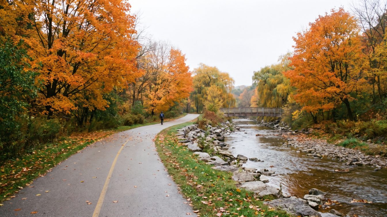
My top five trails in Etobicoke are the Humber River Recreation Trail (one of Toronto’s longest, along a Canadian Heritage River), the Waterfront Trail (mostly asphalt, from Humber Bay Park to Marie Curtis Park), the Etobicoke Creek trail through Etobicoke Valley Park (links the lake to the creek valley), the Mimico Creek valley at West Deane Park (an urban green corridor) and the Humber Arboretum trails in north Etobicoke. The order is my judgement, not an official ranking.
How I chose these five
Etobicoke is shaped by water. Three river and creek valleys, the Humber River, Mimico Creek and Etobicoke Creek, run south through it to Lake Ontario, and the Waterfront Trail ties their mouths together. I picked one trail experience from each of those corridors, plus the lakeshore and one quieter northern option.
I used City of Toronto and Toronto and Region Conservation Authority (TRCA) pages for the facts, plus the Great Lakes Waterfront Trail’s own guide. I left out park-specific picks already covered in my Top 5 Parks in Etobicoke post.
- Connected: each trail links to a larger valley or lakeshore system.
- Documented: described on a City, TRCA or Waterfront Trail page.
- Useful for residents: a realistic walk, run or ride from Etobicoke homes.
The order is my judgement, not an official ranking.
1. Humber River Recreation Trail
What it offers
The Humber River trail is Etobicoke’s backbone trail. The City of Toronto describes the Humber River Recreation Trail as one of Toronto’s longest trails, following the river with many access points, including James Gardens.
The river itself has unusual status. TRCA notes that the Humber is the only Canadian Heritage River in the Greater Toronto Area, designated in 1999, and that its watershed of about 90,258 hectares is the largest in TRCA’s jurisdiction.
History along the way
TRCA also points to the Toronto Carrying Place Trail, a historic route along the Humber used by Indigenous peoples and later travellers, which it describes as one of the oldest established transportation routes in Canada. Walking the valley, you are following a corridor people have used for a very long time.
Practical notes
- Access: many entry points along the valley; James Gardens is one the City names.
- Accessibility: the City notes that some sections are on-road and have accessibility barriers, so check the route if you use a wheelchair or stroller.
- Best for: long runs and rides, and residents of The Kingsway, Humber Valley Village and the Old Mill area.
If you only learn one Etobicoke trail, learn this one. It is the trail most likely to become part of your weekly routine if you live on the east side of Etobicoke.
2. Waterfront Trail, Etobicoke section
What it offers
The Waterfront Trail is the lakeshore link that ties south Etobicoke together. The Great Lakes Waterfront Trail’s guide describes the Toronto trail surface as largely asphalt, routed along quiet residential streets in the west.
It names three Etobicoke staging areas: Humber Bay Park on Waterfront Drive off Lake Shore Boulevard West, Colonel Samuel Smith Park on Lake Shore Boulevard West at Kipling Avenue, and Marie Curtis Park on Lakeshore Road East, east of Dixie Road.
One stretch to watch
The guide flags about 2 km from Royal York Road to Park Lawn Road along Lake Shore Boulevard, where there is parking on both sides and heavier traffic, and asks cyclists to take care. If you ride with kids, that is the section to plan around.
Practical notes
- Start points: Humber Bay Park, Colonel Samuel Smith Park or Marie Curtis Park.
- Surface: mostly asphalt, per the Waterfront Trail guide.
- Nearby stop: the Humber Bay Butterfly Habitat, which the City describes as native plants designed to support butterflies.
- Best for: Humber Bay Shores, Mimico, New Toronto and Long Branch residents.
Followed east, the same route continues past the city’s downtown waterfront.
3. Etobicoke Creek and Etobicoke Valley Park
What it offers
The Etobicoke Creek trail is the western edge of the city and the best choice for a longer, quieter valley walk in south Etobicoke. The City of Toronto describes a trail in Etobicoke Valley Park that follows Etobicoke Creek and connects to Marie Curtis Park and the Lake Ontario waterfront.
The Waterfront Trail guide adds that the Etobicoke River Trail meets the Waterfront Trail at Marie Curtis Park and connects north to the Greenbelt Route in Caledon.
The bigger picture
TRCA says the Etobicoke Creek watershed covers about 22,404 hectares and is the westernmost in its jurisdiction. The creek starts in the Town of Caledon, in the Greenbelt, and flows south through Brampton and Mississauga before entering Lake Ontario in Toronto. TRCA also runs an annual Bike the Creek event in the watershed.
Practical notes
- Start point: Marie Curtis Park at the lake, or Etobicoke Valley Park.
- Connections: the Waterfront Trail at the mouth, and north toward Caledon via the creek route.
- Best for: Long Branch and Alderwood residents.
TRCA invites people to report salmon sightings along Etobicoke Creek, which is a fun thing to look for with kids in the fall.
4. Mimico Creek valley
What it offers
Mimico Creek is the middle valley, smaller and more urban than the other two, and it is where many central Etobicoke residents get their closest green walk. TRCA says the watershed covers about 7,709 hectares, with the creek’s mouth on the Toronto waterfront between Humber Bay Parks East and West.
TRCA completed bank stabilization and trail realignment work in West Deane Park in 2017, which is a good sign that the valley trail there is maintained.
What to expect
Set expectations accordingly. TRCA says about 89 per cent of the Mimico Creek watershed was urban as of 2020, with natural cover of only 7.4 per cent, and that water quality is generally poor. This is a green corridor through a built-up area, not a wilderness walk.
Practical notes
- Where to start: West Deane Park, or the creek mouth between Humber Bay Parks East and West.
- Trail naming: the TRCA watershed page does not name a single continuous Mimico Creek trail, so check the City’s bikeway map before planning a long route.
- Best for: short daily walks for residents of central Etobicoke and Mimico.
For a dog walk or an after-dinner loop, a nearby green corridor matters more than a famous trail.
5. Humber Arboretum trails
What it offers
The Humber Arboretum is the north Etobicoke pick. The City of Toronto lists it among the city’s featured trails and natural areas, with trails running south and north along the Humber River, operated in partnership by the City, TRCA and Humber College.
Why it is different
Most Etobicoke trail lists lean heavily on the lakeshore. The Arboretum gives north Etobicoke residents a trail system that ties into the same Humber valley without driving south to the lake. Because it is run with a college, it also has a teaching and nature-education side that a typical city park does not.
Practical notes
- Connection: trails link along the Humber River, per the City.
- Before you go: when I checked in late October 2026, the Humber Arboretum web page was temporarily offline due to a Humber IT security issue, so confirm hours and parking with Humber College (416-675-3111) before visiting.
- Best for: nature walks, birding and families in north Etobicoke.
It is also a useful reminder that Etobicoke stretches well north of the Gardiner, and that north Etobicoke buyers have their own green options.
The five at a glance
| Trail | Part of Etobicoke | Character | Connects to |
|---|---|---|---|
| Humber River Recreation Trail | East (Kingsway, Old Mill, Humber valley) | Long river valley trail, some on-road sections | James Gardens, Lake Ontario |
| Waterfront Trail | South (Humber Bay to Long Branch) | Mostly asphalt, lakeshore and quiet streets | Humber Bay Park, Colonel Samuel Smith Park, Marie Curtis Park |
| Etobicoke Creek trail | Southwest (Long Branch, Alderwood) | Creek valley | Marie Curtis Park, north toward Caledon |
| Mimico Creek valley | Central and south | Urban green corridor | West Deane Park, Humber Bay Parks |
| Humber Arboretum trails | North | Nature trails | Humber River |
Trail etiquette worth knowing
The City of Toronto asks cyclists and other wheeled users not to exceed 20 km/h in parks, to keep right, pass on the left only when safe, and ring a bell or call out when approaching. Cyclists must yield to pedestrians, and dogs must be leashed in parks and on trails except in designated off-leash areas.
What this means if you’re buying or selling in Etobicoke
Trail access is one of the strongest everyday lifestyle features in Etobicoke, and it varies a lot from street to street. A home that backs onto a ravine or sits a few minutes from a valley entrance offers something you cannot add later.
If you want the Humber, look at The Kingsway and the streets around the Old Mill. If you want the lake and the Waterfront Trail, look south at Humber Bay Shores, New Toronto and Long Branch. Long Branch and Alderwood also sit close to the Etobicoke Creek valley.
Ravine-adjacent homes come with homework. Ask whether the lot is within TRCA-regulated areas, since that can affect additions, pools and tree removal, and check the TRCA flood information for the watershed. TRCA names South Mimico among the flood-vulnerable clusters in the Mimico Creek watershed, so buyers there should ask specific questions about past water issues.
If you are selling a home near a trail entrance, give buyers the actual walking time and route in the listing. Start with my home valuation page if you want to see what that access is worth on your street.
Free tool — AI home value estimator
Instant Home Valuation
What’s your home
worth today?
Answer six quick questions and get an instant value range built from current Toronto & GTA sale data — property type, size, condition, lot and location all weighted the way a real pricing conversation weighs them. Takes about ninety seconds.
Reading recent GTA sale data…
Building your estimate
Estimated market value
—
$0–$0
Most likely value $0 · roughly $0 per square foot
What moved the number
Starting from the area baseline for your property type, here’s what each answer added or subtracted.
Market context
Recent local averages for comparison.
—
A range is a starting point.
A strategy is what sells.
This model doesn’t know that your neighbour’s identical semi went $80,000 over asking last month, or which two upgrades actually pay back in your area. That conversation is free and takes twenty minutes.
Frequently asked questions
What is the longest trail in Etobicoke?
The City of Toronto describes the Humber River Recreation Trail as one of Toronto’s longest trails. It follows the Humber River with many access points, including James Gardens. The City notes that some sections are on-road and have accessibility barriers, so check your route if you use a wheelchair or stroller.
Where does the Waterfront Trail start in Etobicoke?
The Great Lakes Waterfront Trail guide lists three Etobicoke staging areas: Humber Bay Park on Waterfront Drive, Colonel Samuel Smith Park at Lake Shore Boulevard West and Kipling Avenue, and Marie Curtis Park on Lakeshore Road East, east of Dixie Road. The surface is largely asphalt.
Can you bike from Etobicoke to Caledon on a trail?
The Waterfront Trail guide says the Etobicoke River Trail meets the Waterfront Trail at Marie Curtis Park and connects to the Greenbelt Route in Caledon. Etobicoke Creek itself starts in Caledon and flows through Brampton and Mississauga before reaching the lake in Toronto, according to TRCA.
Do dogs have to be on a leash on Etobicoke trails?
Yes. The City of Toronto says dogs must be on a leash in parks and on trails, except in designated off-leash areas, and owners must pick up after them. The City also asks cyclists to keep to 20 km/h or less in parks and to yield to pedestrians.
Is Mimico Creek clean enough to swim or fish in?
TRCA says water quality in Mimico Creek is generally poor, which limits swimming and fishing. About 89 per cent of the watershed was urban as of 2020, with natural cover of only 7.4 per cent. The valley is best treated as a green walking corridor rather than a place to get in the water.
Sources
- Trails — City of Toronto
- Humber River — Toronto and Region Conservation Authority
- Etobicoke Creek — Toronto and Region Conservation Authority
- Mimico Creek — Toronto and Region Conservation Authority
- Toronto — Great Lakes Waterfront Trail
- Park and Trail Rules and Etiquette — City of Toronto
Related reading
- Top 5 Farmers’ Markets in West Toronto, Including Winter Markets (2026)
- Top 5 Waterfront Parks in the West GTA, Etobicoke to Oakville (2026)
- Top 5 Coffee Shops in Mimico and Humber Bay Shores (2026)
- Top 5 Parks in Etobicoke
About the author — Jatin Dua, Toronto and GTA real estate broker
I am Jatin Dua, Broker of Record and co-founder of RE/MAX Quantum Realty Inc., Brokerage, Unit 101, 799 The Queensway, Toronto. I work with buyers and sellers across Toronto and the GTA and have helped more than 100 families sell. Four-plus years of active GTA transactions and over $100 million in sales volume. Every figure here comes from a published table, regulator or statute linked in the sources, so you can check all of it without asking me.
Reach me at [email protected] or 833-330-1925, or book a call.