
Published 7 September 2026 · Updated 29 September 2026 · By Jatin Dua, Broker of Record, RE/MAX Quantum Realty
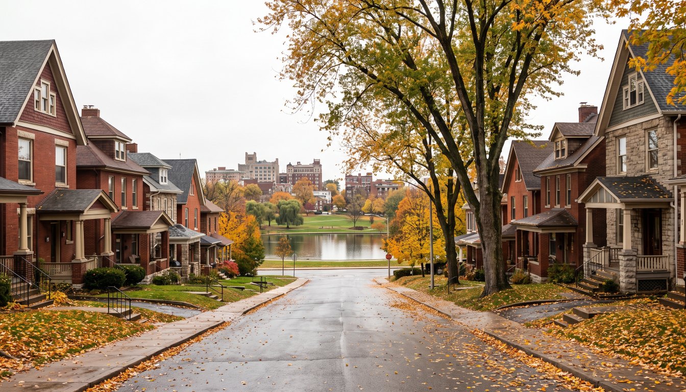
Swansea is bounded by the Humber River west, Bloor Street north, High Park east and Lake Ontario south. It was subdivided as “Windermere” by the 1880s, industrialised with the Swansea Works bolt factory from 1889, incorporated as its own village in 1926, joined Metro Toronto in 1953 and the City of Toronto in 1967. Most houses date from 1905 to 1935, on land 30 to 40 feet above lake level.
High Park North runs from Bloor Street south to Annette Street north, Runnymede Road west to the Weston rail corridor east. It was subdivided from farm and racetrack land by Daniel Clendenan in 1882, with most homes built after the First World War and apartment towers following the Bloor–Danforth subway in the 1960s and 1970s.
Swansea: a village between two permanent boundaries
Swansea sits between the Humber River to the west and High Park to the east, with Bloor Street north and Lake Ontario south. Neither of its long boundaries can be built on. That is unusual, and it is the structural reason the neighbourhood holds its position.
| Year | Event |
|---|---|
| By the 1880s | Subdivided as “Windermere” |
| 1889 | Swansea Works bolt factory begins operating |
| 1890 | Land donated for Swansea Public School |
| 1905–1935 | Most of the housing stock built |
| 1926 | Incorporated as a village, splitting from York Township |
| 1953 | Joins Metro Toronto |
| 1967 | Becomes part of the City of Toronto |
The land sits 30 to 40 feet above lake level, and the neighbourhood contains Grenadier Pond.
High Park North
Bounded by Bloor Street south, Runnymede Road west, Annette Street north and the Weston GO rail corridor east. Daniel Clendenan subdivided the land — formerly farm and racetrack — in 1882, though most homes were built after the First World War.
The stock is Victorian, Edwardian and Tudor, in two and three storey detached brick, frequently with leaded glass. Apartment towers arrived in the 1960s and 1970s following the Bloor–Danforth subway. A notable landmark is 63 Jerome Street, a 1925 fourplex recorded as the first Canadian building by a Canadian-trained female architect, Jean Hall.
What park frontage is actually worth
A view or frontage onto a large public park is one of very few genuinely permanent outlooks available anywhere in a city. Unlike a view over a low-rise site, it is not waiting for a rezoning. That permanence is the same quality buyers pay for on a ravine lot in Rosedale or from a Yorkville unit overlooking a heritage district — and it is worth checking, address by address, exactly what is protected and what merely happens to be low-rise today.
A century-old housing stock
Most of Swansea was built between 1905 and 1935. That means, on a typical property:
- Original or partially replaced electrical, with knob-and-tube a live possibility
- Plumbing of mixed vintage, potentially including a lead water service line
- Foundations not designed for a modern rear addition
- Ceiling heights that are what they are
- A century of alterations, not all of them permitted
None of that is a reason not to buy. It is a reason for a thorough inspection and a careful review of permit history.
Where it sits in the market
The west end of Toronto as a whole recorded 31 sales above $3 million between January and April 2026 — roughly comparable to York Region’s 35. Swansea and High Park sit within that group alongside The Kingsway, Baby Point, Humber Valley Village and the Old Mill area.
The practical takeaway
Buy the boundaries. The Humber, the park and the lake are permanent in a way that almost nothing else in a city is, and they are the reason this pocket holds. Then inspect the house on the assumption that it is a hundred years old, because it usually is.
Frequently asked questions
Was Swansea really its own village?
Yes. Swansea incorporated as a village in 1926, splitting from York Township, joined Metro Toronto in 1953 and became part of the City of Toronto in 1967. It contains Grenadier Pond and sits on land 30 to 40 feet above lake level.
What are the boundaries of High Park North?
Bloor Street to the south, Runnymede Road to the west, Annette Street to the north and the Weston GO rail corridor to the east.
When were the houses built?
Swansea’s housing stock is mostly from 1905 to 1935. High Park North was subdivided by Daniel Clendenan in 1882 with most homes built after the First World War, in Victorian, Edwardian and Tudor two and three storey detached brick, often with leaded glass. Apartment towers followed the Bloor–Danforth subway in the 1960s and 1970s.
What does park frontage do to value?
A view or frontage onto a large public park is one of the few genuinely permanent outlooks available in a city, because parkland cannot be redeveloped. That permanence is what buyers pay for, in the same way they pay for a ravine or a heritage streetscape.
Is there an architectural landmark in the area?
63 Jerome Street, a 1925 fourplex in High Park North, is recorded as the first Canadian building by a Canadian-trained female architect, Jean Hall.
What should a buyer check here?
Elevation and drainage given the 30 to 40 foot rise above the lake, ravine protected area status toward the Humber and the park edges, tree inventory under Chapter 813, and the age and systems of a housing stock that is now roughly a century old.
Thinking about buying or selling at the top end?
Send me the address, or the shortlist you are considering. I will tell you what the property is actually worth today, what the land is worth without the house, what the transfer tax and carrying costs will be, and whether the deal makes sense. Confidential, always.
[email protected] · 833-330-1925 · Book a free consultation
Confidential. Read personally and answered within 24 hours. I never share, sell or distribute your information.
Related reading
- What a view is actually worth in a Toronto condo
- West Toronto vs North Toronto luxury: two different kinds of money
- Buying a ravine lot in Toronto: what the bylaw does to your plans
- Toronto’s luxury neighbourhoods compared
Sources
Everything above that is a rule, a rate or a published number comes from these. Verify anything that matters to your own deal.
- City of Toronto — Municipal Code Chapter 658, Ravine and Natural Feature Protection
- City of Toronto — Municipal Code Chapter 813, Trees
- RE/MAX Canada — 2026 Spotlight on Luxury Real Estate, Greater Toronto
About the author — Jatin Dua, Broker of Record
I’m the Broker of Record at RE/MAX Quantum Realty, 799 The Queensway in Etobicoke, and I work with buyers, sellers and investors across Toronto and the west GTA. A large part of my work sits in the upper end of the market, where the comparables are thin, the rules are heavier and the cost of a wrong number is measured in hundreds of thousands of dollars.
The free estimators on this site are mine. I built them because the first question every owner asks is “what is it worth?” and the honest answer starts with a number you can check yourself. [email protected] or 833-330-1925.