

Published 26 September 2026 · By Jatin Dua, Broker of Record, RE/MAX Quantum Realty
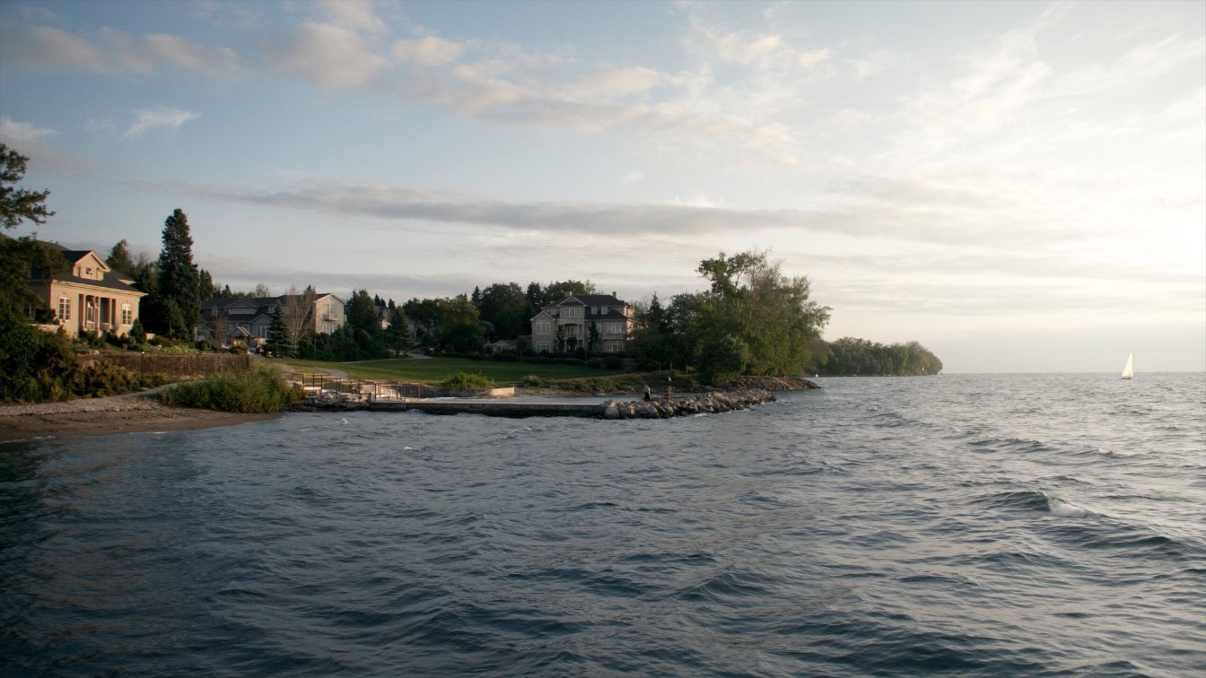
West Oakville’s lakefront runs from Burloak Drive at the Burlington line, past Shell Park and South Shell Waterfront Park, through Bronte village and its harbour at the mouth of Twelve Mile Creek, and east to Coronation Park. It is a mix of post-war houses being replaced one by one with custom builds, a small number of true lakefront lots, and Town-owned parkland that frames the shore. Two rule sets govern a rebuild: Oakville’s Zoning By-law 2014-014, whose residential zones were renamed and amended in June 2026 and whose -0 overlay caps floor area at 33 to 65 percent of the lot depending on size, and Conservation Halton’s hazard setback of 30 metres plus a stable slope from the shoreline. Bronte GO is on Wyecroft Road, a drive from the water. Price lakefront lots, near-lakefront houses and the streets behind them as three markets.
The shore, west to east
Oakville’s western boundary with Burlington is Burloak Drive, and the first thing east of it on the water is parkland: Shell Park at 3307 Lakeshore Road West, 20.6 hectares of rose gardens, sports fields and a dog park, and South Shell Waterfront Park at 3450 Lakeshore Road West, 2.8 hectares of naturalized shoreline that is an important migratory bird stopover. East of the parks the residential streets begin, running to Bronte village, where Twelve Mile Creek, also called Bronte Creek, reaches the lake through the harbour.
Bronte was founded in 1834 as a fishing village and named for Horatio Nelson, Duke of Bronte. Its harbour was completed in 1856; more than 40 schooners worked out of it in the stone-hooking trade, iron-hulled vessels were built there in the 1850s and 29 boats came out of the Northern Shipbuilding yard between 1945 and 1954. Bronte was annexed by Oakville in 1962. East of the creek the shore continues through Bronte Heritage Waterfront Park, 7.8 hectares with 212 parking spaces, to Coronation Park at 1426 Lakeshore Road West, 9.6 hectares with a splash pad, volleyball courts and a stage.
The Bronte bluffs and the heritage landscape
The Town designated the Bronte Harbour and Bluffs as a cultural heritage landscape: about 8.6 hectares comprising the inner harbour, the bluffs and Berta Point. The Town bought the bluff land for a park in 1976 and in 1988 relocated Sovereign House, a circa-1825 home where the author Mazo de la Roche lived from 1911 to 1914, to Bronte Bluffs Park as a museum. For an owner near the harbour that designation shapes what the Town will do with the public land around you; it does not designate private houses. Individual properties may carry their own designation under the Ontario Heritage Act, so check the Town’s register for any address you are considering.
What the Town owns and how it protects it
The Town of Oakville owns more than eight kilometres of Lake Ontario shoreline, protects it with armour stone walls, revetments, groynes, cobble beaches and concrete walls, and assesses those shorelines every five years. That matters to a private owner in two ways. First, your neighbour on one or both sides may be the Town, with an engineered shoreline that either shelters your lot or reflects wave energy toward it. Second, the Town’s own approach, armour stone and revetments rather than vertical walls, is the standard Conservation Halton will expect from you.
Conservation Halton at the edge
Every lakefront lot here is in Conservation Halton’s regulated area under Ontario Regulation 41/24. The flooding hazard is the 100-year flood level plus 15 metres for wave uprush; the erosion hazard is 30 metres plus a long-term stable slope allowance, the 30 metres representing 0.3 metres a year over a century; and the regulated area extends 15 metres beyond the furthest of the hazards. Replacement of an existing house inside the hazard is addressed specifically in Conservation Halton’s policies and is not automatic. Shoreline protection must leave five metres of maintenance access and is assessed over a 35-year design life. Oakville’s Official Plan says it plainly: the delineation and regulation of hazard lands, including the long-term stable top of bank, is administered by the conservation authority, not the Town.
Oakville’s zoning after June 2026
Zoning By-law 2014-014 covers all of Oakville south of Dundas Street. On 15 June 2026 the Town adopted By-law 2026-088, which renamed and amended the Residential Low zones. The current zones are R1 to R6: R1 requires a minimum lot of 1,350 square metres and 30 metres of frontage, R3 450 square metres and 15 metres, R4 250 and 11, R6 for detached houses 270 and 9. The -0 overlay that governs most of the mature lakefront neighbourhoods caps the residential floor area ratio on a sliding scale from 65 percent on lots under 350 square metres down to 33 percent on lots of 1,450 square metres or more, limits height to 10 metres with a sloped roof or 8 metres flat, and prohibits balconies above the first storey.
Two consequences for a buyer. Anything you read about “RL1-0” lot minimums is quoting the pre-June-2026 by-law. And the largest lakefront lots get the smallest floor-area ratio, which is the point: the Livable Oakville plan requires new houses to be compatible in scale, height, massing and character with the surrounding neighbourhood. There is no lakefront-specific zoning provision; the shoreline constraints come entirely from Conservation Halton.
Bronte GO and the commute
Bronte GO at 2104 Wyecroft Road opened in 1967 on the Lakeshore West line and has 2,424 parking spaces. It is a drive from the lakefront streets. West Oakville is a car-first waterfront in a way Port Credit and Long Branch are not, and for many buyers here that is fine; for a daily rail commuter it is the trade-off to price in.
How to price west Oakville lakefront
Three tiers. True lakefront lots on the water are a thin market priced against each other over two or three years, adjusted for frontage, shoreline condition and permits, the Conservation Halton setback, whether the house is a keeper or a teardown, and what the -0 ratio allows on that lot size. Near-lakefront houses within a walk of Coronation Park or Bronte harbour are priced against each other as Oakville houses of that size and age with a location premium. Everything north toward Rebecca Street is an Oakville house. West Oakville lakefront generally trades below Old Oakville’s heritage lakefront and above Burlington’s eastern shore for comparable lots, but the honest answer for any single lakefront lot is a range with reasons. Read the Old Oakville guide for the other end of town.
The takeaway
West Oakville’s lakefront is a working harbour village flanked by Town parks, with post-war lots being rebuilt under a zoning by-law renamed in June 2026 and a conservation setback that decides where a new house may sit. Check the -0 floor-area ratio for the lot size, get Conservation Halton’s view on the setback in writing, look at what the Town has built on either side of you, and price the three tiers separately.
Where I fit
I work the western shoreline from Etobicoke to Burlington and I can show you a west Oakville lakefront lot, a Bronte harbour house and a Burlington Lakeshore Road property on the same afternoon so the trade-offs are concrete. Run the estimator below on your current home, or book a call.
Free tool — AI home value estimator
Instant Home Valuation
What’s your home
worth today?
Answer six quick questions and get an instant value range built from current Toronto & GTA sale data — property type, size, condition, lot and location all weighted the way a real pricing conversation weighs them. Takes about ninety seconds.
Reading recent GTA sale data…
Building your estimate
Estimated market value
—
$0–$0
Most likely value $0 · roughly $0 per square foot
What moved the number
Starting from the area baseline for your property type, here’s what each answer added or subtracted.
Market context
Recent local averages for comparison.
—
A range is a starting point.
A strategy is what sells.
This model doesn’t know that your neighbour’s identical semi went $80,000 over asking last month, or which two upgrades actually pay back in your area. That conversation is free and takes twenty minutes.
Frequently asked questions
Where are the lakefront houses in west Oakville?
Between Burloak Drive and Coronation Park, on the residential streets that reach the water west and east of Bronte harbour. Much of the shore itself is Town parkland: Shell Park, South Shell Waterfront Park, Bronte Heritage Waterfront Park and Coronation Park.
Did Oakville change its residential zoning in 2026?
Yes. By-law 2026-088, adopted 15 June 2026, renamed and amended the Residential Low zones of Zoning By-law 2014-014; they are now R1 to R6. Older references to RL1 to RL11 are out of date.
What is the -0 overlay in Oakville zoning?
A set of rules for mature neighbourhoods that caps floor area on a sliding scale from 65 percent of the lot on small lots to 33 percent on lots of 1,450 square metres or more, limits height to 10 metres sloped or 8 metres flat, and prohibits balconies above the first storey.
Can I rebuild on a west Oakville lakefront lot?
Subject to the zoning and, more importantly, Conservation Halton’s hazard setback of 30 metres plus a stable slope allowance from the shore. Pre-consult with Conservation Halton before buying with a rebuild in mind.
Is Bronte GO within walking distance of the lake?
No. Bronte GO is at 2104 Wyecroft Road, a drive from the lakefront streets.
Is Bronte a heritage district?
The Bronte Harbour and Bluffs are designated as a cultural heritage landscape covering public land around the inner harbour, bluffs and Berta Point. Private houses are not part of that designation, though individual properties may be designated separately.
How does the Town protect its own shoreline?
With armour stone walls, revetments, groynes, cobble beaches and concrete walls along more than eight kilometres it owns, assessed every five years.
Sources
- Town of Oakville — Zoning By-law 2014-014 — By-law 2026-088 amendment
- Town of Oakville — Zoning By-law 2014-014 Part 6, Residential Zones (consolidated June 2026) — R1–R6 minimums, -0 overlay
- Town of Oakville — Shoreline management — 8 km owned, protection methods
- Town of Oakville — Destination parks — park sizes and addresses
- Town of Oakville — Notice of intention to designate Bronte Harbour and Bluffs cultural landscape — landscape designation, harbour history
- Conservation Halton — Policies and Guidelines (amended June 2024) — hazard definitions
- Livable Oakville Official Plan — Part D, Land Use — compatibility and hazard lands policies
Related reading
- What $1.5 million buys on the GTA waterfront
- The Oakville, Burlington and Hamilton waterfront at every budget
- Bronte Harbour, Oakville: living on the lake
- Southeast Oakville lakefront estates
- Old Oakville lakefront homes
- Teardown or renovate on a lakefront lot
- Conservation permits on shoreline property
About the author — Jatin Dua, Toronto and GTA real estate broker
I am Jatin Dua, Broker of Record and co-founder of RE/MAX Quantum Realty Inc., Brokerage, Unit 101, 799 The Queensway, Etobicoke. I work with buyers and sellers across Toronto and the GTA, with deep local knowledge of the west end and the Lake Ontario shoreline. Four-plus years of active GTA transactions and over $100 million in sales volume. Every market figure here comes from TRREB’s published tables and every rule from the regulator or the legislation, so you can check all of it without asking me.
Reach me at connect@jatindua.com or 833-330-1925, or book a call.