
Published 7 September 2026 · Updated 29 September 2026 · By Jatin Dua, Broker of Record, RE/MAX Quantum Realty
What's Your Home Worth Right Now?
Get a free AI-powered price range for your property in under 90 seconds, based on recent GTA comparable sales. No name or address required.
Get My Free Estimate →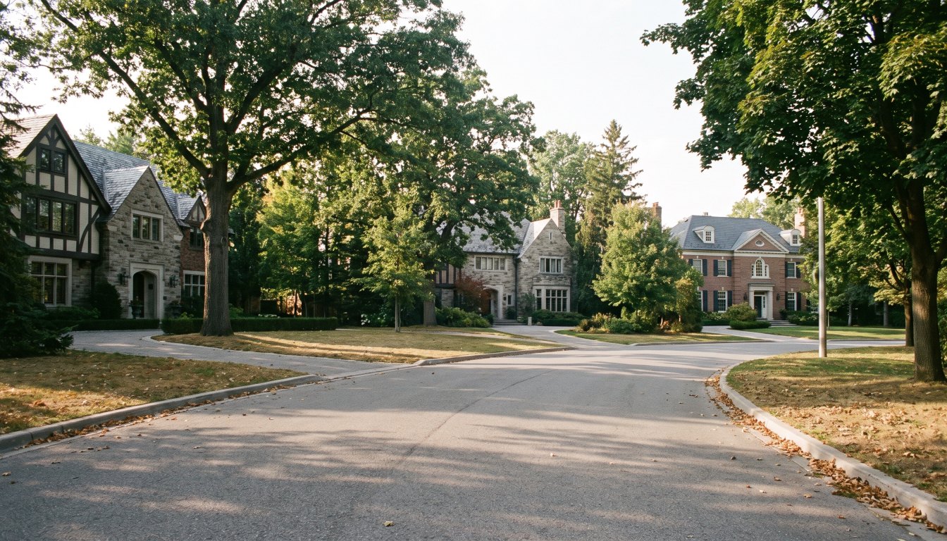
You are buying land in permanently fixed supply. The City neighbourhood is Bridle Path–Sunnybrook–York Mills, bounded by The Bridle Path to the north, Sunnybrook Health Sciences Centre to the south, Bayview Avenue to the west and Wilket Creek to the east. The minimum lot size is two acres and typical parcels run two to four acres — unusual anywhere in the City of Toronto.
It was farmland until the Bayview Bridge opened in 1929, and the area was subdivided into roughly fifty lots at $25,000 each in the 1950s. That fixed supply is why the largest publicly reported GTA transaction of 2025 — $27,325,000 for 20 and 22 Park Lane Circle — was two adjoining properties bought together. When someone wants more land here, the only way to get it is to buy next door.
The facts
| City neighbourhood | Bridle Path–Sunnybrook–York Mills |
| Boundaries | The Bridle Path (north), Sunnybrook Health Sciences Centre (south), Bayview Avenue (west), Wilket Creek (east) |
| Minimum lot size | Two acres |
| Typical parcel | Two to four acres |
| Access opened | Bayview Bridge, 1929 |
| First house | 1929, at 2 The Bridle Path |
| Subdivision | Roughly fifty lots, 1950s, at $25,000 each |
| Heritage district | Not among Toronto’s designated HCDs |
| $3M+ sales, Jan–Apr 2026 | 14 |
How it came to exist
The land was farmland until the Bayview Bridge opened in 1929 and made it reachable. The first house went up that year at 2 The Bridle Path. E.P. Taylor bought land here in 1937, and his estate later became the Canadian Film Centre. In the late 1940s George Montegu Black Jr. imposed private restrictions on development, and in the 1950s the area was subdivided into roughly fifty lots priced at $25,000 each.
That last sentence is the whole neighbourhood. Fifty lots, seventy years ago, on a two-acre minimum, inside a city of nearly three million people.
What has happened to the houses
The original stock was substantially mid-century modernist, by architects including James A. Murray, Jerome Markson, Brook & Banz, and Seligman & Dick. Most of it has been replaced. Because the area is not covered by a Heritage Conservation District plan, demolition and rebuilding here are governed by zoning, the tree bylaw, and ravine and conservation authority rules where they apply — not by heritage compatibility requirements.
The practical consequence is that the land, not the building, is what the market prices. Almost every purchase at this level contemplates either a rebuild or a substantial renovation.
The record sales, and what they show
- $27,325,000 — 20 and 22 Park Lane Circle, North York, two adjoining properties sold together. The largest publicly reported GTA transaction of 2025.
- 93 The Bridle Path — listed at $28.8 million and sold within three weeks in 2020; the final price was not disclosed.
- A Bridle Path property was offered under power of sale at $22.8 million in November 2025, having previously been listed at $29.8 million in June 2024 and then $25 million.
Read those three together. The first is a land assembly. The second is a correctly priced property that sold immediately. The third is what ambitious pricing does even here.
The market, in numbers
RE/MAX counted 14 sales above $3 million in Bridle Path–Sunnybrook–York Mills between January and April 2026 — behind Rosedale and Lawrence Park at 20 each, ahead of Forest Hill South at 11 and Kingsway South at 9. Fourteen sales in four months, in the most expensive residential enclave in the country.
What a buyer should verify
- The survey, and how much of the acreage is table land rather than slope.
- Ravine protected area mapping under Chapter 658.
- TRCA regulated area status under O. Reg. 41/24, since clearance precedes any building permit.
- A tree inventory of everything 30 centimetres or more in trunk diameter.
- The zoning envelope for the specific address.
- Land transfer tax, which at $10,000,000 in Toronto is $721,450 in cash on closing.
The practical takeaway
The Bridle Path is a land market with houses on it. Buy on the acreage, the table land and what you are permitted to build, and treat the existing house as a variable rather than the point. Fourteen sales in four months means the choice set is tiny and the diligence has to be done fast and properly.
Frequently asked questions
What is the minimum lot size on the Bridle Path?
Two acres, with typical parcels running from two to four acres. The neighbourhood was subdivided into roughly fifty lots at $25,000 each in the 1950s, and that supply has not increased.
What are the boundaries of the Bridle Path?
The City neighbourhood Bridle Path–Sunnybrook–York Mills is bounded by The Bridle Path to the north, Sunnybrook Health Sciences Centre to the south, Bayview Avenue to the west and Wilket Creek to the east.
Is the Bridle Path a heritage conservation district?
It does not appear among Toronto’s designated Heritage Conservation Districts. In practice that means rebuilding is constrained by zoning, the ravine bylaw where applicable, TRCA regulation where applicable and the tree bylaw, rather than by a heritage district plan — which is part of why so much of the original 1950s and 1960s housing stock has been replaced.
How many $3 million-plus homes sell there?
RE/MAX recorded 14 sales above $3 million in Bridle Path–Sunnybrook–York Mills between January and April 2026, behind Rosedale and Lawrence Park at 20 each and ahead of Forest Hill South at 11.
What was the highest sale in the area?
The largest publicly reported GTA transaction of 2025 was $27,325,000 for 20 and 22 Park Lane Circle in North York — two adjoining properties sold together. Separately, 93 The Bridle Path was listed at $28.8 million and sold within three weeks in 2020, with the final price undisclosed.
What should a buyer check here specifically?
The survey and the amount of table land versus slope, ravine protected area mapping under Chapter 658, TRCA regulated area status under O. Reg. 41/24, and a count of trees 30 cm or more in trunk diameter — because most purchases here contemplate building.
Thinking about buying or selling at the top end?
Send me the address, or the shortlist you are considering. I will tell you what the property is actually worth today, what the land is worth without the house, what the transfer tax and carrying costs will be, and whether the deal makes sense. Confidential, always.
[email protected] · 833-330-1925 · Book a free consultation
Confidential. Read personally and answered within 24 hours. I never share, sell or distribute your information.
Related reading
- Lot frontage, depth and shape: the quiet driver of luxury home value
- Toronto’s record home sales: what the biggest deals tell you
- Toronto’s luxury neighbourhoods compared
- Buying a ravine lot in Toronto: what the bylaw does to your plans
Sources
Everything above that is a rule, a rate or a published number comes from these. Verify anything that matters to your own deal.
- RE/MAX Canada — 2026 Spotlight on Luxury Real Estate, Greater Toronto
- Canadian Mortgage Professional — 2025 most expensive GTA home sales, ranked
- Bridle Path, Toronto — neighbourhood history and lot sizes
- City of Toronto — Municipal Code Chapter 813, Trees
About the author — Jatin Dua, Broker of Record
I’m the Broker of Record at RE/MAX Quantum Realty, 799 The Queensway in Etobicoke, and I work with buyers, sellers and investors across Toronto and the west GTA. A large part of my work sits in the upper end of the market, where the comparables are thin, the rules are heavier and the cost of a wrong number is measured in hundreds of thousands of dollars.
The free estimators on this site are mine. I built them because the first question every owner asks is “what is it worth?” and the honest answer starts with a number you can check yourself. [email protected] or 833-330-1925.