

Published 25 September 2026 · By Jatin Dua, Broker of Record, RE/MAX Quantum Realty
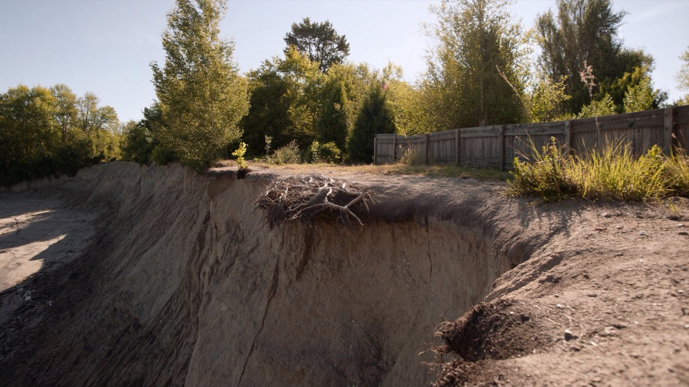
On a Lake Ontario lot the legal boundary and the physical shoreline are two different lines that drift apart over time. Where the water gradually and imperceptibly recedes and adds land, the new land generally accrues to the upland owner. Where the water gradually takes land, the owner generally loses it; the boundary follows the water’s edge. Land created by dumping fill into the lake belongs to the Crown, not to whoever dumped it. Any wall, revetment or armour stone to slow the loss needs a conservation authority permit under Ontario Regulation 41/24 before a municipal permit, and the cost is the owner’s. A buyer should commission a current survey that locates the water’s edge and top of bank, compare it with the previous survey, and price the lot on what is there now and what is likely to remain.
Two lines, not one
Every lot has a legal description — metes and bounds or a reference plan — that was accurate on the day it was surveyed. On an inland lot, that description stays true indefinitely. On a lakefront lot, one of the boundaries is a moving body of water, and the law has had to decide what happens when the water moves.
The short version, which applies across the common-law provinces: where the boundary is the water’s edge and the water moves gradually and imperceptibly, the boundary moves with it. Land added by that slow process (accretion) goes to the upland owner. Land removed by it (erosion) is lost by the upland owner. A sudden, dramatic change — a storm that reshapes a beach overnight — is treated differently and can leave the old boundary in place, which is one of several reasons this area produces litigation.
What the Province owns
Under Ontario’s Beds of Navigable Waters Act, the bed of a navigable lake or river belongs to the Crown unless a specific grant says otherwise. Lake Ontario is navigable. So the lakebed in front of your house is the Province’s, and the boundary between your land and the Crown’s is, in the ordinary case, the water’s edge.
That leads to the fill rule. If an owner pushes soil or rubble into the lake to make a bigger backyard, the new land was created on Crown-owned bed by an act rather than by nature. It belongs to the Crown. It is also, almost certainly, unpermitted shoreline work under conservation authority regulations. Any listing that says a lot was “extended” should prompt a title and permit search, not admiration.
The shore road allowance complication
Along many Ontario waterways the original Crown patent reserved a 66-foot (20-metre) strip along the water as a shore road allowance. Where that allowance was never closed and conveyed to the adjoining owner, the upland lot does not reach the water at all; there is a strip of Crown or municipal land between it and the lake, and the erosion question becomes the Crown’s or the municipality’s rather than the owner’s. Where the allowance has been closed and sold, the owner holds to the water and the accretion and erosion rules above apply to them. Read who owns the beach for how to check which situation you are in.
Slowing the loss: what you may build, and who decides
Owners on eroding shorelines want to armour them: revetments of armour stone, gabion walls, concrete seawalls, groynes. Every one of those is shoreline work within a conservation authority’s regulated area, and under Ontario Regulation 41/24 — in force since 1 April 2024 — it needs a permit from the authority before any municipal permit. On the GTA shoreline that means TRCA in Toronto, Pickering and Ajax; Credit Valley Conservation in Mississauga and Oakville east of Bronte; Conservation Halton in Oakville and Burlington; and Central Lake Ontario Conservation in Whitby and Oshawa. Work in the water may also need federal approval under fisheries legislation.
The authority will ask whether the work protects only your lot or transfers the erosion to your neighbour’s, which hardened shorelines frequently do. It may require an engineered design. It will not pay for it. Shoreline protection is the owner’s cost, and its life is finite. Read what conservation permits allow before you assume a wall is an option.
What a buyer should demand
- A current survey, with the surveyor instructed to locate the water’s edge on the day and the top of bank where there is one, and to note the distance from each to the dwelling.
- The previous survey, from the seller or the registry, for comparison. The difference over the years between them is the lot’s own erosion rate.
- The conservation authority’s mapping showing the regulated area and any hazard setback.
- Permits for any existing shoreline protection, stairs, decks or structures near the edge.
- A title search that answers the shore road allowance question and reveals any water lot.
- An insurance quote on the exact address; erosion and earth movement are excluded from standard policies and some insurers decline at-risk lots entirely.
Read how surveys and title insurance work in Ontario; on a shoreline lot the survey is not a formality.
Pricing a lot that is getting smaller
The market is bad at this. Two lots on the same street with the same view can have very different futures: one on an armoured, stable section with 30 metres to the top of bank, one on an unprotected section that has lost a metre a decade. The first deserves the lakefront premium. The second is a house with a view that will one day need a wall the owner pays for, or a setback that means it can never be rebuilt. Price the second against inland comparables with a view allowance, not against the first.
If you are the seller of an eroding lot, be honest in the listing and price to it. A buyer who discovers the erosion during their survey will walk or renegotiate; a buyer who discovers it after closing may sue.
The takeaway
On the lakefront your boundary is a moving line. Gradual loss is yours; gradual gain is yours; fill is the Crown’s. Protecting the shore needs a conservation permit and your own money. Before buying, get a current survey that marks the water and the bank, compare it with the last one, pull the conservation mapping and the permits, resolve the shore road allowance on title, and get an insurance quote. Then price the lot on what will still be there in twenty years.
Where I fit
I am a real estate broker, not a lawyer or surveyor, and on a shoreline lot I will tell you exactly which of those you need and when. What I do is make sure the survey, the mapping and the permits are in hand before you waive, and price the lot on what is really there. Run the estimator below on your current home, or book a call.
Free tool — AI home value estimator
Instant Home Valuation
What’s your home
worth today?
Answer six quick questions and get an instant value range built from current Toronto & GTA sale data — property type, size, condition, lot and location all weighted the way a real pricing conversation weighs them. Takes about ninety seconds.
Reading recent GTA sale data…
Building your estimate
Estimated market value
—
$0–$0
Most likely value $0 · roughly $0 per square foot
What moved the number
Starting from the area baseline for your property type, here’s what each answer added or subtracted.
Market context
Recent local averages for comparison.
—
A range is a starting point.
A strategy is what sells.
This model doesn’t know that your neighbour’s identical semi went $80,000 over asking last month, or which two upgrades actually pay back in your area. That conversation is free and takes twenty minutes.
Frequently asked questions
If the lake erodes my land, do I still own it?
Generally no. Where the boundary is the water’s edge and the water moves gradually, the boundary moves with it. Land lost to gradual erosion is lost by the upland owner; land gained by gradual accretion is gained by them. Sudden changes are treated differently and can be litigated.
Can I fill in part of the lake to enlarge my lot?
No. The lakebed belongs to the Province under the Beds of Navigable Waters Act, land created by fill belongs to the Crown, and the work would need a conservation authority permit that is unlikely to be granted for that purpose.
Who approves a seawall or armour stone on Lake Ontario?
The local conservation authority under Ontario Regulation 41/24 — TRCA, Credit Valley Conservation, Conservation Halton or Central Lake Ontario Conservation depending on the municipality — before any municipal permit. In-water work may also need federal fisheries approval.
Who pays for shoreline protection?
The property owner. Conservation authorities regulate and may require engineered designs; they do not fund private shoreline works.
What should a survey show on a lakefront lot?
The water’s edge on the survey date, the top of bank where there is one, and the distance from each to the house. Compare it with the previous survey to see how much has changed.
Does insurance cover erosion damage?
Standard Canadian home insurance excludes earth movement, which includes erosion and landslide. Some insurers will not write a policy on an at-risk shoreline lot. Get a quote on the exact address before waiving conditions.
What is a shore road allowance?
A 66-foot strip along many Ontario waterways reserved to the Crown in the original patent. If it was never closed and conveyed, the upland lot does not reach the water and the owner lacks full riparian rights. A title search shows whether it applies.
Sources
- Beds of Navigable Waters Act, R.S.O. 1990, c. B.4 — Crown ownership of navigable lakebeds
- HGR Graham Partners LLP — Cottage property issues: know your water rights — shore road allowance, accretion and fill rules
- Ontario Regulation 41/24 — Prohibited Activities, Exemptions and Permits — conservation authority permits for shoreline work
- TRCA — Three ways that water has shaped the Scarborough Bluffs — erosion mechanisms
- Conservation Ontario — Find your conservation authority — jurisdiction by municipality
Related reading
- Niagara-on-the-Lake waterfront homes
- Port Hope and Cobourg lakefront homes
- Riverfront and ravine lots in the GTA
- Stoney Creek Lakefront Homes
- Shoreline Protection on Lake Ontario
- How to Price a Lakefront House in the GTA When There Are No Comparables
- Hamilton Beach Strip and Burlington Beachway
- Who owns the beach? Riparian rights in Ontario
- Conservation permits on shoreline property
- Scarborough Bluffs: buying on the edge
- Surveys, SRPRs and title insurance
- Encroachments and possessory claims
About the author — Jatin Dua, Toronto and GTA real estate broker
I am Jatin Dua, Broker of Record and co-founder of RE/MAX Quantum Realty Inc., Brokerage, Unit 101, 799 The Queensway, Etobicoke. I work with buyers and sellers across Toronto and the GTA, with deep local knowledge of the west end and the Lake Ontario shoreline. Four-plus years of active GTA transactions and over $100 million in sales volume. Every market figure here comes from TRREB’s published tables and every rule from the regulator or the legislation, so you can check all of it without asking me.
Reach me at connect@jatindua.com or 833-330-1925, or book a call.