

Published 26 September 2026 · By Jatin Dua, Broker of Record, RE/MAX Quantum Realty
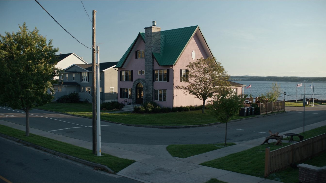
East of downtown Burlington, Lakeshore Road runs for kilometres as a leafy residential street of large houses, parks and a few older apartment buildings, with true lakefront lots on the south side and the 1920s subdivisions of Roseland and Shoreacres behind them. The shore here is low shale and clay, armoured in places and open in others; at the Oakville border Burloak Waterfront Park has a Queenston shale cliff with a bank swallow colony. Every lot at the water is inside Conservation Halton’s regulated area, where the erosion setback is 30 metres plus a stable-slope allowance and the flood line is the 100-year level plus 15 metres. There is no Roseland heritage conservation district, whatever a listing implies; Burlington’s only HCD covers 33 properties on Burlington Avenue and Ontario Street. Burlington GO and Appleby GO are on Fairview Street, a drive from the lake, and there is no municipal land transfer tax.
The street and the surveys behind it
Lakeshore Road east of Brant Street is one of the longest continuous residential lakefront streets in the GTA: a mix of lakefront houses, parkland and a handful of older apartment buildings running toward Burloak Drive. The neighbourhoods behind it were laid out in the 1920s. The Roseland Park survey dates to 1923 and the Hillcrest survey to 1925, and developer W.D. Flatt’s lakefront surveys included Pine Cove, Crystal Beach, Rosehill and Shore Acres. The houses that followed were English cottage, Tudor, Georgian colonial and Arts and Crafts on lots typically 50 to 100 feet wide, with the largest along Lakeshore Road itself.
The Shore Acres estate is now Paletta Lakefront Park: land bought in 1912 by Cyrus Birge, a house built around 1929 to 1931 by his daughter, and purchased by the City in 1990. It is the clearest surviving example of what the lakefront was built to be, and of what has become public since.
What the shore is made of
Burlington’s open-lake shoreline is low: shale and clay banks rather than the high bluffs of Scarborough or Stoney Creek. At the Oakville line, Burloak Waterfront Park has more than 800 metres of shoreline and a Queenston shale cliff that hosts one of the largest bank swallow nesting colonies on the western lake. Elsewhere the edge is a mix of private armour stone, concrete walls and open bank. In May 2019, as the lake approached its 2017 peak, the east-side trail at Paletta Park closed and Conservation Halton reported shoreline erosion near Shoreacres Creek; the floating docks at LaSalle Park on the harbour side were pulled out. Low shore does not mean safe shore; it means the water arrives sideways rather than from below.
Conservation Halton’s rules at the edge
The whole Lake Ontario and Hamilton Harbour shoreline in Burlington is in Conservation Halton’s regulated area under Ontario Regulation 41/24. Its policies, last amended in June 2024, define the hazards a buyer must understand:
| Hazard | How Conservation Halton defines it |
|---|---|
| Flooding | The 100-year flood level plus a 15-metre allowance for wave uprush |
| Erosion | A 30-metre erosion allowance (0.3 m a year over 100 years) plus a long-term stable slope allowance |
| Dynamic beach | The flooding hazard plus a further 30 metres where beach deposits exist |
| Regulated area | Everything within 15 metres of the furthest landward of those three |
New development is generally prohibited in the hazard unless engineering justifies it; habitable structures need flood-free access and dry passive floodproofing; shoreline protection needs a five-metre unobstructed maintenance access and is assessed over a 35-year design life. Conservation Halton posts a Shoreline Hazard Watch when the static lake level is between 75.5 and 75.9 metres and a Warning above 75.9. Its regulated-area mapping is public online. Check the lot before you check the kitchen.
Windows to the lake
Burlington has a policy most shoreline cities lack: street ends that reach the water are kept as small public parks, which the City calls windows to the lake. Three were renewed recently, at Walkers Line in 2023 and 2024, at Appleby Place in 2024 with shoreline reconstruction and a retaining wall, and at Green Street in 2025. For an owner two houses from a window, that is a public path beside your fence and a guaranteed sliver of view. For the market it means the lake is never entirely private here, and it means the City is spending on shoreline structures next to private lots, which is worth knowing when you assess your own.
The heritage question, answered
Listings and neighbourhood guides sometimes describe Roseland as a heritage district. It is not. Burlington’s Municipal Cultural Heritage Register lists one heritage conservation district, Burlington Avenue and Ontario Street, whose plan was approved on 2 March 2026 under By-law 08-2026 and covers 33 properties on Burlington Avenue, Ontario Street and Elgin Street, near downtown and not on the eastern lakeshore. Individual houses elsewhere may be designated or listed under the Ontario Heritage Act, and the province’s Bill 23 deadline requires Burlington to complete designations of listed properties by January 2027, so check the register for the specific address. A designated house limits demolition and exterior change; an undesignated one in Roseland does not carry district rules.
Transit and taxes
Burlington GO at 2101 Fairview Street and Appleby GO at 5111 Fairview Street are both north of the lakeshore neighbourhoods on the rail corridor, with 2,273 and 2,422 parking spaces. From a Lakeshore Road house they are a drive. Burlington charges no municipal land transfer tax; only the provincial Ontario tax applies, which at lakefront prices is a material saving against a Toronto purchase.
How to price a Burlington lakefront house
Separate the true lakefront lots on the south side of Lakeshore Road from the Roseland and Shoreacres houses behind them. The first are a small market priced against other lakefront sales over two or three years, adjusted for frontage, shoreline condition and permits, the Conservation Halton setback, and whether an insurer will write it. The second are large-lot Burlington houses with a lake a short walk away, priced against each other. The lots that have lost buildable depth to the erosion allowance are worth less than their size suggests, and the ones with an engineered, permitted shoreline and room to rebuild are worth more. Read how to price a lakefront house for the method.
The takeaway
Burlington’s eastern lakeshore is a long, established residential shore with 1920s bones, low shale and clay edges, public windows to the water and no municipal land transfer tax. Every lot at the edge is governed by Conservation Halton’s 30-metre erosion allowance and 100-year flood line, there is no Roseland heritage district, and the GO stations are a drive. Price lakefront and near-lakefront as two markets and get the setback in writing.
Where I fit
I sell across the western GTA shoreline and I compare Burlington lakefront against Oakville and Mississauga for buyers who want a house rather than a tower. If you own on Lakeshore Road and want to know what the setback and the shoreline do to your price, run the estimator below for a baseline, or book a call.
Free tool — AI home value estimator
Instant Home Valuation
What’s your home
worth today?
Answer six quick questions and get an instant value range built from current Toronto & GTA sale data — property type, size, condition, lot and location all weighted the way a real pricing conversation weighs them. Takes about ninety seconds.
Reading recent GTA sale data…
Building your estimate
Estimated market value
—
$0–$0
Most likely value $0 · roughly $0 per square foot
What moved the number
Starting from the area baseline for your property type, here’s what each answer added or subtracted.
Market context
Recent local averages for comparison.
—
A range is a starting point.
A strategy is what sells.
This model doesn’t know that your neighbour’s identical semi went $80,000 over asking last month, or which two upgrades actually pay back in your area. That conversation is free and takes twenty minutes.
Frequently asked questions
Is Roseland in Burlington a heritage conservation district?
No. Burlington’s only heritage conservation district is Burlington Avenue and Ontario Street, approved in March 2026 and covering 33 properties. Individual houses in Roseland may be designated or listed; check the City’s heritage register for the address.
Who regulates the Burlington lakeshore?
Conservation Halton, under Ontario Regulation 41/24, for both the Lake Ontario shore and the Hamilton Harbour side. Its erosion hazard is 30 metres plus a stable-slope allowance and its flood hazard is the 100-year level plus 15 metres.
Can I rebuild a house on a Burlington lakefront lot?
Only outside Conservation Halton’s hazard setback, which may leave less depth than the lot size suggests. Pre-consult with Conservation Halton before buying with a rebuild in mind.
What are Burlington’s windows to the lake?
Small public parks at street ends that reach the water. Walkers Line, Appleby Place and Green Street were renewed between 2023 and 2025.
Is there a GO station near Burlington’s lakefront houses?
Burlington GO and Appleby GO are on Fairview Street north of the lakeshore neighbourhoods; both are a drive from Lakeshore Road.
Does Burlington have a municipal land transfer tax?
No. Only the provincial Ontario land transfer tax applies. Toronto is the only Ontario municipality with its own land transfer tax.
What is the Burlington shoreline made of?
Low shale and clay banks, armoured in places. At Burloak Waterfront Park on the Oakville line there is a Queenston shale cliff with a large bank swallow colony.
Sources
- Conservation Halton — Policies and Guidelines for the Administration of the Conservation Authorities Act and O. Reg. 41/24 (amended June 2024) — hazard definitions, design life
- Conservation Halton — Lake Ontario shoreline status — watch and warning thresholds
- City of Burlington — Windows to the Lake — renewal projects
- City of Burlington — Municipal Cultural Heritage Register — single HCD
- Heritage Burlington — Shore Acres Estate (Paletta Mansion) — estate history
- Burlington Cultural Map — Burloak Waterfront Park — shale cliff, bank swallows
- Global News, 30 May 2019 — High water levels, Burlington — 2019 erosion and closures
Related reading
- What $2 million buys on the GTA waterfront
- What $3 million buys on the GTA waterfront
- The Oakville, Burlington and Hamilton waterfront at every budget
- Burlington lakefront condos
- Aldershot and North Shore Boulevard
- West Oakville lakefront homes
- Teardown or renovate on a lakefront lot
- How to price a lakefront house in the GTA
About the author — Jatin Dua, Toronto and GTA real estate broker
I am Jatin Dua, Broker of Record and co-founder of RE/MAX Quantum Realty Inc., Brokerage, Unit 101, 799 The Queensway, Etobicoke. I work with buyers and sellers across Toronto and the GTA, with deep local knowledge of the west end and the Lake Ontario shoreline. Four-plus years of active GTA transactions and over $100 million in sales volume. Every market figure here comes from TRREB’s published tables and every rule from the regulator or the legislation, so you can check all of it without asking me.
Reach me at connect@jatindua.com or 833-330-1925, or book a call.