
Published 1 September 2026 · Updated 29 September 2026 · By Jatin Dua, Broker of Record, RE/MAX Quantum Realty
What's Your Home Worth Right Now?
Get a free AI-powered price range for your property in under 90 seconds, based on recent GTA comparable sales. No name or address required.
Get My Free Estimate →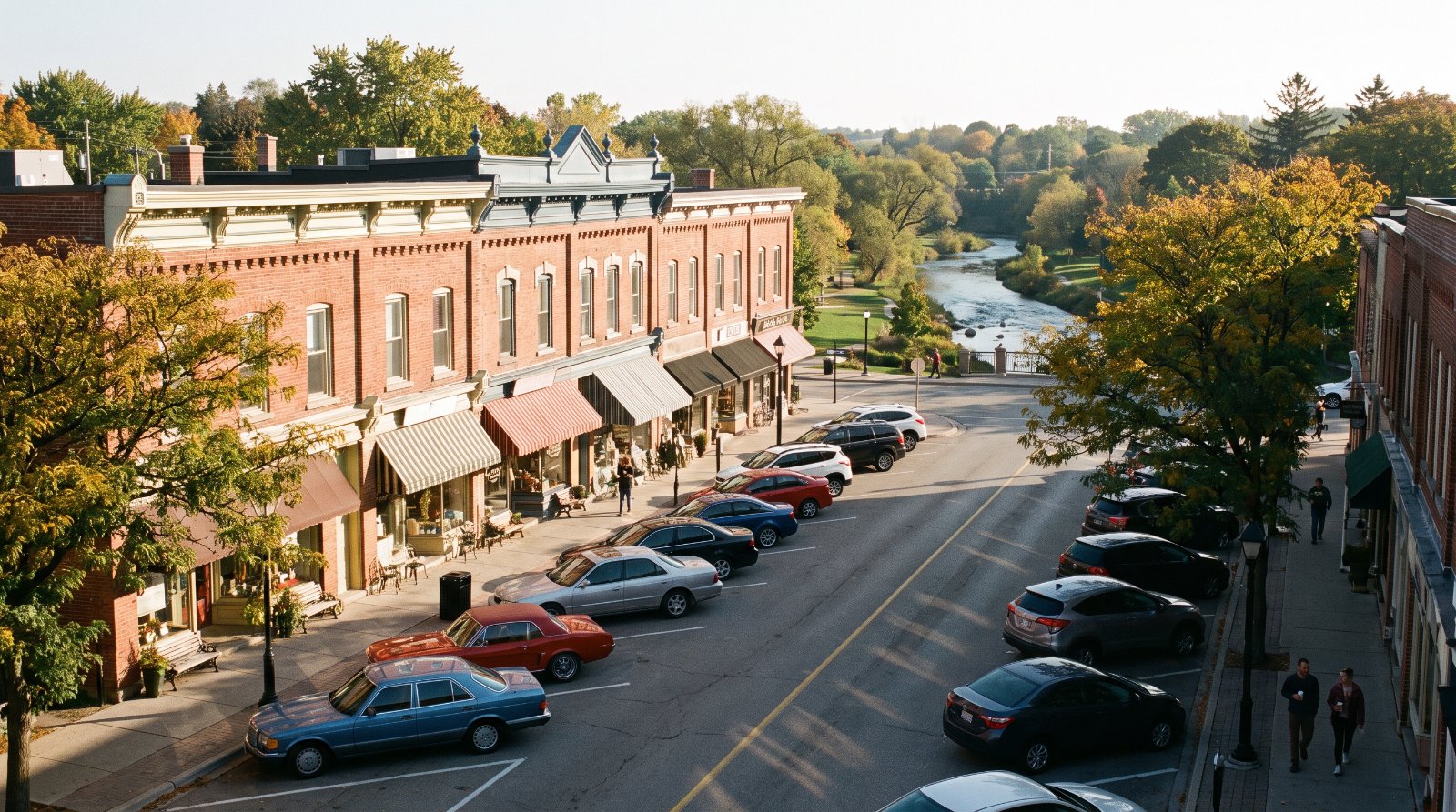
The ten things buyers in Streetsville are least often told, all of them documented. The village is a Heritage Conservation District — designated by By-law 0234-2024 and governed by a Plan adopted by By-law 0235-2024, both passed by Council on 11 December 2024 under Part V of the Ontario Heritage Act, City file CS.08.STR — and almost everything written about Streetsville before 2025 describes a village that was merely “listed,” which is a different legal animal. Inside the district, on a contributing property, the HCD Plan says demolition of a building “shall not be permitted.” The district is 181 properties — 105 contributing, 76 other — and 94 of them front Queen Street South. The Official Plan caps the Mixed Use main street at three storeys and requires a minimum of two, and forbids setting a building back more than 3.0 metres from the street. Queen Street South is frozen at a basic two-lane cross-section by Official Plan policy between Britannia Road West and the railway. Streetsville GO is a Planned Major Transit Station Area, not a Protected one — the only one of Mississauga’s three Milton-line stations missing from Table 11-1 — so there is no minimum density target, no inclusionary zoning and parking minimums still apply, while Metrolinx forecasts the station’s home-station ridership to fall from 2,675 to 2,225 daily riders by 2041 and contemplates removing 360 of its 1,541 parking spaces. Live applications propose roughly 3,466 units in a census tract that held 3,053 dwellings in 2021. By my own mapping, 52 of 177 heritage district addresses — 29.4 per cent — sit inside the Credit Valley Conservation regulated area. Mississauga’s tree by-law bites at 15 centimetres with fines of $2,500 per tree, and still defines a “Heritage Tree” as one designated under Part IV only. And there is no municipal land transfer tax here — about $26,475 saved at closing on a $1.5M purchase against Toronto — but Mississauga’s 2026 residential tax rate of 1.087901 per cent is 41.8 per cent above Toronto’s, which repays that saving in about five and a half years on equal assessed value.
None of that is an argument against buying here. Streetsville is the best-preserved historic main street in Mississauga and the heritage district is the reason it will still look like this in twenty years. It is an argument for buying here with the by-law open.
Every item is traced to a primary source — a by-law, a corporate report to a Council committee, an Official Plan chapter, a conservation authority dataset, a transit agency station report, a school board planning document — and each is listed at the bottom with the date I read it, 31 August 2026. Six figures on this page are my own arithmetic, not published statistics, and each is labelled where it appears: the street-by-street tally of the 181 properties in Appendix C of the HCD Plan and the 105 contributing / 76 other split, which I extracted and counted from the Plan’s own property list; the finding that 52 of 177 heritage district addresses (29.4 per cent) fall inside Credit Valley Conservation’s regulated area, which is my point-in-polygon test of City address points against CVC’s published Generic Regulations Limit and is an address-point test, not a parcel test; the 3,466 proposed units, which is my sum of the unit counts recorded in the City’s own active-applications dataset, and its ratio to the 3,053 dwellings the 2021 Census counted in tract 0550.02; the 16.8 per cent forecast fall in home-station ridership at Streetsville GO, which is my percentage of Metrolinx’s own 2,675 and 2,225 figures; and both tax calculations — the $26,475 land transfer tax and the 41.8 per cent rate gap and 5.5-year break-even — which I built band by band from the published provincial, Mississauga and Toronto rate tables. Recompute them before you rely on them, and verify four things independently for your own address: the district boundary on Schedule “A” to By-law 0234-2024, whether your specific parcel is regulated by CVC, the current status of the appealed development applications, and the current tax rates. Nine things I deliberately left off because I could not source them properly: any Ontario Land Tribunal case number, hearing date or outcome for the Streetsville development appeals, because I could not obtain one; any Mississauga Committee of Adjustment approval rate, because the City publishes none and no dataset exists — and Toronto’s figure does not transfer; any claim about who owns the Milton rail corridor, because no Metrolinx or provincial document I read states it; a specific in-force date for the heritage district by-law, because the notice gives an appeal deadline and no document I found records the outcome; rainfall totals or flooded-property counts for the 2024 storms; a utilisation percentage for Streetsville Secondary School, and any Dufferin-Peel capacity figure; any median income, dwelling value or tenure split for Streetsville, because Statistics Canada publishes a census tract, not a village; the Streetsville BIA’s boundary and levy; and block-specific height numbers read off a zoning map, because the maps are images and I read the policy text. I will publish those when I can cite them.
Streetsville is the one part of Mississauga that reads as a town rather than a suburb: a two-lane main street with nineteenth-century storefronts on it, a river at the bottom of the hill, a flour mill still operating, and a GO station on the Milton corridor. It is also, as of very recently, one of the most tightly regulated pieces of ground in the city — and the regulation that matters most arrived quietly, in a December 2024 Council meeting, without most owners noticing.
A definition note before the list, because it changes what the documents say. Streetsville now sits under three overlapping frameworks. It is a Growth Node and a Neighbourhood Character Area under Mississauga Official Plan 2051, which was adopted by Council on 16 April 2025 and approved with modifications by the Province on 24 March 2026; every chapter now carries that footer date. It is a Heritage Conservation District under Part V of the Ontario Heritage Act. And parts of it are inside Credit Valley Conservation’s regulated area — CVC, not the TRCA; this is the Credit River watershed, and the conservation authority that governs the Humber and the Don has no jurisdiction here. Which of those three applies to your address decides almost everything below. Two terminology traps: the current term is Streetsville Growth Node, not “Community Node,” which is old-plan language still appearing in 2025 staff reports; and unlike Port Credit and Lakeview, Streetsville has no Local Area Plan. Its entire policy framework is about three pages of Chapter 14, one page of Chapter 15, and a run of Special Sites in Chapter 17.
1Council designated Streetsville a Heritage Conservation District on 11 December 2024 — almost everything written before 2025 says otherwise
This is the finding that reframes every other fact about the village, and the City’s own report admits the confusion in terms: “Many believe that Streetsville is already an HCD.” Until December 2024 it was not. Now it is.
Two by-laws did it, both passed by Council on the same day. By-law 0234-2024 designated the district; By-law 0235-2024 adopted the Heritage Conservation District Plan that governs it. The City’s Notice of Passing gives the authority as “Section 41.1 of the Ontario Heritage Act, R.S.O., 1990, c.O.18, Part V” and the operative words of the by-law are these:
“That the area outlined by a heavy dashed line shown on the map attached as Schedule ‘A’ hereto and forming part of this by-law is hereby designated as the Streetsville Heritage Conservation District.” — “ENACTED AND PASSED this 11th day of December 2024.”
| Field | What the Notice of Passing states |
|---|---|
| Designating by-law | BL-0234-2024, passed by Council 11 December 2024 |
| Plan by-law | BL-0235-2024, passed by Council 11 December 2024 |
| City file number | CS.08.STR, Ward 11 |
| Statutory authority | Section 41.1, Ontario Heritage Act, Part V |
| Date of notice | 15 January 2025 |
| Last date to file an appeal | 14 February 2025 |
| Appeal of the Plan by-law | “There is no general ability to appeal the Streetsville Heritage Conservation District Plan By-law 0235-2024” |
One conflict on the record, and I am flagging it rather than smoothing it over. The by-law was passed 11 December 2024. But Mississauga Official Plan 2051, Chapter 6, page 6-7, says the city has three heritage conservation districts: “Meadowvale Village, designated in 1980 and Ontario’s first Heritage Conservation District, Old Port Credit Village, designated in 2004, and Streetsville, designated in 2025.” The likely explanation is that the by-law came into force after the 14 February 2025 appeal deadline passed — but I did not find a document that says so, and I could not confirm whether any appeal was filed. So I use the date on the face of the by-law: designated by By-law 0234-2024, passed 11 December 2024. I do not assert an in-force date, and neither should anyone quoting this page. If that date matters to your transaction, ask the City Clerk in writing.
Why the City did it is the second under-reported half of this story, and it is not sentiment. It is Bill 23. The corporate report from the Commissioner of Community Services dated 7 November 2024, item 9.1 to the Heritage Advisory Committee meeting of 26 November 2024, says it in the executive summary:
“Over 120 properties in Streetsville have had some measure of recognition/protection, known as ‘heritage listing’ since the 1970/80/90s” — “The Province’s More Homes Built Faster Act, implemented in 2023, has brought an expiry date to this ‘Heritage Register’ status” — “As such, if Streetsville’s Heritage character is to be conserved, it must be designated under the Ontario Heritage Act.”
The background section is blunter still: “Due to the 2023 More Homes Built Faster Act, this protection will no longer be available to properties currently listed on the City’s Heritage Register as of 2027, as heritage listing will only be permitted on a temporary basis.” The consultants — MHBC Planning with +VG Architects, Wendy Shearer Landscape Architecture and Archeoworks — concluded that “only part of the study area, approximately two hundred properties, meets the current now more stringent criteria.” The project was funded through capital project 21491 with a budget of $250,000, all 600 owners in the study area were mailed directly, and across three surveys with 311, 194 and 159 participants, more than 80 per cent supported the district.
The scale of what was rescued shows up in the City’s earlier Heritage Register Review report of 14 April 2023: staff identified 375 properties that might meet the designation criteria, broken into “priority (122), secondary (22) and those included in the Streetsville Core (231)” — and then noted that “The Streetsville properties will be addressed through the Streetsville HCD, leaving 144 individual properties across the City to research and review.” The same report costs out what other municipalities were doing: Mississauga $75,000 of existing staff time for 144 properties plus the Streetsville district; the City of Toronto $1.7 million and 17 new heritage planners to review roughly 3,000 properties.
If you do want to challenge a designation like this one, the notice sets out the price: an appeal to the Tribunal within 30 days after the date of publication of the notice, an OLT filing fee of $1,100.00 per application with “a reduction to $400.00 may be requested at the time of filing,” plus a City processing fee of $328.88 per application under the User Fees and Charges By-law.
How to read this as a buyer. If a listing, a brochure, a blog post or an agent tells you Streetsville is a “heritage-listed village” or a “cultural heritage landscape,” that description expired in December 2024. Ask one question before you write an offer on anything between the rail line and the river: is this address inside the boundary on Schedule “A” to By-law 0234-2024? The answer changes what you may do to the building, what studies you will pay for, and in one important case — the next item — whether you may take it down at all.
2On a contributing property, demolition “shall not be permitted” — and every property in the district is designated
Start with the sentence most owners inside the boundary have never read. HCD Plan §2.1, on classification of properties:
“Every property located within the Streetsville Heritage Conservation District, either privately or publicly owned, is designated under Part V of the Ontario Heritage Act. As a result, all properties must comply with the policies of this HCD Plan.”
There is no opt-out and no grandfathering. The Plan then splits the district in two. A contributing property is one “whose age, history, or physical features are significant and/or contribute to the identified character of the District,” which the Plan says “may include both older buildings that are of historic interest, as well as more recent buildings that are of a scale, type and built form that contributes”. An other property has “physical features that do not substantially add to the identified heritage character.” Then comes §2.5.1(a):
“The demolition of buildings and structures on contributing properties shall not be permitted.”
The exceptions in §2.5.1(b) are narrow and expensive. Demolition may be considered only where a Heritage Impact Assessment determines that “the heritage integrity of the structure has been lost”; or where demolition is required by “natural disaster”; or where “public health and safety is considered to be compromised and the City of Mississauga Chief Building Official has received structural assessment advising that a building or structure is beyond repair and has been determined to be unsafe” — and that structural assessment “must be prepared by a professional engineer with expertise and experience in heritage buildings (such as a full member of the Canadian Association of Heritage Professionals).” Before that, under §2.5.1(d), the owner must demonstrate that “all other options have been investigated including: preservation; rehabilitation; restoration; retro-fitting; re-use; mothballing” and that none is feasible. And what replaces it is constrained too: §2.5.1(c) says the new building “shall not be designed as an attempt to re-create the building which was removed/demolished… Any new design should not attempt to falsify history through the creation of a period-accurate design.” If nothing is built within two years of that submission, or a longer agreed period “in no case greater than 5 years,” the provisions of the Ontario Heritage Act apply again.
Even on an other property, demolition is not free. The Plan’s own preamble to §2.5.1 says demolition “will be actively discouraged… Regardless of whether or not the property is contributing, the demolition of existing buildings has the ability to impact the character of the District.”
Renovation is where most owners will actually meet this Plan, so here is what is exempt and what is not. §3.2.2 lists the work you may do on private property with no heritage permit at all:
| No heritage permit required | But a permit is required for |
|---|---|
| Anything inside. “The interiors of buildings or structures are not subject to regulation within the Heritage Conservation District.” | — |
| Roof materials replaced in kind | Replacing or removing original metal, slate, tile or wood shingle roofing with other materials |
| Eaves and downspouts replaced in the same material | A change of material |
| Solar panels in the same plane as the roof and not visible from the public realm | Freestanding, pole or frame-mounted panels visible from the public realm |
| Fencing in the rear yard and behind the mid-point of the side façade | Front-yard fencing, and side-yard fencing forward of that mid-point |
| Single-storey porches, verandahs and decks in the rear yard, away from views from the street | Front yard, or a street-abutting side yard |
| Stairs and steps replaced in kind, storm windows, screen doors, security and amenity lighting, street-number signs | — |
| Painting, and ongoing maintenance that does not significantly affect the outside appearance | Painting masonry that has not previously been painted; installing or removing any cladding visible from the public realm; cleaning any façade by sandblasting, chemical cleaning or pressurised water; even carrying out test patches; removing paint from masonry |
And then the catch-all, §3.3: “Generally, all work which has not been specifically identified as ‘exempt’… shall be required to submit a Heritage Permit Application under Part V of the Ontario Heritage Act,” though the requirement “may be scoped or waived by City staff, as deemed appropriate.”
Two further rules will surprise anyone planning an addition. §2.2.2.1: “Additions are not permitted on the front/principal façade, and shall be located at the rear and/or side of the building,” and “The height of the roof ridge in new additions shall not exceed the height of the ridge of the original building.” And §2.2.6 requires a Heritage Impact Assessment for all new buildings other than accessory buildings, on contributing and other properties alike, prohibits “replicas of historic buildings which falsify history,” prohibits “blank façades that interface with the street,” requires red brick and siding as the predominant cladding in residential areas, and states that “There shall be a presumption against stone (including split-faced stone cladding) given that it is not in-keeping with the character of the area.” The split-faced stone front that is standard on new Mississauga infill is, in Streetsville, presumptively refused.
On process, §3.5: a complete heritage permit application is either approved by staff under the Delegated Authority By-law or referred to the Heritage Advisory Committee, which recommends to City Council, who makes the final decision; applications “may be denied, approved, or approved with conditions,” and “Decisions on Heritage Permit Applications may be appealed to the Ontario Land Tribunal.” Under §3.5.1, Heritage Impact Assessments “are required to be submitted with Heritage Permit applications for the demolition of buildings and all new construction,” and are not required for alterations that comply with the Plan or for accessory structures under 10 m². Emergency work after a fire, flood, tornado or earthquake proceeds without a permit under §3.4, with before-and-after photographs supplied to the City.
How to read this as a buyer. If your plan for a Streetsville house is “knock it down and build new,” the classification of that property is not a detail — it is the whole deal. On a contributing property the answer is no, subject to exceptions that require a heritage engineer and the Chief Building Official. Get the property’s classification from the City in writing before the deposit goes hard, and price the studies: a Heritage Impact Assessment is mandatory for any new building, and the Plan also contemplates Conservation Plans, Cultural Heritage Documentation and Salvage Reports and Commemoration Plans.
3The district is 181 properties — and 94 of them front Queen Street South
Appendix C of the HCD Plan, at pages 123 to 131, is a table listing every property in the district and labelling each one Contributing or Other. It is the single most useful document in Streetsville and almost nobody has opened it.
The table below is my own calculation, not a published City statistic. Method, so you can check it: I extracted the Appendix C property list from the text layer of the HCD Plan PDF, matched every row of the form number · street name · Contributing or Other, and tallied by street. Total rows matched: 181 — consistent with the corporate report’s “approximately two hundred properties.”
| Street | Properties in the district | Address range in the list |
|---|---|---|
| Queen St S | 94 | 167 to 371 |
| Main St | 27 | 6 to 69 |
| Church St | 26 | 101 to 282 |
| Wyndham St | 11 | 176 to 207 |
| Mill St | 6 | 12 to 41 |
| Reid Dr | 5 | 10 to 27 |
| Maiden Lane | 3 | 6, 8, 24 |
| Thomas St | 2 | 7, 9 |
| Barbertown Rd, Bristol Rd W, Britannia Rd E, Britannia Rd W, Old Pine St, Ontario St E, Pearl St | 1 each | — |
| Total | 181 | — |
By classification, again my own count from the same extraction: 105 Contributing and 76 Other. And 94 of 181 — 51.9 per cent of the entire district — front Queen Street South, the great majority of them contributing. Streetsville’s heritage district is, functionally, Queen Street South plus the blocks around it.
The caveat that has to travel with those numbers. The authoritative boundary is the map at Schedule “A” of By-law 0234-2024 and Appendix A of the Plan — a raster image I did not read. My tally is derived from the property list, not from the boundary line, so do not treat it as a description of where the boundary runs. Note also that the corporate report’s “rail line to river valley to Britannia Road” describes the study area, which Council adopted in 2022; the district is a subset of it.
The Plan divides the district into four character areas — the Credit River Valley, the Former Residential Area East of Church Street, the Commercial Downtown Streetsville area, and the 19th to Early 20th Century Queen Street Residential Neighbourhood — grouped into three policy sets: Residential Lands, Commercial Lands, and Credit River & Valley Lands. It also protects three named views: the Credit River in either direction over the Main Street/Bristol Road crossing, and the river and mill infrastructure remnants south and east of the Main Street Bridge and of Ellen Street. Its statement of significance names Streetsville Heritage Hall at 327 Queen Street South and St. Andrew’s Church at 295 Queen Street South as landmarks, and lists among the attributes of the Queen Street residential area “narrow side-yard driveways leading to detached garages… and lack of attached garages having prominence along the street” and a “narrow street along Queen Street (2 lanes) with sidewalks on either side.”
Now the money consequence of the contributing / other split, which is the thing nobody mentions. HCD Plan §3.6: the City’s Designated Heritage Property Grant Program is available to properties designated under the Ontario Heritage Act, and “This includes properties which are ‘contributing’ in a Heritage Conservation District. Properties which are identified as ‘other’ in the Heritage Conservation District are not eligible.… Grants range from $500.00 to a maximum of $25,000.00.”
How to read this as a buyer. Two houses across the street from one another can carry the same permit burden and completely different access to money. A contributing property can apply for up to $25,000 of matching grant toward conservation work; an other property in the same district cannot apply at all, while still needing heritage permits for front-yard fencing, cladding, unpainted masonry and any new building. That asymmetry is worth real money over a decade of ownership, and it is decided by a label in an appendix.
4The main street is capped at three storeys — and has a two-storey minimum, and a 3.0 m setback ceiling
Most height rules in Mississauga are ceilings. Streetsville’s main street has a ceiling and a floor, and a rule about how close to the sidewalk you must build. Read Mississauga Official Plan 2051 §14.2.12.1.2 twice:
“For lands designated Mixed Use the permitted height of new buildings will be at least two storeys but not more than three storeys in height.”
A single-storey retail box is as non-conforming on Queen Street South as a four-storey building. And on the designations that carry the towers everywhere else in the city, §14.2.12.1.1 states: “For lands designated Residential Mid-Rise and Residential High-Rise a maximum building height of seven storeys is permitted.”
The zoning by-law says the same thing in numbers. Streetsville’s main street is zoned C4, which Zoning By-law 0225-2007 describes as “Mainstreet areas which are pedestrian-oriented and street-related retail areas.” From Table 6.2.1:
| C4 Mainstreet Commercial regulation | Value |
|---|---|
| Minimum height — sloped or flat roof | 2 storeys |
| Maximum height — sloped roof | 16.0 m and 3 storeys |
| Maximum height — flat roof | 12.5 m and 3 storeys |
| Minimum front yard | 0.0 m |
| Maximum front yard | 3.0 m |
| Minimum interior side yard, lot abutting a Residential Zone | 4.5 m |
| Parking and loading | “shall not be located between a streetwall and a lot line that is a street line” |
| Maximum length of streetwall set back beyond the maximum front yard | 30% |
| Residential uses permitted | Apartment; and a dwelling unit above the first storey of a commercial building |
That table is why Streetsville looks the way it does. It is not nostalgia and it is not the heritage plan — it is a zoning schedule that requires you to build at least two storeys, forbids you from setting the building back more than 3.0 metres from the street line, and forbids parking between the building face and the street.
The Official Plan reinforces it in words. §14.2.12.2.3: “Queen Street South will remain the focus of the commercial core.” §14.2.12.2.9: building additions “will not be more than three storeys in height”; new front setbacks “should match the setback of adjacent buildings so as to create a uniform street wall,” and “Where the building setbacks on either side are not equal, the lesser setback should be used.” §14.2.12.2.7 goes as far as the signs: “Hand painted wooden signs, projecting signs… and other signs which reflect late nineteenth or early twentieth century practices will be encouraged.”
Chapter 17 adds site-specific rules that are just as durable. Special Site 44, covering both sides of Queen Street South and stretches of Tannery, Broadway, Pearl and Thomas: “Notwithstanding the provisions of the Mixed Use designations, drive-through facilities will not be permitted.” The same prohibition reappears at Sites 47 and 174. Special Site 50 allows offices in the Queen Street South houses only if “The existing houses should be preserved, if at all possible,” additions are “largely confined to the rear,” parking is “only surface parking… in the rear yard only at grade without removal of existing trees, except at the discretion of the City arborist,” and “Existing lot sizes should be retained.”
And here is where the height actually is. The two tallest permissions anywhere in Streetsville are not in the village core at all: Special Site 174, on the west side of Queen Street South south of Britannia Road West, permits “an apartment dwelling with a maximum height of eight storeys with a maximum floor space index of 2.2”; Special Site 175, on the east side of Queen Street North north of Britannia Road West, permits “a maximum height of 10 storeys and a maximum floor space index of 3.1.” Both sit outside the historic core and outside the heritage district boundary.
One honest observation about a gap. Chapter 14’s heritage policy for Streetsville, §14.2.12.3.1, says only that “Heritage resources will include those properties listed on the City’s Heritage Register but, will not be restricted to the list” — it does not mention the HCD Plan. Chapter 15 does (§15.16.1.2: “There are heritage characteristics throughout Streetsville that are defined in the Streetsville Heritage Conservation District Plan”) and so does Chapter 6. The HCD plainly applies; Chapter 14 simply was not updated to cross-reference it. That is a drafting gap worth knowing about if you ever find yourself reading two City documents that seem to disagree.
5Queen Street South is legally frozen at two lanes — while thousands of units are proposed beside it
This is the buried lede on traffic in Streetsville, and it is one policy long. Mississauga Official Plan 2051 §14.2.12.4.1:
“The maximum pavement width of Queen Street South, from Britannia Road West to the St. Lawrence and Hudson Railway, will not exceed a basic two lane cross-section, except for bus bays, on-street parking lanes, turning lanes at intersections and bicycle and pedestrian routes.”
And the cross street is protected the same way. §14.2.12.4.2: “Main Street between Queen Street South and Church Street will not be widened to accommodate additional through traffic lanes… major modifications which would have an adverse effect on the character of the street, will require an amendment to this Plan.”
Read those two together with the next item and the picture is unusual. Streetsville’s main street cannot be widened without an Official Plan amendment, at the same time as applications proposing roughly 3,466 dwelling units sit before the City and the Tribunal within a few hundred metres of it. The HCD Plan reinforces the same constraint from the heritage side, naming the “narrow street along Queen Street (2 lanes) with sidewalks on either side” as a heritage attribute of the district. The street is not going to get wider. That is not a prediction; it is policy in two documents.
Parking is the release valve, and the Official Plan is candid about where it is heading. §14.2.12.4.3: the City “will continue to encourage and promote better utilization of the existing and future parking inventory through discussions with the members of the Streetsville Business Improvement Area (BIA), with a goal of developing a self-sufficient parking operation through measures such as parking charges.” Alongside it, §14.2.12.2.9(e) encourages “integrated parking opportunities, which may include rear lane access to combined parking areas and the development of private pay parking lots,” and §14.2.12.2.10 encourages parking to the rear of buildings and the consolidation of driveways.
One naming detail worth carrying with you. The Official Plan calls the rail corridor at the edge of the village the “St. Lawrence and Hudson Railway” — a Canadian Pacific operating name. That is the corridor Streetsville GO sits on. I am not going to tell you who owns those tracks today, because no Metrolinx or provincial document I read states it; what I can tell you is what the City says about why the service on them is what it is, which is the next item.
How to read this as a buyer. If you are buying on or near Queen Street South, the traffic you can see today is roughly the road capacity you will have in twenty years, because widening it takes an Official Plan amendment. That cuts both ways: it protects the walkable street you are paying for, and it means new development in the node will be absorbed by the same two lanes. Ask about parking specifically — the plan’s stated direction for Streetsville is paid parking, not more parking.
6Streetsville GO is a Planned transit station area, not a Protected one — and Metrolinx forecasts its ridership to fall
Mississauga has three stations on the Milton corridor. Two of them — Dixie GO and Cooksville GO — are Protected Major Transit Station Areas listed in Table 11-1 of Mississauga Official Plan 2051, with reference codes MIL-6 and MIL-5. I read every row of that table. Streetsville GO is not in it.
That is not a technicality. §11.2.3 states: “All delineated Major Transit Station Areas in this Plan are Protected Major Transit Station Areas.” And §11.4 describes what Streetsville has instead: “Planned Major Transit Station Areas do not have delineated boundaries or minimum density targets. Transit infrastructure in Planned Major Transit Station Areas may be existing and operational, however, service levels may be limited and transit improvements unfunded or without a commitment for funding. They may become Protected Major Transit Station Areas, but require a City-initiated study prior to being delineated.” Under §11.4.2 that conversion can happen “only… through a City-Initiated Official Plan Amendment,” and until then, under §11.4.3, ordinary City Structure and Character Area policies govern.
The HCD Plan said the same thing when it was drafted in 2024: “it should be noted that the Streetsville GO transit station area has no set minimum density target at the time of drafting this HCD Plan given that the area is a planned, rather than a protected MTSA.” The City’s 2025 planning report on the largest development file said it a third time: “The boundaries for the Streetsville GO Station MTSA will be delineated through a future municipal review. Until such time, the existing policies of the Official Plan pertaining to height and density continue to apply.” And the City’s own development-application dataset confirms it record by record: every active Streetsville file is flagged “Not within a Major Transit Station Area.”
| What a Protected MTSA brings | Streetsville GO |
|---|---|
| A delineated boundary in the Official Plan | None |
| A minimum density target in residents and jobs per hectare | None |
| Inclusionary zoning — §11.2.8: “Inclusionary zoning will apply to specific Protected Major Transit Station Areas” | Does not apply |
| The Planning Act restriction on requiring parking minimums in a protected station area | Parking minimums still apply |
| Neighbourhood policy §15.1.1.2, which applies protected-MTSA height and density provisions | Does not apply — the 3-storey Mixed Use and 7-storey Residential ceilings stand unqualified |
Now the station itself, from Metrolinx’s own GO Rail Station Access report for the Milton line. Streetsville GO is classified “B – Limited Service” under the Station Service Model, and “Medium” under the Station Categorization Framework. Its numbers:
| Measure | Current (2019) | Forecast (2041) |
|---|---|---|
| Daily riders’ home station | 2,675 | 2,225 |
| Daily riders’ destination station | 250 | 950 |
| Daily total footfall | 5,200 | 6,000 |
| Drive & park mode share | 48% | 30% (target) |
| Vehicular parking | 1,541 spaces (233 north, 1,308 south) — requirement stated as “surplus of 360 spaces” | |
My arithmetic on Metrolinx’s two published figures, labelled as mine: 2,225 − 2,675 = −450 daily riders, and −450 ÷ 2,675 = −16.8 per cent. Metrolinx forecasts the number of people whose home station is Streetsville to fall by about a sixth between 2019 and 2041. Total footfall still rises, but only because the destination side quadruples from 250 to 950 — Metrolinx expects more people to travel to Streetsville than to commute from it. That cuts squarely against the standard “buy near the GO station” pitch.
The station plan also contemplates less parking, not more. Improvement STGO-07: “As part of any future site redevelopment, upgrades or other works, total supply may be decreased by 360 spaces.” STGO-06: “Consider implementing the modified reserved and carpool parking programs on up to 85% of total spaces.” And STGO-05 writes the corridor’s uncertainty into the station itself — the pick-up and drop-off rebuild is “Dependent on two-way all-day service being confirmed for the Milton Corridor.” Other planned works are modest: a multi-use path from Thomas Street to the station plaza (STGO-01), a bus loop expanded from two bays to three bays and two layovers (STGO-02), a 16-space shelter (STGO-03) and a reconfigured pick-up and drop-off area (STGO-04).
Why is the service what it is? The City of Mississauga’s own Missing Link project page is the cleanest primary statement: the Province wants two-way all-day GO service on the Milton and Kitchener lines, but heavy freight traffic prevents it; the Milton line is “the second busiest by ridership in GO Transit’s rail network after the Lakeshore line, yet service on this line is presently limited to peak-direction service during peak hours.” The proposed fix — a new rail line connecting the Milton corridor west of Trafalgar Road to the CN bypass at Bramalea via the Parkway Belt — was completed as a feasibility study in 2015 and remains in the planning and advocacy phase.
How to read this as a buyer. Two opposite things are true and both are useful. If you want protection from tower-scale intensification, the absence of a Protected MTSA at Streetsville GO is your friend — there is no minimum density target for a developer to point at, and the three- and seven-storey ceilings stand. If you are buying for the transit, understand what you are buying: peak-direction rush-hour rail, a station Metrolinx classifies as limited service, a forecast decline in home-station ridership, and a parking lot the agency’s own plan contemplates shrinking by 360 spaces. Also check before you rely on any of it — §11.2.5 expressly contemplates additional station areas being identified, so a City-initiated amendment could delineate Streetsville later.
7Applications propose about 3,466 units in a census tract that held 3,053 dwellings
The City publishes a live dataset of active development applications, and it lets you see the whole Streetsville pipeline in one view. Filtering it to the Streetsville Growth Node returns seven records, all in Ward 11, as of the layer’s last edit on 25 August 2026:
| File | Submitted | Status | Site | Units |
|---|---|---|---|---|
| OZ/OPA 24 8 | 7 Jun 2024 | Appealed | 120–158 Queen St S and 169 Crumbie St | 1,808 |
| SP 25 16 | 11 Mar 2025 | In process | 66 Thomas Street | 1,043 |
| SP 25 17 | 12 Mar 2025 | Withheld | 120, 128 & 154 Queen St S | 526 (same lands as OZ/OPA 24 8) |
| OZ/OPA 24 12 | 3 Oct 2024 | Withheld | 150 Rutledge Rd | 305 |
| SP 26 11 | 23 Mar 2026 | Withheld | 51 & 57 Tannery St and 208 Emby | 229 |
| SP 21 155 | 20 Sep 2021 | Withheld | 190 Rutledge Road | 79 |
| SP 23 1 | 10 Jan 2023 | Withheld | 29 Queen Street South | 2 |
The next two numbers are my own calculation, not a City statistic. Summing the six distinct sites and excluding SP 25 17, because those 526 units sit on the same Dezen lands already counted in OZ/OPA 24 8: 1,808 + 1,043 + 305 + 229 + 79 + 2 = 3,466 proposed units. I then geocoded each site against the City’s address layer and found that all six fall inside 2021 census tract 0550.02, which the City’s own census layer records as having a 2021 population of 7,557, 3,053 total private dwellings and a land area of 2.9899 km². So: 3,466 ÷ 3,053 = 1.135. The applications now before the City or the Tribunal propose about 113 per cent of the dwellings that existed in the surrounding tract in 2021. For scale, that same tract grew by 93 people between 2016 and 2021 — from 7,464 to 7,557, or 1.25 per cent in five years.
Three caveats that must travel with those figures. A census tract is not the Growth Node and not the heritage district; tract 0550.02 is bigger than the village core. These are proposals — most are recorded as “withheld” and the largest is under appeal, and the unit counts are the applicants’ numbers as recorded by the City, not approvals. Nobody should read this as “3,466 units are coming.” Read it as: this is what has been asked for.
The flagship file is worth understanding on its own. OZ/OPA 24-8 W11 and 21T-M 24-4 W11, by Dezen Realty Company Limited, covers a 4.2-hectare plaza site on the west side of Queen Street South with 185.9 m of Queen Street frontage. The proposal is “five mixed use buildings which include eight towers ranging in heights between two (2) and 15 storeys, new public roads and new public and private open space,” in four phases including “four residential towers with heights of 10, 12, 15 and 15 storeys connected with a six storey podium” and a two-storey above-ground parking garage designed to “function as a crash wall and railway buffer.”
On 3 March 2025 the Planning and Development Committee received a staff report recommending that Council “direct Legal Services… to attend the Ontario Land Tribunal hearing… in support of the recommendations outlined in the report… that concludes that the proposed official plan amendment, rezoning and draft plan of subdivision are not acceptable from a planning standpoint and should not be approved.” Council also authorised staff to bring a settlement report back if one emerged. The five stated grounds: an incomplete road network because the subdivision covers only phase one; a distribution of height and density that “needs to be justified and/or revised… to reinforce the existing Streetsville Main Street character”; unconfirmed non-residential floor space; a built form that “significantly decreases the development potential of the adjoining hold out property” — 136 Queen Street South, under different ownership and not part of the application; and numerous easements requiring relocation.
The same report carries three facts that should matter to anyone buying nearby, and they are quoted from the agencies that said them. Servicing: “The Region of Peel has advised that there is adequate water and inadequate sanitary sewer capacity to service this site, and that off site upgrades are required to facilitate the development.” Parkland: the 2022 Parks Plan standard is 1.2 ha per 1,000 people, and the Streetsville character area “currently has a 1.2 ha parkland deficiency and is underserved with 0.4 ha per 1000 people (2021)” — one third of the City’s own standard. Schools: the Dufferin-Peel Catholic District School Board asked for “warning clauses… stating that sufficient accommodations may not be available for all anticipated students in the neighborhood schools,” and the Peel District School Board advised that the development “may result in capacity issues for nearby schools.”
On the appeal, here is exactly what I can and cannot tell you. The report records that “On October 31, 2024, the owner appealed the applications to OLT for non-decision” and that a case management conference was scheduled for 18 March 2025. I could not obtain an Ontario Land Tribunal case number for this file, so this page does not print one — and neither should any other page. If someone quotes you a case number, ask where it came from. Because Council authorised settlement discussions, the file may have moved since; check its current status before you rely on any of it.
8Three in ten heritage-district addresses are also inside Credit Valley Conservation’s regulated area
First, the jurisdiction, because this is one of the most common errors in GTA property copy. Streetsville is in the Credit River watershed. The conservation authority here is Credit Valley Conservation, not the TRCA. Mullet Creek, which runs through the largest redevelopment blocks, is a CVC watercourse.
What follows is my own analysis, and I am labelling it as such. Method, so it can be checked. I extracted the 181 addresses in Appendix C of the HCD Plan. I geocoded them against the City of Mississauga’s own Address point layer, matching 177 of 181 — the four failures are all “0 <street>” entries, valley or vacant parcels with no civic address point. I then downloaded CVC’s published Generic Regulations Limit (2025) polygon, repaired it, and ran a point-in-polygon test on each address.
Result: 52 of 177 geocoded heritage district addresses — 29.4 per cent — fall inside the CVC regulated area.
| Street | HCD addresses inside the CVC regulated area (my count) |
|---|---|
| Queen St S | 14 |
| Main St | 12 |
| Church St | 10 |
| Wyndham St | 7 |
| Mill St | 4 |
| Reid Dr | 3 |
| Bristol Rd W | 1 |
| Ontario St E | 1 |
| Total | 52 of 177 |
Four caveats, all of which matter. This is a point-in-polygon test on a single address point per property, not a parcel-overlap test — a parcel can be partly inside the regulated area while its address point sits outside, so the true count is at least 52 and probably higher. CVC’s own disclaimer says its mapping is “meant for information purposes only” and does not represent “all areas regulated by Credit Valley Conservation.” Being inside the line is not a development prohibition; it means you need CVC’s permission. And no one should rely on my result for a specific address — for that, ask CVC.
What is that regulated line actually made of? CVC’s own layer description sets it out, and these are the numbers to know: “Crest of slope (including 15 meter allowance); Estimated floodplain (including 15 meter allowance); Engineered floodplain mapping (including 15 meter allowance); Lake Ontario shoreline (including 15 meter allowance); Drainage network (including 15 meter allowance); Meander belt (including 15 meter allowance); Slope hazard (including 15 meter allowance); Wetlands (including 30 meter allowance),” consistent with Ontario Regulation 41/24 under the Conservation Authorities Act. CVC’s most recent mapping update was approved by its Board of Directors on 20 February 2026.
Then the costs, from CVC’s fee schedule effective 1 January 2026, Board Resolution #23/26:
| CVC item | 2026 fee |
|---|---|
| Solicitor / Realtor / Property Inquiry | $392 (includes HST) |
| Permit for Minor Works | $274 |
| Development – Small Scale | $561 |
| Development – Medium Scale | $2,157 |
| Fill placement under 500 m³ | $879 |
| Unauthorized works | 2× the current fee on compliance, 3× on non-compliance |
| Technical review of a report | $2,854 scoped study; $5,627 full report |
That first line is the one nobody warns buyers about: $392 to ask CVC, in writing, whether a specific property is regulated and what has been permitted on it. It is the conservation-authority equivalent of a compliance letter and a real closing cost on a Streetsville purchase near the river. The last line is the one nobody warns owners about: building a deck or dropping fill inside the regulated area without a permit does not attract a slap on the wrist, it doubles or triples the fee before any restoration order.
The hazard is written into the Official Plan too, and the watercourse people forget is not the Credit. Special Sites 46, 49 and 51 — the Tannery Street, Rutledge Road and Old Station Road blocks, the biggest redevelopment parcels in the village — each make the developable area contingent on “the extent of the ‘regulatory storm’ flood plain and the erosion hazards associated with Mullet Creek, whichever is greater,” determined “to the satisfaction of Credit Valley Conservation Authority and the City.” Special Site 53, the flour mill lands east of Queen Street South and south of Reid Drive, permits replacement buildings in the Greenlands portion only “subject to the approval of the Credit Valley Conservation Authority… provided that any new building or structure is not larger or higher than the building or structure it replaces and is in the same location.”
And there is a drainage policy attached to the whole neighbourhood that exists in very few other parts of Mississauga. §15.16.1.3, one of only three policies in the entire Streetsville Neighbourhood Character Area: “A stormwater drainage report will be required to ensure that the existing drainage system has the capability to convey the increased storm flow from redevelopment in accordance with current City drainage standards.”
9Mississauga’s tree by-law bites at 15 centimetres — and still protects “heritage trees” under Part IV only
Do not import Toronto’s tree rules here. Mississauga has its own by-law, its own threshold and its own fine schedule, and all three are different. The instrument is the Private Tree Protection By-law 0021-2022, passed 2 February 2022, in force from 1 April 2022, as amended by By-law 0144-2025.
§9: “No Person shall Injure or Destroy a Tree with a Diameter of 15 centimetres or greater located on private property without a valid Permit.” And §11 extends that to the tree you plant afterwards: “No Person shall injure or destroy a Replacement Tree without a valid Permit” — regardless of its size.
The penalties are steeper than most owners expect:
| Offence | Fine under By-law 0021-2022 |
|---|---|
| A charge under Part III of the Provincial Offences Act (§52) | Minimum $500, maximum $100,000 |
| Failure to comply with an order (§53) | Minimum $500, maximum $10,000 for each day the offence continues — and “the total of all daily fines… is not limited to $100,000” |
| Multiple trees, individual, first offence (§55) | up to $2,500 per tree |
| Multiple trees, individual, subsequent conviction | up to $5,000 per tree |
| Multiple trees, corporation | up to $5,000 per tree first conviction; $10,000 per tree after |
| Economic advantage from the offence (§54) | An aggravating factor attracting a special fine of up to $100,000 |
Now the clause that changed for every Streetsville owner in December 2024, and almost nobody has noticed. §18 lists the grounds on which an officer may issue a tree permit, and subsection (5) reads: a permit may be issued where “the Lot on which the Tree is located is designated under the Ontario Heritage Act… and a written report by the City’s Heritage Coordinator has been provided, indicating that: (a) the Tree is not relevant to the heritage designation of the Lot; or (b) the Tree is relevant to the heritage designation of the Lot but the Heritage Advisory Committee has approved the Injury or Destruction of the Tree.”
Every lot inside the heritage district is now designated under the Ontario Heritage Act. On the face of the by-law, that means a tree-removal permit on any of those 181 properties now runs through the City’s Heritage Coordinator, and possibly the Heritage Advisory Committee — a materially longer and less certain process than a tree permit three streets away. The clause was written in 2022, when Mississauga had two heritage districts; Streetsville roughly doubled the number of designated lots overnight. Confirm with Forestry how it is being administered in practice before you plan around it.
And here is the gap that runs the other way. Mature trees matter to this district — the Official Plan protects the established residential character of Queen Street South through, among other things, “intensive landscaping, streetscapes with many mature trees,” and the district plan asked the City to extend tree protection to heritage conservation districts. But the tree by-law’s definition in §2 says a “Heritage Tree” “means a Tree that has received designation under Part IV of the Ontario Heritage Act” — Part IV only, the individual-property designation, not the Part V district designation Streetsville received. The HCD Plan says the same thing from the other side, at §2.2.4.1(b): “The removal of trees on private lands within the Streetsville HCD boundary does not require a Heritage Permit Application unless the trees are subject to a Part IV designation by-law and are specifically identified as being heritage attributes.”
The Plan asked the City to fix exactly this. Its §3.1 recommendations ask that the tree by-laws be updated to recognise trees in heritage conservation districts and to “refer to both Part IV and Part V designation.” That was December 2024. As consolidated to By-law 0144-2025, the definition still says Part IV. The City has a live tree by-law review project, so this is exactly the kind of thing that may be quietly fixed — check it before you rely on the gap in either direction.
How to read this as a buyer. If a mature tree matters to your plans — because you want it, or because it stands where you want a garden suite — establish two things before closing: its diameter at the by-law’s measuring point, and whether the lot is inside the heritage district. Fifteen centimetres is a small tree; most established Streetsville front-yard trees are well past it. And note the refusal grounds in §28: a permit can be refused outright while a building permit, rezoning, consent, minor variance, subdivision or site plan application on the land is still pending.
10You save about $26,475 at closing versus Toronto — and give it back in roughly five and a half years
This is the arithmetic that decides more Mississauga-versus-Toronto conversations than anything else on this page, and it is almost always presented as half a story. Here is both halves, with the working shown, because every number in this item is my own calculation from published rate tables, not a published example.
Half one: there is no municipal land transfer tax in Mississauga. The Government of Ontario’s land transfer tax page names exactly one municipality: “If you buy property in the City of Toronto, you may also pay the City of Toronto’s own municipal land transfer tax.” Toronto’s tax is levied under a power granted by the City of Toronto Act, 2006, which applies to Toronto alone. Mississauga has no equivalent power and no such tax.
The provincial rate table is 0.5 per cent to $55,000; 1.0 per cent to $250,000; 1.5 per cent to $400,000; 2.0 per cent above that; and 2.5 per cent above $2,000,000 where the land contains one or two single family residences. Worked band by band at a $1,500,000 purchase — a plausible Streetsville detached price; substitute your own:
| Band | Calculation | Tax |
|---|---|---|
| 0.5% on the first $55,000 | 0.005 × 55,000 | $275.00 |
| 1.0% from $55,000 to $250,000 | 0.01 × 195,000 | $1,950.00 |
| 1.5% from $250,000 to $400,000 | 0.015 × 150,000 | $2,250.00 |
| 2.0% from $400,000 to $1,500,000 | 0.02 × 1,100,000 | $22,000.00 |
| Ontario land transfer tax | cross-check: 0.02 × 1,500,000 − 3,525 | $26,475.00 |
| Toronto municipal land transfer tax on the same price | identical bands to $2,000,000 | $26,475.00 |
| Total at closing — Streetsville | provincial only | $26,475 |
| Total at closing — Toronto | provincial + municipal | $52,950 |
So the closing-day saving on a $1,500,000 purchase is $26,475. The tax is exactly halved.
Half two: the annual rate runs the other way, and harder than most people assume. Mississauga’s 2026 residential tax rate is set by By-law 0061-2026, enacted 29 April 2026. Schedule A, class RT:
| Component | Mississauga 2026 | Toronto 2026 |
|---|---|---|
| City | 0.396141% | 0.605295% |
| Region of Peel | 0.538760% | — |
| City Building Fund | — | 0.009016% |
| Education | 0.153000% | 0.153000% |
| Total residential rate | 1.087901% | 0.767311% |
My arithmetic, labelled as mine. 1.087901 ÷ 0.767311 = 1.4178. Per dollar of assessment, a Mississauga residential tax bill is 41.8 per cent higher than a Toronto one. On a $1,500,000 current value assessment that is $1,500,000 × 1.087901% = $16,318.52 in Mississauga against $1,500,000 × 0.767311% = $11,509.67 in Toronto — a difference of $4,808.85 a year. And $26,475 ÷ $4,808.85 = 5.505.
The land transfer tax saving on a $1.5M Streetsville purchase is repaid, through higher annual property tax, in about five and a half years — on equal assessed value.
That last clause is load-bearing and I want it said out loud. This is a rate-on-rate comparison, not a bill-on-bill comparison. A Streetsville house and a Toronto house that sell for the same price today may carry very different assessments, because of the next paragraph. Anyone who quotes the 41.8 per cent or the five and a half years without that caveat is selling you something.
Because assessments are still frozen at 2016. MPAC states it plainly: “Property assessments for the 2026 property tax year will continue to be based on fully phased-in January 1, 2016 current values.” The postponement was extended by regulation filed 16 August 2023, and MPAC gives no date for the next province-wide reassessment. Your 2026 Streetsville tax bill is 1.087901 per cent of what MPAC thought your house was worth a decade ago — before the heritage district, before the 3,466 proposed units, before any of this. Two similar houses on Queen Street South can carry materially different bills purely because of what stood on each lot in 2016.
How to read this as a buyer. Use the closing-day saving for what it is — roughly $26,475 of cash you do not have to bring on a $1.5M purchase, which is a genuine and immediate advantage over the same price in Toronto. Do not treat it as a permanent discount. Ask the listing agent for the actual current tax bill on the specific property rather than applying a rate to the purchase price, because the assessment behind that bill was struck in 2016 and is the only number that determines what you will actually pay.
Three more, because they come up every week
You cannot appeal your neighbour’s minor variance — and nobody can tell you the odds. The Committee of Adjustment is “a citizen board appointed by City Council with seven members” that grants minor variances and consents; in the City’s words, “The Committee does not change the zoning of a property, it only adjusts regulations on a case by case basis.” The part homeowners in a heritage district need to know is this, quoted from the City’s page: “Under Bill 23 (2022), only applicants, municipalities, certain public bodies, and the Minister may appeal to the Ontario Land Tribunal. Private citizens cannot appeal.” If your neighbour obtains a variance you object to, the Committee’s decision is the end of the road for you. Where an appeal is available — the applicant’s — the deadline is 20 days from the decision and the City’s own processing fee is $338.74, on top of the Tribunal’s. Note that heritage permits run on a different track: the HCD Plan says heritage permit decisions may be appealed to the Tribunal. Different statutes, different rights — do not blur them. And a finding by absence, which is itself useful: there is no published Mississauga Committee of Adjustment approval rate. The Committee publishes no statistics, Mississauga Open Data has no Committee of Adjustment dataset, and decisions appear only as individual PDF agendas and minutes through the City’s meeting system. Toronto publishes such a dataset; Mississauga does not, and Toronto’s numbers do not transfer to a different committee applying a different zoning by-law. If anyone quotes you a Mississauga approval percentage, ask them to show you the source — there is not one.
What the school board actually says about Streetsville. These figures come from the Peel District School Board’s Annual Planning Document 2024/25, and I have to be transparent about how I got it: peelschools.org blocks automated requests, so I read the document from an Internet Archive snapshot crawled 31 December 2025. Anyone relying on it should re-download it from the board directly and check whether a newer edition exists. Three things in it bear on Streetsville. First, the board’s table of schools operating under 60 per cent capacity, with enrolment as at 30 September 2024, includes Willow Way P.S. — rated capacity 421, enrolment 223, utilisation 53.0 per cent, in the Streetsville family of schools. Streetsville Secondary School is not on that list, which means its utilisation is above 60 per cent — but the document publishes no figure for it, so neither will I. Second, the enrolment cap table records that John Fraser S.S. has a cap of 1,700 students against a September 2024 enrolment of 1,236, and the board’s own note says that “Should the cap become active, new students would be redirected to Streetsville Secondary School. Streetsville S.S. does not offer an ESL/ELD program, therefore students requiring ESL/ELD programs would be redirected to Stephen Lewis Secondary School.” Third, the board’s Grade 1 French Immersion allocation table shows Vista Heights P.S. with 60 FI spaces and 36.3 per cent of its Grade 1 population in French Immersion — one of the highest access rates in Peel, in a table the board itself introduces as illustrating “the inequity of opportunity that is occurring between catchment areas.” And the projected-new-schools table for 2025–2035 lists four Mississauga projects — Brightwater P.S., an Elm Drive P.S. addition, Lakeview P.S. and a T.L. Kennedy S.S. replacement. None of them is in Streetsville, and there is no Streetsville boundary review or accommodation review in the document. Set that beside the roughly 3,466 units proposed and the two boards’ requests for warning clauses, and you have the story. Attendance boundaries change; confirm the actual school for a specific address with the board before you buy on the strength of one.
What the heritage district does not do. Three limits worth knowing, all from the Plan itself. It does not change what you may use the property for: §2.5.6 says “The City of Mississauga Official Plan and Zoning By-law identifies the permitted land uses and zoning regulation for all lands within the District” — the district governs what you may do to the fabric, not what the building may be used for. It does not reach across the boundary: §3.8 says “Lands adjacent to a heritage conservation district are not subject to the policies and guidelines contained within a heritage conservation district plan,” although development on contiguous land “shall be required to undertake the preparation of a cultural heritage impact assessment.” And it does not refresh itself often: §3.7 recommends the City consider updating the Plan “a minimum every 20 years” — while the Plan’s own recommendations at §3.1 ask for review “every 10 years, no less than every 15-20 years.” The Plan disagrees with itself on that point, and I would rather show you the disagreement than pick one. One more, on the industrial edge: the Plan asked the City to acknowledge sites likely to redevelop, “including (but not limited to) the former Beatty’s Mills site (also Reid Mill) which is designated future Business and Employment Lands,” and recommended that a Secondary Plan or similar study be completed before the employment lands near Reid Drive are developed.
What this list is not
It is not an argument against buying in Streetsville. It is the best-preserved historic main street in Mississauga: a two-lane commercial core the Official Plan will not let anyone widen, a zoning table that requires shopfronts to hold the street line, a district plan that will not permit the demolition of a contributing building, a ban on drive-throughs on the main street, a river valley with protected views over the mill crossings, a working flour mill, and a heritage grant of up to $25,000 for the owners of contributing properties. Very few places in the GTA have that combination, and the two nearest comparisons — Meadowvale Village and Old Port Credit Village — are both in the same city and both much smaller.
The point is that every item above was knowable before an offer was signed, and most of it sat in documents that have been public since December 2024. The difference between a good purchase here and a painful one is usually one question asked in the right order: is this address inside the boundary, is it contributing or other, and is it inside the conservation authority’s regulated line. That is the entire difference between working with someone who has read the district plan and working with someone who has read the listing.
Thinking about a specific street or property in Streetsville?
A neighbourhood list is the right frame for understanding a market and the wrong frame for a decision. What a home is worth here depends on whether it sits inside the heritage district boundary, whether it is classified contributing or other, whether it falls inside Credit Valley Conservation’s regulated area, which Special Site applies to the block beside it, and what has actually sold on that stretch. Send me the address and I will give you the comparable sales that apply to it, the live applications on that block, and a straight answer on whether to move now or wait.
[email protected] · 833-330-1925 · Book a free consultation
Confidential. Read personally and answered within 24 hours. I never share, sell or distribute your information.
Ask the local expert
Ask me anything about Streetsville
Send me the address, the block or the question. You get a straight answer from someone who reads the by-laws before the listing, including when the answer is that you should wait. No drip campaign you cannot get out of.
Got it.
I read these personally and answer within 24 hours. If it is urgent, call or text 833-330-1925.
Confidential. Read personally and answered within 24 hours. I never share, sell or distribute your information. Not intended to solicit buyers or sellers currently under contract with another brokerage.
Frequently asked questions
Is Streetsville a heritage conservation district?
Yes. Mississauga City Council designated the Streetsville Heritage Conservation District by By-law 0234-2024 and adopted the district plan by By-law 0235-2024, both passed on 11 December 2024 under Part V of the Ontario Heritage Act, City file CS.08.STR, Ward 11. Almost every description of Streetsville written before 2025 calls it a listed village or a cultural heritage landscape, which is a different and much weaker status. Note one discrepancy on the record: Mississauga Official Plan 2051, Chapter 6, says Streetsville was designated in 2025, while the by-law itself was passed on 11 December 2024. I use the by-law date and do not assert an in-force date, because no document I read records whether an appeal was filed by the 14 February 2025 deadline.
Can I demolish a house in the Streetsville heritage district?
Not if it is on a contributing property. The HCD Plan, section 2.5.1(a), says the demolition of buildings and structures on contributing properties shall not be permitted. Exceptions require a Heritage Impact Assessment showing the heritage integrity has been lost, or a natural disaster, or a public health and safety case supported by a structural assessment received by the City’s Chief Building Official and prepared by a professional engineer with heritage expertise. There are 105 contributing properties out of 181 in the district, by my own count from the Plan’s Appendix C. Even on a non-contributing property, the Plan says demolition will be actively discouraged.
Do I need a heritage permit to renovate in Streetsville?
It depends on the work. Section 3.2.2 of the HCD Plan exempts all interior work, painting, roof replacement in kind, rear-yard fencing and decks, in-plane solar panels not visible from the street, storm windows, and ordinary maintenance. It requires a permit for front-yard fencing, any cladding change visible from the public realm, painting masonry that has not been painted before, cleaning a facade by sandblasting, chemicals or pressure washing, and any new building. Section 3.3 is the catch-all: work not specifically listed as exempt requires a heritage permit application, though staff may scope or waive that requirement.
How tall can a building be on Queen Street South in Streetsville?
Mississauga Official Plan 2051, policy 14.2.12.1.2, permits new buildings on Mixed Use lands to be at least two storeys but not more than three. Zoning By-law 0225-2007 says the same thing in the C4 Mainstreet Commercial zone, with a two-storey minimum and a maximum of 16.0 metres and three storeys for a sloped roof, or 12.5 metres and three storeys for a flat roof, plus a maximum front yard of 3.0 metres and a prohibition on parking between the streetwall and the street line. Residential Mid-Rise and High-Rise lands in the node are capped at seven storeys. The tallest permissions in Streetsville are Special Sites 174 and 175 at Britannia Road, at eight and ten storeys, outside the historic core.
Is Streetsville GO a protected major transit station area?
No. It is a Planned Major Transit Station Area, which under Official Plan policy 11.4 has no delineated boundary and no minimum density target. Streetsville GO is the only one of Mississauga’s three Milton-corridor stations missing from Table 11-1 of the Official Plan, which lists Dixie GO and Cooksville GO. The practical consequences are that no minimum density applies, inclusionary zoning does not apply, minimum parking requirements still apply, and the Official Plan’s three-storey and seven-storey height ceilings stand unqualified. Converting it would require a City-initiated Official Plan amendment.
Will the Milton GO line get all-day two-way service?
No date has been announced. The City of Mississauga’s own Missing Link project page states that the Province wants two-way all-day service on the Milton and Kitchener lines but that heavy freight traffic prevents it, and describes the Milton line as the second busiest in the GO rail network by ridership while service is limited to peak-direction service during peak hours. The Missing Link, a proposed new rail connection via the Parkway Belt, was completed as a feasibility study in 2015 and remains in planning and advocacy. Metrolinx has written the uncertainty into the station plan: one of the station’s listed improvements is expressly dependent on two-way all-day service being confirmed for the Milton corridor.
How much new development is proposed in Streetsville?
By my own calculation from the City’s active development applications dataset, as last edited 25 August 2026, six distinct sites in the Streetsville Growth Node propose about 3,466 dwelling units. That is 1,808 at 120 to 158 Queen Street South, 1,043 at 66 Thomas Street, 305 at 150 Rutledge Road, 229 at 51 and 57 Tannery Street, 79 at 190 Rutledge Road and 2 at 29 Queen Street South, excluding a 526-unit site plan on lands already counted. The 2021 Census counted 3,053 total private dwellings in census tract 0550.02, which contains all six sites, so the proposals equal about 113 per cent of the existing dwelling stock of the tract. These are proposals, not approvals, and the largest is under appeal after the City recommended refusal.
Does my Streetsville property need Credit Valley Conservation approval?
It might, and the authority is Credit Valley Conservation, not the TRCA. By my own point-in-polygon test of City address points against CVC’s published Generic Regulations Limit, 52 of the 177 heritage district addresses I could geocode, or 29.4 per cent, fall inside the regulated area. That is an address-point test rather than a parcel test, so the true number is at least 52 and probably higher. The regulated line includes a 15-metre allowance beyond the crest of slope, the floodplain, the meander belt, the drainage network and slope hazards, and 30 metres beyond a wetland. For a specific property, CVC charges $392 including HST for a solicitor or realtor property inquiry, and bills unauthorized works at two to three times the applicable permit fee.
Can I cut down a tree on my Streetsville property?
Not without a permit if it is 15 centimetres in diameter or greater. Mississauga’s Private Tree Protection By-law 0021-2022, section 9, sets that threshold on private property, and section 11 protects replacement trees regardless of size. Fines run from a $500 minimum to a $100,000 maximum on a charge, with up to $2,500 per tree for an individual on a first multiple-tree offence, up to $5,000 per tree for a corporation, and up to $10,000 for each day an order is ignored. Since December 2024 there is an extra step in Streetsville: section 18(5) allows a permit on a lot designated under the Ontario Heritage Act only with a written report from the City’s Heritage Coordinator, and Heritage Advisory Committee approval if the tree is relevant to the designation. Every lot in the district is now designated.
Does Mississauga have a municipal land transfer tax?
No. Ontario’s land transfer tax page names only the City of Toronto as levying a municipal land transfer tax, under a power granted by the City of Toronto Act, 2006. By my own calculation from the published rate tables, a $1,500,000 purchase carries $26,475 of provincial land transfer tax in Streetsville against $52,950 in Toronto, a saving of $26,475 at closing. The other side of the ledger is the annual rate: Mississauga’s 2026 residential rate under By-law 0061-2026 is 1.087901 per cent against Toronto’s 0.767311 per cent, which is 41.8 per cent higher per dollar of assessment, so on equal assessed values the closing-day saving is repaid in about five and a half years. Assessments are still based on 1 January 2016 values, so compare actual tax bills, not rates applied to purchase prices.
Related reading
- Top 10 things no one will tell you about Port Credit, Mississauga
- Top 10 things no one will tell you about Lakeview, Mississauga
- Top 10 things no one will tell you about Cooksville, Mississauga
- Top 10 things no one will tell you about The Kingsway, Etobicoke
- Top 10 things no one will tell you about Islington and Etobicoke Centre
- Top 10 things no one will tell you about Mimico and Humber Bay Shores
- Toronto West market report, July 2026
Sources
Every figure on this page traces to one of these twenty-five, and each was read on 31 August 2026. Primary sources only — a by-law, a corporate report to a Council committee, an Official Plan chapter, a municipal or conservation authority open dataset, a transit agency station report, a school board planning document, or the agency that administers the thing being described. Where a figure is my own arithmetic from those sources, the text says so and shows the inputs. Where I could not verify something from a primary source, it is not on this page.
- Notice of Passing, Heritage Conservation District By-law 0234-2024. City of Mississauga. The designating by-law number, the 11 December 2024 passing date, file CS.08.STR Ward 11, the Part V and section 41.1 authority, the Schedule ‘A’ boundary wording, the 14 February 2025 appeal deadline, the $1,100 Tribunal fee reducible to $400 and the $328.88 City processing fee. The companion Notice of Passing for HCD Plan By-law 0235-2024, published at the same time, carries the same 11 December 2024 date and the statement that there is no general ability to appeal the Plan by-law. mississauga.ca
- Streetsville Heritage Conservation District Plan, December 2024. City of Mississauga, adopted by By-law 0235-2024. Section 2.1 designating every property in the district under Part V, the contributing and other definitions, section 2.5.1 on demolition, sections 2.2.2 and 2.2.6 on additions and new construction, section 3.2.2 exemptions, sections 3.3 to 3.5.1 on permits and Heritage Impact Assessments, section 3.6 on the $500 to $25,000 grant and the exclusion of ‘other’ properties, sections 2.5.6, 3.7 and 3.8, section 2.2.4.1 on trees, section 1.6 on the planned MTSA, the four character areas and protected views, and Appendix C, the 181-property list I extracted and tallied. mississauga.ca
- Corporate Report, Streetsville Heritage Conservation District (Ward 11), 7 November 2024. City of Mississauga, Commissioner of Community Services, item 9.1 to the Heritage Advisory Committee meeting of 26 November 2024. The Bill 23 driver in the City’s own words, the expiry of listing protection as of 2027, the “Many believe that Streetsville is already an HCD” passage, the roughly two hundred qualifying properties, the study area from rail line to river valley to Britannia Road, the consultant team, the 600 owners mailed, the three surveys and over 80 per cent support, and capital project 21491 with its $250,000 budget. pub-mississauga.escribemeetings.com
- Corporate Report, Heritage Register Review, 14 April 2023. City of Mississauga, item 9.5 to the Heritage Advisory Committee meeting of 9 May 2023. The register of over 1,500 properties, the difference between listed and designated status, the two-year limit on listing and the five-year re-listing bar, the 375 properties identified for review split into priority (122), secondary (22) and Streetsville Core (231), and the municipal comparison table showing Mississauga at $75,000 against the City of Toronto at $1.7 million and 17 new heritage planners. pub-mississauga.escribemeetings.com
- When heritage approval is required. City of Mississauga, page last modified 23 July 2026. What Part IV designation requires, what listed status requires — no approval for alterations but 60 days’ notice before demolition — and the confirmation that the City administers three heritage conservation districts: Meadowvale Village, Old Port Credit Village and Streetsville. mississauga.ca
- Mississauga Official Plan 2051, Chapter 6 — Recognizing our Past. Approved with modifications 24 March 2026. Page 6-7 naming Mississauga’s three heritage conservation districts including “Streetsville, designated in 2025” — the wording that conflicts with the 11 December 2024 by-law date — and the significant cultural heritage landscape list that includes the Streetsville Village Core. mississauga.ca
- Mississauga Official Plan 2051, Chapter 11 — Transit Communities. Approved with modifications 24 March 2026. Section 11.2.3 stating that all delineated Major Transit Station Areas are Protected, section 11.2.8 on inclusionary zoning, section 11.4 defining Planned Major Transit Station Areas as having no delineated boundaries or minimum density targets, section 11.4.2 requiring a City-initiated amendment to delineate one, and Table 11-1, the complete list of Protected Major Transit Station Areas, which includes Dixie GO and Cooksville GO and does not include Streetsville GO. mississauga.ca
- Mississauga Official Plan 2051, Chapter 14 — Growth Nodes. Approved with modifications 24 March 2026. Section 14.2.12, the Streetsville Growth Node: the two-to-three-storey Mixed Use height range at 14.2.12.1.2, the seven-storey Residential ceiling at 14.2.12.1.1, the village character and urban design policies at 14.2.12.2, the heritage policy at 14.2.12.3.1, and the transportation policies at 14.2.12.4 freezing Queen Street South at a two-lane cross-section, protecting Main Street from widening and directing the City toward parking charges. mississauga.ca
- Mississauga Official Plan 2051, Chapter 15 — Neighbourhoods. Approved with modifications 24 March 2026. Section 15.16, the Streetsville Neighbourhood Character Area and its three policies, including 15.16.1.2 recognising the Streetsville Heritage Conservation District Plan and 15.16.1.3 requiring a stormwater drainage report for redevelopment; and section 15.1.1.2, which applies protected Major Transit Station Area provisions and therefore does not apply in Streetsville. mississauga.ca
- Mississauga Official Plan 2051, Chapter 17 — Special Sites. Approved with modifications 24 March 2026. The Streetsville sites: 44 prohibiting drive-through facilities on the main street, 46, 49 and 51 subordinating developable area to the regulatory storm floodplain and Mullet Creek erosion hazards, 47 and 48 requiring a connecting road network and library and open space concept plan, 50 and 52 on office conversion of the Queen Street South houses, 53 on the flour mill lands and Credit Valley Conservation approval, and 174 and 175 permitting eight and ten storeys at Britannia Road. mississauga.ca
- Zoning By-law 0225-2007, Part 6 — Commercial Zones, General Provisions and Table 6.2.1. City of Mississauga office consolidation. The C4 Mainstreet Commercial zone: the purpose statement, the two-storey minimum height, the maximum of 16.0 metres and three storeys for a sloped roof and 12.5 metres and three storeys for a flat roof, the 3.0 metre maximum front and exterior side yards, the 4.5 metre interior side and rear yards abutting a residential zone, the prohibition on parking between a streetwall and a street line, and the residential uses permitted above the first storey. www7.mississauga.ca
- Committee of Adjustment. City of Mississauga, page last modified 25 February 2026. The seven-member citizen board, what minor variances and consents are, the statement that the Committee does not change zoning, the Bill 23 restriction under which private citizens cannot appeal to the Ontario Land Tribunal, the 20-day appeal deadline and the $338.74 City processing fee. This page publishes no approval-rate statistics, and the City operates no Committee of Adjustment open dataset. mississauga.ca
- Private Tree Protection By-law 0021-2022, as amended by By-law 0144-2025. City of Mississauga, passed 2 February 2022, in force 1 April 2022. Section 2 defining a Heritage Tree as one designated under Part IV of the Ontario Heritage Act, section 9 setting the 15 centimetre threshold, section 11 protecting replacement trees, sections 17 and 18 on exemptions and the grounds for issuing a permit including subsection 18(5) on lots designated under the Ontario Heritage Act, section 28 on refusal, and sections 52 to 56 setting the fines. mississauga.ca
- Generic Regulations Limit (2025), Credit Valley Conservation open data, and CVC Regulation Mapping. CVC Open Data Hub feature service and the authority’s regulation mapping page. The layer description setting out what the regulated line comprises — crest of slope, estimated and engineered floodplain, shoreline, drainage network, meander belt and slope hazard each with a 15 metre allowance, and wetlands with a 30 metre allowance — consistent with Ontario Regulation 41/24; and the mapping update approved by CVC’s Board of Directors on 20 February 2026, with the disclaimer that the mapping does not represent all regulated areas. This is the polygon I tested the 177 geocoded heritage district addresses against. cvc-camaps.opendata.arcgis.com
- Credit Valley Conservation Fee Schedule, effective 1 January 2026. Board Resolution #23/26. The $392 solicitor, realtor and property inquiry fee including HST, the $274 permit for minor works, the $561 small scale and $2,157 medium scale development fees, fill placement fees, technical review fees, and the unauthorized works charges of two times the current fee on compliance and three times on non-compliance. cvc.ca
- GO Rail Station Access — On-site, Milton Line. Metrolinx, pages 71 to 72 covering Streetsville GO. The Station Service Model B – Limited Service classification, the Medium categorization, daily riders’ home station of 2,675 in 2019 falling to a 2041 forecast of 2,225, destination-station riders rising from 250 to 950, total footfall of 5,200 rising to 6,000, the 48 per cent drive and park share against a 30 per cent target, the 1,541-space parking inventory, and improvements STGO-01 to STGO-07 including the 360-space reduction, the up-to-85-per-cent reserved and carpool programme and the improvement expressly dependent on two-way all-day service being confirmed. assets.metrolinx.com
- Missing Link. City of Mississauga project page. The proposed new rail line connecting the Milton corridor west of Trafalgar Road to the CN bypass at Bramalea via the Parkway Belt; the statement that heavy freight traffic prevents two-way all-day GO service on the Milton and Kitchener lines; the description of the Milton line as the second busiest by ridership in the GO rail network with service presently limited to peak-direction service during peak hours; and the 2015 feasibility study. mississauga.ca
- Growth Management — Active Development Applications. City of Mississauga Open Data feature service, layer data last edited 25 August 2026. The seven active Streetsville Growth Node files with their file numbers, submission dates, statuses, addresses, unit counts, non-residential floor areas, business improvement area flags and the field recording that none is within a Major Transit Station Area. This is the dataset I summed to reach 3,466 proposed units across six distinct sites. services6.arcgis.com
- Public Meeting Recommendation Report, OZ/OPA 24-8 W11 and 21T-M 24-4 W11, 12 February 2025. City of Mississauga, Commissioner of Planning and Building, item 6.3 to the Planning and Development Committee meeting of 3 March 2025 on the Dezen Realty application at 120 to 158 Queen Street South and 169 Crumbie Street. The recommendation that the applications are not acceptable from a planning standpoint, the five grounds for refusal, the 31 October 2024 appeal for non-decision and the 18 March 2025 case management conference, the Region of Peel advice on inadequate sanitary sewer capacity, the 1.2 hectare parkland deficiency and 0.4 hectares per 1,000 people, the two school boards’ requests for warning clauses, and the confirmation that the site is in a Planned rather than Protected Major Transit Station Area. pub-mississauga.escribemeetings.com
- Census tract population and dwellings, Mississauga. City of Mississauga Open Data feature service carrying 2021 Census of Population counts on Statistics Canada boundaries. Census tract 0550.02, which contains all six live Streetsville development sites: 2021 population 7,557 against 7,464 in 2016, 3,053 total private dwellings, 2,903 occupied by usual residents, and a land area of 2.9899 square kilometres. services6.arcgis.com
- Tax Ratios and Tax Rates By-law 0061-2026. City of Mississauga, enacted and passed 29 April 2026. Schedule A, residential class RT: City rate 0.396141 per cent, Region of Peel rate 0.538760 per cent, education rate 0.153000 per cent, total 1.087901 per cent; the 2026 tax ratios; the returned residential assessment of $131.5 billion and the total residential levy of $1.43 billion; and the recitals recording the 2026 budget resolution and the Region of Peel by-laws behind the rates. mississauga.ca
- Property Tax Rates & Fees. City of Toronto, page modified 11 May 2026. The 2026 residential rates used for comparison only: city rate 0.605295 per cent, education rate 0.153000 per cent, City Building Fund 0.009016 per cent, total 0.767311 per cent. toronto.ca
- Land Transfer Tax, and Calculating Land Transfer Tax. Government of Ontario, updated 2 January 2026 and 22 April 2026. The provincial rate bands of 0.5, 1.0, 1.5, 2.0 and 2.5 per cent and the published shortcut formula for the top band; and the statement that names the City of Toronto as the municipality that may also levy its own municipal land transfer tax, which is the basis for the finding that Mississauga levies none. ontario.ca
- The Assessment Cycle. Municipal Property Assessment Corporation. The statement that property assessments for the 2026 property tax year continue to be based on fully phased-in 1 January 2016 current values, the record of the postponement extended by regulation filed 16 August 2023, and the absence of any announced date for the next province-wide reassessment. mpac.ca
- Annual Planning Document 2024/25, Peel District School Board. Read on 31 August 2026 from an Internet Archive snapshot crawled 31 December 2025, because peelschools.org refused automated requests; re-download it from the board before relying on it. The under-60-per-cent utilisation table showing Willow Way P.S. at 421 rated capacity, 223 enrolment and 53.0 per cent as at 30 September 2024, and the absence of Streetsville Secondary School from that table; the enrolment cap table and note making Streetsville Secondary the redirect school for John Fraser S.S. at a 1,700 cap against 1,236 enrolment, and recording that Streetsville S.S. offers no ESL/ELD programme; the Grade 1 French Immersion allocation table showing Vista Heights P.S. at 36.3 per cent; and the projected new schools table for 2025 to 2035, which contains no Streetsville project. web.archive.org
What this page is and is not. This is general information about public documents affecting a Mississauga neighbourhood, not legal, tax, engineering, environmental, planning or financial advice, and not an opinion on the value or condition of any particular property. Statutes, by-laws, tax rates, conservation authority fees, transit plans, development application statuses, school data and municipal policies change; every figure here is dated to 31 August 2026 and should be re-checked against the source before you rely on it. Several figures on this page are expressly my own calculations from published data — the heritage district property tallies, the share of district addresses inside the Credit Valley Conservation regulated area, the proposed unit total and its ratio to existing dwellings, the forecast ridership change, and both tax calculations — and they are labelled where they appear; recompute them before acting. Whether a specific property is inside the Streetsville Heritage Conservation District boundary, whether it is classified contributing or other, and whether it is inside a regulated area are property-specific questions to be answered by the City of Mississauga and by Credit Valley Conservation in writing, not by this page. Note that Mississauga levies no municipal land transfer tax — Ontario names only the City of Toronto as charging one — so a Toronto land transfer tax calculator will overstate your closing costs on a Streetsville purchase; confirm the actual figure with your lawyer. Development applications described here are proposals or decisions as recorded on the dates stated and may since have changed; an application that has been received, withheld or appealed is not a built building. Where a source could not be verified, the point is either omitted or flagged as unverified rather than estimated. For advice on a specific transaction, consult a lawyer, an accountant and a qualified professional as applicable. Jatin Dua is a Broker of Record with RE/MAX Quantum Realty Inc., Brokerage. Not intended to solicit buyers or sellers currently under contract with another brokerage.
About the author — Jatin Dua, Etobicoke, Toronto and Mississauga real estate expert
I am the Broker of Record and co-founder of RE/MAX Quantum Realty at 799 The Queensway in Etobicoke, with more than $100 million in GTA sales volume. I write these pages the same way I work a file: read the primary source, quote it, date it, show my arithmetic when a number is mine rather than a published statistic, and say plainly where the source is silent or where two documents disagree. On this page, two documents disagree about when Streetsville was designated and I have shown you both. If a figure here has no citation beside it, that is a mistake and I want to hear about it.
I work with buyers, sellers, renters and investors across Streetsville, Port Credit, Cooksville, Lakeview and the wider Mississauga market, and across Islington, Etobicoke Centre, The Kingsway, Stonegate-Queensway, Mimico, Humber Bay Shores and Alderwood. [email protected] or 833-330-1925.