
Published 30 August 2026 · Updated 5 October 2026 · By Jatin Dua, Broker of Record, RE/MAX Quantum Realty
What's Your Home Worth Right Now?
Get a free AI-powered price range for your property in under 90 seconds, based on recent GTA comparable sales. No name or address required.
Get My Free Estimate →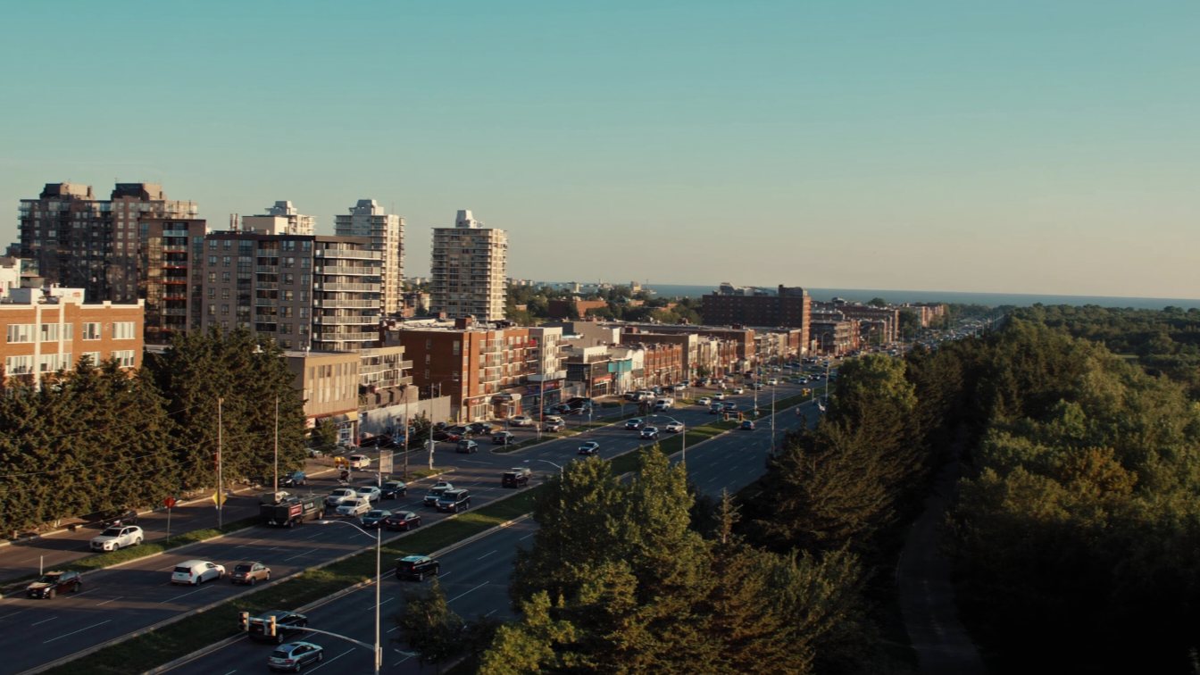
The Queensway is a major arterial road running from the Queen Street West, King Street West and Roncesvalles Avenue junction east of the Humber, west to Etobicoke Creek and the Mississauga boundary — address range 10 to 2225. It is Queen Street West, renamed, reportedly in 1941. It is a designated Avenue in the Official Plan with Mixed Use Areas designation, governed by an Avenue Study from 2003 that envisaged six to eight storeys — while current approvals run to 46 storeys, with 50 proposed. Six live applications carry an active Ontario Land Tribunal appeal. And no part of the street is within walking distance of Line 2: the nearest station from the Etobicoke stretch is roughly 2 to 2.5 kilometres in a straight line.
My office is at 799 The Queensway, so I have a reason to get this right that most people writing about the corridor do not. This page is the reference version: what the street actually is, who plans it, what is approved and appealed along it, what transit really serves it, and the seven things that get repeated about it that are wrong. Everything traces to a City of Toronto, Metrolinx, TTC or TRREB source, and where I could not verify something I say so instead of filling the gap.
What The Queensway actually is
The Queensway is a major arterial road running from the Queen Street West, King Street West and Roncesvalles Avenue junction in the east to Etobicoke Creek and the Mississauga boundary in the west. The City’s own street geometry gives the extent precisely: 95 centreline segments, address range 10 to 2225, east end at 43.63874, -79.44610 and west end at 43.60964, -79.56728.
It is Queen Street West, renamed. That is the whole explanation for most of the confusion around it: the street is one continuous axis, the name changes at Roncesvalles, and King Street West meets the same junction. The rename is reported to have happened in 1941, at Etobicoke Township’s initiative — though I could not find the by-law itself, so treat the year as reported rather than proven.
| Detail | Source | |
|---|---|---|
| Classification | Major arterial. 94 of the City’s 95 centreline segments are coded major arterial; a City transportation report states it directly. | Toronto Centreline; City staff report |
| Extent | Queen Street West / King Street West / Roncesvalles Avenue junction to Etobicoke Creek | Toronto Centreline |
| Municipality | Entirely City of Toronto. The Etobicoke portion is in the former City of Etobicoke; east of the Humber it is in the former City of Toronto. | Toronto Centreline; City bridge records |
| Ward | Ward 3, Etobicoke-Lakeshore. It was Ward 5 before the 2018 boundary change, which is why older sources say Ward 5. | City ward profile; development application records coded WARD_NUMBER 03 |
| Community council | Etobicoke York. Planning items carry the prefix EY. | City council records |
| A jurisdiction quirk | Nine centreline segments around the Highway 427 and QEW interchange are coded as provincial rather than City jurisdiction. | Toronto Centreline |
| In Mississauga | Continues as Queensway East and Queensway West, Peel Regional Road 20. The definite article is dropped. | Secondary sources only — not verified against a Peel by-law |
Lane count: I am not going to give you one. The City does not publish a lane count per segment in any dataset or report I could reach. Secondary sources describe four to six lanes west of South Kingsway. If a listing tells you the number of lanes outside your window, that number is unsourced.
How it is planned
This is the part that decides what gets built next to a unit you are thinking about buying, and it is genuinely more complicated than any marketing page will tell you.
It is an Avenue
City of Toronto planning staff, in the report on 801 The Queensway: the site “is identified on Map 2 — Urban Structure in the Official Plan as an Avenue”, and the lands are “designated Mixed Use Areas on Map 15 — Land Use Plan of the Official Plan.” Avenues are the corridors the City has designated for reurbanisation.
The Avenue Study is from 2003
The Queensway Avenue Study was completed and adopted in 2003 and implemented through Zoning By-law 514-2003, with accompanying design guidelines and streetscape improvements. Its vision, quoted in current City staff reports, was “six to eight storey mixed-use and mid-rise development with a density of three times the area of the lot.”
That vision is twenty-three years old and the corridor has left it behind. Current approvals and live applications on The Queensway run to 10, 12, 13, 14, 15, 18, 30, 35, 38, 40, 45, 46 and, in one proposal, 50 storeys. Quoting “six to eight storeys” as though it describes what may be built next door is technically sourced and badly misleading. I have not found any City page for a refreshed Queensway Avenue Study, and the corridor does not appear on the City’s active planning studies list.
The mid-rise rules, in plain terms
The Mid-Rise Building Design Guidelines were replaced on 5 December 2024. Two things in them matter to a buyer.
Height follows street width. The governing principle is that a mid-rise building’s height should generally be no greater than the width of the right-of-way it fronts. The City publishes a table:
| Planned right-of-way width | Maximum height | Storeys |
|---|---|---|
| 20 m | 20 m | 6 |
| 23 m | 23 m | 7 |
| 27 m | 27 m | 8 |
| 30 m | 30 m | 9 |
| 33 m | 33 m | 10 |
| 36 m or more | 36 m | 11 |
I could not retrieve the planned right-of-way width for The Queensway from Official Plan Map 3, so I am not going to tell you which row applies. Anyone quoting a storey figure for the corridor from this table without citing Map 3 is guessing.
The angular plane is gone. The old rule stepped buildings back along a 45-degree plane from the rear property line — the wedding-cake shape. The current standard is simpler: a 7.5 metre setback from the rear property line up to six storeys (20 metres), plus a further 2.5 metre step-back above 20 metres.
The as-of-right zoning trap
Zoning By-law 1260-2024, passed 14 November 2024, created as-of-right mid-rise permissions on Avenues. The City describes it as facilitating mid-rise development on Avenues “in areas without completed Avenue Studies”, and the supporting report lists exclusions for areas with conflicting Secondary Plans or Avenue Studies.
The Queensway has a completed Avenue Study. On the face of it the by-law therefore does not apply here — but I could not obtain the by-law’s schedule maps to confirm it parcel by parcel. If someone tells you The Queensway now has as-of-right mid-rise zoning, ask them which schedule. Verify it property by property before you rely on it.
Two other layers
Site and Area Specific Policy 432 applies to the lands known as 1025 The Queensway, established by Ontario Land Tribunal final order on 19 January 2023. It requires a minimum of 14,500 square metres of employment floor area with at least 51 per cent core employment uses, 75 affordable dwelling units, a minimum 2,500 square metres of non-residential floor area in the mixed-use portion, a block context plan, and a phasing strategy that sequences the employment and non-residential construction before or alongside the residential.
The Sherway Area Secondary Plan (OPA 469), adopted in October 2019 with further parts confirmed in force by the Ontario Land Tribunal effective 15 August 2023, covers a study area bounded by Highway 427, the CP rail corridor, Etobicoke Creek and the QEW. That geography implies it reaches the westernmost stretch of the corridor, but the City page does not state that Queensway frontage itself is inside the plan. Check OPA 469’s schedule map before assuming it applies to a specific property.
What is actually approved and appealed
From the City’s live development application register. Status values are the City’s own words. Where a staff report gives a different figure from the dataset, both are shown.
| Address | Proposal | Status |
|---|---|---|
| 1025 (Cineplex site) | Ten mixed-use buildings, 18 to 46 storeys, plus two 7-storey employment buildings. 4,222 units per the dataset, 4,077 per the May 2025 staff report. Central public park, three new public streets, a 929 sq m child care facility. | Council approved, June 2025. Subdivision application under review. |
| 1233–1255 (Kipling-Queensway Mall) | Official Plan Amendment: six mixed-use blocks, roughly 500,000 sq m of floor area, two park blocks, new site-specific policies. The notice states density and heights are not part of this amendment. | Council approved, June 2025. |
| 1549–1551 + 76 Fordhouse | A 30-storey mixed-use building plus towers of 35, 40 and 45 storeys. 1,819 units, of which 342 affordable. Daycare, 1,322 sq m of parkland. | Under appeal at the Ontario Land Tribunal. |
| 125 | Redesignation to enable seven buildings, 12 to 50 storeys. | Under appeal for non-decision, filed 30 October 2025. City staff recommend opposing it. |
| 829 | 15 storeys, roughly 332 units, minimum 590 sq m non-residential. | Adopted by Council 4 February 2026; the by-law is withheld pending OLT-25-000221. |
| 1361 / 1325 | Two towers of 46 and 35 storeys on an 11-storey base, with retail and a daycare. | Zoning approved at the Tribunal 17 October 2023. Site plan under review. |
| 1230 | 13 storeys, 175 purpose-built rental units, ground-floor retail. | Under review — the newest application on the corridor, filed May 2026. |
| 1045–1049 (Joya) | 12 storeys, 321 units, 715 sq m retail. | Zoning approved. Site plan under review. |
| 801 | 10 storeys, 203 units. | Final approval completed. |
| 875 (Maxium) | 14 storeys, 183 units. | Zoning appealed, OLT-21-001071. Final outcome not verified. |
| 1061 | Three towers of 26, 34 and 43 storeys, 1,166 units. | Long-standing appeal. Two 2023 site plan applications refused. |
| 1750–1900 | Eight buildings, 6 to 38 storeys, 2,135 units, of which 200 affordable rental. | Approved at the Board. Not built. |
| 722 | 8 storeys, 26 units. Prefabricated mass timber, no underground parking. | Under review. |
This corridor is unusually appeal-heavy. Of the applications that are not closed, six carry an active Ontario Land Tribunal or Board appeal status. That is a material fact if you are buying pre-construction here: an approval on paper and a building on the ground are separated, on this street, by years and sometimes by a tribunal. The two approvals that never became buildings are the cautionary example.
Transit, honestly
Route data below is taken from the TTC’s scheduled service feed rather than a printed map, and the distances are computed straight-line from station coordinates to the street centreline. They are not walking distances, which are longer.
What runs along the street
| Route | Termini |
|---|---|
| 80 Queensway (bus) | 80A Sherway Gardens to Keele Station; 80B Sherway Gardens to Mimico GO via Marine Parade; 80S short turn to Royal York |
| 501 Queen (streetcar) | Humber Loop to Neville Park |
| 508 Lake Shore (streetcar, weekday peak) | Humber to Distillery |
| 507 Long Branch | Humber to Long Branch — currently operating as a replacement bus in the schedule feed, not a streetcar |
| 301 Queen (Blue Night) | Overnight service |
Crossing routes include 123 Sherway, 66 Prince Edward, 76 Royal York South, 77 Swansea, 110 Islington South, 44 and 944 Kipling South, 15 and 315 Evans, and 402 Parkdale.
Streetcars returned to Humber Loop on 29 October 2023 — the TTC described it as the first streetcar operation along The Queensway since January 2021.
The subway distance nobody states plainly
| From | Nearest Line 2 station | Straight-line distance |
|---|---|---|
| Queensway and Royal York (near 799) | Royal York | 2,541 m |
| Queensway and Islington | Islington | 2,709 m |
| Queensway and Kipling | Kipling | 2,215 m |
| Queensway and Park Lawn | Old Mill | 2,357 m |
No part of The Queensway is within walking distance of Line 2. From the Etobicoke commercial stretch the nearest subway station is roughly 2 to 2.5 kilometres in a straight line, which is further on foot. The closest approach anywhere on the whole street is High Park Station at about 1,689 metres, and that is at the far eastern end, not in Etobicoke.
This is the corridor’s real trade-off and it is worth being straight about it. The bus service along the street is frequent and the GO options are genuinely good. The subway is a bus ride away, not a walk.
GO
| Station | Straight-line distance to the corridor | Line |
|---|---|---|
| Mimico GO | 1,093 m | Lakeshore West |
| Kipling GO | 2,042 m | Milton |
| Long Branch GO | 2,643 m | Lakeshore West |
Metrolinx has Mimico GO station upgrades in procurement and design — a new east connection with elevator and stair access to all platforms, a new south tunnel entrance at Manchester and Blue Goose with elevator and stair connections, and accessibility work — as part of Lakeshore West GO Expansion. No completion date is published.
Park Lawn GO: do not count on it. Metrolinx’s Mimico page makes no mention of a Park Lawn station. A business case exists, but I could not confirm it is a funded, in-delivery project as at today. Separately, a Mimico GO redevelopment — a transit-oriented community, a different thing from the station upgrades — was reported cancelled. Those two are easy to conflate and are frequently conflated in listing copy.
The Complete Street
Council approved The Queensway Complete Street on 7 April 2022. From the Humber River to Burma Drive near Mimico Creek, it brings raised protected cycle tracks on both sides, level with the sidewalk and separated from the roadway by a curb; bike signals and protected corner islands; sidewalks widened to 2.1 metres where possible; a centre median to reduce left-turn collisions; improved bus stops; landscaping and stormwater features.
It is currently in detailed design, with construction anticipated in 2027, deferred behind bridge repairs.
It is not a road diet. The City states plainly that “the number of vehicle lanes will be maintained at current levels.” This gets misreported constantly, in both directions.
Parks and schools
Names and straight-line distances from the City’s own datasets. No rankings and no catchment claims — catchments are set by the school boards, they change, and a realtor asserting one is doing you no favours.
Parks on or immediately adjacent to the Etobicoke stretch: Jeff Healey Park (19 m), Queensway Park (61 m), Market Garden Mews (85 m), Senator Marian Maloney Park (120 m), Zorra Park (154 m), Saunders Crescent Parkette (164 m), Winslow-Dalesford Parkette (239 m), Dalesford Park (268 m), Queensland Park (414 m), Alan-Oxford Parkette (462 m), Grand Avenue Park (559 m), Bisset Park (561 m), Douglas Park (577 m), Berry Road Park (583 m). East of the Humber the corridor runs past South Humber Park, Humber Marshes and High Park.
New parkland is being secured through development: roughly 4,265 to 4,286 square metres at 1025, and 1,322 square metres at 1549–1551.
Schools within about 500 metres: St Louis Catholic Elementary (11 Morgan Avenue), Karen Kain School of the Arts (60 Berl Avenue), Garden Avenue Junior Public School (225 Garden Avenue), Mary Mother of God School (1515A Queen Street West). Between 500 and 900 metres: Etobicoke School of the Arts, Holy Angels Catholic Elementary, St Mark Catholic Elementary, Etienne Brule Junior School, Castlebar Junior School, George R Gauld Junior School, Fern Avenue Junior and Senior Public School, St Ambrose Catholic Elementary, Lanor Junior Middle School, Parkdale Collegiate Institute, St Vincent de Paul Catholic Elementary, Swansea Junior and Senior Public School, Parkdale Junior and Senior Public School.
Market data, with the caveat it needs
| TRREB district | Covers | Relationship to the corridor |
|---|---|---|
| W07 | Stonegate-Queensway | The core Etobicoke stretch. This is the district a Queensway practice lives in. |
| W08 | Islington-City Centre West, Markland Wood, Etobicoke West Mall and others | The corridor west of roughly Islington and Kipling |
| W01 | High Park-Swansea, Roncesvalles, South Parkdale | The east end, east of the Humber |
| W06 | Alderwood, Long Branch, Mimico, New Toronto | Adjacent, not on. W06 is south of the Gardiner and QEW. The Queensway is not in W06. |
The most recent Toronto West community report I could retrieve is Q1 2025, which is roughly eighteen months old. Its W07 figures: average price $1,460,627, median $1,449,000, 137 new listings, 64 active, average sale-to-list 100 per cent, average 26 days on market.
Two reasons not to lean on those. They are stale. And the W07 condo apartment sample that quarter was one transaction — so the district average is dominated by low-rise resale, not by the condominium product that most of this corridor actually is. For current figures see the condo price page, and ask me for the live numbers rather than trusting any published quarterly average for a street this specific.
Seven things people get wrong about The Queensway
| The claim | What the primary source says |
|---|---|
| “It runs from the Humber River to the Mississauga border.” | Wrong. The City centreline puts the east end at the Queen West, King West and Roncesvalles junction, about 2 km east of the Humber, and the City maintains a bridge carrying The Queensway over the Humber. The claim describes the Etobicoke neighbourhood called The Queensway, not the street. |
| “It is in Ward 5.” | Out of date. Ward 3, Etobicoke-Lakeshore, since the 2018 boundary change. |
| “Sherway Gardens is on The Queensway.” | Wrong. Sherway Gardens is at 25 The West Mall. It is near the west end and is the northern terminus of the 80 Queensway bus, but it does not front the street. |
| “The Queensway has as-of-right mid-rise zoning now.” | Probably wrong. By-law 1260-2024 is described as applying to Avenues without completed Avenue Studies. The Queensway has one, from 2003. |
| “The planning framework allows six to eight storeys.” | Technically sourced, badly misleading. That is the 2003 Avenue Study vision. Current approvals run to 46 storeys, with 50 proposed. |
| “The Complete Street will remove traffic lanes.” | Wrong. The City: “The number of vehicle lanes will be maintained at current levels.” |
| “It is named after Queen Elizabeth II” or “after the QEW”. | Neither. It is named for Queen Street, which it is a continuation of, reportedly in 1941. Elizabeth II acceded in 1952. |
Every page I have written about this street
Thirty-six of them, organised by what you are actually trying to find out.
The buildings
- 689 The Queensway — Reina Condos
- 700 The Queensway — the townhomes
- 760 The Queensway — Qube Condos
- 784 The Queensway — Queensway Park Condos
- 799 The Queensway — Curio Condos
- 859 The Queensway — 859 West
- 875 The Queensway — Maxium
- 880 The Queensway — Kazmir Condos
- 892 The Queensway — The Hive Lofts
- 935 The Queensway — BLVD Q
- 1007 The Queensway — Verge Condos, east tower
- 1037 The Queensway — Verge Condos, west tower
- 1040 The Queensway — Loggia Condos
- 1045 The Queensway — Joya Condos
- 1050 The Queensway — Loggia 2
- 1156 and 1230 The Queensway — the mid-rises
- 1185 The Queensway — IQ Condos
- 1195 The Queensway — The Tailor Residences
- Dalesford, Backyard and Queensview — the Stonegate side streets
- Every condo building on The Queensway — the full directory
What is being built
- The Queensway development pipeline, 2026
- 1025 The Queensway — the Cineplex site master plan
- 1255 The Queensway — the Kipling-Queensway Mall redevelopment
- 1549 The Queensway — 1,819 homes, 342 affordable
- 1750 and 1061 The Queensway — two approvals that never became buildings
- Pre-construction on The Queensway in 2026
Getting around
- Getting around from The Queensway: what actually runs
- The Queensway Complete Street: bike lanes approved 2022, built 2027
- Gardiner Section 3: what is closed near The Queensway, and until when
Everyday life
- Shopping and everyday life on The Queensway
- Urgent care, parks and libraries near The Queensway
- Is Stonegate-Queensway safe? What the reported crime data shows
Deciding
- Queensway condo prices: what W07 and W08 actually show
- The Queensway or Humber Bay Shores: where to buy
- Why buy a condo on The Queensway
- M8Y and M8Z: the Stonegate-Queensway postal code guide
There is also a condo-focused overview of the corridor if that is what you came for, and the Etobicoke condo directory covers the buildings off The Queensway itself.
What I could not verify
Stated plainly, because a reference page that hides its gaps is not a reference page.
- Lane count. No City source publishes one per segment.
- The planned right-of-way width on Official Plan Map 3, which is what would let anyone state a defensible as-of-right height for the corridor.
- Whether By-law 1260-2024 applies here. Needs the schedule maps.
- Whether OPA 469 covers Queensway frontage. Needs the OPA schedule.
- The outcome of the 875 The Queensway tribunal hearing scheduled for October 2022.
- Park Lawn GO status. Not asserting it either way.
- A 2026 TRREB Toronto West community report. Q1 2025 is the most recent I could retrieve.
- The 1941 renaming by-law. Two secondary sources agree on the year; no primary record found.
The councillor for Ward 3 is worth checking at the source rather than trusting any page, including this one — a Toronto municipal election falls in October 2026.
Buying, selling or just trying to work out what happens next on this street?
I work this corridor from an office on it. If you want to know what is approved beside a specific building, what a specific tribunal appeal actually means for your view, or what a unit is genuinely worth against real comparables rather than a district average, send me the address. No obligation and no follow-up campaign.
[email protected] · 833-330-1925 · Book a free consultation
Confidential. Read personally and answered within 24 hours. I never share, sell or distribute your information.
Free tool — AI condo value estimator
Condo Valuation
What’s your condo
worth today?
Three quick steps. Condos don’t price like houses — your floor, your view, and whether you own parking move the number more than anything else. This weighs all of them.
Reading recent condo sales…
Estimated market value
—
$0–$0
Most likely $0 · about $0 per square foot
What moved the number
Starting from what comparable units in your area sell for, here’s what your specifics added or subtracted.
Market context
—
—
Two units, same floor plan,
$90,000 apart.
That happens constantly in condos — one has the parking, the right exposure, or a board that keeps the reserve fund healthy. A model can’t see your status certificate. I can.
Frequently asked questions
Where does The Queensway start and end?
It runs from the junction of Queen Street West, King Street West and Roncesvalles Avenue in the east to Etobicoke Creek and the Mississauga boundary in the west, with an address range of 10 to 2225, per the City of Toronto Centreline dataset. It crosses the Humber River rather than beginning there — the City maintains a bridge carrying The Queensway over the Humber.
Is The Queensway the same as Queen Street West?
It is the same continuous road, renamed. The name changes at the Roncesvalles junction, where King Street West also meets. The rename is reported to have happened in 1941 at Etobicoke Township’s initiative, though I could not locate the by-law itself.
How tall can buildings on The Queensway be?
The 2003 Queensway Avenue Study envisaged six to eight storeys at three times lot area, and that figure is still quoted in City staff reports. It no longer describes what is being approved: current approvals and live applications run to 10, 12, 13, 14, 15, 18, 30, 35, 38, 40, 45 and 46 storeys, with 50 proposed at 125 The Queensway. The mid-rise guidelines tie height to the planned right-of-way width, but I could not retrieve that width for The Queensway from Official Plan Map 3, so no defensible as-of-right figure can be stated.
How far is The Queensway from the subway?
Further than most listings suggest. Straight-line from the Etobicoke stretch to the nearest Line 2 station is roughly 2.2 to 2.5 kilometres — Royal York is about 2,541 m from Queensway and Royal York, Kipling about 2,215 m from Queensway and Kipling. Walking distances are longer. No part of the street is a walk to the subway. Mimico GO, on the Lakeshore West line, is closer at about 1,093 m.
Is The Queensway getting bike lanes?
Yes. The Queensway Complete Street was approved by Council on 7 April 2022 and brings raised protected cycle tracks on both sides from the Humber River to Burma Drive, along with widened sidewalks, a centre median and improved bus stops. It is in detailed design with construction anticipated in 2027. The City states the number of vehicle lanes will be maintained at current levels — it is not a road diet.
Which ward is The Queensway in?
Ward 3, Etobicoke-Lakeshore. It was Ward 5 before Toronto’s 2018 ward boundary change, which is why older pages still say Ward 5. Planning items go to Etobicoke York Community Council.
Which TRREB district is The Queensway in?
Mostly W07, Stonegate-Queensway, for the core Etobicoke stretch; W08 further west around Islington and Kipling; W01 at the east end past the Humber. It is not in W06 — that district is Alderwood, Long Branch, Mimico and New Toronto, south of the Gardiner and QEW.
Is Sherway Gardens on The Queensway?
No. Sherway Gardens is at 25 The West Mall. It is near the west end of the corridor and is the northern terminus of the 80 Queensway bus, but it does not front the street. Listing copy that places it “on” The Queensway is inaccurate.
How many condo buildings are on The Queensway?
I maintain individual pages for the buildings along the corridor, from 689 at the east end to 1195 in the west, plus a full directory. The number keeps moving because the corridor has a large pipeline: at the time of writing there are approvals or live applications at 125, 722, 801, 829, 875, 1025, 1045, 1061, 1230, 1233 to 1255, 1325, 1361, 1549 to 1551 and 1750 to 1900.
Related reading
- The Queensway development pipeline, 2026
- Every condo building on The Queensway
- Getting around from The Queensway: what actually runs
Sources
Every figure on this page traces to one of these, and each was read on 30 August 2026. Primary sources only — statute, regulation, and the government or agency that administers the rule. Where I could not verify something from a primary source, the page says so instead of guessing.
- Toronto Centreline (TCL) — City of Toronto Open Data. The City’s authoritative street geometry. Filtering for “The Queensway” returns 95 segments running from the Queen Street West and Roncesvalles junction west to Etobicoke Creek, address range 10 to 2225. Accessed 30 August 2026.
- Development Applications — City of Toronto Open Data. The City’s live application register. 127 records carry The Queensway as the street name; status values quoted on this page are the City’s own. Accessed 30 August 2026.
- Final Report — 801 The Queensway (PDF). City of Toronto planning staff report. Confirms The Queensway is identified as an Avenue on Map 2 of the Official Plan, that the abutting lands are Mixed Use Areas on Map 15, and sets out the 2003 Queensway Avenue Study vision of six to eight storeys at three times lot area. Accessed 30 August 2026.
- Report for Action — 1025 The Queensway (PDF). City of Toronto planning staff report on the Cineplex site master plan, May 2025. Accessed 30 August 2026.
- Council item 2025.EY23.4 — 1025 The Queensway. Etobicoke York Community Council and City Council record for the 1025 The Queensway approval, June 2025. Accessed 30 August 2026.
- Ontario Land Tribunal appeal of OPA 231 — 1025 The Queensway (PDF). City of Toronto. Records Site and Area Specific Policy 432 and its employment, affordable housing and phasing requirements, confirmed by OLT final order 19 January 2023. Accessed 30 August 2026.
- Report for Action — 125 The Queensway (PDF). City of Toronto planning staff report, 2026. Staff recommend opposing the appeal. Accessed 30 August 2026.
- Council item 2026.EY28.2 — 829 The Queensway. Etobicoke York Community Council, January 2026. Adopted by Council 4 February 2026 with the bill withheld pending OLT-25-000221. Accessed 30 August 2026.
- Notice of Application — 1549-1551 The Queensway. City of Toronto public notice. Four towers of 30, 35, 40 and 45 storeys, 1,819 units of which 342 affordable. Accessed 30 August 2026.
- Public Notice — 1233-1255 The Queensway. City of Toronto public notice, 1 August 2025. Six mixed-use blocks and two park blocks; the notice states density and heights are not part of this Official Plan Amendment. Accessed 30 August 2026.
- Mid-Rise Building Design Guidelines. City of Toronto. Current version adopted 5 December 2024, replacing the 2010 Performance Standards and the 2016 Addendum. Accessed 30 August 2026.
- As-of-Right Zoning Permissions for Mid-Rise Buildings on Avenues (PDF). City of Toronto Housing Action Plan report. Sets out the height-to-right-of-way table and the rear transition standard of a 7.5 metre setback to 20 metres plus a further 2.5 metre step-back above. Accessed 30 August 2026.
- Notice of Passing of Zoning By-law 1260-2024. City of Toronto, passed 14 November 2024. Creates as-of-right mid-rise permissions on Avenues; the City describes it as applying in areas without completed Avenue Studies. Accessed 30 August 2026.
- Avenues Policy Review. City of Toronto. Phase One concluded with OPA 778, adopted 5 February 2025 and substantially in force 14 March 2025, adding 283 kilometres of new Avenues. Accessed 30 August 2026.
- Sherway Area Study. City of Toronto. Secondary Plan OPA 469 adopted 29 to 30 October 2019; further parts confirmed in force by Ontario Land Tribunal decision of 25 August 2023, effective 15 August 2023. Accessed 30 August 2026.
- The Queensway Complete Street. City of Toronto. Raised protected cycle tracks from the Humber River to Burma Drive; Council approved 7 April 2022; construction anticipated 2027. The City states the number of vehicle lanes will be maintained at current levels. Accessed 30 August 2026.
- TTC Routes and Schedules (GTFS) — City of Toronto Open Data. The TTC’s scheduled service feed. Route and terminus information on this page is taken from the feed rather than from a printed map. Accessed 30 August 2026.
- TTC restoring streetcar service to Humber Loop. Toronto Transit Commission, October 2023. 501 Queen streetcars returned to Humber Loop on 29 October 2023, the first streetcar operation along The Queensway since January 2021. Accessed 30 August 2026.
- Mimico GO Station — Lakeshore West GO Expansion. Metrolinx. New east connection, south tunnel entrance and accessibility upgrades, described as in procurement and design. No completion date published. Accessed 30 August 2026.
- Ward 3 Etobicoke-Lakeshore. City of Toronto ward profile. The Queensway is in Ward 3; it was in Ward 5 before the 2018 ward boundary change. Accessed 30 August 2026.
- Green Spaces — City of Toronto Open Data. The City’s parks and open space geometry. Distances quoted on this page are straight-line from the park boundary to the street centreline. Accessed 30 August 2026.
- School Locations — All Types — City of Toronto Open Data. The City’s school location register. Names and straight-line distances only; catchment boundaries are set by the school boards and change. Accessed 30 August 2026.
- TRREB Community Market Report — Toronto West, Q1 2025 (PDF). Toronto Regional Real Estate Board. District and community level figures for W01, W06, W07 and W08. The most recent Toronto West community report I could retrieve. Accessed 30 August 2026.
- Exclusive Right Turn Lane, North Queen Street at The Queensway (PDF). City of Toronto transportation services report. States that The Queensway is classified as a major arterial road. Accessed 30 August 2026.
About the author — Jatin Dua, Etobicoke real estate agent
I’m the Broker of Record at RE/MAX Quantum Realty, 799 The Queensway in Etobicoke. I write these pages the same way I work a file: read the primary source, quote it, date it, and say plainly where the source is silent or where two sources disagree. If a figure on this page has no citation beside it, that is a mistake and I want to hear about it.
I work with buyers, sellers, renters and investors across Etobicoke, Mimico, Humber Bay Shores, New Toronto, Long Branch, Alderwood and Stonegate–Queensway. [email protected] or 833-330-1925.
Weighing King West and Roncesvalles against somewhere else? Liberty Village vs King West, King West vs Yorkville, High Park–Swansea vs Roncesvalles and Roncesvalles vs Liberty Village. All of it sits in one place: 100 Toronto neighbourhood comparisons, head to head.